Plan your visit
Getting here
54.51389, -3.16385
Best for
4 activitiesDog walks
Strong match
Dogs allowed with public access
Hiking
Good match
Named hiking route nearby: Coast to Coast Walk (St Bees to Shap)
Family friendly
Good match
Urban park — family destination
Picnic day out
Good match
Urban park — open green space
Trails nearby
Within roughly 5 km🚶Walking
v11 signed routes nearby · 19 public paths nearby
Signed route nearbyPublic paths
Walking
Coast to Coast Walk (St Bees to Shap)Walking route▾
Peace How Walk From High Brandelhow Jetty, North Lakes OutdoorsWalking route3 km▾
A gentle walk with time & space to reflect. Peace How looks over Derwent Water to the north, & Castle Crag – a WW1 memorial fell – to the south. It was gifted to NT in 1917, so that anyone affected by the WW1 could come & experience peace & tranquility.
Borger Dalr Geology Walk, North Lakes OutdoorsWalking route6.4 km▾
Explore the origins of Borrowdale as you walk from Bowder Stone car park to Castle Crag, including the poignant war memorial Peace Howe, and amazing views of the flat valley bed that was formerly the bottom of an Ice Age lake. A steep but gradual climb.
Seatoller, Styhead Tarn and Grains Gill Walk, North Lakes OutdoorsWalking route11.2 km▾
An invigorating circular into the the Lakeland fells beyond Borrowdale. Follow an ancient packhorse route, as mountain views of Great End & Great Gable rise above you. Relax by Sprinkling Tarn before returning via Grains Gill stream. Rugged rock paths.
Bowder Stone, North Lakes OutdoorsWalking route900 m▾
A short linear walk to the Bowder Stone; a house-sized boulder balanced inexplicably on its side. Climb the ladder to the top of this Georgian tourist attraction.
Folly Bridgepublic footpath · 12 m▾
Seatoller National Trust Car Parkpublic footpath · 43 m▾
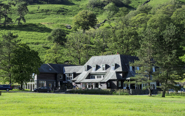
About this urban park
Glaramara is a urban park covering 1 hectares.
Wildlife to spot
Photos
22 photos from nearby open sources
v
Photos
22 photos from nearby open sources
Photos
Visiting this spring
Seasonal nature notes and what to look for now
v
Visiting this spring
Seasonal nature notes and what to look for now
- 🐦Prime nesting season — listen for woodpecker drumming, warbler song and the first cuckoos from April
- 🦌Roe deer are active before the leaf canopy closes in — dawn and dusk are best
🌱 Visiting this spring
- 🐦Prime nesting season — listen for woodpecker drumming, warbler song and the first cuckoos from April
- 🦌Roe deer are active before the leaf canopy closes in — dawn and dusk are best
Facilities
Café
Honisters Yew Tree Coffee House · 282m
Campsite
402m away
Parking
Seatoller NT car park · Paid · 191m
Toilets
211m away
Good to know
- £Free to visit — no entry charge
- 🐕Dogs welcome
Weather for this location
Next 14 daysLoading local forecast…
Nearby places
Useful places within 5 km