Reconnecting the UK with its wild green spaces
Thousands of woodlands, nature reserves, and parks are within walking distance of most UK homes — yet most people couldn't name one near them. Glade changes that.
Nature is closer than you think — but harder to find than it should be
Great Britain has over 3.2 million hectares of publicly accessible green space — ancient woodland, nature reserves, open access land, reservoir trails. Yet 1 in 3 people say they'd spend more time in nature if they simply knew where to go.
Fragmented open datasets, no unified discovery layer, and poor mobile tools leave the local ancient woodland, the reservoir trail, the dog-friendly forest invisible. We're building the layer that makes them findable.

We believe everyone deserves to find their forest — the quiet clearing, the ancient oak, the reservoir path at dawn.The Glade mission
Built on three principles
Open by default
Every boundary, trail, and facility comes from openly licensed public datasets — National Forest Inventory, Ordnance Survey, Natural England, OpenStreetMap. No proprietary lock-in. No walled gardens.
See signal coverage →Intelligently surfaced
We don't just dump data on a map. Glade enriches each location with activities, facilities, photos, and nearby events — so you arrive knowing what to expect.
Free at its core
No subscription, no account required to explore. Public funding built these landscapes — the open data that describes them should be accessible to everyone.
Everything you need to get outside. Nothing you don't.
Glade is built for ordinary people who want to spend more time outdoors — not data enthusiasts or power users. No account, no subscription, no hidden rankings.
No account needed
Search, explore, and plan visits without signing up for anything. Just open it and go.
Family and dog friendly
Filter for playgrounds, flat paths, dog-friendly sites, and easy-access walks — all in one place.
Open and transparent
Every boundary, trail, and facility traces back to a named public dataset. We show our working.
Building the layer the UK's green spaces deserve

Every visit starts with knowing where to go
We're building toward AI-generated location overviews, community trail condition reports, and seasonal access alerts — so every Glade page tells you not just that a place exists, but whether it's worth visiting on a wet Wednesday in November.
Glade Aerial
AI-generated location footage — coming soon
Built on 15+ openly licensed public datasets
Every piece of information on Glade — from ancient woodland boundaries to cycle trail waypoints — comes from government datasets, national bodies, and the OpenStreetMap community under open licences.
This means the data is freely reusable and attributable. When open data improves, Glade improves — automatically.
View all data sources and licencesAll datasets used under OGL v3.0, ODbL, or Creative Commons licences.
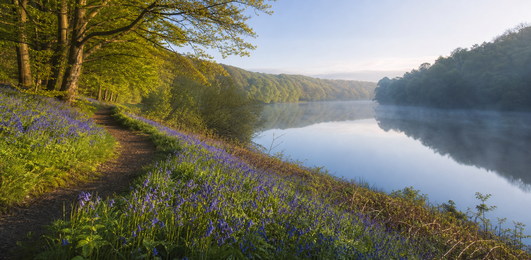
The bluebells. The reservoir. The path you didn't know was there.
Glade turns scattered open data into the kind of local detail that helps ordinary places feel visible, seasonal and worth stepping out for.
Everything you need to get outside
Glade is live — core discovery and open data features are free, with no account required.
Location discovery
Search by postcode, browse by type, find accessible and dog-friendly spaces near you.
Trails & paths
Walking paths, cycling routes, bridleways, and long-distance trails shown on every location map.
Nearby events
Outdoor events and guided activities shown for each location and search area.
Wildlife & habitat
Activities surfaced from real species records and habitat surveys — birdwatching, foraging, insect spotting, and more.
Facilities at a glance
Car parks, toilets, cafes, picnic areas, and playgrounds shown for each location.
Open data sources
Every boundary, trail, and facility traceable to a named open dataset. No hidden rankings, no paid placements.

The quiet clearing. The ancient oak. The reservoir at dawn.
Your forest is waiting
Enter your postcode and discover what's been hiding in plain sight all along.
Find your forest