Plan your visit
Getting here
52.50604, -1.88465
Best for
4 activitiesPlaygrounds
Strong match
playground, café, parking
Dog walks
Strong match
Dogs allowed with public access
Family friendly
Good match
Urban park — family destination
Picnic day out
Good match
Urban park — open green space
Trails nearby
Within roughly 5 km🚶Walking
v23 signed routes nearby · 39 public paths nearby
Signed route nearbyPublic paths
Walking
Grand Union Canal WalkWalking route234 km▾
Coy Carp to Brentford section
The Findings TrailWalking route▾
Tourism/ history walking route from the city centre to the Jewellery Quarter and back. Marked by pavement plates. Designed by Laura Potter
Revolution WalkWalking route▾
The Revolution Walk celebrates three eras of transport: canals, roads and railway. Enjoy the mix of nature and heritage as you venture out of the city along this lush stretch.
Beacon WayWalking route40 km▾
Starting at Sandwell Valley via the outskirts of Birmingham and the countryside of Walsall into Staffordshire. Take in the Forest of Mercia, lakes, nature reserves, woods, and canal banks. Named after Barr Beacon, one of the highest hills in this area.
Handsworth & Lozells Places of Worship Heritage TrailWalking route2.5 km▾
Trail around Handsworth and Lozells- a culturally diverse area, where you can learn about the rich variety of religious communities who live alongside one another in a relatively small area.
Nugent Closepublic footpath · 90 m▾
Bulwell Closepublic footpath · 129 m▾
Nugent Closepublic footpath · 46 m▾
🚴Cycling
v151 signed routes nearby
Signed route nearby
Cycling
Jewellery Quarter Pop Up Cycle RouteCycling route▾
National Cycle Network Route 533Cycling route▾
SCWIP Cycle Route 11Cycling route▾
[PROPOSED]Sandwell Local Cycle NetworkCycling route▾
Sandwell Local Cycle Network (Proposed)
Rushall Junction to Ryders Green LocksCycling route12 km▾
This route features an unusual aqueduct; one of the few examples of a canal crossing over a railway. Distance: 7.5 miles/12 km (approx) Duration: 1 hour 15 min (approx)
Factory Junction to Ladywood JunctionCycling route10 km▾
Cycle along The New Main Line and follow the signs for The National Cycle Route, which takes you to Ladywood Junction and on into Birmingham City Centre. Distance: 6 miles/10 km (approx) Duration: 60 min (approx)
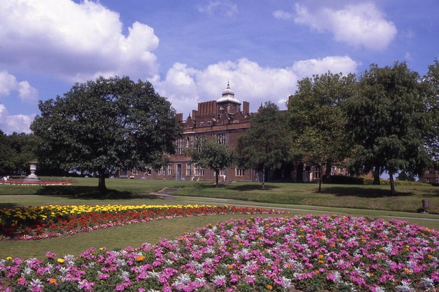
About this urban park
Aston Park is a urban park covering 38 hectares.
Wildlife to spot
Photos
15 photos from nearby open sources
v
Photos
15 photos from nearby open sources
Photos
Visiting this spring
Seasonal nature notes and what to look for now
v
Visiting this spring
Seasonal nature notes and what to look for now
- 🐦Prime nesting season — listen for woodpecker drumming, warbler song and the first cuckoos from April
- 🦌Roe deer are active before the leaf canopy closes in — dawn and dusk are best
🌱 Visiting this spring
- 🐦Prime nesting season — listen for woodpecker drumming, warbler song and the first cuckoos from April
- 🦌Roe deer are active before the leaf canopy closes in — dawn and dusk are best
Facilities
Café
1 nearby · 118m
Parking
Sycamore Centre / AVFC Season Ticket Holders · 110m
Playground
2 · 269m away
Good to know
- £Free to visit — no entry charge
- 🐕Dogs welcome
Weather for this location
Next 14 daysLoading local forecast…
Nearby places
Useful places within 5 km