Plan your visit
Getting here
51.20831, -3.59566
Best for
5 activitiesPlaygrounds
Very strong match
playground, toilets, café, parking
Dog walks
Good match
Dogs allowed with public access
Cycling
Good match
Named cycling route nearby: Regional Route 51
Hiking
Good match
Named hiking route nearby: Coleridge Way
Heritage
Moderate match
Religious grounds — local heritage
Trails nearby
Within roughly 5 km🚶Walking
v13 signed routes nearby · 21 public paths nearby
Signed route nearbyPublic paths
Walking
Selworthy Circular Pink Route, Holnicote EstateWalking route▾
Selworthy and Bury Castle circular walkWalking route4.8 km▾
Webber's Post wanderWalking route1.6 km▾
Bossington Circular Pink Route, Holnicote EstateWalking route▾
Horner Wood ancient trees walkWalking route3.2 km▾
Hacketty Waypublic footpath · 215 m▾
Coach Roadpublic footpath · 71 m▾
Toll Roadpublic footpath · 121 m▾
🚴Cycling
v19 signed routes nearby
Signed route nearby
Cycling
Regional Route 51Cycling route▾
N/ACycling route504 m▾
N/ACycling route597 m▾
N/ACycling route1.4 km▾
N/ACycling route2.1 km▾
N/ACycling route891 m▾
🐴Horse riding
v6 public paths nearby
Public paths
Horse riding
Mill Lanebridleway · 141 m▾
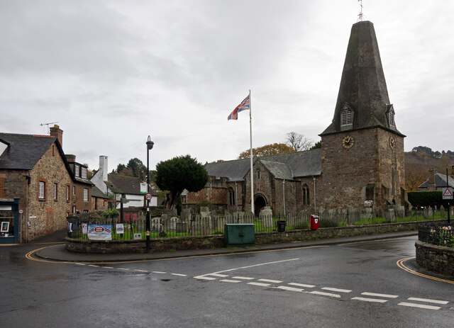
About this religious grounds
St Dubricius's Church is a religious grounds.
Wildlife to spot
Photos
15 photos from nearby open sources
v
Photos
15 photos from nearby open sources
Photos
Visiting this spring
Seasonal nature notes and what to look for now
v
Visiting this spring
Seasonal nature notes and what to look for now
- 🐦Prime nesting season — listen for woodpecker drumming, warbler song and the first cuckoos from April
- 🦌Roe deer are active before the leaf canopy closes in — dawn and dusk are best
🌱 Visiting this spring
- 🐦Prime nesting season — listen for woodpecker drumming, warbler song and the first cuckoos from April
- 🦌Roe deer are active before the leaf canopy closes in — dawn and dusk are best
Facilities
Café
Mrs Jackson's Victorian Tearooms · 78m
Campsite
285m away
Parking
4 nearby · Paid · 147m
Playground
2 · 101m away
Toilets
4 · 157m away
Good to know
- £Free to visit — no entry charge
- 🐕Dogs welcome
Weather for this location
Next 14 daysLoading local forecast…
Nearby places
Useful places within 5 km