Plan your visit
PlayCyclingDogs
Public accessFree entryDogs welcome
Getting here
51.85509, 0.95941
Best for
5 activitiesPlaygrounds
Very strong match
playground, toilets, café, parking
Free
Cycling
Good match
Named cycling route nearby: NCN 51
Varies
Dog walks
Good match
Dogs allowed with public access
Free
Hiking
Moderate match
Named hiking route nearby: Maurice Britton Walk
Free
Heritage
Moderate match
Religious grounds — local heritage
Free
Trails nearby
Within roughly 5 km🚶Walking
v14 signed routes nearby · 31 public paths nearby
Signed route nearbyPublic paths
🚶
vWalking
Colchester Orbital West AWalking route▾
Named routeLocal walking route
Colchester Orbital Spoke (North)Walking route▾
Named routeLocal walking route
Colchester Orbital Spoke (West)Walking route▾
Named routeLocal walking route
Colchester Orbital Spoke (South)Walking route▾
Named routeLocal walking route
Colne Valley PathWalking route37 km▾
Named routeLength 37 kmLocal walking route
West Quaypublic footpath · 225 m▾
Public pathpublic footpathLength 225 mSurface paving_stonesPath type: footway
Ballast Quay Roadpublic footpath · 618 m▾
Public pathpublic footpathLength 618 mSurface gravelPath type: track
Wivenhoe Ferry Trailpublic footpath · 613 m▾
Public pathpublic footpathLength 613 mSurface grassPath type: footway
🚴Cycling
v100 signed routes nearby
Signed route nearby
🚴
vCycling
NCN 51Cycling route▾
Named routeRef 51National Cycle Network
Greenstead to North StationCycling route▾
Named routeLocal cycle route
EuroVelo 2 - Capitals Route - part United Kingdom 8Cycling route▾
Named routeRef EV2International cycle route
Colchester Orbital CycleCycling route▾
Named routeLocal cycle route
Colchester Orbital Cycle Spoke (South-East)Cycling route▾
Named routeLocal cycle route
Colchester Orbital Cycle Spoke (North East)Cycling route▾
Named routeLocal cycle route
🐴Horse riding
v5 public paths nearby
Public paths
🐴
vHorse riding
The Quaybyway open to all traffic · 100 m▾
Public pathbyway open to all trafficLength 100 mPath type: residential
The Quaybyway open to all traffic · 75 m▾
Public pathbyway open to all trafficLength 75 mPath type: residential
The Follybyway open to all traffic · 54 m▾
Public pathbyway open to all trafficLength 54 mSurface compactedPath type: residential
The Quaybyway open to all traffic · 42 m▾
Public pathbyway open to all trafficLength 42 mPath type: residential
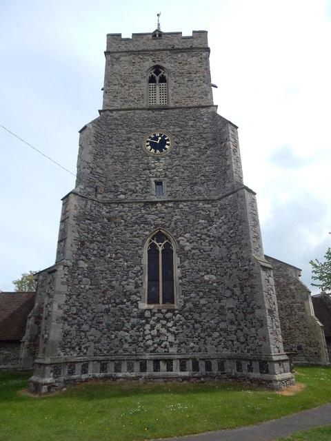
About this religious grounds
St Mary's Church is a religious grounds.
Wildlife to spot
Photos
21 photos from nearby open sources
v
Photos
21 photos from nearby open sources
1 / 21
Photos
1 / 21
Visiting this spring
Seasonal nature notes and what to look for now
v
Visiting this spring
Seasonal nature notes and what to look for now
- 🐦Prime nesting season — listen for woodpecker drumming, warbler song and the first cuckoos from April
- 🦌Roe deer are active before the leaf canopy closes in — dawn and dusk are best
🌱 Visiting this spring
- 🐦Prime nesting season — listen for woodpecker drumming, warbler song and the first cuckoos from April
- 🦌Roe deer are active before the leaf canopy closes in — dawn and dusk are best
Facilities
☕
Café
1 nearby · 42m
🅿️
Parking
7 nearby · Paid · 136m
🛝
Playground
204m away
🚻
Toilets
176m away
✓ Public accessFree entry🐶 Dogs
Good to know
- £Free to visit — no entry charge
- 🐕Dogs welcome
Weather for this location
Next 14 daysLoading local forecast…
Nearby places
Useful places within 5 km