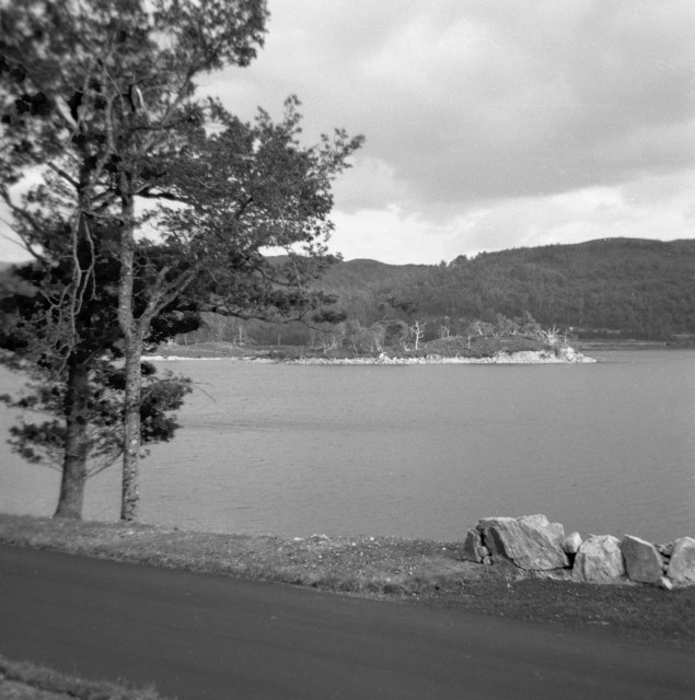
Eilean Nan Mhuilchean, Crannog ✦ Ancient woodland
Plan your visit
🦅 Birds🌳 Ancient🦉 Wildlife
Dogs welcome
Getting here
57.07769, -4.87772
Open directionsv Visiting this summer
Seasonal nature notes and what to look for now
▾ 🐦 44+ species recorded in this area — summer evenings are best for activity; watch for Chaffinch and Coal Tit 🌳 Ancient woodland is at its best in summer here 🐕 Dogs welcome — bring water in summer; the site has enough space to find shade on hot days 🌤️ Visiting this summer
🐦 44+ species recorded in this area — summer evenings are best for activity; watch for Chaffinch and Coal Tit 🌳 Ancient woodland is at its best in summer here 🐕 Dogs welcome — bring water in summer; the site has enough space to find shade on hot days
Best for 9 activities 🦅 Bird watching
Very strong match
Free Birds — Chaffinch, Coal Tit, Siskin +41 more · last seen 2025; Ancient woodland — owls, woodpeckers, warblers
🌳 Ancient woodland
Strong match
Free Ancient woodland — continuous woodland since before 1600
Birds — Chaffinch, Coal Tit, Siskin +41 more · last seen 2025; Ancient woodland
🍄 Mushroom foraging
Strong match
Varies Fungi — Peltigera membranacea, Thelotrema lepadinum, Pannaria rubiginosa +33 more · last seen 2015
🍂 Seasonal nature
Strong match
Free Plants — Heather, Bulbous Rush, Soft-rush +188 more · last seen 2016; Ancient woodland — bluebells, fungi and autumn colour
🦋 Insect spotting
Strong match
Free Insects — Scotch Argus, Common Hawker, Dark Green Fritillary +29 more · last seen 2024
Trails nearby Within roughly 5 km 3 signed routes nearby
Signed route nearby
Great Glen Way - Slighe a' Ghlinne Mhòir Walking route 120 km ▾ A waymarked route (75 m/120 km) from Fort William (leaving behind Britain’s highest mountain, Ben Nevis) to Inverness, the Highlands capital. It follows a great geological fault and sections of Thomas Telford’s historic Caledonian Canal.
Named route Length 120 km National walking route
Show on map Cape Wrath Trail (Fort William → Invergarry → Morvich) Walking route ▾ unmarked
Named route National walking route
Show on map Great Glen Way Low Route Walking route ▾ Named route National walking route
Show on map 6 signed routes nearby
Signed route nearby
NCN National Route 78 (north) Cycling route ▾ Named route Ref 78 National Cycle Network
Show on map Main Route Cycling route 374 m ▾ Named route Ref 78 Length 374 m National Cycle Network On-road Surface asphalt
Show on map Main Route Cycling route 6.6 km ▾ Named route Ref 78 Length 6.6 km National Cycle Network Traffic-free Surface unsealedloose
Show on map Main Route Cycling route 24 m ▾ Named route Ref 78 Length 24 m National Cycle Network On-road Surface unsealedloose
Show on map Main Route Cycling route 20 m ▾ Named route Ref 78 Length 20 m National Cycle Network Traffic-free Surface unsealedloose
Show on map Main Route Cycling route 2.5 km ▾ Named route Ref 78 Length 2.5 km National Cycle Network Traffic-free Surface unsealedfirm
Show on map 2 signed routes nearby
Signed route nearby
Scotland Trail Mountain bike route ▾ Named route Regional cycle route
Show on map Highland Trail 550 Mountain bike route ▾ ✦ Ancient woodland — continuously wooded since at least 1600 AD. A rare and irreplaceable habitat, rich in biodiversity and historical character.
Photos
15 photos from nearby open sources
▾ Good to know 🐕 Dogs welcome🌿 Ancient woodland — rare wildlife habitat
Weather for this location Next 14 days Nearby places Useful places within 5 km
All Historic
UK green spaces mapped from open public data — so anyone can find the woodland, trail, or nature reserve closest to them.
© 2026 Glade · Made with care for UK green spaces
Wildlife to spot
711 records from NBN Atlas
▾
Wildlife to spot 711 records · NBN Atlas 🐦 Birds 44 species
spring summer
2025 Chaffinch · Coal Tit · Siskin · Great Spotted Woodpecker · Wood Warbler
+39 more species Hide species list All 44 birds recorded nearby (NBN Atlas)
Chaffinch Fringilla coelebs Coal Tit Periparus ater Siskin Spinus spinus Great Spotted Woodpecker Dendrocopos major Wood Warbler Phylloscopus sibilatrix2024 Willow Warbler Phylloscopus trochilus2022 Robin Erithacus rubecula2022 Goldcrest Regulus regulus2022 Bullfinch Pyrrhula pyrrhula House Martin Delichon urbicum Song Thrush Turdus philomelos2022 Wren Troglodytes troglodytes2022 Dipper Cinclus cinclus2022 Blue Tit Cyanistes caeruleus2022 Swallow Hirundo rustica Woodpigeon Columba palumbus Mallard Anas platyrhynchos2022 Tree Pipit Anthus trivialis Goosander Mergus merganser2022 Grey Wagtail Motacilla cinerea2019 Hooded Crow Corvus cornix Swift Apus apus Jay Garrulus glandarius2022 Canada Goose Branta canadensis2022 Greylag Goose Anser anser2022 Lesser Redpoll Acanthis flammea cabaret2017 Blackbird Turdus merula2017 Great Tit Parus major2017 Stonechat Saxicola rubicola2017 Crested Tit Lophophanes cristatus Garden Warbler Sylvia borin2022 Pink-footed Goose Anser brachyrhynchus2022 Sand Martin Riparia riparia2017 Meadow Pipit Anthus pratensis2017 Cuckoo Cuculus canorus2017 House Sparrow Passer domesticus2017 Long-tailed Tit Aegithalos caudatus2017 Blackcap Sylvia atricapilla2017 Oystercatcher Haematopus ostralegus2017 Herring Gull Larus argentatus2017 Raven Corvus corax2014 Treecreeper Certhia familiaris2011 Crossbill Loxia curvirostra2011 Carrion Crow Corvus corone2011 Red Deer · Wild Boar · Pine Marten · Red Squirrel · Roe Deer
+2 more species Hide species list All 7 mammals recorded nearby (NBN Atlas)
Red Deer Cervus elaphus2015 Wild Boar Sus scrofa2019 Pine Marten Martes martes Red Squirrel Sciurus vulgaris2021 Roe Deer Capreolus capreolus2015 Red Fox Scotch Argus · Common Hawker · Dark Green Fritillary · Large Red Damselfly · Golden-ringed Dragonfly
+27 more species Hide species list All 32 insects recorded nearby (NBN Atlas)
Scotch Argus Erebia aethiops2014 Common Hawker Aeshna juncea Dark Green Fritillary Speyeria aglaja2014 Large Red Damselfly Pyrrhosoma nymphula2023 Golden-ringed Dragonfly Cordulegaster boltonii2023 🍄 Fungi 36 species
spring summer
2015 Peltigera membranacea · Thelotrema lepadinum · Pannaria rubiginosa · Lungwort Lichen · Lobarina scrobiculata
+31 more species Hide species list All 36 fungi recorded nearby (NBN Atlas)
Peltigera membranacea Peltigera membranacea Thelotrema lepadinum Thelotrema lepadinum Pannaria rubiginosa Pannaria rubiginosa Lungwort Lichen Lobaria pulmonaria Lobarina scrobiculata Lobarina scrobiculata Sticta fuliginosa s. lat. 🌿 Plants 191 species
spring summer
2016 Heather · Bulbous Rush · Soft-rush · Purple Moor-grass · Jacobaea
+186 more species Hide species list All 191 plants recorded nearby (NBN Atlas)
Heather Calluna vulgaris Bulbous Rush Juncus bulbosus Soft-rush Juncus effusus Purple Moor-grass Molinia caerulea Jacobaea Jacobaea Alder Alnus glutinosa Species observations from the last 10 years via NBN Atlas
Vulpes vulpes2015
Vulpes vulpes2015
American Mink Neovison vison2014
American Mink Neovison vison2014 Four-spotted Chaser
Four-spotted Chaser
Libellula quadrimaculata2023
Libellula quadrimaculata2023
Peacock Aglais io2011
Peacock Aglais io2011
Green-veined White Pieris napi2010
Green-veined White Pieris napi2010
White-faced Darter Leucorrhinia dubia2021
White-faced Darter Leucorrhinia dubia2021
Meadow Brown Maniola jurtina2013
Meadow Brown Maniola jurtina2013
Common Darter Sympetrum striolatum2012
Common Darter Sympetrum striolatum2012
Common Blue Polyommatus icarus2016
Common Blue Polyommatus icarus2016
Azure Hawker Aeshna caerulea2022
Azure Hawker Aeshna caerulea2022
Black Darter Sympetrum danae2014
Black Darter Sympetrum danae2014
Pearl-bordered Fritillary Boloria euphrosyne2010
Pearl-bordered Fritillary Boloria euphrosyne2010
Green Tiger Beetle Cicindela campestris2010
Green Tiger Beetle Cicindela campestris2010
Northern Emerald Somatochlora arctica2023
Northern Emerald Somatochlora arctica2023
Common Blue Damselfly Enallagma cyathigerum2023
Common Blue Damselfly Enallagma cyathigerum2023
Emerald Damselfly Lestes sponsa2014
Emerald Damselfly Lestes sponsa2014
Dictyoptera aurora Dictyoptera aurora2011
Dictyoptera aurora Dictyoptera aurora2011
Grey Birch Aethalura punctulata2011
Grey Birch Aethalura punctulata2011
Brown Silver-line Petrophora chlorosata2011
Brown Silver-line Petrophora chlorosata2011
Common Ground-hopper Tetrix undulata2011
Common Ground-hopper Tetrix undulata2011
Drinker Euthrix potatoria2011
Drinker Euthrix potatoria2011
Satyr Pug Eupithecia satyrata2011
Satyr Pug Eupithecia satyrata2011
Oak Eggar Lasiocampa quercus2011
Oak Eggar Lasiocampa quercus2011
Dalopius marginatus Dalopius marginatus2011
Dalopius marginatus Dalopius marginatus2011
Barynotus squamosus Barynotus squamosus2011
Barynotus squamosus Barynotus squamosus2011
Common Spangle Causer Neuroterus quercusbaccarum f. agamic2010
Common Spangle Causer Neuroterus quercusbaccarum f. agamic2010
Bee Beetle Trichius fasciatus2010
Bee Beetle Trichius fasciatus2010
Poplar Hawk-moth Laothoe populi2010
Poplar Hawk-moth Laothoe populi2010
Scottish Wood Ant Formica aquilonia2011
Scottish Wood Ant Formica aquilonia2011 Sticta fuliginosa s. lat.
Sticta fuliginosa s. lat.
Ricasolia virens Ricasolia virens
Ricasolia virens Ricasolia virens
Protopannaria pezizoides Protopannaria pezizoides
Protopannaria pezizoides Protopannaria pezizoides
Cudbear Ochrolechia tartarea
Cudbear Ochrolechia tartarea
Bunodophoron melanocarpum Bunodophoron melanocarpum
Bunodophoron melanocarpum Bunodophoron melanocarpum
Pectenia plumbea s. str. Pectenia plumbea s. str.
Pectenia plumbea s. str. Pectenia plumbea s. str.
Nephroma laevigatum Nephroma laevigatum
Nephroma laevigatum Nephroma laevigatum
Peltigera collina Peltigera collina
Peltigera collina Peltigera collina
Roselliniopsis tartaricola Roselliniopsis tartaricola2012
Roselliniopsis tartaricola Roselliniopsis tartaricola2012
Varicellaria hemisphaerica Varicellaria hemisphaerica2012
Varicellaria hemisphaerica Varicellaria hemisphaerica2012
Pertusaria coronata Pertusaria coronata2012
Pertusaria coronata Pertusaria coronata2012
Lopadium disciforme Lopadium disciforme2012
Lopadium disciforme Lopadium disciforme2012
Violet Bramble Rust Phragmidium violaceum2010
Violet Bramble Rust Phragmidium violaceum2010
Graphis elegans Graphis elegans2010
Graphis elegans Graphis elegans2010
Parmeliella thriptophylla Parmeliella thriptophylla2010
Parmeliella thriptophylla Parmeliella thriptophylla2010
Sticta sylvatica Sticta sylvatica2010
Sticta sylvatica Sticta sylvatica2010
Sphaerophorus globosus Sphaerophorus globosus2010
Sphaerophorus globosus Sphaerophorus globosus2010
Lecanactis abietina Lecanactis abietina2010
Lecanactis abietina Lecanactis abietina2010
Parmeliopsis hyperopta Parmeliopsis hyperopta2010
Parmeliopsis hyperopta Parmeliopsis hyperopta2010
Script Lichen Graphis scripta s. lat.2010
Script Lichen Graphis scripta s. lat.2010
Cladonia diversa Cladonia diversa2010
Cladonia diversa Cladonia diversa2010
Platismatia glauca Platismatia glauca2010
Platismatia glauca Platismatia glauca2010
crotail rèin-fhèidh Cladonia portentosa2010
crotail rèin-fhèidh Cladonia portentosa2010
Mycoblastus sanguinarius f. sanguinarius Mycoblastus sanguinarius f. sanguinarius2010
Mycoblastus sanguinarius f. sanguinarius Mycoblastus sanguinarius f. sanguinarius2010
Pectenia cyanoloma Pectenia cyanoloma2010
Pectenia cyanoloma Pectenia cyanoloma2010
Usnea dasopoga Usnea dasopoga2010
Usnea dasopoga Usnea dasopoga2010
Cladonia squamosa s. lat. Cladonia squamosa s. lat.2010
Cladonia squamosa s. lat. Cladonia squamosa s. lat.2010
Loxospora elatina s. lat. Loxospora elatina s. lat.2010
Loxospora elatina s. lat. Loxospora elatina s. lat.2010
Parmelia saxatilis s. lat. Parmelia saxatilis s. lat.2010
Parmelia saxatilis s. lat. Parmelia saxatilis s. lat.2010
Usnea cornuta s. lat. Usnea cornuta s. lat.2010
Usnea cornuta s. lat. Usnea cornuta s. lat.2010
Dark Crottle Hypogymnia physodes2010
Dark Crottle Hypogymnia physodes2010
Cross-leaved Heath Erica tetralix
Cross-leaved Heath Erica tetralix
Lesser Spearwort Ranunculus flammula
Lesser Spearwort Ranunculus flammula
Common Yellow-sedge Carex demissa
Common Yellow-sedge Carex demissa
Jointed Rush Juncus articulatus
Jointed Rush Juncus articulatus
Bog-myrtle Myrica gale
Bog-myrtle Myrica gale
Star Sedge Carex echinata
Star Sedge Carex echinata
Downy Birch Betula pubescens2013
Downy Birch Betula pubescens2013
Rowan Sorbus aucuparia2013
Rowan Sorbus aucuparia2013
Slender St John's-wort Hypericum pulchrum2013
Slender St John's-wort Hypericum pulchrum2013
Sitka Spruce Picea sitchensis2013
Sitka Spruce Picea sitchensis2013
Bilberry Vaccinium myrtillus2013
Bilberry Vaccinium myrtillus2013
Hard-fern Blechnum spicant2013
Hard-fern Blechnum spicant2013
Rosebay Willowherb Chamaenerion angustifolium2013
Rosebay Willowherb Chamaenerion angustifolium2013
Carnation Sedge Carex panicea
Carnation Sedge Carex panicea
Alternate Water-milfoil Myriophyllum alterniflorum
Alternate Water-milfoil Myriophyllum alterniflorum
Common Sedge Carex nigra
Common Sedge Carex nigra
Shoreweed Littorella uniflora
Shoreweed Littorella uniflora
Selfheal Prunella vulgaris
Selfheal Prunella vulgaris
Gwair Merllyn Isoetes lacustris
Gwair Merllyn Isoetes lacustris
Floating Bur-reed Sparganium angustifolium
Floating Bur-reed Sparganium angustifolium
Creeping Bent Agrostis stolonifera
Creeping Bent Agrostis stolonifera
Devil's-bit Scabious Succisa pratensis
Devil's-bit Scabious Succisa pratensis
Marsh Violet Viola palustris
Marsh Violet Viola palustris
Woolly Fringe-moss Racomitrium lanuginosum2015
Woolly Fringe-moss Racomitrium lanuginosum2015
Lesser Featherwort Plagiochila porelloides var. porelloides2015
Lesser Featherwort Plagiochila porelloides var. porelloides2015
Palmate Germanderwort Riccardia palmata2015
Palmate Germanderwort Riccardia palmata2015
Creeping Fingerwort Lepidozia reptans2015
Creeping Fingerwort Lepidozia reptans2015
White Earwort Diplophyllum albicans2015
White Earwort Diplophyllum albicans2015
Mougeot's Yoke-moss Amphidium mougeotii2015
Mougeot's Yoke-moss Amphidium mougeotii2015
Lyon's Notchwort Tritomaria quinquedentata2015
Lyon's Notchwort Tritomaria quinquedentata2015
Elegant Silk-moss Pseudotaxiphyllum elegans2015
Elegant Silk-moss Pseudotaxiphyllum elegans2015
Mueller's Pouchwort Calypogeia muelleriana2015
Mueller's Pouchwort Calypogeia muelleriana2015
Bifid Crestwort Lophocolea bidentata2015
Bifid Crestwort Lophocolea bidentata2015
Little Shaggy-moss Rhytidiadelphus loreus2015
Little Shaggy-moss Rhytidiadelphus loreus2015
Dwarf Neckera Neckera pumila2015
Dwarf Neckera Neckera pumila2015
Forked Veilwort Metzgeria furcata2015
Forked Veilwort Metzgeria furcata2015
Common Tamarisk-moss Thuidium tamariscinum2015
Common Tamarisk-moss Thuidium tamariscinum2015
Common Striated Feather-moss Eurhynchium striatum2015
Common Striated Feather-moss Eurhynchium striatum2015
Frizzled Crisp-moss Tortella tortuosa2015
Frizzled Crisp-moss Tortella tortuosa2015
Big Shaggy-moss Hylocomiadelphus triquetrus2015
Big Shaggy-moss Hylocomiadelphus triquetrus2015
Wood-rust Cephalozia curvifolia2015
Wood-rust Cephalozia curvifolia2015
Common Apple-moss Bartramia pomiformis2015
Common Apple-moss Bartramia pomiformis2015
Isothecium interludens Isothecium interludens2015
Isothecium interludens Isothecium interludens2015
Isothecium myosuroides Isothecium myosuroides2015
Isothecium myosuroides Isothecium myosuroides2015
Ostrich-plume Feather-moss Ptilium crista-castrensis2015
Ostrich-plume Feather-moss Ptilium crista-castrensis2015
Western Earwort Scapania gracilis2015
Western Earwort Scapania gracilis2015
Pearl Pouncewort Lejeunea patens2015
Pearl Pouncewort Lejeunea patens2015
Hart's-tongue Thyme-moss Plagiomnium undulatum2015
Hart's-tongue Thyme-moss Plagiomnium undulatum2015
Prickly Featherwort Plagiochila spinulosa2015
Prickly Featherwort Plagiochila spinulosa2015
Balding Pincushion Ulota calvescens2015
Balding Pincushion Ulota calvescens2015
Shining Hookeria Hookeria lucens2015
Shining Hookeria Hookeria lucens2015
Dotted Thyme-moss Rhizomnium punctatum2015
Dotted Thyme-moss Rhizomnium punctatum2015
Woodsy Silk-moss Plagiothecium nemorale2015
Woodsy Silk-moss Plagiothecium nemorale2015
Common Feather-moss Kindbergia praelonga2015
Common Feather-moss Kindbergia praelonga2015
Twisted Grimmia Grimmia torquata2015
Twisted Grimmia Grimmia torquata2015
Broom Fork-moss Dicranum scoparium2015
Broom Fork-moss Dicranum scoparium2015
Greater Featherwort Plagiochila asplenioides2015
Greater Featherwort Plagiochila asplenioides2015
Greater Fork-moss Dicranum majus2015
Greater Fork-moss Dicranum majus2015
Swan's-neck Thyme-moss Mnium hornum2015
Swan's-neck Thyme-moss Mnium hornum2015
Marsh Bryum Bryum pseudotriquetrum2015
Marsh Bryum Bryum pseudotriquetrum2015
Bruch's Pincushion Ulota bruchii2015
Bruch's Pincushion Ulota bruchii2015
Hair-pointed Feather-moss Cirriphyllum piliferum2015
Hair-pointed Feather-moss Cirriphyllum piliferum2015
Hartman's Grimmia Grimmia hartmanii2015
Hartman's Grimmia Grimmia hartmanii2015
Tall Thyme-moss Plagiomnium elatum2015
Tall Thyme-moss Plagiomnium elatum2015
Silky Wall Feather-moss Homalothecium sericeum2015
Silky Wall Feather-moss Homalothecium sericeum2015
Pendulous Wing-moss Antitrichia curtipendula2015
Pendulous Wing-moss Antitrichia curtipendula2015
Shady Earwort Scapania umbrosa2015
Shady Earwort Scapania umbrosa2015
Cliff Scalewort Porella cordaeana2015
Cliff Scalewort Porella cordaeana2015
Even Scalewort Radula complanata2015
Even Scalewort Radula complanata2015
Rhododendron Rhododendron ponticum2015
Rhododendron Rhododendron ponticum2015
Glittering Wood-moss Hylocomium splendens2015
Glittering Wood-moss Hylocomium splendens2015
Flat Neckera Neckera complanata2015
Flat Neckera Neckera complanata2015
Sharp-leaved Blindia Blindia acuta2015
Sharp-leaved Blindia Blindia acuta2015
Neat Feather-moss Pseudoscleropodium purum2015
Neat Feather-moss Pseudoscleropodium purum2015
Pellucid Four-tooth Moss Tetraphis pellucida2015
Pellucid Four-tooth Moss Tetraphis pellucida2015
Waved Silk-moss Plagiothecium undulatum2015
Waved Silk-moss Plagiothecium undulatum2015
Short-beaked Wood-moss Loeskeobryum brevirostre2015
Short-beaked Wood-moss Loeskeobryum brevirostre2015
Spotty Featherwort Plagiochila punctata2015
Spotty Featherwort Plagiochila punctata2015
Lesser Yoke-moss Zygodon conoideus2015
Lesser Yoke-moss Zygodon conoideus2015
Yorkshire-fog Holcus lanatus2013
Yorkshire-fog Holcus lanatus2013
Eared Willow Salix aurita2013
Eared Willow Salix aurita2013
Dryopteris affinis Dryopteris affinis2013
Dryopteris affinis Dryopteris affinis2013
Marsh Thistle Cirsium palustre2013
Marsh Thistle Cirsium palustre2013
Compact Rush Juncus conglomeratus2013
Compact Rush Juncus conglomeratus2013
Bracken Pteridium aquilinum2013
Bracken Pteridium aquilinum2013
Green-ribbed Sedge Carex binervis2013
Green-ribbed Sedge Carex binervis2013
Common Juniper Juniperus communis subsp. communis2013
Common Juniper Juniperus communis subsp. communis2013
Broad Buckler-fern Dryopteris dilatata2013
Broad Buckler-fern Dryopteris dilatata2013
Smooth Hawk's-beard Crepis capillaris2013
Smooth Hawk's-beard Crepis capillaris2013
Heath Wood-rush Luzula multiflora2013
Heath Wood-rush Luzula multiflora2013
Fairy Flax Linum catharticum2013
Fairy Flax Linum catharticum2013
Broad-leaved Willowherb Epilobium montanum2013
Broad-leaved Willowherb Epilobium montanum2013
Foxglove Digitalis purpurea2013
Foxglove Digitalis purpurea2013
Heath Speedwell Veronica officinalis2013
Heath Speedwell Veronica officinalis2013
Gorse Ulex europaeus2013
Gorse Ulex europaeus2013
White Clover Trifolium repens2013
White Clover Trifolium repens2013
Beech Fern Phegopteris connectilis2013
Beech Fern Phegopteris connectilis2013
Scots Pine Pinus sylvestris2013
Scots Pine Pinus sylvestris2013
Flea Sedge Carex pulicaris2013
Flea Sedge Carex pulicaris2013
Male-fern Dryopteris filix-mas2013
Male-fern Dryopteris filix-mas2013
Creeping Soft-grass Holcus mollis2013
Creeping Soft-grass Holcus mollis2013
Raspberry Rubus idaeus2013
Raspberry Rubus idaeus2013
Grass Poaceae2013
Grass Poaceae2013
Herb-Robert Geranium robertianum2013
Herb-Robert Geranium robertianum2013
Lemon-scented Fern Oreopteris limbosperma2013
Lemon-scented Fern Oreopteris limbosperma2013
Agrostis canina Agrostis canina2013
Agrostis canina Agrostis canina2013
Honeysuckle Lonicera periclymenum2013
Honeysuckle Lonicera periclymenum2013
Wood-sorrel Oxalis acetosella2013
Wood-sorrel Oxalis acetosella2013
Oak Fern Gymnocarpium dryopteris2013
Oak Fern Gymnocarpium dryopteris2013
Wild Strawberry Fragaria vesca2013
Wild Strawberry Fragaria vesca2013
Spreading Meadow-grass Poa humilis2013
Spreading Meadow-grass Poa humilis2013
Dandelion Taraxacum2013
Dandelion Taraxacum2013
Bush Vetch Vicia sepium2013
Bush Vetch Vicia sepium2013
Lodgepole Pine Pinus contorta2013
Lodgepole Pine Pinus contorta2013
Silver Birch Betula pendula2013
Silver Birch Betula pendula2013
Hazel Corylus avellana2013
Hazel Corylus avellana2013
Meadowsweet Filipendula ulmaria
Meadowsweet Filipendula ulmaria
Intermediate Water-Starwort Callitriche brutia subsp. hamulata
Intermediate Water-Starwort Callitriche brutia subsp. hamulata
Spring Quillwort Isoetes echinospora
Spring Quillwort Isoetes echinospora
Marsh Pennywort Hydrocotyle vulgaris
Marsh Pennywort Hydrocotyle vulgaris
Tormentil Potentilla erecta
Tormentil Potentilla erecta
Nordic Bladderwort Utricularia stygia
Nordic Bladderwort Utricularia stygia
Autumn Hawkbit Scorzoneroides autumnalis
Autumn Hawkbit Scorzoneroides autumnalis
Tufted Hair-grass Deschampsia cespitosa
Tufted Hair-grass Deschampsia cespitosa
Cypress-leaved Plait-moss Hypnum cupressiforme2015
Cypress-leaved Plait-moss Hypnum cupressiforme2015
Hypnum cupressiforme var. cupressiforme Hypnum cupressiforme var. cupressiforme2015
Hypnum cupressiforme var. cupressiforme Hypnum cupressiforme var. cupressiforme2015
Common Bent Agrostis capillaris2013
Common Bent Agrostis capillaris2013
Greater Plantain Plantago major2013
Greater Plantain Plantago major2013
Hare's-tail Cottongrass Eriophorum vaginatum2013
Hare's-tail Cottongrass Eriophorum vaginatum2013
Polypody Polypodium vulgare2013
Polypody Polypodium vulgare2013
Wavy Bitter-cress Cardamine flexuosa2013
Wavy Bitter-cress Cardamine flexuosa2013
Bell Heather Erica cinerea2013
Bell Heather Erica cinerea2013
Common Dog-violet Viola riviniana2013
Common Dog-violet Viola riviniana2013
Common Mouse-ear Cerastium fontanum2013
Common Mouse-ear Cerastium fontanum2013
Cowberry Vaccinium vitis-idaea2013
Cowberry Vaccinium vitis-idaea2013
Tufted Vetch Vicia cracca2013
Tufted Vetch Vicia cracca2013
Common Figwort Scrophularia nodosa2013
Common Figwort Scrophularia nodosa2013
Annual Meadow-grass Poa annua2013
Annual Meadow-grass Poa annua2013
New Zealand Willowherb Epilobium brunnescens2013
New Zealand Willowherb Epilobium brunnescens2013
Pale Sedge Carex pallescens2013
Pale Sedge Carex pallescens2013
Deergrass Trichophorum cespitosum2013
Deergrass Trichophorum cespitosum2013
Goat Willow Salix caprea2013
Goat Willow Salix caprea2013
Common Butterwort Pinguicula vulgaris2013
Common Butterwort Pinguicula vulgaris2013
Marsh Hawk's-beard Crepis paludosa2013
Marsh Hawk's-beard Crepis paludosa2013
Cat's-ear Hypochaeris radicata2013
Cat's-ear Hypochaeris radicata2013
Yellow-rattle Rhinanthus minor2013
Yellow-rattle Rhinanthus minor2013
False Oat-grass Arrhenatherum elatius2013
False Oat-grass Arrhenatherum elatius2013
Cock's-foot Dactylis glomerata2013
Cock's-foot Dactylis glomerata2013
Smooth Lady's-mantle Alchemilla glabra2013
Smooth Lady's-mantle Alchemilla glabra2013
Ribwort Plantain Plantago lanceolata2013
Ribwort Plantain Plantago lanceolata2013
Yarrow Achillea millefolium2013
Yarrow Achillea millefolium2013
Heath Rush Juncus squarrosus2013
Heath Rush Juncus squarrosus2013
Mouse-ear-hawkweed Pilosella officinarum2013
Mouse-ear-hawkweed Pilosella officinarum2013
Viviparous Sheep's-fescue Festuca vivipara2013
Viviparous Sheep's-fescue Festuca vivipara2013
Round-leaved Sundew Drosera rotundifolia2013
Round-leaved Sundew Drosera rotundifolia2013
Field Horsetail Equisetum arvense2013
Field Horsetail Equisetum arvense2013
Meadow Vetchling Lathyrus pratensis2013
Meadow Vetchling Lathyrus pratensis2013
Sweet Vernal-grass Anthoxanthum odoratum2013
Sweet Vernal-grass Anthoxanthum odoratum2013
Heath Bedstraw Galium saxatile2013
Heath Bedstraw Galium saxatile2013
Yellow Pimpernel Lysimachia nemorum2013
Yellow Pimpernel Lysimachia nemorum2013
Festuca rubra Festuca rubra2013
Festuca rubra Festuca rubra2013
Scaly Male-fern Dryopteris affinis2013
Scaly Male-fern Dryopteris affinis2013
Long-Stalked Yellow Sedge Carex lepidocarpa2013
Long-Stalked Yellow Sedge Carex lepidocarpa2013
Red Clover Trifolium pratense2013
Red Clover Trifolium pratense2013
Common Bird's-foot-trefoil Lotus corniculatus2013
Common Bird's-foot-trefoil Lotus corniculatus2013
Creeping Buttercup Ranunculus repens2013
Creeping Buttercup Ranunculus repens2013
Common Nettle Urtica dioica2013
Common Nettle Urtica dioica2013
Procumbent Pearlwort Sagina procumbens2013
Procumbent Pearlwort Sagina procumbens2013
Hogweed Heracleum sphondylium2013
Hogweed Heracleum sphondylium2013
Pimpernel Lysimachia2013
Pimpernel Lysimachia2013
Sycamore Acer pseudoplatanus2013
Sycamore Acer pseudoplatanus2013
Spear Thistle Cirsium vulgare2013
Spear Thistle Cirsium vulgare2013
Bog Asphodel Narthecium ossifragum2013
Bog Asphodel Narthecium ossifragum2013
Ash Fraxinus excelsior2013
Ash Fraxinus excelsior2013
Wood Sage Teucrium scorodonia2013
Wood Sage Teucrium scorodonia2013
Germander Speedwell Veronica chamaedrys2013
Germander Speedwell Veronica chamaedrys2013
Common Cottongrass Eriophorum angustifolium2013
Common Cottongrass Eriophorum angustifolium2013
Rusty Willow Salix cinerea subsp. oleifolia2013
Rusty Willow Salix cinerea subsp. oleifolia2013
Norway Spruce Picea abies2013
Norway Spruce Picea abies2013
Bugle Ajuga reptans2011
Bugle Ajuga reptans2011
Sessile Oak Quercus petraea2011
Sessile Oak Quercus petraea2011
Primrose Primula vulgaris2011
Primrose Primula vulgaris2011
Wild Angelica Angelica sylvestris2011
Wild Angelica Angelica sylvestris2011
Great Wood-rush Luzula sylvatica2011
Great Wood-rush Luzula sylvatica2011
Goldenrod Solidago virgaurea2011
Goldenrod Solidago virgaurea2011 Events & activities nearby Switch provider to compare local events, tours and bookable activities.
Bookable tours GetYourGuide Tripadvisor