🐦36+ species recorded in this area — summer evenings are best for activity; watch for Woodpigeon and Kestrel
✦Historic character is a year-round quality here — summer brings its own atmosphere to the setting
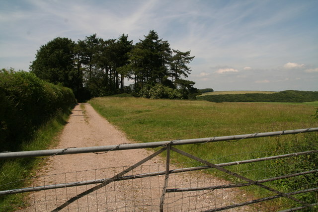
🐕Dogs welcome — bring water in summer; the site has enough space to find shade on hot days
🌤️ Visiting this summer
🐦36+ species recorded in this area — summer evenings are best for activity; watch for Woodpigeon and Kestrel
✦Historic character is a year-round quality here — summer brings its own atmosphere to the setting
🐕Dogs welcome — bring water in summer; the site has enough space to find shade on hot days
Best for
7 activities
🦅
Bird watching
Very strong match
Free
Birds — Woodpigeon, Kestrel, Blue Tit +33 more · last seen 2025; Deciduous woodland — woodpeckers, warblers and woodland birds
🦉
Wildlife
Strong match
Free
Birds — Woodpigeon, Kestrel, Blue Tit +33 more · last seen 2025; Deciduous woodland priority habitat
🌳
Ancient woodland
Strong match
Free
Ancient woodland — continuous woodland since before 1600
🦋
Insect spotting
Strong match
Free
Chalk and limestone grassland — chalkhill blue, adonis blue and rare moths; Insects — Meadow Brown, Gatekeeper, Small White +47 more · last seen 2026
✦
Heritage
Strong match
Free
Historic site
🌿
Foraging
Good match
Varies
Deciduous woodland — fungi, berries and wild garlic
Trails nearby
Within roughly 5 km
🚶
Walking
▾
5 signed routes nearby
Signed route nearby
Cranborne Droves WayWalking route▾
The route of the Cranborne Droves Way walkers route between Win Green where it links with Wessex Ridgeway and Salisbury where it links with the Sarsen Way
Named routeRegional walking route
Fontmell Down walk, Fontmell and Melbury DownsWalking route1.6 km▾
The down has open access, so you can explore the whole area. The well-used paths and tracks include steep slopes, with uneven surfaces which become muddy and slippery after wet weather.
Named routeLength 1.6 kmDuration 00:45Round tripLocal walking route
Melbury Beacon walk, Fontmell and Melbury DownsWalking route3.7 km▾
The down has open access, so you can explore the whole area. The well-used paths and tracks include steep slopes, with uneven surfaces that become muddy and slippery after wet weather. Dogs are welcome under close control, as livestock grazes the down.
Named routeLength 3.7 kmDuration 01:30Round tripLocal walking route
Wessex RidgewayWalking route▾
Named routeRef WRRegional walking route
The Hardy WayWalking route▾
Named routeRegional walking route
🚴
Cycling
▾
8 signed routes nearby
Signed route nearby
Wiltshire CyclewayCycling route155 km▾
Named routeRef WCLength 155 kmRound tripRegional cycle route
Route 25Cycling route▾
Named routeRef 25National Cycle Network
National BywayCycling route▾
Named routeRef NBRegional cycle route
North Dorset Cycle WayCycling route▾
Named routeRegional cycle route
National Byway Dorset LoopCycling route▾
Named routeRef NB LoopLocal cycle route
Main RouteCycling route1.6 km▾
Named routeRef 25Length 1.6 kmNational Cycle NetworkOn-roadSurface asphalt
🚵
Mountain biking
▾
2 signed routes nearby
Signed route nearby
Wessex Ridgeway TrailMountain bike route▾
Named routeListed length 207km
Cranborne Droves Way TrailMountain bike route▾
Named route
🐴
Horse riding
▾
1 public path nearby
Public paths
No named routes yet. Public paths are shown on the map.