World War II bombing decoy, 500m north west of John Cross ✦ Ancient woodland 11 ha
Plan your visit
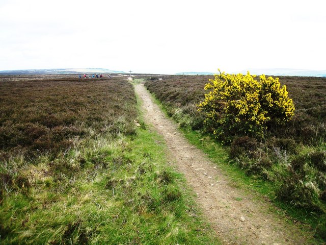
🦅 Birds🌳 Ancient🦉 Wildlife
Public access Free entry Dogs welcome 11 ha
Getting here
54.41389, -0.60793
Open directionsv Visiting this summer
Seasonal nature notes and what to look for now
▾ 🐦 89+ species recorded in this area — summer evenings are best for activity; watch for Wigeon and Chaffinch 🌳 Ancient woodland is at its best in summer here 🐕 Dogs welcome — bring water in summer; the site has enough space to find shade on hot days 🌤️ Visiting this summer
🐦 89+ species recorded in this area — summer evenings are best for activity; watch for Wigeon and Chaffinch 🌳 Ancient woodland is at its best in summer here 🐕 Dogs welcome — bring water in summer; the site has enough space to find shade on hot days
Best for 11 activities 🦅 Bird watching
Very strong match
Free Birds — Wigeon, Chaffinch, Blackbird +86 more · last seen 2025; Upland heathland — red grouse, merlin and short-eared owl
🌳 Ancient woodland
Very strong match
Free Ancient woodland — continuous woodland since before 1600
Birds — Wigeon, Chaffinch, Blackbird +86 more · last seen 2025; Upland heathland priority habitat
Historic site with public access
💜 Bluebell walks
Strong match
Free Ancient woodland — native bluebell habitat
🍂 Seasonal nature
Strong match
Free Ancient woodland — bluebells, fungi and autumn colour; Plants — Broad-leaved Helleborine, Marsh Pennywort, Heath Spotted-orchid +62 more · last seen 2026
Trails nearby Within roughly 5 km 6 signed routes nearby · 13 public paths nearby
Signed route nearby Public paths
Cleveland Way Walking route ▾ Named route Point-to-point National walking route
Show on map Lyke Wake Walk Walking route ▾ Named route Regional walking route
Show on map Esk Valley Walk Walking route ▾ Named route Ref EV Regional walking route
Show on map King Charles III England Coast Path: Filey Brigg to North Gare Walking route ▾ Named route Ref ECP National walking route
Show on map Coast to Coast Walk (Richmond to Robin Hood’s Bay) Walking route ▾ Named route Ref C2C Regional walking route
Show on map 15 signed routes nearby
Signed route nearby
EuroVelo 12 - North Sea Cycle Route - part United Kingdom 3 Cycling route ▾ Lincoln - Whitby
Named route Ref EV12 International cycle route
Show on map NCN 1 Humber to Tees Cycling route ▾ Named route Ref 1 National Cycle Network
Show on map Main Route Cycling route 63 m ▾ Named route Ref 1 Length 63 m National Cycle Network On-road Surface asphalt
Show on map Main Route Cycling route 1.1 km ▾ Named route Ref 1 Length 1.1 km National Cycle Network Traffic-free Surface asphalt
Show on map Main Route Cycling route 106 m ▾ Named route Ref 1 Length 106 m National Cycle Network On-road Surface asphalt
Show on map Main Route Cycling route 27 m ▾ Named route Ref 1 Length 27 m National Cycle Network On-road Surface asphalt
Show on map 1 signed route nearby
Signed route nearby
Moors to Sea Mountain bike route ▾ 2 public paths nearby
Public paths
Robin Hood's Bay Road bridleway · 724 m ▾ Public path bridleway Length 724 m Surface dirt Path type: bridleway
Show on map Robin Hood's Bay Road bridleway · 285 m ▾ Public path bridleway Length 285 m Surface dirt Path type: track
Show on map About this historic site Scheduled Monument
Photos
15 photos from nearby open sources
▾ ✦ Ancient ✓ Public access Free entry 🐶 Dogs
Good to know £ Free to visit — no entry charge🐕 Dogs welcome🌿 Ancient woodland — rare wildlife habitat
Weather for this location Next 14 days Nearby places Useful places within 5 km
All Historic
UK green spaces mapped from open public data — so anyone can find the woodland, trail, or nature reserve closest to them.
© 2026 Glade · Made with care for UK green spaces
Vulpes vulpes
Vulpes vulpes
Bottle-nosed Dolphin Tursiops truncatus
Bottle-nosed Dolphin Tursiops truncatus
Badger Meles meles
Badger Meles meles
Roe Deer Capreolus capreolus2023
Roe Deer Capreolus capreolus2023
Mole Talpa europaea2023
Mole Talpa europaea2023
Grey Squirrel Sciurus carolinensis2022
Grey Squirrel Sciurus carolinensis2022
December Moth Poecilocampa populi2019
December Moth Poecilocampa populi2019
Feathered Thorn Colotois pennaria2019
Feathered Thorn Colotois pennaria2019
Agapanthia villosoviridescens Agapanthia villosoviridescens
Agapanthia villosoviridescens Agapanthia villosoviridescens
Sericomyia silentis Sericomyia silentis2024
Sericomyia silentis Sericomyia silentis2024
Batman Hoverfly Myathropa florea
Batman Hoverfly Myathropa florea
Green Tiger Beetle Cicindela campestris
Green Tiger Beetle Cicindela campestris
Bog Bush-cricket Metrioptera brachyptera
Bog Bush-cricket Metrioptera brachyptera
Meliscaeva auricollis Meliscaeva auricollis2024
Meliscaeva auricollis Meliscaeva auricollis2024
Platycheirus albimanus Platycheirus albimanus2024
Platycheirus albimanus Platycheirus albimanus2024
Small Garden Bumblebee Bombus hortorum2023
Small Garden Bumblebee Bombus hortorum2023
Spruce Carpet Thera britannica2019
Spruce Carpet Thera britannica2019
Mottled Umber Erannis defoliaria2019
Mottled Umber Erannis defoliaria2019
Red-green Carpet Chloroclysta siterata2019
Red-green Carpet Chloroclysta siterata2019
Large Yellow Underwing Noctua pronuba2019
Large Yellow Underwing Noctua pronuba2019
Syrphus Syrphus
Syrphus Syrphus
Common Red Soldier Beetle Rhagonycha fulva
Common Red Soldier Beetle Rhagonycha fulva
Leucozona glaucia Leucozona glaucia2024
Leucozona glaucia Leucozona glaucia2024
Rhingia campestris Rhingia campestris2024
Rhingia campestris Rhingia campestris2024
Chrysogaster solstitialis Chrysogaster solstitialis2024
Chrysogaster solstitialis Chrysogaster solstitialis2024
Melanostoma scalare Melanostoma scalare2024
Melanostoma scalare Melanostoma scalare2024
Helophilus pendulus Helophilus pendulus2024
Helophilus pendulus Helophilus pendulus2024
Epistrophe grossulariae Epistrophe grossulariae2024
Epistrophe grossulariae Epistrophe grossulariae2024
Cheilosia illustrata Cheilosia illustrata2024
Cheilosia illustrata Cheilosia illustrata2024
Xylota segnis Xylota segnis2024
Xylota segnis Xylota segnis2024
Meliscaeva cinctella Meliscaeva cinctella2024
Meliscaeva cinctella Meliscaeva cinctella2024
Keeled Skimmer Orthetrum coerulescens2022
Keeled Skimmer Orthetrum coerulescens2022
Scarce Umber Agriopis aurantiaria2019
Scarce Umber Agriopis aurantiaria2019
Common Marbled Carpet Dysstroma truncata2019
Common Marbled Carpet Dysstroma truncata2019
Green Carpet Colostygia pectinataria2019
Green Carpet Colostygia pectinataria2019
Small Wainscot Denticucullus pygmina2019
Small Wainscot Denticucullus pygmina2019
Canary-shouldered Thorn Ennomos alniaria2019
Canary-shouldered Thorn Ennomos alniaria2019
Lesser Yellow Underwing Noctua comes2019
Lesser Yellow Underwing Noctua comes2019
Dingy Footman Eilema griseola2019
Dingy Footman Eilema griseola2019
July Highflyer Hydriomena furcata2019
July Highflyer Hydriomena furcata2019
Silver Y Autographa gamma2019
Silver Y Autographa gamma2019
Fork-tailed Flower Bee Anthophora furcata2019
Fork-tailed Flower Bee Anthophora furcata2019
Painted Lady Vanessa cardui2019
Painted Lady Vanessa cardui2019
Large Skipper Ochlodes sylvanus2019
Large Skipper Ochlodes sylvanus2019
Small Pearl-bordered Fritillary Boloria selene2019
Small Pearl-bordered Fritillary Boloria selene2019
Common Blue Polyommatus icarus2019
Common Blue Polyommatus icarus2019
Dasysyrphus Dasysyrphus
Dasysyrphus Dasysyrphus
Melanostoma Melanostoma
Melanostoma Melanostoma
Large Red Damselfly Pyrrhosoma nymphula
Large Red Damselfly Pyrrhosoma nymphula
Mottled Grasshopper Myrmeleotettix maculatus
Mottled Grasshopper Myrmeleotettix maculatus
Green Shieldbug Palomena prasina
Green Shieldbug Palomena prasina
Common Green Grasshopper Omocestus viridulus
Common Green Grasshopper Omocestus viridulus
Meadow Grasshopper Pseudochorthippus parallelus
Meadow Grasshopper Pseudochorthippus parallelus
Volucella bombylans Volucella bombylans
Volucella bombylans Volucella bombylans
Downlooker Snipefly Rhagio scolopaceus
Downlooker Snipefly Rhagio scolopaceus
Green Hairstreak Callophrys rubi
Green Hairstreak Callophrys rubi
Eristalis nemorum Eristalis nemorum2024
Eristalis nemorum Eristalis nemorum2024
Common Hawker Aeshna juncea2024
Common Hawker Aeshna juncea2024
Greater Bulb-Fly Merodon equestris2024
Greater Bulb-Fly Merodon equestris2024
Ferdinandea cuprea Ferdinandea cuprea2024
Ferdinandea cuprea Ferdinandea cuprea2024
Xanthandrus comtus Xanthandrus comtus2024
Xanthandrus comtus Xanthandrus comtus2024
Banded Demoiselle Calopteryx splendens2024
Banded Demoiselle Calopteryx splendens2024
Necklace Ground Beetle Carabus monilis2023
Necklace Ground Beetle Carabus monilis2023
Baccha elongata Baccha elongata2023
Baccha elongata Baccha elongata2023
Common Carder Bee Bombus pascuorum2023
Common Carder Bee Bombus pascuorum2023
Tree Bumblebee Bombus hypnorum2023
Tree Bumblebee Bombus hypnorum2023
Rhinoceros Beetle Sinodendron cylindricum2023
Rhinoceros Beetle Sinodendron cylindricum2023
Rhagium bifasciatum Rhagium bifasciatum2023
Rhagium bifasciatum Rhagium bifasciatum2023
Exechia borealis Exechia borealis2023
Exechia borealis Exechia borealis2023
Golden-ringed Dragonfly Cordulegaster boltonii2022
Golden-ringed Dragonfly Cordulegaster boltonii2022
Minotaur Beetle Typhaeus typhoeus2022
Minotaur Beetle Typhaeus typhoeus2022
Ctenicera cuprea Ctenicera cuprea2022
Ctenicera cuprea Ctenicera cuprea2022
Ditropis pteridis Ditropis pteridis2022
Ditropis pteridis Ditropis pteridis2022
Wasp Beetle Clytus arietis2022
Wasp Beetle Clytus arietis2022
Cercopis vulnerata Cercopis vulnerata2022
Cercopis vulnerata Cercopis vulnerata2022
Cream-spot Ladybird Calvia quattuordecimguttata2022
Cream-spot Ladybird Calvia quattuordecimguttata2022
Common Burying Beetle Nicrophorus vespillo2022
Common Burying Beetle Nicrophorus vespillo2022
Broad-bodied Chaser Libellula depressa2022
Broad-bodied Chaser Libellula depressa2022
Spiked Shieldbug Picromerus bidens2021
Spiked Shieldbug Picromerus bidens2021
Common Ground-hopper Tetrix undulata2021
Common Ground-hopper Tetrix undulata2021
Red Poplar Leaf Beetle Chrysomela populi2021
Red Poplar Leaf Beetle Chrysomela populi2021
Emerald Damselfly Lestes sponsa2021
Emerald Damselfly Lestes sponsa2021
Cicadella viridis Cicadella viridis2021
Cicadella viridis Cicadella viridis2021
Dark-edged Bee-fly Bombylius major2021
Dark-edged Bee-fly Bombylius major2021
Tipula Tipula2021
Tipula Tipula2021
Eristalis tenax Eristalis tenax2021
Eristalis tenax Eristalis tenax2021
Autumn Green Carpet Chloroclysta miata2019
Autumn Green Carpet Chloroclysta miata2019
Green-brindled Crescent Allophyes oxyacanthae2019
Green-brindled Crescent Allophyes oxyacanthae2019
Chestnut Conistra vaccinii2019
Chestnut Conistra vaccinii2019
Grey Pine Carpet Thera obeliscata2019
Grey Pine Carpet Thera obeliscata2019
Angle Shades Phlogophora meticulosa2019
Angle Shades Phlogophora meticulosa2019
Brindled Ochre Dasypolia templi2019
Brindled Ochre Dasypolia templi2019
Satellite Eupsilia transversa2019
Satellite Eupsilia transversa2019
Oak Eggar Lasiocampa quercus2019
Oak Eggar Lasiocampa quercus2019
Flame Carpet Xanthorhoe designata2019
Flame Carpet Xanthorhoe designata2019
Pink-barred Sallow Xanthia togata2019
Pink-barred Sallow Xanthia togata2019
Pine Carpet Pennithera firmata2019
Pine Carpet Pennithera firmata2019
Lunar Underwing Anchoscelis lunosa2019
Lunar Underwing Anchoscelis lunosa2019
Common Footman Eilema lurideola2019
Common Footman Eilema lurideola2019
Common Rustic agg. Mesapamea secalis agg.2019
Common Rustic agg. Mesapamea secalis agg.2019
Square-spot Rustic Xestia xanthographa2019
Square-spot Rustic Xestia xanthographa2019
Straw Dot Rivula sericealis2019
Straw Dot Rivula sericealis2019
Copper Underwing agg. Amphipyra pyramidea agg.2019
Copper Underwing agg. Amphipyra pyramidea agg.2019
Autumnal Rustic Eugnorisma glareosa2019
Autumnal Rustic Eugnorisma glareosa2019
Sallow Cirrhia icteritia2019
Sallow Cirrhia icteritia2019
Garden Carpet Xanthorhoe fluctuata2019
Garden Carpet Xanthorhoe fluctuata2019
Flounced Rustic Luperina testacea2019
Flounced Rustic Luperina testacea2019
Chevron Eulithis testata2019
Chevron Eulithis testata2019
Centre-barred Sallow Atethmia centrago2019
Centre-barred Sallow Atethmia centrago2019
Small Dotted Buff Photedes minima2019
Small Dotted Buff Photedes minima2019
Smoky Wainscot Mythimna impura2019
Smoky Wainscot Mythimna impura2019
Antler Moth Cerapteryx graminis2019
Antler Moth Cerapteryx graminis2019
Lesser Swallow Prominent Pheosia gnoma2019
Lesser Swallow Prominent Pheosia gnoma2019
Dark Arches Apamea monoglypha2019
Dark Arches Apamea monoglypha2019
Drinker Euthrix potatoria2019
Drinker Euthrix potatoria2019
Dotted Clay Xestia baja2019
Dotted Clay Xestia baja2019
Light Emerald Campaea margaritaria2019
Light Emerald Campaea margaritaria2019
Small Fan-footed Wave Idaea biselata2019
Small Fan-footed Wave Idaea biselata2019
Birch Clubhorn Cimbex femoratus2019
Birch Clubhorn Cimbex femoratus2019
Mesembrina meridiana Mesembrina meridiana2019
Mesembrina meridiana Mesembrina meridiana2019
Wool Carder Bee Anthidium manicatum2019
Wool Carder Bee Anthidium manicatum2019
Rutpela maculata Rutpela maculata2019
Rutpela maculata Rutpela maculata2019
Greater Horntail Wasp Urocerus gigas2019
Greater Horntail Wasp Urocerus gigas2019
Red-legged Shieldbug Pentatoma rufipes2019
Red-legged Shieldbug Pentatoma rufipes2019
Chimney Sweep Odezia atrata2019
Chimney Sweep Odezia atrata2019
Speckled Wood Pararge aegeria2019
Speckled Wood Pararge aegeria2019
Garden Tiger Arctia caja2019
Garden Tiger Arctia caja2019 Ranunculus flammula2025
Ranunculus flammula2025
Pirri-pirri-bur Acaena novae-zelandiae2024
Pirri-pirri-bur Acaena novae-zelandiae2024
Bifid Crestwort Lophocolea bidentata2025
Bifid Crestwort Lophocolea bidentata2025
Hart's-tongue Thyme-moss Plagiomnium undulatum2025
Hart's-tongue Thyme-moss Plagiomnium undulatum2025
Greater Featherwort Plagiochila asplenioides2025
Greater Featherwort Plagiochila asplenioides2025
White Earwort Diplophyllum albicans2025
White Earwort Diplophyllum albicans2025
Raspberry Rubus idaeus2025
Raspberry Rubus idaeus2025
Enchanter's-nightshade Circaea lutetiana2025
Enchanter's-nightshade Circaea lutetiana2025
Round-leaved Sundew Drosera rotundifolia2025
Round-leaved Sundew Drosera rotundifolia2025
Sheep's Sorrel Rumex acetosella2025
Sheep's Sorrel Rumex acetosella2025
Small-white Orchid Pseudorchis albida2025
Small-white Orchid Pseudorchis albida2025
Heath Bedstraw Galium saxatile2025
Heath Bedstraw Galium saxatile2025
Yellow Loosestrife Lysimachia vulgaris2024
Yellow Loosestrife Lysimachia vulgaris2024
Springy Turf-moss Rhytidiadelphus squarrosus2024
Springy Turf-moss Rhytidiadelphus squarrosus2024
Common Liverwort Marchantia polymorpha
Common Liverwort Marchantia polymorpha
Swan's-neck Thyme-moss Mnium hornum2025
Swan's-neck Thyme-moss Mnium hornum2025
Shining Hookeria Hookeria lucens2025
Shining Hookeria Hookeria lucens2025
Yellow Fringe-moss Racomitrium aciculare2025
Yellow Fringe-moss Racomitrium aciculare2025
Wood Speedwell Veronica montana2025
Wood Speedwell Veronica montana2025
Waved Silk-moss Plagiothecium undulatum2025
Waved Silk-moss Plagiothecium undulatum2025
Water Earwort Scapania undulata2025
Water Earwort Scapania undulata2025
Plagiochila porelloides Plagiochila porelloides2025
Plagiochila porelloides Plagiochila porelloides2025
Blueish Veilwort Metzgeria violacea2025
Blueish Veilwort Metzgeria violacea2025
Lateral Cryphaea Cryphaea heteromalla2025
Lateral Cryphaea Cryphaea heteromalla2025
Common Smoothcap Atrichum undulatum2025
Common Smoothcap Atrichum undulatum2025
Foxglove Digitalis purpurea2025
Foxglove Digitalis purpurea2025
Tormentil Potentilla erecta2025
Tormentil Potentilla erecta2025
Bell Heather Erica cinerea2025
Bell Heather Erica cinerea2025
Ivy Hedera helix2025
Ivy Hedera helix2025
Hard-fern Blechnum spicant2025
Hard-fern Blechnum spicant2025
Holly Ilex aquifolium2025
Holly Ilex aquifolium2025
Hart's-Tongue Asplenium scolopendrium2025
Hart's-Tongue Asplenium scolopendrium2025
Common Cow-wheat Melampyrum pratense2024
Common Cow-wheat Melampyrum pratense2024
Common Fragrant-orchid Gymnadenia conopsea2024
Common Fragrant-orchid Gymnadenia conopsea2024
Marsh Willowherb Epilobium palustre2024
Marsh Willowherb Epilobium palustre2024
Brooklime Veronica beccabunga2024
Brooklime Veronica beccabunga2024
Marsh Foxtail Alopecurus geniculatus2024
Marsh Foxtail Alopecurus geniculatus2024
Plicate Sweet-grass Glyceria notata2024
Plicate Sweet-grass Glyceria notata2024
Cuckooflower Cardamine pratensis2024
Cuckooflower Cardamine pratensis2024
Bog Stitchwort Stellaria alsine2024
Bog Stitchwort Stellaria alsine2024
Remote Sedge Carex remota2024
Remote Sedge Carex remota2024
Blinks Montia fontana2024
Blinks Montia fontana2024
Danish Scurvygrass Cochlearia danica2024
Danish Scurvygrass Cochlearia danica2024
Lemon-scented Fern Oreopteris limbosperma2023
Lemon-scented Fern Oreopteris limbosperma2023
Great Horsetail Equisetum telmateia2023
Great Horsetail Equisetum telmateia2023
Wall Lettuce Mycelis muralis2023
Wall Lettuce Mycelis muralis2023
Common Spotted-orchid Dactylorhiza fuchsii2021
Common Spotted-orchid Dactylorhiza fuchsii2021
Bulrush Typha latifolia2019
Bulrush Typha latifolia2019
Common Centaury Centaurium erythraea2019
Common Centaury Centaurium erythraea2019
Common Yellow-sedge Carex demissa2019
Common Yellow-sedge Carex demissa2019
Sneezewort Achillea ptarmica2019
Sneezewort Achillea ptarmica2019
Common Eyebright Euphrasia nemorosa2019
Common Eyebright Euphrasia nemorosa2019
Toad Rush Juncus bufonius2019
Toad Rush Juncus bufonius2019
Lesser Stitchwort Stellaria graminea2019
Lesser Stitchwort Stellaria graminea2019
Harebell Campanula rotundifolia2019
Harebell Campanula rotundifolia2019
Knotted Pearlwort Sagina nodosa2019
Knotted Pearlwort Sagina nodosa2019
Betony Betonica officinalis2019
Betony Betonica officinalis2019
Bulbous Rush Juncus bulbosus2019
Bulbous Rush Juncus bulbosus2019
Marsh Violet Viola palustris2019
Marsh Violet Viola palustris2019
Heath-grass Danthonia decumbens2019
Heath-grass Danthonia decumbens2019
Cross-leaved Heath Erica tetralix2019
Cross-leaved Heath Erica tetralix2019 Events & activities nearby Switch provider to compare local events, tours and bookable activities.
Bookable tours GetYourGuide Tripadvisor