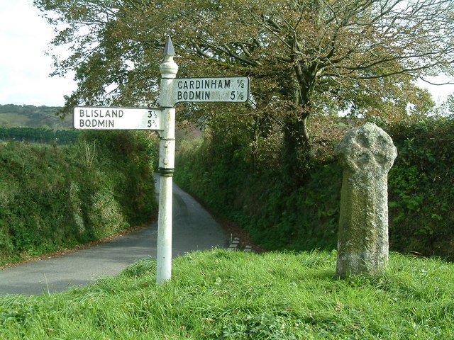
Treslea Cross, 750m ENE of Cardinham Church ✦ Ancient woodland 0 ha
Plan your visit
🦅 Birds🌳 Ancient🦉 Wildlife
Public access Free entry Dogs welcome 0 ha
Getting here
50.48964, -4.63692
Open directionsv Visiting this summer
Seasonal nature notes and what to look for now
▾ 🐦 55+ species recorded in this area — summer evenings are best for activity; watch for Chaffinch and Robin 🌳 Ancient woodland is at its best in summer here 🐕 Dogs welcome — bring water in summer; the site has enough space to find shade on hot days 🌤️ Visiting this summer
🐦 55+ species recorded in this area — summer evenings are best for activity; watch for Chaffinch and Robin 🌳 Ancient woodland is at its best in summer here 🐕 Dogs welcome — bring water in summer; the site has enough space to find shade on hot days
Best for 8 activities 🦅 Bird watching
Very strong match
Free Birds — Chaffinch, Robin, Great Tit +52 more · last seen 2025
🌳 Ancient woodland
Strong match
Free Ancient woodland — continuous woodland since before 1600
Birds — Chaffinch, Robin, Great Tit +52 more · last seen 2025; Ancient woodland
Historic site with public access
🦋 Insect spotting
Strong match
Free Insects — Non-biting midges, Protonemura, Simulium +19 more · last seen 2025
Dogs allowed with public access
Trails nearby Within roughly 5 km 3 signed routes nearby · 4 public paths nearby
Signed route nearby Public paths
Camel Trail Walking route ▾ Named route Ref CAM Point-to-point Regional walking route
Show on map Lanhydrock Great Wood and Beech Avenue walk, Lanhydrock Walking route 4 km ▾ Lady's Walk is a little bumpy in places but is approached in a downhill direction. Short, steep incline as you enter the Beech Avenue.
Named route Length 4 km Duration 1:30 Round trip Local walking route
Show on map Lanhydrock Parkland walk, Lanhydrock Walking route 5 km ▾ Most of the walk is on hard surfaced paths except alongside the River Fowey, where the path is earth and may be softer and muddy underfoot if wet. The route also cuts across grass pasture towards the swimming pool and includes a rough, stony track up towa
Named route Length 5 km Duration 1:30 Round trip Local walking route
Show on map 19 signed routes nearby
Signed route nearby
UK:National Cycle Network - local link Cycling route ▾ Named route Ref 3 Local cycle route
Show on map Route 3 Cycling route 527.7 km ▾ Named route Ref 3 Length 527.7 km National Cycle Network
Show on map Main Route Cycling route 65 m ▾ Named route Ref 3 Length 65 m National Cycle Network Traffic-free Surface asphalt
Show on map Main Route Cycling route 866 m ▾ Named route Ref 3 Length 866 m National Cycle Network Traffic-free Surface unsealedfirm
Show on map Main Route Cycling route 172 m ▾ Named route Ref 3 Length 172 m National Cycle Network Traffic-free Surface asphalt
Show on map Main Route Cycling route 130 m ▾ Named route Ref 3 Length 130 m National Cycle Network On-road Surface asphalt
Show on map 2 public paths nearby
Public paths
No named routes yet. Public paths are shown on the map.
About this historic site Scheduled Monument
Photos
21 photos from nearby open sources
▾ ✦ Ancient ✓ Public access Free entry 🐶 Dogs
Good to know £ Free to visit — no entry charge🐕 Dogs welcome🌿 Ancient woodland — rare wildlife habitat
Weather for this location Next 14 days Nearby places Useful places within 5 km
All Historic
UK green spaces mapped from open public data — so anyone can find the woodland, trail, or nature reserve closest to them.
© 2026 Glade · Made with care for UK green spaces
Wildlife to spot
23,645 records from NBN Atlas
▾
Wildlife to spot 23,645 records · NBN Atlas 🐦 Birds 55 species
winter spring autumn
2025 Chaffinch · Robin · Great Tit · Goldfinch · House Sparrow
+50 more species Hide species list All 55 birds recorded nearby (NBN Atlas)
Chaffinch Fringilla coelebs Robin Erithacus rubecula Great Tit Parus major Goldfinch Carduelis carduelis House Sparrow Passer domesticus Blue Tit Cyanistes caeruleus Woodpigeon Columba palumbus Dunnock Prunella modularis Blackbird Turdus merula Jackdaw Coloeus monedula Collared Dove Streptopelia decaocto Magpie Pica pica Carrion Crow Corvus corone Rook Corvus frugilegus Greenfinch Chloris chloris Siskin Spinus spinus Coal Tit Periparus ater Wren Troglodytes troglodytes Starling Sturnus vulgaris Pheasant Phasianus colchicus Swallow Hirundo rustica Herring Gull Larus argentatus Chiffchaff Phylloscopus collybita Lesser Black-backed Gull Larus fuscus Great Spotted Woodpecker Dendrocopos major House Martin Delichon urbicum Jay Garrulus glandarius Blackcap Sylvia atricapilla Song Thrush Turdus philomelos Long-tailed Tit Aegithalos caudatus Linnet Linaria cannabina Grey Wagtail Motacilla cinerea Green Woodpecker Picus viridis Marsh Tit Poecile palustris Willow Warbler Phylloscopus trochilus Swift Apus apus Raven Corvus corax Goldcrest Regulus regulus Nuthatch Sitta europaea Tawny Owl Strix aluco Mistle Thrush Turdus viscivorus Dipper Cinclus cinclus Pied Wagtail Motacilla alba yarrellii Redstart Phoenicurus phoenicurus Redwing Turdus iliacus Yellowhammer Emberiza citrinella Black-headed Gull Chroicocephalus ridibundus Canada Goose Branta canadensis Red-legged Partridge Alectoris rufa Garden Warbler Sylvia borin Kestrel Falco tinnunculus Treecreeper Certhia familiaris Crossbill Loxia curvirostra Meadow Pipit Anthus pratensis Stock Dove Columba oenas 🦌 Mammals 2 species
spring summer
2025 Roe Deer · Brown Rat
🐸 Amphibians 1 species
winter
2026 Common Frog
🐝 Insects 22 species
spring summer
2025 Non-biting midges · Protonemura · Simulium · Siphonoperla torrentium · Beautiful Demoiselle
+17 more species Hide species list All 22 insects recorded nearby (NBN Atlas)
Non-biting midges Chironomidae Protonemura Protonemura Simulium Simulium Siphonoperla torrentium Siphonoperla torrentium Beautiful Demoiselle Calopteryx virgo Golden-ringed Dragonfly Cordulegaster boltonii Species observations from the last 10 years via NBN Atlas
Ecdyonurus Ecdyonurus
Ecdyonurus Ecdyonurus
Ecdyonurus torrentis Ecdyonurus torrentis
Ecdyonurus torrentis Ecdyonurus torrentis
Anoplotrupes stercorosus Anoplotrupes stercorosus
Anoplotrupes stercorosus Anoplotrupes stercorosus
Brillia bifida Brillia bifida
Brillia bifida Brillia bifida
Corynoneura Corynoneura
Corynoneura Corynoneura
Common Blue Damselfly Enallagma cyathigerum
Common Blue Damselfly Enallagma cyathigerum
Baetis rhodani/atlanticus Baetis rhodani/atlanticus
Baetis rhodani/atlanticus Baetis rhodani/atlanticus
Blue-winged Olive Serratella ignita
Blue-winged Olive Serratella ignita
Simulium cryophilum Simulium cryophilum
Simulium cryophilum Simulium cryophilum
Isoperla grammatica Isoperla grammatica
Isoperla grammatica Isoperla grammatica
Biting Midge Ceratopogonidae
Biting Midge Ceratopogonidae
Baetis Baetis
Baetis Baetis
Rhithrogena semicolorata Rhithrogena semicolorata
Rhithrogena semicolorata Rhithrogena semicolorata
River Skater Aquarius najas
River Skater Aquarius najas
Contacyphon Contacyphon
Contacyphon Contacyphon
Iron Blue Mayfly Baetis muticus
Iron Blue Mayfly Baetis muticus Events & activities nearby Switch provider to compare local events, tours and bookable activities.
Bookable tours GetYourGuide Tripadvisor