Plan your visit
🦅Birds🌳Ancient🦉Wildlife
Public accessDogs welcome0 ha
Getting here
54.20001, -2.30504
Open directionsv
Visiting this summer
Seasonal nature notes and what to look for now
- 🐦76+ species recorded in this area — summer evenings are best for activity; watch for Carrion Crow and Grey Heron
- ✦Historic character is a year-round quality here — summer brings its own atmosphere to the setting
- 🐕Dogs welcome — bring water in summer; the site has enough space to find shade on hot days
🌤️ Visiting this summer
- 🐦76+ species recorded in this area — summer evenings are best for activity; watch for Carrion Crow and Grey Heron
- ✦Historic character is a year-round quality here — summer brings its own atmosphere to the setting
- 🐕Dogs welcome — bring water in summer; the site has enough space to find shade on hot days
Best for
11 activities🦅Bird watching
Very strong match
Birds — Carrion Crow, Grey Heron, Meadow Pipit +73 more · last seen 2025
🌳Ancient woodland
Strong match
Ancient woodland — continuous woodland since before 1600
Birds — Carrion Crow, Grey Heron, Meadow Pipit +73 more · last seen 2025; Ancient woodland
Historic site with public access
🍄Mushroom foraging
Strong match
Fungi — Meadow Waxcap, Scarlet Caterpillarclub, Heath Waxcap +41 more · last seen 2019
🦋Insect spotting
Strong match
Insects — Melanostoma mellinum, Melanostoma scalare, Green-veined White +56 more · last seen 2019
Trails nearby
Within roughly 5 km7 signed routes nearby
Signed route nearby
Pennine Way (Horton in Ribblesdale to Hawes)Walking route▾
Named routeNational walking route
Three Peaks WalkWalking route▾
Named routeRegional walking route
Ribblehead Quarry WalkWalking route▾
Named routeRound tripLocal walking route
Dales WayWalking route129 km▾
Named routeLength 129 kmRegional walking route
Ribble WayWalking route114 km▾
The Ribble Way follows the valley of the River Ribble from the mouth to the source near to the Pennine Way National Trail on Gayle Moor.
Named routeLength 114 kmRegional walking route
1 signed route nearby
Signed route nearby
Great North Trail (Yorkshire Dales)Mountain bike route172.2 km▾
Named routeLength 172.2 km
3 public paths nearby
Public paths
Cam Roadrestricted byway · 1.2 km▾
Public pathrestricted bywayLength 1.2 kmSurface gravelPath type: track
Cam Roadrestricted byway · 394 m▾
Public pathrestricted bywayLength 394 mSurface gravelPath type: track
Cam Roadrestricted byway · 150 m▾
Public pathrestricted bywayLength 150 mSurface gravelPath type: track
Photos
22 photos from nearby open sources
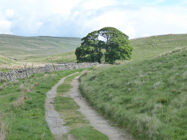
The Pennine Way near Fair Bottom Hill
Photos
The Pennine Way near Fair Bottom Hill
Weather for this location
Next 14 daysNearby places
Useful places within 5 km
Sericomyia silentis
Sericomyia silentis
Sericomyia silentis2013
Sericomyia silentis2013
Platycheirus albimanusPlatycheirus albimanus2012Platycheirus albimanusPlatycheirus albimanus2012Oulimnius tuberculatusOulimnius tuberculatus2010Oulimnius tuberculatusOulimnius tuberculatus2010Small TortoiseshellAglais urticae2014Small TortoiseshellAglais urticae2014Meliscaeva cinctellaMeliscaeva cinctella2013Meliscaeva cinctellaMeliscaeva cinctella2013Helophorus brevipalpisHelophorus brevipalpis2010Helophorus brevipalpisHelophorus brevipalpis2010Helophorus flavipesHelophorus flavipes2010Helophorus flavipesHelophorus flavipes2010Hydraena ripariaHydraena riparia2010Hydraena ripariaHydraena riparia2010Anacaena globulusAnacaena globulus2010Anacaena globulusAnacaena globulus2010Silver YAutographa gamma2018Silver YAutographa gamma2018Red AdmiralVanessa atalanta2014Red AdmiralVanessa atalanta2014Marmalade HoverflyEpisyrphus balteatus2013Marmalade HoverflyEpisyrphus balteatus2013Ilybius fuliginosusIlybius fuliginosus2010Ilybius fuliginosusIlybius fuliginosus2010Haliplus sibiricusHaliplus sibiricus2010Haliplus sibiricusHaliplus sibiricus2010Limnebius truncatellusLimnebius truncatellus2010Limnebius truncatellusLimnebius truncatellus2010Limnius volckmariLimnius volckmari2010Limnius volckmariLimnius volckmari2010Agabus bipustulatusAgabus bipustulatus2010Agabus bipustulatusAgabus bipustulatus2010Hydroporus palustrisHydroporus palustris2010Hydroporus palustrisHydroporus palustris2010Esolus parallelepipedusEsolus parallelepipedus2010Esolus parallelepipedusEsolus parallelepipedus2010Nebrioporus elegansNebrioporus elegans2010Nebrioporus elegansNebrioporus elegans2010Hydroporus incognitusHydroporus incognitus2010Hydroporus incognitusHydroporus incognitus2010Platambus maculatusPlatambus maculatus2010Platambus maculatusPlatambus maculatus2010Haliplus lineatocollisHaliplus lineatocollis2010Haliplus lineatocollisHaliplus lineatocollis2010Helophorus aequalisHelophorus aequalis2010Helophorus aequalisHelophorus aequalis2010Elmis aeneaElmis aenea2010Elmis aeneaElmis aenea2010Cheilosia albipilaCheilosia albipilaCheilosia albipilaCheilosia albipilaOrange-tipAnthocharis cardaminesOrange-tipAnthocharis cardaminesSilver-ground CarpetXanthorhoe montanata2018Silver-ground CarpetXanthorhoe montanata2018Chimney SweepOdezia atrata2018Chimney SweepOdezia atrata2018Large SkipperOchlodes sylvanus2018Large SkipperOchlodes sylvanus2018Banded DemoiselleCalopteryx splendens2016Banded DemoiselleCalopteryx splendens2016Meadow BrownManiola jurtina2014Meadow BrownManiola jurtina2014RingletAphantopus hyperantus2014RingletAphantopus hyperantus2014Common BluePolyommatus icarus2014Common BluePolyommatus icarus2014Platycheirus clypeatusPlatycheirus clypeatus2013Platycheirus clypeatusPlatycheirus clypeatus2013Small Garden BumblebeeBombus hortorum2013Small Garden BumblebeeBombus hortorum2013Norwegian WaspDolichovespula norwegica2013Norwegian WaspDolichovespula norwegica2013Platycheirus manicatusPlatycheirus manicatus2013Platycheirus manicatusPlatycheirus manicatus2013Forest Cuckoo BeeBombus sylvestris2013Forest Cuckoo BeeBombus sylvestris2013Buffish Mining BeeAndrena nigroaenea2012Buffish Mining BeeAndrena nigroaenea2012Helophilus pendulusHelophilus pendulus2012Helophilus pendulusHelophilus pendulus2012Cheilosia paganaCheilosia pagana2012Cheilosia paganaCheilosia pagana2012Empis albohirtaEmpis albohirta2011Empis albohirtaEmpis albohirta2011Agabus guttatusAgabus guttatus2010Agabus guttatusAgabus guttatus2010Ochthebius bicolonOchthebius bicolon2010Ochthebius bicolonOchthebius bicolon2010Plateumaris sericeaPlateumaris sericea2010Plateumaris sericeaPlateumaris sericea2010Hydroporus tristisHydroporus tristis2010Hydroporus tristisHydroporus tristis2010Hydroporus pubescensHydroporus pubescens2010Hydroporus pubescensHydroporus pubescens2010Hydroporus nigritaHydroporus nigrita2010Hydroporus nigritaHydroporus nigrita2010Hydroporus memnoniusHydroporus memnonius2010Hydroporus memnoniusHydroporus memnonius2010Plateumaris discolorPlateumaris discolor2010Plateumaris discolorPlateumaris discolor2010Hydroporus gyllenhaliiHydroporus gyllenhalii2010Hydroporus gyllenhaliiHydroporus gyllenhalii2010Hydroporus melanariusHydroporus melanarius2010Hydroporus melanariusHydroporus melanarius2010Haliplus flavicollisHaliplus flavicollis2010Haliplus flavicollisHaliplus flavicollis2010Horn StalkballOnygena equina2018Horn StalkballOnygena equina2018Apricot ClubClavulinopsis luteoalba2017Apricot ClubClavulinopsis luteoalba2017Blackening WaxcapHygrocybe conica2017Blackening WaxcapHygrocybe conica2017Fool's FunnelClitocybe rivulosa2017Fool's FunnelClitocybe rivulosa2017White SpindlesClavaria fragilis2017White SpindlesClavaria fragilis2017Drab BonnetMycena aetites2017Drab BonnetMycena aetites2017Crimson WaxcapHygrocybe punicea2017Crimson WaxcapHygrocybe punicea2017Cowpat GemCheilymenia granulata2017Cowpat GemCheilymenia granulata2017Dewdrop MottlegillPanaeolus acuminatus2017Dewdrop MottlegillPanaeolus acuminatus2017Hairy EarthtongueTrichoglossum hirsutum2017Hairy EarthtongueTrichoglossum hirsutum2017Cap Cŵyr ParhaolHygrocybe acutoconica2017Cap Cŵyr ParhaolHygrocybe acutoconica2017Bitter WaxcapHygrocybe mucronella2017Bitter WaxcapHygrocybe mucronella2017Glutinous EarthtongueGlutinoglossum glutinosum s. lat.2017Glutinous EarthtongueGlutinoglossum glutinosum s. lat.2017Cap Cŵyr Melyn y MwsoglGloioxanthomyces vitellinus2017Cap Cŵyr Melyn y MwsoglGloioxanthomyces vitellinus2017Tagell Binc Sbôr SerogEntoloma conferendum2017Tagell Binc Sbôr SerogEntoloma conferendum2017Winged InkcapCoprinopsis semitalis2017Winged InkcapCoprinopsis semitalis2017Peppery RoundheadStropharia pseudocyanea2017Peppery RoundheadStropharia pseudocyanea2017Butter WaxcapHygrocybe ceracea2017Butter WaxcapHygrocybe ceracea2017Golden WaxcapHygrocybe chlorophana2017Golden WaxcapHygrocybe chlorophana2017Olive EarthtongueMicroglossum olivaceum agg.2017Olive EarthtongueMicroglossum olivaceum agg.2017Honey WaxcapHygrocybe reidii2017Honey WaxcapHygrocybe reidii2017Yellow ClubClavulinopsis helvola2017Yellow ClubClavulinopsis helvola2017Meadow CoralClavulinopsis corniculata2017Meadow CoralClavulinopsis corniculata2017Deceptive EarthtongueGeoglossum fallax2017Deceptive EarthtongueGeoglossum fallax2017Spangle WaxcapHygrocybe insipida2017Spangle WaxcapHygrocybe insipida2017Toasted WaxcapCuphophyllus colemannianus2017Toasted WaxcapCuphophyllus colemannianus2017Orange MosscapRickenella fibula2017Orange MosscapRickenella fibula2017Plain EarthtongueGeoglossum umbratile2017Plain EarthtongueGeoglossum umbratile2017Golden SpindlesClavulinopsis fusiformis2017Golden SpindlesClavulinopsis fusiformis2017Galerina mniophilaGalerina mniophila2017Galerina mniophilaGalerina mniophila2017Grey WaxcapCuphophyllus lacmus2017Grey WaxcapCuphophyllus lacmus2017Cedarwood WaxcapCuphophyllus russocoriaceus2017Cedarwood WaxcapCuphophyllus russocoriaceus2017Dung RoundheadStropharia semiglobata2017Dung RoundheadStropharia semiglobata2017Mycena metataMycena metata2017Mycena metataMycena metata2017Entoloma inutileEntoloma inutile2017Entoloma inutileEntoloma inutile2017Scarlet WaxcapHygrocybe coccinea2017Scarlet WaxcapHygrocybe coccinea2017Earthy PowdercapCystoderma amianthinum2017Earthy PowdercapCystoderma amianthinum2017Parrot WaxcapGliophorus psittacinus2017Parrot WaxcapGliophorus psittacinus2017Bird's-Eye Primrose SmutUrocystis primulicola2016Bird's-Eye Primrose SmutUrocystis primulicola2016Chalk Comb-mossCtenidium molluscum2011Chalk Comb-mossCtenidium molluscum2011Marchantia polymorpha subsp. polymorphaMarchantia polymorpha subsp. polymorpha2018Marchantia polymorpha subsp. polymorphaMarchantia polymorpha subsp. polymorpha2018Yellowish Fork-mossDichodontium flavescens2011Yellowish Fork-mossDichodontium flavescens2011Craven FeatherwortPedinophyllum interruptum2011Craven FeatherwortPedinophyllum interruptum2011Capillary Thread-mossBryum capillare2011Capillary Thread-mossBryum capillare2011Rough EarwortScapania aspera2011Rough EarwortScapania aspera2011Dwarf Feather-mossMicroeurhynchium pumilum2011Dwarf Feather-mossMicroeurhynchium pumilum2011Mountain NotchwortMesoptychia collaris2011Mountain NotchwortMesoptychia collaris2011Hart's-tongue Thyme-mossPlagiomnium undulatum2011Hart's-tongue Thyme-mossPlagiomnium undulatum2011Wood Bristle-mossLewinskya affinis2011Wood Bristle-mossLewinskya affinis2011River Feather-mossBrachythecium rivulare2011River Feather-mossBrachythecium rivulare2011Oeder's Apple-mossPlagiopus oederianus2011Oeder's Apple-mossPlagiopus oederianus2011Slender DitrichumFlexitrichum gracile2011Slender DitrichumFlexitrichum gracile2011Swartz's Feather-mossOxyrrhynchium hians2011Swartz's Feather-mossOxyrrhynchium hians2011Shining HookeriaHookeria lucens2011Shining HookeriaHookeria lucens2011Juicy Silk-mossPlagiothecium succulentum2011Juicy Silk-mossPlagiothecium succulentum2011Palustriella commutataPalustriella commutata2011Palustriella commutataPalustriella commutata2011Pict-mossHygrohypnum luridum2011Pict-mossHygrohypnum luridum2011Common Pocket-mossFissidens taxifolius2011Common Pocket-mossFissidens taxifolius2011Crisped NeckeraNeckera crispa2011Crisped NeckeraNeckera crispa2011Fern-leaved Hook-mossCratoneuron filicinum2011Fern-leaved Hook-mossCratoneuron filicinum2011Greater FeatherwortPlagiochila asplenioides2011Greater FeatherwortPlagiochila asplenioides2011Sharp Rock-bristleSeligeria acutifolia2011Sharp Rock-bristleSeligeria acutifolia2011Broom Fork-mossDicranum scoparium2011Broom Fork-mossDicranum scoparium2011St Winifrid's MossChiloscyphus polyanthos2011St Winifrid's MossChiloscyphus polyanthos2011Rock Pocket-mossFissidens dubius2011Rock Pocket-mossFissidens dubius2011Dark-green FlapwortJungermannia atrovirens2011Dark-green FlapwortJungermannia atrovirens2011Short-beaked Wood-mossLoeskeobryum brevirostre2011Short-beaked Wood-mossLoeskeobryum brevirostre2011Little Shaggy-mossRhytidiadelphus loreus2011Little Shaggy-mossRhytidiadelphus loreus2011Swan's-neck Thyme-mossMnium hornum2011Swan's-neck Thyme-mossMnium hornum2011Rock PouncewortCololejeunea calcarea2011Rock PouncewortCololejeunea calcarea2011Common Striated Feather-mossEurhynchium striatum2011Common Striated Feather-mossEurhynchium striatum2011Micheli's Least PouncewortLejeunea cavifolia2011Micheli's Least PouncewortLejeunea cavifolia2011Greater Fork-mossDicranum majus2011Greater Fork-mossDicranum majus2011Fine-leaved LeskeaOrthothecium intricatum2011Fine-leaved LeskeaOrthothecium intricatum2011Bifid CrestwortLophocolea bidentata2011Bifid CrestwortLophocolea bidentata2011Frizzled Crisp-mossTortella tortuosa2011Frizzled Crisp-mossTortella tortuosa2011Fox-tail Feather-mossThamnobryum alopecurum2011Fox-tail Feather-mossThamnobryum alopecurum2011Dotted Thyme-mossRhizomnium punctatum2011Dotted Thyme-mossRhizomnium punctatum2011Spiral Extinguisher-mossEncalypta streptocarpa2011Spiral Extinguisher-mossEncalypta streptocarpa2011Long-beaked Thyme-mossPlagiomnium rostratum2011Long-beaked Thyme-mossPlagiomnium rostratum2011Common Tamarisk-mossThuidium tamariscinum2011Common Tamarisk-mossThuidium tamariscinum2011Red Beard-mossBryoerythrophyllum recurvirostrum2011Red Beard-mossBryoerythrophyllum recurvirostrum2011Teesdale Feather-mossRhynchostegiella teneriffae2011Teesdale Feather-mossRhynchostegiella teneriffae2011Lesser Yoke-mossZygodon conoideus2011Lesser Yoke-mossZygodon conoideus2011Blueish VeilwortMetzgeria violacea2011Blueish VeilwortMetzgeria violacea2011Hair-pointed Feather-mossCirriphyllum piliferum2011Hair-pointed Feather-mossCirriphyllum piliferum2011Knotted PearlwortSagina nodosaKnotted PearlwortSagina nodosaSmall-white OrchidPseudorchis albida2019Small-white OrchidPseudorchis albida2019Golden-head MossBreutelia chrysocoma2011Golden-head MossBreutelia chrysocoma2011Rusty Feather-mossSciuro-hypnum plumosum2011Rusty Feather-mossSciuro-hypnum plumosum2011Larger Mouse-tail MossIsothecium alopecuroides2011Larger Mouse-tail MossIsothecium alopecuroides2011Silky Wall Feather-mossHomalothecium sericeum2011Silky Wall Feather-mossHomalothecium sericeum2011Prickly FeatherwortPlagiochila spinulosa2011Prickly FeatherwortPlagiochila spinulosa2011Opal Thread-mossPohlia cruda2011Opal Thread-mossPohlia cruda2011Lesser FeatherwortPlagiochila porelloides var. porelloides2011Lesser FeatherwortPlagiochila porelloides var. porelloides2011Hypnum cupressiforme var. cupressiformeHypnum cupressiforme var. cupressiforme2011Hypnum cupressiforme var. cupressiformeHypnum cupressiforme var. cupressiforme2011Pellucid Four-tooth MossTetraphis pellucida2011Pellucid Four-tooth MossTetraphis pellucida2011Bruch's PincushionUlota bruchii2011Bruch's PincushionUlota bruchii2011Sickle-leaved Hook-mossSanionia uncinata2011Sickle-leaved Hook-mossSanionia uncinata2011Upright Screw-mossTortula subulata2011Upright Screw-mossTortula subulata2011Conocephalum salebrosumConocephalum salebrosum2011Conocephalum salebrosumConocephalum salebrosum2011Isothecium myosuroidesIsothecium myosuroides2011Isothecium myosuroidesIsothecium myosuroides2011Pale Glaucous Thread-mossPohlia wahlenbergii2011Pale Glaucous Thread-mossPohlia wahlenbergii2011Depressed Feather-mossTaxiphyllum wissgrillii2011Depressed Feather-mossTaxiphyllum wissgrillii2011Narrow Mushroom-headed LiverwortMarchantia quadrata2011Narrow Mushroom-headed LiverwortMarchantia quadrata2011Rock VeilwortMetzgeria conjugata2011Rock VeilwortMetzgeria conjugata2011Short-beaked Thyme-mossMnium thomsonii2011Short-beaked Thyme-mossMnium thomsonii2011Silky Forklet-mossDicranella heteromalla2011Silky Forklet-mossDicranella heteromalla2011Overleaf PelliaPellia epiphylla2011Overleaf PelliaPellia epiphylla2011Whiskered VeilwortMetzgeria consanguinea2011Whiskered VeilwortMetzgeria consanguinea2011Green Pocket-mossFissidens viridulus2011Green Pocket-mossFissidens viridulus2011Variable Crisp-mossTrichostomum brachydontium2011Variable Crisp-mossTrichostomum brachydontium2011Rough-stalked Feather-mossBrachythecium rutabulum2011Rough-stalked Feather-mossBrachythecium rutabulum2011Springy Turf-mossRhytidiadelphus squarrosus2011Springy Turf-mossRhytidiadelphus squarrosus2011Creeping FingerwortLepidozia reptans2011Creeping FingerwortLepidozia reptans2011Campylium protensumCampylium protensum2011Campylium protensumCampylium protensum2011Seligeria patulaSeligeria patula2011Seligeria patulaSeligeria patula2011Wood-rustCephalozia curvifolia2011Wood-rustCephalozia curvifolia2011Rusty Swan-neck MossCampylopus flexuosus2011Rusty Swan-neck MossCampylopus flexuosus2011Flat NeckeraNeckera complanata2011Flat NeckeraNeckera complanata2011Curly Crisp-mossTrichostomum crispulum2011Curly Crisp-mossTrichostomum crispulum2011Blunt Feather-mossHomalia trichomanoides2011Blunt Feather-mossHomalia trichomanoides2011Common Cord-mossFunaria hygrometrica2011Common Cord-mossFunaria hygrometrica2011Even ScalewortRadula complanata2011Even ScalewortRadula complanata2011GreasewortAneura pinguis2011GreasewortAneura pinguis2011Dwarf Rock-bristleSeligeria pusilla2011Dwarf Rock-bristleSeligeria pusilla2011Big Shaggy-mossHylocomiadelphus triquetrus2011Big Shaggy-mossHylocomiadelphus triquetrus2011Common Feather-mossKindbergia praelonga2011Common Feather-mossKindbergia praelonga2011Starry Thyme-mossMnium stellare2011Starry Thyme-mossMnium stellare2011Hymenostylium recurvirostrum var. recurvirostrumHymenostylium recurvirostrum var. recurvirostrum2011Hymenostylium recurvirostrum var. recurvirostrumHymenostylium recurvirostrum var. recurvirostrum2011Common SmoothcapAtrichum undulatum2011Common SmoothcapAtrichum undulatum2011Beech Feather-mossCirriphyllum crassinervium2011Beech Feather-mossCirriphyllum crassinervium2011Notched PouchwortCalypogeia arguta2011Notched PouchwortCalypogeia arguta2011Cylindric Beard-mossDidymodon insulanus2011Cylindric Beard-mossDidymodon insulanus2011Waved Silk-mossPlagiothecium undulatum2011Waved Silk-mossPlagiothecium undulatum2011Beck Pocket-mossFissidens rufulus2011Beck Pocket-mossFissidens rufulus2011Woodsy Thyme-mossPlagiomnium cuspidatum2011Woodsy Thyme-mossPlagiomnium cuspidatum2011Mnium marginatum var. marginatumMnium marginatum var. marginatum2011Mnium marginatum var. marginatumMnium marginatum var. marginatum2011Narrow-leaved Pocket-mossFissidens gracilifolius2011Narrow-leaved Pocket-mossFissidens gracilifolius2011Rambling Tail-mossAnomodon viticulosus2011Rambling Tail-mossAnomodon viticulosus2011Maidenhair Pocket-mossFissidens adianthoides2011Maidenhair Pocket-mossFissidens adianthoides2011Claw Brook-mossHygrohypnella ochracea2011Claw Brook-mossHygrohypnella ochracea2011Seligeria trifariaSeligeria trifaria2011Seligeria trifariaSeligeria trifaria2011Tamarisk ScalewortFrullania tamarisci2011Tamarisk ScalewortFrullania tamarisci2011Long-beaked Water Feather-mossRhynchostegium riparioides2011Long-beaked Water Feather-mossRhynchostegium riparioides2011Smaller Lattice-mossCinclidotus fontinaloides2011Smaller Lattice-mossCinclidotus fontinaloides2011Downy VeilwortMetzgeria pubescens2011Downy VeilwortMetzgeria pubescens2011Tree-mossClimacium dendroides2011Tree-mossClimacium dendroides2011Twiggy Spear-mossSarmentypnum sarmentosum2011Twiggy Spear-mossSarmentypnum sarmentosum2011Events & activities nearby
Switch provider to compare local events, tours and bookable activities.