🐦18+ species recorded in this area — summer evenings are best for activity; watch for Robin and Magpie
✦Historic character is a year-round quality here — summer brings its own atmosphere to the setting
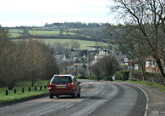
🐕Dogs welcome — bring water in summer; the site has enough space to find shade on hot days
🌤️ Visiting this summer
🐦18+ species recorded in this area — summer evenings are best for activity; watch for Robin and Magpie
✦Historic character is a year-round quality here — summer brings its own atmosphere to the setting
🐕Dogs welcome — bring water in summer; the site has enough space to find shade on hot days
Good to know
🐕Dogs welcome
🅿️Parking· Free
Best for
6 activities
🦅
Bird watching
Very strong match
Birds — Robin, Magpie, Woodpigeon +15 more · last seen 2026
Free
🦋
Insect spotting
Strong match
Insects — Red-headed Cardinal Beetle, 7-spot Ladybird, Cercopis vulnerata +26 more · last seen 2026
Free
🍂
Seasonal nature
Strong match
Plants — Common Spotted-orchid, Common Twayblade, Lords-and-Ladies +172 more · last seen 2026
Free
🦉
Wildlife
Strong match
Birds — Robin, Magpie, Woodpigeon +15 more · last seen 2026
Free
✦
Heritage
Strong match
Historic site
Free
🏡
Historic gardens
Moderate match
Historic site
Varies
Trails nearby
Within roughly 5 km
🚶
Walking
▾
4 signed routes nearby · 8 public paths nearby
Signed route nearbyPublic paths
Macmillan WayWalking route290 km▾
Named routeRef MWALength 290 kmListed length 461Regional walking route
Kennet and Avon Canal TrailWalking route140 km▾
Rivers linked by a canal. The name refers to the entire navigable length. From Bristol the way is the Avon. The canal is from Bath to Newbury. From there to Reading the way is the Kennet. 53 locks to Summit Pound (150 m asl) and 54 down to Reading.
Named routeRef K&ALength 140 kmRegional walking route
Bath Skyline WalkWalking route9.6 km▾
An elevated clockwise circular with panoramic views of the Bath landscape. The contrast of the city, so close to this rural haven, has earned the area World Heritage Site status. Roads, surfaced paths, steep hills, a rocky uneven section, steps & a stile.
Named routeRef BSLength 9.6 kmDuration 03:30-04:00Round tripLocal walking route
Limestone LinkWalking route58 km▾
Named routeRef LLLength 58 kmRegional walking route
🚴
Cycling
▾
10 signed routes nearby
Signed route nearby
Wiltshire CyclewayCycling route155 km▾
Named routeRef WCLength 155 kmRound tripRegional cycle route
EuroVelo 2 - Capitals Route - part United Kingdom 4Cycling route▾
Named routeRef EV2International cycle route
Bath Two Tunnels CircuitCycling route▾
Named routeLocal cycle route
National Cycle Network Route 4Cycling route▾
Named routeRef 4National Cycle Network
Main RouteCycling route55 m▾
Named routeRef 4Length 55 mNational Cycle NetworkTraffic-freeSurface concrete
Main RouteCycling route28 m▾
Named routeRef 4Length 28 mNational Cycle NetworkTraffic-freeSurface unsealedloose
🐴
Horse riding
▾
1 public path nearby
Public paths
No named routes yet. Public paths are shown on the map.