Abbey Church of St Mary and St Germain
Plan your visit
🛝Family🎠Play🧺Picnic
Public accessFree entryDogs welcome
Getting here
53.78408, -1.06708
Open directionsv
Visiting this summer
Seasonal nature notes and what to look for now
- 🐦73+ species recorded in this area — summer evenings are best for activity; watch for Blackbird and Woodpigeon
- ☀️Summer family visits work well here — arrive early and plan for a longer stay
- ☕Micklegate Tea Room — makes this an easy full-day family visit without needing to pack food
🌤️ Visiting this summer
- 🐦73+ species recorded in this area — summer evenings are best for activity; watch for Blackbird and Woodpigeon
- ☀️Summer family visits work well here — arrive early and plan for a longer stay
- ☕Micklegate Tea Room — makes this an easy full-day family visit without needing to pack food
- £Free to visit — no entry charge
- 🐕Dogs welcome
☕Café🅿️Parking· Paid🧺Picnic spot🛝Playground🚻Toilets
🛝Family friendly
Very strong match
playground, café, toilets, picnic area
Free
🎠Playgrounds
Very strong match
playground, toilets, café, parking
Free
🧺Picnic day out
Very strong match
picnic area, café, toilets, car park
Free
🦅Bird watching
Very strong match
Birds — Blackbird, Woodpigeon, Goldfinch +70 more · last seen 2026
Free
✦Heritage
Very strong match
Grade I listed building: CHURCH OF ST MARY AND ST GERMAIN (SELBY ABBEY); Religious grounds — local heritage
Free
Birds — Blackbird, Woodpigeon, Goldfinch +70 more · last seen 2026
Free
Trails nearby
Within roughly 5 km6 signed routes nearby · 2 public paths nearby
Signed route nearbyPublic paths
Trans-Pennine Trail (Wombwell to Selby)Walking route▾
Named routeRegional walking route
Trans-Pennine Trail (Selby to Hull)Walking route▾
Named routeRegional walking route
Trans-Pennine Trail (Selby to York)Walking route▾
Trans-Pennine Trail (Selby to York spur)
Named routeRegional walking route
Camino Ingles to SantiagoWalking route▾
Named routeRegional walking route
Selby HorseshoeWalking route▾
Named routeLocal walking route
49 signed routes nearby
Signed route nearby
The White Rose Cycle RouteCycling route▾
Named routeRef 65National Cycle Network
Trans Pennine TrailCycling route▾
Named routeRef TPTNational Cycle Network
Trans Pennine TrailCycling route▾
Named routeRef 62National Cycle Network
Main RouteCycling route2.4 km▾
Named routeRef 65Length 2.4 kmNational Cycle NetworkOn-roadSurface asphalt
Main RouteCycling route144 m▾
Named routeRef 62Length 144 mNational Cycle NetworkTraffic-freeSurface asphalt
Main RouteCycling route15 m▾
Named routeRef 62Length 15 mNational Cycle NetworkTraffic-freeSurface concrete
5 public paths nearby
Public paths
No named routes yet. Public paths are shown on the map.
Photos
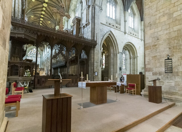
Selby Abbey, Nave east end
Weather for this location
Next 14 daysNearby places
Useful places within 5 km
Wildlife to spot
7,804 records · National Biodiversity Network
Wildlife to spot
7,804 records · National Biodiversity Network🐦Birds45 species
springsummerautumnwinter
2026▾
Woodpigeon · Blackbird · Robin · Goldfinch · House Sparrow +40
- WoodpigeonColumba palumbus2025
- BlackbirdTurdus merula2025
- RobinErithacus rubecula2025
- GoldfinchCarduelis carduelis2025
- House SparrowPasser domesticus2025
- MallardAnas platyrhynchos2025
- Blue TitCyanistes caeruleus2025
- Mute SwanCygnus olor
- MagpiePica pica2025
- Great TitParus major2025
- StarlingSturnus vulgaris2025
- Long-tailed TitAegithalos caudatus2025
- Carrion CrowCorvus corone2025
- Black-headed GullChroicocephalus ridibundus2025
- Collared DoveStreptopelia decaocto2025
- DunnockPrunella modularis2025
- MoorhenGallinula chloropus2025
- Rock DoveColumba livia2025
- WrenTroglodytes troglodytes2025
- ChiffchaffPhylloscopus collybita2025
- PheasantPhasianus colchicus2025
- OystercatcherHaematopus ostralegus2025
- Canada GooseBranta canadensis2025
- Greylag GooseAnser anser2025
- Coal TitPeriparus ater2025
- Grey HeronArdea cinerea2025
- Stock DoveColumba oenas2025
- CormorantPhalacrocorax carbo2025
- JackdawColoeus monedula2025
- GreenfinchChloris chloris2025
- SwallowHirundo rustica2025
- BlackcapSylvia atricapilla2025
- TealAnas crecca2025
- RookCorvus frugilegus2025
- GadwallMareca strepera2025
- Song ThrushTurdus philomelos2025
- Tufted DuckAythya fuligula2025
- Cetti's WarblerCettia cetti2025
- Little EgretEgretta garzetta2025
- LapwingVanellus vanellus2025
- CootFulica atra2025
- Little GrebeTachybaptus ruficollis2025
- ChaffinchFringilla coelebs2025
- KestrelFalco tinnunculus2025
- Tawny OwlStrix aluco2024
🦌Mammals5 species
springautumnwinter
2025▾
Mole · Grey Squirrel · Feral Cat · Cricetidae · Hedgehog
- MoleTalpa europaea
- Grey SquirrelSciurus carolinensis
- Feral CatFelis catus
- CricetidaeCricetidae
- HedgehogErinaceus europaeus
🐸Amphibians2 species
summerautumn
2025▾
Common Frog · Great Crested Newt
- Common FrogRana temporaria
- Great Crested NewtTriturus cristatus
🐝Insects23 species
springsummer
2025▾
Western Honey Bee · 7-spot Ladybird · Rhododendron Leafhopper · 14-spot Ladybird · Varied Carpet Beetle +18
- Western Honey BeeApis mellifera
- 7-spot LadybirdCoccinella septempunctata
- Rhododendron LeafhopperGraphocephala fennahi
- 14-spot LadybirdPropylea quattuordecimpunctata
- Varied Carpet BeetleAnthrenus verbasci
- Turnip TigressAthalia rosae
Hemlock Water-dropwort · Springy Turf-moss
- Hemlock Water-dropwortOenanthe crocata
- Springy Turf-mossRhytidiadelphus squarrosus
Species observations from the last 10 years via NBN Atlas
Events & activities nearby
Switch provider to compare local events, tours and bookable activities.