Birds — Wren, Carrion Crow, Woodpigeon +63 more · last seen 2026; Birds — Wren, Carrion Crow, Woodpigeon +63 more · last seen 2026
Free
🌿
Foraging
Strong match
Plants — Crowberry, Bramble, Hawthorn +13 more foraging species; Deciduous woodland — fungi, berries and wild garlic
Varies
🍂
Seasonal nature
Strong match
Plants — Cross-leaved Heath, Cranberry, Opposite-leaved Golden-saxifrage +84 more · last seen 2026; Plants — Cross-leaved Heath, Cranberry, Opposite-leaved Golden-saxifrage +84 more · last seen 2026
Free
🐶
Dog walks
Strong match
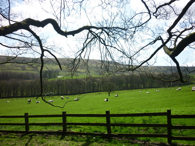
Dogs allowed — public woodland
Free
🦋
Insect spotting
Strong match
Insects — Black Darter, Common Hawker, White-letter Hairstreak +35 more · last seen 2026; Insects — Black Darter, Common Hawker, White-letter Hairstreak +35 more · last seen 2026
Free
Trails nearby
Within roughly 5 km
🚶
Walking
▾
5 signed routes nearby · 31 public paths nearby
Signed route nearbyPublic paths
Warpers Trail - Witton Weavers WayWalking route▾
Named routeLocal walking route
Irwell Sculpture TrailWalking route▾
Named routeRegional walking route
Rossendale WayWalking route▾
A high-level route around Bacup, Rawtenstall, Haslingden and Whitworth in the Rossendale Valley, crossing the open moors and farmland of the South Pennines which roughly follows the Rossendale Borough boundary.
Named routeRegional walking route
GM Ringway Stage 12Walking route21.1 km▾
GM Ringway Stage 12 - Norden to Bury
Named routeLength 21.1 kmRegional walking route
GM Ringway Stage 13Walking route18 km▾
GM Ringway Stage 13 - Bury to Bromley Cross
Named routeLength 18 kmRegional walking route
Sunnybank Cottagespublic footpath · 46 m▾
Public pathpublic footpathLength 46 mPath type: residential
Alden Roadpublic footpath · 331 m▾
Public pathpublic footpathLength 331 mPath type: residential
Alden Roadpublic footpath · 266 m▾
Public pathpublic footpathLength 266 mPath type: residential
🚴
Cycling
▾
62 signed routes nearby
Signed route nearby
Route 6Cycling route▾
Named routeRef 6National Cycle Network
Lancashire Cycleway (Southern Loop)Cycling route▾
Named routeRef 91Regional cycle route
Blackburn Rd/Manchester Rd ACLCycling route▾
Named routeLocal cycle route
Britannia GreenwayCycling route▾
Named routeLocal cycle route
Main RouteCycling route510 m▾
Named routeRef 6Length 510 mNational Cycle NetworkTraffic-freeSurface asphalt
Main RouteCycling route343 m▾
Named routeRef 6Length 343 mNational Cycle NetworkOn-roadSurface asphalt
🐴
Horse riding
▾
7 public paths nearby
Public paths
Moor Roadbridleway · 346 m▾
Public pathbridlewayLength 346 mPath type: track
Alden Roadbridleway · 230 m▾
Public pathbridlewayLength 230 mPath type: residential
Moor Roadbridleway · 210 m▾
Public pathbridlewayLength 210 mPath type: bridleway
Alden Roadbridleway · 216 m▾
Public pathbridlewayLength 216 mPath type: residential
Moor Roadbridleway · 213 m▾
Public pathbridlewayLength 213 mPath type: bridleway