🐦45+ species recorded in this area — summer evenings are best for activity; watch for Robin and House Sparrow
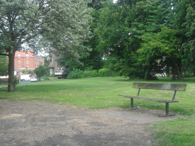
🧺Good picnic destination in summer — open space and facilities for a relaxed day out
🛝Playground on site — built-in entertainment for younger visitors alongside the wider site
🌤️ Visiting this summer
🐦45+ species recorded in this area — summer evenings are best for activity; watch for Robin and House Sparrow
🧺Good picnic destination in summer — open space and facilities for a relaxed day out
🛝Playground on site — built-in entertainment for younger visitors alongside the wider site
Good to know
£Free to visit — no entry charge
🐕Dogs welcome
🚲Bike parking🅿️Parking🧺Picnic spot🛝Playground
Best for
10 activities
🧺
Picnic day out
Strong match
picnic area, car park; Urban park — open green space
Free
🛝
Family friendly
Strong match
playground, picnic area; Urban park — family destination
Free
🦅
Bird watching
Strong match
Birds — Robin, House Sparrow, Magpie +42 more · last seen 2026; Birds — Robin, House Sparrow, Magpie +42 more · last seen 2026
Free
🍂
Seasonal nature
Strong match
Plants — Green Alkanet, Lesser Celandine, Butterfly-bush +22 more · last seen 2026; Plants — Green Alkanet, Lesser Celandine, Butterfly-bush +22 more · last seen 2026
Free
🦉
Wildlife
Strong match
Deciduous woodland priority habitat; Birds — Robin, House Sparrow, Magpie +42 more · last seen 2026
Free
🎠
Playgrounds
Strong match
playground, parking
Free
Trails nearby
Within roughly 5 km
🚶
Walking
▾
8 signed routes nearby · 1 public path nearby
Signed route nearbyPublic paths
King Charles III England Coast Path: East: Shotley Gate to Felixstowe FerryWalking route▾
Named routeRef ECPNational walking route
Sandlings WalkWalking route89 km▾
Southwold to Rushmere Heath on the outskirts of Ipswich
Named routeLength 89 kmRegional walking route
Stour & Orwell WalkWalking route▾
Named routeRegional walking route
Sandlings Walk (St Augustine's route)Walking route▾
Named routeRegional walking route
Sandlings Walk (Heath Road route)Walking route▾
Named routeRegional walking route
🚴
Cycling
▾
193 signed routes nearby
Signed route nearby
NCN 51Cycling route▾
Named routeRef 51National Cycle Network
Route 2Cycling route▾
Named routeRef 2Local cycle route
2ACycling route▾
Named routeLocal cycle route
Route 10BCycling route▾
Named routeRef 10BLocal cycle route
NCN51 Proposed change avoiding Duke Street, IpswichCycling route▾
Named routeRef 51National Cycle Network
Route 4Cycling route▾
Named routeRef 4Local cycle route
🐴
Horse riding
▾
5 public paths nearby
Public paths
Orwell Quayrestricted byway · 383 m▾
Public pathrestricted bywayLength 383 mSurface paving_stonesPath type: pedestrian
Common Quayrestricted byway · 56 m▾
Public pathrestricted bywayLength 56 mSurface settPath type: unclassified
Neptune Quayrestricted byway · 55 m▾
Public pathrestricted bywayLength 55 mSurface paving_stonesPath type: pedestrian
Neptune Quayrestricted byway · 199 m▾
Public pathrestricted bywayLength 199 mPath type: unclassified
Wherry Quayrestricted byway · 96 m▾
Public pathrestricted bywayLength 96 mSurface settPath type: unclassified