Plan your visit
🦉 Wildlife🦅 Birds🧺 Picnic
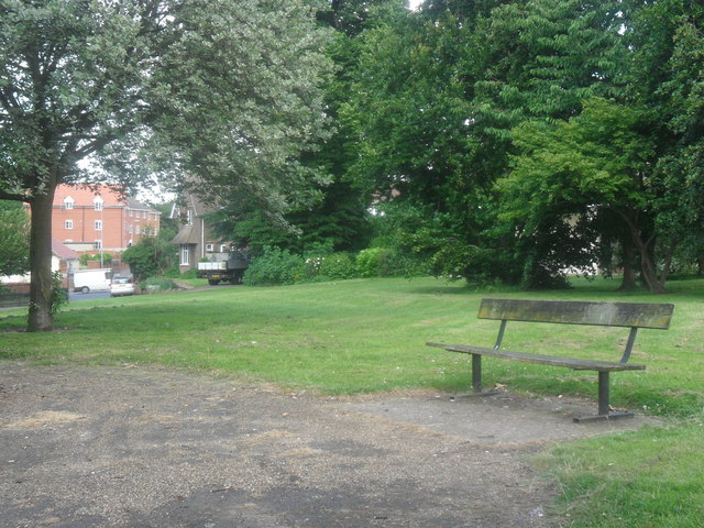
Public access Free entry Dogs welcome 7 ha
Places › England › Eastern › Ipswich Getting here
52.05438, 1.16788
Open directionsv Visiting this summer
Seasonal nature notes and what to look for now
▾ ☀️ June — long evenings and clear skies; one of the most rewarding months for a late visit 🧺 Good picnic destination in summer — open space and facilities for a relaxed day out 🛝 Playground on site — built-in entertainment for younger visitors alongside the wider site 🌤️ Visiting this summer
☀️ June — long evenings and clear skies; one of the most rewarding months for a late visit 🧺 Good picnic destination in summer — open space and facilities for a relaxed day out 🛝 Playground on site — built-in entertainment for younger visitors alongside the wider site £ Free to visit — no entry charge🐕 Dogs welcome🚲 Bike parking🅿️ Parking🧺 Picnic spot🛝 Playground
🦉 Wildlife
Very strong match
Multi-group wildlife — Birds, Mammals, Reptiles; Multi-group wildlife — Birds, Mammals, Reptiles
Free
🦅 Bird watching
Very strong match
Birds — Blue Tit, Robin, Magpie +66 more · last seen 2026; Birds — Blue Tit, Robin, Magpie +66 more · last seen 2026
Free
🧺 Picnic day out
Strong match
picnic area, car park; Urban park — open green space
Free
🛝 Family friendly
Strong match
playground, picnic area; Urban park — family destination
Free
🍂 Seasonal nature
Strong match
Plants — Green Alkanet, Wild Carrot, Field Scabious +76 more · last seen 2026; Plants — Green Alkanet, Wild Carrot, Field Scabious +76 more · last seen 2026
Free
🦋 Insect spotting
Strong match
Insects — Stag Beetle, Firebug, Large Red Damselfly +59 more · last seen 2026; Insects — Stag Beetle, Firebug, Large Red Damselfly +59 more · last seen 2026
Free
Trails nearby Within roughly 5 km 8 signed routes nearby · 1 public path nearby
Signed route nearby Public paths
King Charles III England Coast Path: East: Shotley Gate to Felixstowe Ferry Walking route ▾
Named route Ref ECP National walking route
Show on map Sandlings Walk Walking route 89 km ▾
Southwold to Rushmere Heath on the outskirts of Ipswich
Named route Length 89 km Regional walking route
Show on map Stour & Orwell Walk Walking route ▾
Named route Regional walking route
Show on map Sandlings Walk (St Augustine's route) Walking route ▾
Named route Regional walking route
Show on map Sandlings Walk (Heath Road route) Walking route ▾
Named route Regional walking route
Show on map 193 signed routes nearby
Signed route nearby
NCN 51 Cycling route ▾
Named route Ref 51 National Cycle Network
Show on map Route 2 Cycling route ▾
Named route Ref 2 Local cycle route
Show on map 2A Cycling route ▾
Named route Local cycle route
Show on map Route 10B Cycling route ▾
Named route Ref 10B Local cycle route
Show on map NCN51 Proposed change avoiding Duke Street, Ipswich Cycling route ▾
Named route Ref 51 National Cycle Network
Show on map Route 4 Cycling route ▾
Named route Ref 4 Local cycle route
Show on map 5 public paths nearby
Public paths
Orwell Quay restricted byway · 383 m ▾
Public path restricted byway Length 383 m Surface paving_stones Path type: pedestrian
Show on map Common Quay restricted byway · 56 m ▾
Public path restricted byway Length 56 m Surface sett Path type: unclassified
Show on map Neptune Quay restricted byway · 55 m ▾
Public path restricted byway Length 55 m Surface paving_stones Path type: pedestrian
Show on map Neptune Quay restricted byway · 199 m ▾
Public path restricted byway Length 199 m Path type: unclassified
Show on map Wherry Quay restricted byway · 96 m ▾
Public path restricted byway Length 96 m Surface sett Path type: unclassified
Show on map
Weather for this location Next 14 days Nearby places Useful places within 5 km
All Historic
Own or manage this place?
Claim this listing to keep details accurate, add photos, and highlight what makes it special — free.
Claim this page→ How useful was the information on this page?
id: de6aa34e-1a8d-4a12-a210-9a0592ef89de
UK green spaces mapped from open public data — so anyone can find the woodland, trail, or nature reserve closest to them.
© 2026 Glade · Made with care for UK green spaces
Events & activities nearby Switch provider to compare local events, tours and bookable activities.
Bookable tours GetYourGuide Promote here
Wildlife to spot
90,769 records · National Biodiversity Network
▾
Wildlife to spot 90,769 records · National Biodiversity Network Robin · House Sparrow · Magpie · Black-headed Gull · Moorhen +40
Robin Erithacus rubecula House Sparrow Passer domesticus Magpie Pica pica Black-headed Gull Chroicocephalus ridibundus Moorhen Gallinula chloropus Blackbird Turdus merula Blue Tit Cyanistes caeruleus Great Tit Parus major Mute Swan Cygnus olor Mallard Anas platyrhynchos Canada Goose Branta canadensis Woodpigeon Columba palumbus Jay Garrulus glandarius Carrion Crow Corvus corone2025 Green Woodpecker Picus viridis Coal Tit Periparus ater Treecreeper Certhia familiaris2025 Redshank Tringa totanus2025 Cormorant Phalacrocorax carbo2025 Herring Gull Larus argentatus2025 Lesser Black-backed Gull Larus fuscus2025 Rock Dove Columba livia2025 Dunnock Prunella modularis Goldfinch Carduelis carduelis Coot Fulica atra Pied Wagtail Motacilla alba Chaffinch Fringilla coelebs Starling Sturnus vulgaris carbo cormorant Phalacrocorax carbo carbo2025 Great Spotted Woodpecker Dendrocopos major2025 Stock Dove Columba oenas2025 Siskin Spinus spinus2025 Redwing Turdus iliacus2025 Linnet Linaria cannabina2025 Green Sandpiper Tringa ochropus2025 Mandarin Duck Aix galericulata2025 Little Grebe Tachybaptus ruficollis2025 Little Egret Egretta garzetta2025 Common Sandpiper Actitis hypoleucos2025 Grey Wagtail Motacilla cinerea2025 Kingfisher Alcedo atthis2025 Raven Corvus corax2025 Collared Dove Streptopelia decaocto2025 Chiffchaff Phylloscopus collybita2025 Wren Troglodytes troglodytes2025 🐝 Insects 19 species
spring summer
2026 ▾
7-spot Ladybird · Firebug · Rhyparochromus vulgaris · Harlequin Ladybird · Common Darter +14
7-spot Ladybird Coccinella septempunctata Firebug Pyrrhocoris apterus Rhyparochromus vulgaris Rhyparochromus vulgaris Harlequin Ladybird Harmonia axyridis Common Darter Sympetrum striolatum2025 Southern Oak Bush-cricket Meconema meridionale Green Alkanet · Lesser Celandine · Butterfly-bush · Horse-chestnut · Hawthorn +20
Green Alkanet Pentaglottis sempervirens Lesser Celandine Ficaria verna Butterfly-bush Buddleja davidii2025 Horse-chestnut Aesculus hippocastanum Hawthorn Crataegus monogyna Alexanders Smyrnium olusatrum Musk Stork's-bill Species observations from the last 10 years via NBN Atlas
2025
2025
Stag Beetle Lucanus cervus2025
Stag Beetle Lucanus cervus2025
10-spot Ladybird Adalia decempunctata
10-spot Ladybird Adalia decempunctata
Rhaphigaster nebulosa Rhaphigaster nebulosa
Rhaphigaster nebulosa Rhaphigaster nebulosa
Juniper Shieldbug Cyphostethus tristriatus2025
Juniper Shieldbug Cyphostethus tristriatus2025
Hornet Hoverfly Volucella zonaria2025
Hornet Hoverfly Volucella zonaria2025
Migrant Hawker Aeshna mixta2025
Migrant Hawker Aeshna mixta2025
Drosophila melanogaster Drosophila melanogaster2025
Drosophila melanogaster Drosophila melanogaster2025
Willow Emerald Damselfly Chalcolestes viridis2025
Willow Emerald Damselfly Chalcolestes viridis2025
Common Stiletto Thereva nobilitata2025
Common Stiletto Thereva nobilitata2025
Forget-me-not Shieldbug Sehirus luctuosus2025
Forget-me-not Shieldbug Sehirus luctuosus2025
Xanthogramma pedissequum Xanthogramma pedissequum2025
Xanthogramma pedissequum Xanthogramma pedissequum2025
Rose Chafer Cetonia aurata2025
Rose Chafer Cetonia aurata2025
Swollen-thighed Beetle Oedemera nobilis2025
Swollen-thighed Beetle Oedemera nobilis2025 Erodium moschatum
Erodium moschatum
Pellitory-of-the-wall Parietaria judaica
Pellitory-of-the-wall Parietaria judaica
Heart-leaved Bergenia Bergenia cordifolia
Heart-leaved Bergenia Bergenia cordifolia
Petty Spurge Euphorbia peplus
Petty Spurge Euphorbia peplus
Sweet Violet Viola odorata
Sweet Violet Viola odorata
Ground-ivy Glechoma hederacea
Ground-ivy Glechoma hederacea
Sowbread Cyclamen hederifolium
Sowbread Cyclamen hederifolium
Goat Willow Salix caprea
Goat Willow Salix caprea
Lungwort Pulmonaria officinalis2025
Lungwort Pulmonaria officinalis2025
Black Nightshade Solanum nigrum2025
Black Nightshade Solanum nigrum2025
Sweet Chestnut Castanea sativa2025
Sweet Chestnut Castanea sativa2025
Bristly Oxtongue Helminthotheca echioides2025
Bristly Oxtongue Helminthotheca echioides2025
Large-flowered Evening-primrose Oenothera glazioviana2025
Large-flowered Evening-primrose Oenothera glazioviana2025
Mexican Orange Choisya ternata2025
Mexican Orange Choisya ternata2025
Lady's Bedstraw Galium verum2025
Lady's Bedstraw Galium verum2025
Wild Carrot Daucus carota2025
Wild Carrot Daucus carota2025
Dittander Lepidium latifolium2025
Dittander Lepidium latifolium2025
Wild Marjoram Origanum vulgare2025
Wild Marjoram Origanum vulgare2025
Field Scabious Knautia arvensis2025
Field Scabious Knautia arvensis2025