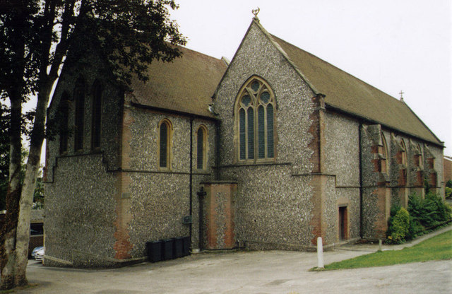
All Saints' Church
Getting here
51.05815, -1.30350
Visiting this summer
Seasonal nature notes and what to look for now
Visiting this summer
Seasonal nature notes and what to look for now
- 🌞Midsummer — early morning visits most comfortable; look for deer fawns in quieter clearings
- 🐕Early mornings are best for dog walks in summer — visit before 9am to avoid the heat and find quieter trails
- 🅿️Chesil Multi-Storey 206m away — 16 car parks within reach
🌤️ Visiting this summer
- 🌞Midsummer — early morning visits most comfortable; look for deer fawns in quieter clearings
- 🐕Early mornings are best for dog walks in summer — visit before 9am to avoid the heat and find quieter trails
- 🅿️Chesil Multi-Storey 206m away — 16 car parks within reach
Good to know
- £Free to visit — no entry charge
- 🐕Dogs welcome
Best for
Wildlife
Very strong match
Multi-group wildlife — Amphibians, Birds, Mammals, Reptiles; Multi-group wildlife — Amphibians, Birds, Mammals, Reptiles
Bird watching
Very strong match
Birds — Mallard, Robin, Blackbird +79 more · last seen 2026; Birds — Mallard, Robin, Blackbird +79 more · last seen 2026
Dog walks
Good match
Dogs allowed with public access
Hiking
Good match
Named hiking route nearby: South Downs Way
Mountain biking
Good match
Named MTB route nearby: South Downs Way
Cycling
Good match
Named cycling route nearby: National Cycle Route 23
Trails nearby
Within roughly 5 km🚶Walking
12 signed routes nearby · 10 public paths nearby
Signed route nearbyPublic paths
Walking
Allan King WayWalking route
Monarch's WayWalking route990 km
approximate route of Charles II's escape
Itchen WayWalking route
Pilgrims' TrailWalking route
St Swithun's WayWalking route
🚴Cycling
43 signed routes nearby
Signed route nearby
Cycling
Winchester Local Cycle NetworkCycling route
NCN 23 linkCycling route
National Cycle Route 23Cycling route
National BywayCycling route
Viaduct WayCycling route
NCN23 temporary diversion routeCycling route
🚵Mountain biking
7 signed routes nearby
Signed route nearby
Mountain biking
South Downs WayMountain bike route
Sparsholt Off Road Cycle TrailMountain bike route
Farley Mount Off Road Cycle TrailMountain bike route
Winchester Off Road Cycle TrailMountain bike route
King Alfred's WayMountain bike route
King Alfreds Way is 350km (220 miles) off road route designed to be ridden clockwise. It starts & ends in Winchester. It is suitable for gravel or cross-country bikes.
The Ox Drove mountain bike routeMountain bike route
🐴Horse riding
3 public paths nearby
Public paths
Horse riding
Domum Roadbridleway · 233 m
Domum Roadbridleway · 48 m
Domum Roadbridleway · 59 m
Wildlife to spot
Photos
Weather for this location
Loading local forecast…
Nearby places
Useful places within 5 km
Own or manage this place?
Claim this listing to keep details accurate, add photos, and highlight what makes it special — free.
Claim this pageHow was your visit?
How useful was the information on this page?
id: 779edd68-566a-4c3b-afc6-a92431583fcf