Plan your visit
🦅 Birds🦉 Wildlife✦ Heritage
Public access Dogs welcome 90 ha
Getting here
52.98509, -1.88746
Open directionsv Alton Towers is a historic estate located near the village of Alton in Staffordshire, England. It was the seat of the Earls of Shrewsbury during the 19th century. The area around Alton Towers has seen human habitation for more than a thousand years.
Read more on Wikipedia → English country house Grade II* listed building c. 1814
Visiting this summer
Seasonal nature notes and what to look for now
▾ 🐦 82+ species recorded in this area — summer evenings are best for activity; watch for Mallard and Mute Swan ✦ Historic character is a year-round quality here — summer brings its own atmosphere to the setting ☕ Forest Feast — makes this an easy full-day family visit without needing to pack food 🌤️ Visiting this summer
🐦 82+ species recorded in this area — summer evenings are best for activity; watch for Mallard and Mute Swan ✦ Historic character is a year-round quality here — summer brings its own atmosphere to the setting ☕ Forest Feast — makes this an easy full-day family visit without needing to pack food 🦅 Bird watching
Very strong match
Birds — Mallard, Mute Swan, Coot +79 more · last seen 2026; Deciduous woodland — woodpeckers, warblers and woodland birds
Free
Mammals — Grey Squirrel, Mole, Rabbit +11 more · last seen 2026; Deciduous woodland priority habitat
Free
Historic site with public access; Grade II* listed building: THE CONSERVATORY AND ATTACHED WALL, STEPS AND URNS
Free
🧺 Picnic day out
Strong match
café, toilets
Free
🦋 Insect spotting
Strong match
Insects — Meliscaeva cinctella, Green Shieldbug, Alder Leaf Beetle +17 more · last seen 2026
Free
🛝 Family friendly
Strong match
café, toilets
Free
Trails nearby Within roughly 5 km 4 signed routes nearby · 74 public paths nearby
Signed route nearby Public paths
Limestone Way Walking route 74 km ▾
Castleton to Rocester
Named route Length 74 km Point-to-point Regional walking route
Show on map Weaver Walk Walking route ▾
Named route Local walking route
Show on map Staffordshire Way (Rushton Spencer - Cannock Chase) Walking route 76 km ▾
Staffordshire Way, part Rushton Spencer - Cannock Chase
Named route Length 76 km Regional walking route
Show on map Churnet Way Walking route ▾
Bridge 70 public footpath · 8 m ▾
Public path public footpath Length 8 m Path type: footway
Show on map Alton 8 public footpath · 360 m ▾
Public path public footpath Length 360 m Surface gravel Path type: service
Show on map Toothill Lane public footpath · 371 m ▾
Public path public footpath Length 371 m Surface gravel Path type: service
Show on map 1 signed route nearby
Signed route nearby
Churnet Valley Cycleway Cycling route ▾
Named route Local cycle route
Show on map 8 public paths nearby
Public paths
Alton 11 bridleway · 164 m ▾
Public path bridleway Length 164 m Path type: bridleway
Show on map Alton 11 bridleway · 98 m ▾
Public path bridleway Length 98 m Path type: service
Show on map Alton 11 bridleway · 216 m ▾
Public path bridleway Length 216 m Surface gravel Path type: service
Show on map Alton 11 bridleway · 251 m ▾
Public path bridleway Length 251 m Path type: path
Show on map Farley 22 bridleway · 326 m ▾
Public path bridleway Length 326 m Path type: bridleway
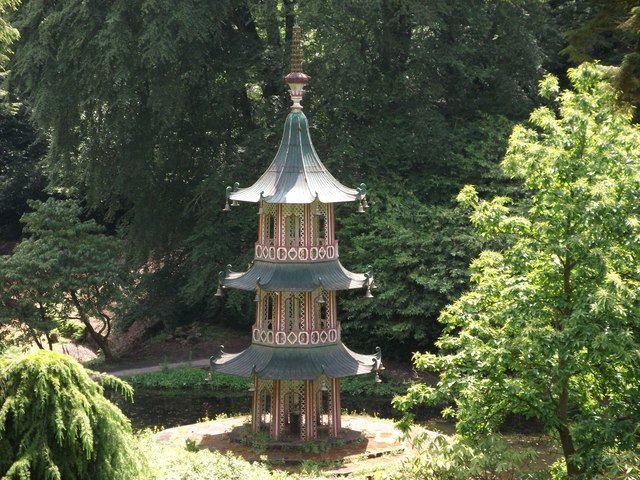
Show on map Photos Alton Towers Pagoda Fountain
‹ ›
Weather for this location Next 14 days Nearby places Useful places within 5 km
All Historic
UK green spaces mapped from open public data — so anyone can find the woodland, trail, or nature reserve closest to them.
© 2026 Glade · Made with care for UK green spaces
Wildlife to spot
7,668 records · National Biodiversity Network
▾
Wildlife to spot 7,668 records · National Biodiversity Network 🐦 Birds 41 species
summer autumn winter
2026 ▾
Mute Swan · Blackbird · Goldcrest · Coot · Mallard +36
Mute Swan Cygnus olor2025 Blackbird Turdus merula Goldcrest Regulus regulus2025 Coot Fulica atra2025 Mallard Anas platyrhynchos2025 Grey Heron Ardea cinerea2025 Mandarin Duck Aix galericulata2025 Cormorant Phalacrocorax carbo2025 Little Grebe Tachybaptus ruficollis2025 Gadwall Mareca strepera2025 Moorhen Gallinula chloropus2025 Nuthatch Sitta europaea2025 Woodpigeon Columba palumbus2025 Robin Erithacus rubecula2025 Kingfisher Alcedo atthis2025 Red-legged Partridge Alectoris rufa2025 Pheasant Phasianus colchicus2025 Raven Corvus corax2025 Wren Troglodytes troglodytes2025 Great Crested Grebe Podiceps cristatus2025 Crossbill Loxia curvirostra2025 Pochard Aythya ferina2025 Shoveler Spatula clypeata2025 Fieldfare Turdus pilaris2025 Coal Tit Periparus ater2025 Carrion Crow Corvus corone2025 Siskin Spinus spinus2025 Black-headed Gull Chroicocephalus ridibundus2025 Wigeon Mareca penelope2025 Treecreeper Certhia familiaris2025 Mediterranean Gull Ichthyaetus melanocephalus2025 Black-tailed Godwit Limosa limosa2025 Jackdaw Coloeus monedula2025 Greylag Goose Anser anser2025 Great Tit Parus major2025 Song Thrush Turdus philomelos2025 Blackcap Sylvia atricapilla2025 Grey Wagtail Motacilla cinerea2025 Blue Tit Cyanistes caeruleus2025 Willow Tit Poecile montanus2025 Canada Goose Branta canadensis2025 🦌 Mammals 2 species
spring summer
2026 ▾
Rabbit · Weasel
Rabbit Oryctolagus cuniculus Weasel Mustela nivalis2025 Meliscaeva cinctella · Western Conifer Seed Bug · 7-spot Ladybird · Cantharis cryptica · Anaspis maculata
Meliscaeva cinctella Meliscaeva cinctella2025 Western Conifer Seed Bug Leptoglossus occidentalis 7-spot Ladybird Coccinella septempunctata2025 Cantharis cryptica Cantharis cryptica2025 Anaspis maculata Anaspis maculata2025 Himalayan Balsam · Broad Buckler-fern · Holly · Ivy · Hart's-Tongue +76
Himalayan Balsam Impatiens glandulifera Broad Buckler-fern Dryopteris dilatata2025 Holly Ilex aquifolium2025 Ivy Hedera helix Hart's-Tongue Asplenium scolopendrium Herb-Robert Geranium robertianum Lesser Celandine Species observations from the last 10 years via NBN Atlas
Ficaria verna
Ficaria verna
Ribwort Plantain Plantago lanceolata
Ribwort Plantain Plantago lanceolata
Primrose Primula vulgaris
Primrose Primula vulgaris
Dog's Mercury Mercurialis perennis
Dog's Mercury Mercurialis perennis
Sycamore Acer pseudoplatanus2025
Sycamore Acer pseudoplatanus2025
Norway Maple Acer platanoides2025
Norway Maple Acer platanoides2025
Honeysuckle Lonicera periclymenum2025
Honeysuckle Lonicera periclymenum2025
Wych Elm Ulmus glabra2025
Wych Elm Ulmus glabra2025
Pedunculate Oak Quercus robur2025
Pedunculate Oak Quercus robur2025
Male-fern Dryopteris filix-mas2025
Male-fern Dryopteris filix-mas2025
Red Clover Trifolium pratense2025
Red Clover Trifolium pratense2025
Hogweed Heracleum sphondylium2025
Hogweed Heracleum sphondylium2025
Wood Dock Rumex sanguineus2025
Wood Dock Rumex sanguineus2025
Lords-and-Ladies Arum maculatum
Lords-and-Ladies Arum maculatum
Opposite-leaved Golden-saxifrage Chrysosplenium oppositifolium
Opposite-leaved Golden-saxifrage Chrysosplenium oppositifolium
Wood Anemone Anemone nemorosa
Wood Anemone Anemone nemorosa
Lamiastrum galeobdolon subsp. argentatum Lamiastrum galeobdolon subsp. argentatum
Lamiastrum galeobdolon subsp. argentatum Lamiastrum galeobdolon subsp. argentatum
Meadowsweet Filipendula ulmaria
Meadowsweet Filipendula ulmaria
Red Dead-nettle Lamium purpureum
Red Dead-nettle Lamium purpureum
Snowdrop Galanthus nivalis
Snowdrop Galanthus nivalis
Alder Alnus glutinosa2025
Alder Alnus glutinosa2025
Sweet Chestnut Castanea sativa2025
Sweet Chestnut Castanea sativa2025
Himalayan Honeysuckle Leycesteria formosa2025
Himalayan Honeysuckle Leycesteria formosa2025
Tufted Vetch Vicia cracca2025
Tufted Vetch Vicia cracca2025
Crested Dog's-tail Cynosurus cristatus2025
Crested Dog's-tail Cynosurus cristatus2025
Bugle Ajuga reptans2025
Bugle Ajuga reptans2025
Bramble Rubus fruticosus2025
Bramble Rubus fruticosus2025
Lesser Burdock Arctium minus2025
Lesser Burdock Arctium minus2025
Creeping Thistle Cirsium arvense2025
Creeping Thistle Cirsium arvense2025
Garden Lady's-mantle Alchemilla mollis2025
Garden Lady's-mantle Alchemilla mollis2025
Germander Speedwell Veronica chamaedrys2025
Germander Speedwell Veronica chamaedrys2025
Common Dog-violet Viola riviniana2025
Common Dog-violet Viola riviniana2025
Hoary Plantain Plantago media2025
Hoary Plantain Plantago media2025
Cleavers Galium aparine2025
Cleavers Galium aparine2025
Bog Stitchwort Stellaria alsine2025
Bog Stitchwort Stellaria alsine2025
Hedge Woundwort Stachys sylvatica2025
Hedge Woundwort Stachys sylvatica2025
Common Comfrey Symphytum officinale2025
Common Comfrey Symphytum officinale2025
Wood Millet Milium effusum2025
Wood Millet Milium effusum2025
Red Campion Silene dioica2025
Red Campion Silene dioica2025
Annual Meadow-grass Poa annua2025
Annual Meadow-grass Poa annua2025
Perennial Rye-grass Lolium perenne2025
Perennial Rye-grass Lolium perenne2025
Broad-leaved Dock Rumex obtusifolius2025
Broad-leaved Dock Rumex obtusifolius2025
Bullate Cotoneaster Cotoneaster rehderi2025
Bullate Cotoneaster Cotoneaster rehderi2025
Meadow Buttercup Ranunculus acris2025
Meadow Buttercup Ranunculus acris2025
Wavy Bitter-cress Cardamine flexuosa2025
Wavy Bitter-cress Cardamine flexuosa2025
Smooth Sow-thistle Sonchus oleraceus2025
Smooth Sow-thistle Sonchus oleraceus2025
Wood Avens Geum urbanum2025
Wood Avens Geum urbanum2025
Blackthorn Prunus spinosa2025
Blackthorn Prunus spinosa2025
Common Sorrel Rumex acetosa2025
Common Sorrel Rumex acetosa2025
Common Soft-brome Bromus hordeaceus subsp. hordeaceus2025
Common Soft-brome Bromus hordeaceus subsp. hordeaceus2025
Black Bryony Tamus communis2025
Black Bryony Tamus communis2025
Pineappleweed Matricaria discoidea2025
Pineappleweed Matricaria discoidea2025
Thyme-leaved Speedwell Veronica serpyllifolia2025
Thyme-leaved Speedwell Veronica serpyllifolia2025
White Clover Trifolium repens2025
White Clover Trifolium repens2025
Wild Angelica Angelica sylvestris2025
Wild Angelica Angelica sylvestris2025
Smooth Meadow-grass Poa pratensis2025
Smooth Meadow-grass Poa pratensis2025
Bluebell Hyacinthoides non-scripta2025
Bluebell Hyacinthoides non-scripta2025
Greater Stitchwort Stellaria holostea2025
Greater Stitchwort Stellaria holostea2025
Field Forget-me-not Myosotis arvensis2025
Field Forget-me-not Myosotis arvensis2025
Mugwort Artemisia vulgaris2025
Mugwort Artemisia vulgaris2025
Snowberry Symphoricarpos albus2025
Snowberry Symphoricarpos albus2025
Garlic Mustard Alliaria petiolata2025
Garlic Mustard Alliaria petiolata2025
Meadow Fescue Schedonorus pratensis2025
Meadow Fescue Schedonorus pratensis2025
Field Maple Acer campestre2025
Field Maple Acer campestre2025
Bracken Pteridium aquilinum2025
Bracken Pteridium aquilinum2025
Hazel Corylus avellana2025
Hazel Corylus avellana2025
Wood Speedwell Veronica montana2025
Wood Speedwell Veronica montana2025
Yorkshire-fog Holcus lanatus2025
Yorkshire-fog Holcus lanatus2025
Meadow Vetchling Lathyrus pratensis2025
Meadow Vetchling Lathyrus pratensis2025
Hawthorn Crataegus monogyna2025
Hawthorn Crataegus monogyna2025
Curled Dock Rumex crispus2025
Curled Dock Rumex crispus2025
White Dead-nettle Lamium album2025
White Dead-nettle Lamium album2025
Sweet Vernal-grass Anthoxanthum odoratum2025
Sweet Vernal-grass Anthoxanthum odoratum2025
Ash Fraxinus excelsior2025
Ash Fraxinus excelsior2025
Field-rose Rosa arvensis2025
Field-rose Rosa arvensis2025 Events & activities nearby Switch provider to compare local events, tours and bookable activities.
Bookable tours GetYourGuide Tripadvisor