Ambleside Roman fort, associated vicus and Roman road 12 ha
Plan your visit
🦅 Birds✦ Heritage🦉 Wildlife
Public access Free entry Dogs welcome 12 ha
Getting here
54.42300, -2.96781
Open directionsv ✦ Scheduled Ancient Monument — Nationally protected archaeological site on the National Heritage List for England (NHLE). Scheduled monuments represent the best surviving examples of England's irreplaceable archaeological heritage.
Castrum Grade I listed building
Visiting this summer
Seasonal nature notes and what to look for now
▾ 🐦 82+ species recorded in this area — summer evenings are best for activity; watch for Jackdaw and Robin ✦ Historic character is a year-round quality here — summer brings its own atmosphere to the setting 🐕 Dogs welcome — bring water in summer; the site has enough space to find shade on hot days 🌤️ Visiting this summer
🐦 82+ species recorded in this area — summer evenings are best for activity; watch for Jackdaw and Robin ✦ Historic character is a year-round quality here — summer brings its own atmosphere to the setting 🐕 Dogs welcome — bring water in summer; the site has enough space to find shade on hot days £ Free to visit — no entry charge🐕 Dogs welcome🦅 Bird watching
Very strong match
Birds — Jackdaw, Robin, Woodpigeon +79 more · last seen 2026; Lowland fens — specialist fen birds and passage waders
Free
✦ Heritage
Very strong match
Grade I listed building: BORRAN'S FIELD (GALAVA ROMAN FORT); Historic site with public access
Free
Birds — Jackdaw, Robin, Woodpigeon +79 more · last seen 2026; Deciduous woodland priority habitat
Free
🦋 Insect spotting
Strong match
Insects — Black Darter, Common Hawker, Red-legged Shieldbug +16 more · last seen 2026; Lowland meadows — marbled white, meadow brown and pollinating insects
Free
🍂 Seasonal nature
Strong match
Plants — Salmonberry, Springy Turf-moss, Common Tamarisk-moss +30 more · last seen 2026
Free
Named cycling route nearby: Route 6
Varies
Trails nearby Within roughly 5 km 27 signed routes nearby · 10 public paths nearby
Signed route nearby Public paths
Cumbria Way Walking route 118 km ▾
Named route Length 118 km Regional walking route
Show on map Miles without Stiles: Elterwater to Skelwith Bridge Walking route ▾
Named route Ref 11 Point-to-point Local walking route
Show on map Miles without Stiles: Wray Castle to Loanthwaite Walking route ▾
Named route Ref 47 Point-to-point Local walking route
Show on map High Close Tree Trail Walking route 1.9 km ▾
Originally a hill farm, the High Close estate was re-designed after Wheatley-Balme bought it in 1857. Exotic flora was planted to enhance views of the surrounding fells. Some species are now grown for the International Conifer Conservation Programme
Named route Length 1.9 km Duration 01:30 Round trip Local walking route
Show on map Watbarrow Wood Waymarked Walk, Wray Castle Walking route 1.1 km ▾
Rought and uneven path with some steep sections around Watbarrow Wood.
Named route Length 1.1 km Duration 00:30 Round trip Local walking route
Show on map 86 signed routes nearby
Signed route nearby
Route 6 Cycling route ▾
Named route Ref 6 National Cycle Network
Show on map Route 637 Cycling route ▾
Named route Ref 637 National Cycle Network
Show on map Regional Route 37 Cycling route ▾
Named route Ref 37 Regional cycle route
Show on map Main Route Cycling route 471 m ▾
Named route Ref 6 Length 471 m National Cycle Network Traffic-free Surface unsealedfirm
Show on map Main Route Cycling route 615 m ▾
Named route Ref 637 Length 615 m National Cycle Network Traffic-free Surface unsealedloose
Show on map Main Route Cycling route 287 m ▾
Named route Ref 6 Length 287 m National Cycle Network On-road Surface asphalt
Show on map 4 public paths nearby
Public paths
Skelghyll Lane bridleway · 121 m ▾
Public path bridleway Length 121 m Surface asphalt Path type: residential
Show on map Skelghyll Lane bridleway · 510 m ▾
Public path bridleway Length 510 m Surface asphalt Path type: residential
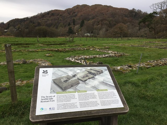
Show on map Photos Heart of Ambleside Roman Fort
‹ ›
Weather for this location Next 14 days Nearby places Useful places within 5 km
All Historic
UK green spaces mapped from open public data — so anyone can find the woodland, trail, or nature reserve closest to them.
© 2026 Glade · Made with care for UK green spaces
Events & activities nearby Switch provider to compare local events, tours and bookable activities.
Bookable tours GetYourGuide Tripadvisor
Wildlife to spot
25,422 records · National Biodiversity Network
▾
Wildlife to spot 25,422 records · National Biodiversity Network 🐦 Birds 46 species
autumn winter
2026 ▾
Robin · Blackbird · Mute Swan · Blue Tit · Woodpigeon +41
Robin Erithacus rubecula Blackbird Turdus merula Mute Swan Cygnus olor Blue Tit Cyanistes caeruleus Woodpigeon Columba palumbus2025 Black-headed Gull Chroicocephalus ridibundus Jackdaw Coloeus monedula Chaffinch Fringilla coelebs2025 Coal Tit Periparus ater2025 Magpie Pica pica2025 Grey Heron Ardea cinerea2025 Dunnock Prunella modularis Dipper Cinclus cinclus Great Tit Parus major2025 Nuthatch Sitta europaea2025 Wren Troglodytes troglodytes2025 Carrion Crow Corvus corone2025 Canada Goose Branta canadensis Goldfinch Carduelis carduelis2025 Song Thrush Turdus philomelos2025 Mallard Anas platyrhynchos2025 Long-tailed Tit Aegithalos caudatus2025 Pied Wagtail Motacilla alba yarrellii2025 Goosander Mergus merganser2025 Greenfinch Chloris chloris2025 Jay Garrulus glandarius2025 Rock Dove Columba livia2025 Siskin Spinus spinus2025 Great Spotted Woodpecker Dendrocopos major2025 Cormorant Phalacrocorax carbo2025 Redwing Turdus iliacus2025 Kingfisher Alcedo atthis Marsh Tit Poecile palustris2025 Tawny Owl Strix aluco2025 Herring Gull Larus argentatus2025 Little Grebe Tachybaptus ruficollis2025 Kestrel Falco tinnunculus2025 Collared Dove Streptopelia decaocto2025 Mistle Thrush Turdus viscivorus2025 Lesser Black-backed Gull Larus fuscus2025 Pheasant Phasianus colchicus2025 Meadow Pipit Anthus pratensis2025 Fieldfare Turdus pilaris2025 Treecreeper Certhia familiaris2025 Snipe Gallinago gallinago2025 Rook Corvus frugilegus2025 🐸 Amphibians 3 species
spring
2026 ▾
Common Frog · Common Toad · Palmate Newt
Common Frog Rana temporaria Common Toad Bufo bufo Palmate Newt Lissotriton helveticus Eristalis tenax
Eristalis tenax Eristalis tenax Salmonberry · Mamillate Plait-moss · Common Tamarisk-moss · Neat Feather-moss · Springy Turf-moss +25
Salmonberry Rubus spectabilis Mamillate Plait-moss Hypnum andoi2025 Common Tamarisk-moss Thuidium tamariscinum2025 Neat Feather-moss Pseudoscleropodium purum2025 Springy Turf-moss Rhytidiadelphus squarrosus2025 Wood Bristle-moss Lewinskya affinis Species observations from the last 10 years via NBN Atlas
2025
2025
Barbilophozia Barbilophozia2025
Barbilophozia Barbilophozia2025
Common Feather-moss Kindbergia praelonga2025
Common Feather-moss Kindbergia praelonga2025
Isothecium myosuroides Isothecium myosuroides2025
Isothecium myosuroides Isothecium myosuroides2025
Bank Haircap Polytrichum formosum2025
Bank Haircap Polytrichum formosum2025
Swan's-neck Thyme-moss Mnium hornum2025
Swan's-neck Thyme-moss Mnium hornum2025
Plagiochila porelloides Plagiochila porelloides2025
Plagiochila porelloides Plagiochila porelloides2025
Flat Neckera Neckera complanata2025
Flat Neckera Neckera complanata2025
Even Scalewort Radula complanata2025
Even Scalewort Radula complanata2025
Squirrel-tail Moss Leucodon sciuroides2025
Squirrel-tail Moss Leucodon sciuroides2025
Little Shaggy-moss Rhytidiadelphus loreus2025
Little Shaggy-moss Rhytidiadelphus loreus2025
Cypress-leaved Plait-moss Hypnum cupressiforme2025
Cypress-leaved Plait-moss Hypnum cupressiforme2025
Overleaf Pellia Pellia epiphylla2025
Overleaf Pellia Pellia epiphylla2025
Rusty Swan-neck Moss Campylopus flexuosus2025
Rusty Swan-neck Moss Campylopus flexuosus2025
Common Pocket-moss Fissidens taxifolius2025
Common Pocket-moss Fissidens taxifolius2025
Forked Veilwort Metzgeria furcata2025
Forked Veilwort Metzgeria furcata2025
Marsh Thyme-moss Plagiomnium ellipticum2025
Marsh Thyme-moss Plagiomnium ellipticum2025
Dilated Scalewort Frullania dilatata2025
Dilated Scalewort Frullania dilatata2025
Rough-stalked Feather-moss Brachythecium rutabulum2025
Rough-stalked Feather-moss Brachythecium rutabulum2025
Racomitrium heterostichum Racomitrium heterostichum2025
Racomitrium heterostichum Racomitrium heterostichum2025
Frizzled Pincushion Plenogemma phyllantha2025
Frizzled Pincushion Plenogemma phyllantha2025
Common Smoothcap Atrichum undulatum2025
Common Smoothcap Atrichum undulatum2025
Broom Fork-moss Dicranum scoparium2025
Broom Fork-moss Dicranum scoparium2025
Capillary Thread-moss Bryum capillare2025
Capillary Thread-moss Bryum capillare2025
Wall Scalewort Porella platyphylla2025
Wall Scalewort Porella platyphylla2025