Ash Copse ✦ Ancient woodland 19 ha
Plan your visit
🦉 Wildlife🦅 Birds🍂 Seasonal
Public access Free entry Dogs welcome 19 ha
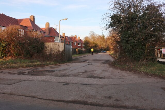
Places › England › South East › Vale of White Horse Getting here
51.59954, -1.64415
Open directionsv Visiting this summer
Seasonal nature notes and what to look for now
▾ 🌞 Midsummer — early morning visits most comfortable; look for deer fawns in quieter clearings 🐕 Early mornings are best for dog walks in summer — visit before 9am to avoid the heat and find quieter trails 🅿️ Car Park K 7m away — 16 car parks within reach 🌤️ Visiting this summer
🌞 Midsummer — early morning visits most comfortable; look for deer fawns in quieter clearings 🐕 Early mornings are best for dog walks in summer — visit before 9am to avoid the heat and find quieter trails 🅿️ Car Park K 7m away — 16 car parks within reach £ Free to visit — no entry charge🐕 Dogs welcome🌿 Ancient woodland — rare wildlife habitat🚲 Bike parking🅿️ Parking· Free
🦉 Wildlife
Very strong match
Multi-group wildlife — Amphibians, Birds, Mammals, Reptiles; Multi-group wildlife — Amphibians, Birds, Mammals, Reptiles
Free
🦅 Bird watching
Very strong match
Birds — Robin, Corn Bunting, Blackbird +67 more · last seen 2026; Birds — Robin, Corn Bunting, Blackbird +67 more · last seen 2026
Free
🍂 Seasonal nature
Strong match
Ancient woodland — bluebells, fungi and autumn colour; Plants — Rough-stalked Feather-moss · last seen 2023
Free
🦋 Insect spotting
Strong match
Insects — Western Conifer Seed Bug, Bird-cherry Ermine, Common Carder Bee +186 more · last seen 2025; Insects — Western Conifer Seed Bug, Bird-cherry Ermine, Common Carder Bee +186 more · last seen 2025
Free
Dogs allowed — public woodland
Free
Deciduous woodland — fungi, berries and wild garlic
Varies
Trails nearby Within roughly 5 km 11 signed routes nearby · 3 public paths nearby
Signed route nearby Public paths
The Ridgeway Walking route 140 km ▾
Named route Ref RW Length 140 km National walking route
Show on map D'Arcy Dalton Way Walking route 107 km ▾
Follows roughly the western boundary of Oxfordshire in unspoilt countryside.
Named route Length 107 km Regional walking route
Show on map The Roman Way Walking route 274.5 km ▾
Named route Length 274.5 km Regional walking route
Show on map The Vale Way Walking route 43 km ▾
Route through the Vale of White Horse in Oxfordshire, UK. (27 miles).
Named route Length 43 km Local walking route
Show on map White horse circular walk Walking route ▾
Named route Ref WHCW Local walking route
Show on map 1 signed route nearby
Signed route nearby
Vale Cycle Links Cycling route ▾
1 signed route nearby
Signed route nearby
King Alfred's Way Mountain bike route ▾
King Alfreds Way is 350km (220 miles) off road route designed to be ridden clockwise. It starts & ends in Winchester. It is suitable for gravel or cross-country bikes.
Named route Regional cycle route
Show on map 2 public paths nearby
Public paths
Pennyhooks Lane byway open to all traffic · 503 m ▾
Public path byway open to all traffic Length 503 m Surface gravel Path type: track
Show on map Pennyhooks Lane byway open to all traffic · 191 m ▾
Public path byway open to all traffic Length 191 m Surface asphalt Path type: unclassified
Show on map ✦ Ancient woodland — continuously wooded since at least 1600 AD. A rare and irreplaceable habitat, rich in biodiversity and historical character.
Weather for this location Next 14 days Nearby places Useful places within 5 km
All Historic
Own or manage this place?
Claim this listing to keep details accurate, add photos, and highlight what makes it special — free.
Claim this page→ How useful was the information on this page?
id: 13e8b4cd-2647-420b-ad38-8824262be960
UK green spaces mapped from open public data — so anyone can find the woodland, trail, or nature reserve closest to them.
© 2026 Glade · Made with care for UK green spaces
Wildlife to spot
2,940 records · National Biodiversity Network
▾
Wildlife to spot 2,940 records · National Biodiversity Network Blackbird · Robin · Woodpigeon · Goldfinch · Magpie +27
Blackbird Turdus merula Robin Erithacus rubecula2025 Woodpigeon Columba palumbus2025 Goldfinch Carduelis carduelis2025 Magpie Pica pica2025 Chaffinch Fringilla coelebs Kingfisher Alcedo atthis2025 Moorhen Gallinula chloropus2025 Greenfinch Chloris chloris2025 Starling Sturnus vulgaris2025 Herring Gull Larus argentatus2025 Jackdaw Coloeus monedula2025 Carrion Crow Corvus corone2025 Wren Troglodytes troglodytes2025 Rock Dove Columba livia2025 Green Woodpecker Picus viridis2025 Cormorant Phalacrocorax carbo2025 Blue Tit Cyanistes caeruleus2025 Woodcock Scolopax rusticola2025 Goldcrest Regulus regulus2025 Dunnock Prunella modularis2025 Redwing Turdus iliacus2025 Great Tit Parus major2025 Mistle Thrush Turdus viscivorus2025 Bullfinch Pyrrhula pyrrhula2025 Mallard Anas platyrhynchos2025 Rook Corvus frugilegus2025 Swallow Hirundo rustica2025 Swift Apus apus2025 Black-headed Gull Chroicocephalus ridibundus2025 Raven Corvus corax2025 Grey Heron Ardea cinerea2025 Grey Squirrel · Badger
Grey Squirrel Sciurus carolinensis Badger Meles meles Shuttle-shaped Dart · Riband Wave · Bird-cherry Ermine · Common Wainscot · Common Rustic agg. +81
Shuttle-shaped Dart Agrotis puta Riband Wave Idaea aversata Bird-cherry Ermine Yponomeuta evonymella Common Wainscot Mythimna pallens Common Rustic agg. Mesapamea secalis agg. Large Yellow Underwing Noctua pronuba Common Footman Species observations from the last 10 years via NBN Atlas
Eilema lurideola
Eilema lurideola
Dark Arches Apamea monoglypha
Dark Arches Apamea monoglypha
Gypsy Moth Lymantria dispar
Gypsy Moth Lymantria dispar
Grey/Dark Dagger Acronicta psi/tridens
Grey/Dark Dagger Acronicta psi/tridens
Lime-speck Pug Eupithecia centaureata
Lime-speck Pug Eupithecia centaureata
Dusky Sallow Eremobia ochroleuca
Dusky Sallow Eremobia ochroleuca
Elephant Hawk-moth Deilephila elpenor
Elephant Hawk-moth Deilephila elpenor
Garden Grass-veneer Chrysoteuchia culmella
Garden Grass-veneer Chrysoteuchia culmella
Turnip Moth Agrotis segetum
Turnip Moth Agrotis segetum
Coronet Craniophora ligustri
Coronet Craniophora ligustri
Scalloped Oak Crocallis elinguaria
Scalloped Oak Crocallis elinguaria
Flame Axylia putris
Flame Axylia putris
Ash-bark Knot-horn Euzophera pinguis
Ash-bark Knot-horn Euzophera pinguis
Rosy Footman Miltochrista miniata
Rosy Footman Miltochrista miniata
Nut-tree Tussock Colocasia coryli
Nut-tree Tussock Colocasia coryli
Leopard Moth Zeuzera pyrina
Leopard Moth Zeuzera pyrina
July Highflyer Hydriomena furcata
July Highflyer Hydriomena furcata
Marbled Minor agg. Oligia strigilis agg.
Marbled Minor agg. Oligia strigilis agg.
European Corn-borer Ostrinia nubilalis
European Corn-borer Ostrinia nubilalis
Uncertain Hoplodrina octogenaria
Uncertain Hoplodrina octogenaria
Peppered Moth Biston betularia
Peppered Moth Biston betularia
Flame Shoulder Ochropleura plecta
Flame Shoulder Ochropleura plecta
Brassica Whitefly Aleyrodes proletella
Brassica Whitefly Aleyrodes proletella
Setaceous Hebrew Character Xestia c-nigrum
Setaceous Hebrew Character Xestia c-nigrum
Ringed China-mark Parapoynx stratiotata
Ringed China-mark Parapoynx stratiotata
Dusky Thorn Ennomos fuscantaria
Dusky Thorn Ennomos fuscantaria
Copper Underwing agg. Amphipyra pyramidea agg.
Copper Underwing agg. Amphipyra pyramidea agg.
Grey Knot-horn Acrobasis advenella
Grey Knot-horn Acrobasis advenella
Marbled Beauty Bryophila domestica
Marbled Beauty Bryophila domestica
Light Brown Apple Moth Epiphyas postvittana
Light Brown Apple Moth Epiphyas postvittana
Swallow Prominent Pheosia tremula
Swallow Prominent Pheosia tremula
Gold Spot Plusia festucae
Gold Spot Plusia festucae
Brimstone Moth Opisthograptis luteolata
Brimstone Moth Opisthograptis luteolata
Shaded Broad-bar Scotopteryx chenopodiata
Shaded Broad-bar Scotopteryx chenopodiata
Wax Moth Galleria mellonella
Wax Moth Galleria mellonella
Lesser Broad-bordered Yellow Underwing Noctua janthe
Lesser Broad-bordered Yellow Underwing Noctua janthe
Willow Beauty Peribatodes rhomboidaria
Willow Beauty Peribatodes rhomboidaria
Least Carpet Idaea rusticata
Least Carpet Idaea rusticata
Cloaked Minor Mesoligia furuncula
Cloaked Minor Mesoligia furuncula
Currant Pug Eupithecia assimilata
Currant Pug Eupithecia assimilata
Small Emerald Hemistola chrysoprasaria
Small Emerald Hemistola chrysoprasaria
Garden Straw Agapeta hamana
Garden Straw Agapeta hamana
Broad-bordered Yellow Underwing Noctua fimbriata
Broad-bordered Yellow Underwing Noctua fimbriata
Straw Dot Rivula sericealis
Straw Dot Rivula sericealis
Small Grey Eudonia mercurella
Small Grey Eudonia mercurella
Magpie Moth Abraxas grossulariata
Magpie Moth Abraxas grossulariata
Rosy Tabby Endotricha flammealis
Rosy Tabby Endotricha flammealis
Brown-line Bright-eye Mythimna conigera
Brown-line Bright-eye Mythimna conigera
Small Ranunculus Hecatera dysodea
Small Ranunculus Hecatera dysodea
Burdock Straw Aethes rubigana
Burdock Straw Aethes rubigana
Rusty Dot Udea ferrugalis
Rusty Dot Udea ferrugalis
Netted Tortrix Acleris forsskaleana
Netted Tortrix Acleris forsskaleana
Bulrush Veneer Calamotropha paludella
Bulrush Veneer Calamotropha paludella
Diamond-back Marble Eudemis profundana
Diamond-back Marble Eudemis profundana
Mint Moth Pyrausta aurata
Mint Moth Pyrausta aurata
Spotted Magpie Anania coronata
Spotted Magpie Anania coronata
Red-barred Tortrix Ditula angustiorana
Red-barred Tortrix Ditula angustiorana
Swallow-tailed Moth Ourapteryx sambucaria
Swallow-tailed Moth Ourapteryx sambucaria
Australian Orange-tip Tachystola acroxantha
Australian Orange-tip Tachystola acroxantha
Light Emerald Campaea margaritaria
Light Emerald Campaea margaritaria
Brown Scallop Philereme vetulata
Brown Scallop Philereme vetulata
Garden Tiger Arctia caja
Garden Tiger Arctia caja
Garden Carpet Xanthorhoe fluctuata
Garden Carpet Xanthorhoe fluctuata
Pine Hawk-moth Sphinx pinastri
Pine Hawk-moth Sphinx pinastri
Ruby Tiger Phragmatobia fuliginosa
Ruby Tiger Phragmatobia fuliginosa
Heart & Club Agrotis clavis
Heart & Club Agrotis clavis
Little Grey Eudonia lacustrata
Little Grey Eudonia lacustrata
Bright-line Brown-eye Lacanobia oleracea
Bright-line Brown-eye Lacanobia oleracea
Privet Hawk-moth Sphinx ligustri
Privet Hawk-moth Sphinx ligustri
Heart & Dart Agrotis exclamationis
Heart & Dart Agrotis exclamationis
Thistle Ermine Myelois circumvoluta
Thistle Ermine Myelois circumvoluta
White-point Mythimna albipuncta
White-point Mythimna albipuncta
Large Fruit-tree Tortrix Archips podana
Large Fruit-tree Tortrix Archips podana
Buff-tip Phalera bucephala
Buff-tip Phalera bucephala
Poplar Grey Subacronicta megacephala
Poplar Grey Subacronicta megacephala
Ling Pug Eupithecia absinthiata
Ling Pug Eupithecia absinthiata
Yponomeuta Yponomeuta
Yponomeuta Yponomeuta
Plain Golden Y Autographa jota
Plain Golden Y Autographa jota
Light Arches Apamea lithoxylaea
Light Arches Apamea lithoxylaea
Puss Moth Cerura vinula
Puss Moth Cerura vinula Events & activities nearby Switch provider to compare local events, tours and bookable activities.
Bookable tours GetYourGuide Promote here