Getting here
54.82913, -1.67615
Visiting this summer
Seasonal nature notes and what to look for now
Visiting this summer
Seasonal nature notes and what to look for now
- 🌞Midsummer — early morning visits most comfortable; look for deer fawns in quieter clearings
- 🐕Early mornings are best for dog walks in summer — visit before 9am to avoid the heat and find quieter trails
- 📍Open access throughout summer — no booking required
🌤️ Visiting this summer
- 🌞Midsummer — early morning visits most comfortable; look for deer fawns in quieter clearings
- 🐕Early mornings are best for dog walks in summer — visit before 9am to avoid the heat and find quieter trails
- 📍Open access throughout summer — no booking required
Good to know
- £Free to visit — no entry charge
- 🐕Dogs welcome
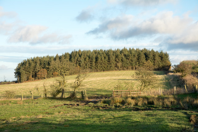
- 🌿Ancient woodland — rare wildlife habitat
Best for
Seasonal nature
Strong match
Ancient woodland — bluebells, fungi and autumn colour
Dog walks
Strong match
Dogs allowed — public woodland
Bird watching
Strong match
Ancient woodland — owls, woodpeckers, warblers
Wildlife
Strong match
Ancient woodland
Forest walks
Good match
Public woodland
Heritage
Good match
Ancient woodland — historic landscape
Trails nearby
Within roughly 5 km🚶Walking
8 signed routes nearby · 17 public paths nearby
Signed route nearbyPublic paths
Walking
Small Pilgrim PlacesWalking route14.5 km
Way of LightWalking route
Heritage 100 - Walridge FellWalking route
Heritage 100 - BearparkWalking route
H100 - Witton GilbertWalking route
Charlaw Lanepublic footpath · 345 m
🚴Cycling
29 signed routes nearby
Signed route nearby
Cycling
Route 14Cycling route
Satley LoopCycling route30 km
Langley Park to Sniperly LinkCycling route
National Byway (County Durham and Northumberland)Cycling route
The National Byway route through County Durham and Northumberland
Route 7Cycling route
Main RouteCycling route912 m
🐴Horse riding
5 public paths nearby
Public paths
Horse riding
Charlaw Lanebridleway · 155 m
Charlaw Lanebridleway · 6 m
Charlaw Lanebridleway · 1 m
Charlaw Lanebridleway · 2 m
Wildlife to spot
Photos
Weather for this location
Loading local forecast…
Nearby places
Useful places within 5 km
Own or manage this place?
Claim this listing to keep details accurate, add photos, and highlight what makes it special — free.
Claim this pageHow was your visit?
How useful was the information on this page?
id: db7d7b9b-331b-4d22-8856-c6a8c897af2d