Plan your visit
Getting here
51.07031, -0.15109
Visiting this summer
Seasonal nature notes and what to look for now
Visiting this summer
Seasonal nature notes and what to look for now
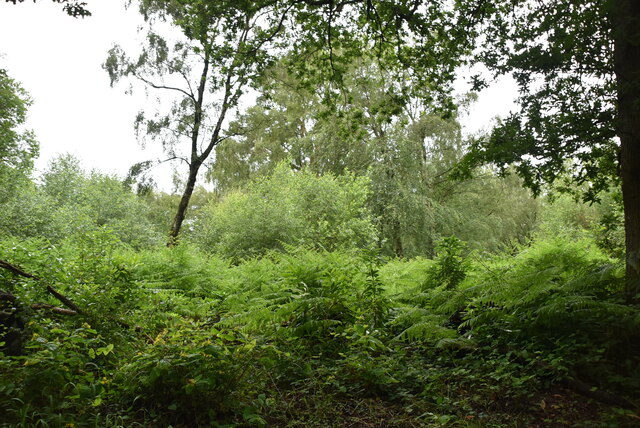
- ☀️June — canopy now fully closed, creating cool dappled shade even on warm days
- 🐕Early mornings are best for dog walks in summer — visit before 9am to avoid the heat and find quieter trails
- 🅿️Parking 180m away — 2 car parks within reach
🌤️ Visiting this summer
- ☀️June — canopy now fully closed, creating cool dappled shade even on warm days
- 🐕Early mornings are best for dog walks in summer — visit before 9am to avoid the heat and find quieter trails
- 🅿️Parking 180m away — 2 car parks within reach
Good to know
- £Free to visit — no entry charge
- 🐕Dogs welcome
- 🌿Ancient woodland — rare wildlife habitat
Best for
Wildlife
Very strong match
Multi-group wildlife — Birds, Mammals; Multi-group wildlife — Birds, Mammals
Bird watching
Very strong match
Birds — Blue Tit, Robin, Chaffinch +66 more · last seen 2025; Birds — Blue Tit, Robin, Chaffinch +66 more · last seen 2025
Seasonal nature
Strong match
Ancient woodland — bluebells, fungi and autumn colour
Dog walks
Strong match
Dogs allowed — public woodland
Foraging
Good match
Deciduous woodland — fungi, berries and wild garlic
Forest walks
Good match
Public woodland
Trails nearby
Within roughly 5 km🚶Walking
8 signed routes nearby · 15 public paths nearby
Signed route nearbyPublic paths
Walking
Sussex Diamond WayWalking route97 km
Crawley GreenwayWalking route
walking route around Crawley along many leafy paths, signposted
Sussex Ouse Valley WayWalking route67 km
Worth WayWalking route
Accessible Route, NymansWalking route1.2 km
Nurtured for nearly 130 years, the garden features an internationally important plant collection containing species from around the world.
Boundary Roadpublic footpath · 414 m
Westup Roadpublic footpath · 29 m
Boundary Roadpublic footpath · 638 m
🚴Cycling
80 signed routes nearby
Signed route nearby
Cycling
Route KCycling route
Route J (incomplete)Cycling route
Route JCycling route
Route F (incomplete)Cycling route
Route DCycling route
National Cycle Route 228 Crawley to PulboroughCycling route
🚵Mountain biking
1 signed route nearby
Signed route nearby
Mountain biking
Tilgate Forest SingletrackMountain bike route
🐴Horse riding
2 public paths nearby
Public paths
Horse riding
No named routes yet. Public paths are shown on the map.
Wildlife to spot
Photos
Weather for this location
Loading local forecast…
Nearby places
Useful places within 5 km
Nearby reservoirs
How was your visit?
How useful was the information on this page?
id: 0b1ac795-9226-469d-ae96-bca96df2226b