Getting here
55.78022, -4.56993
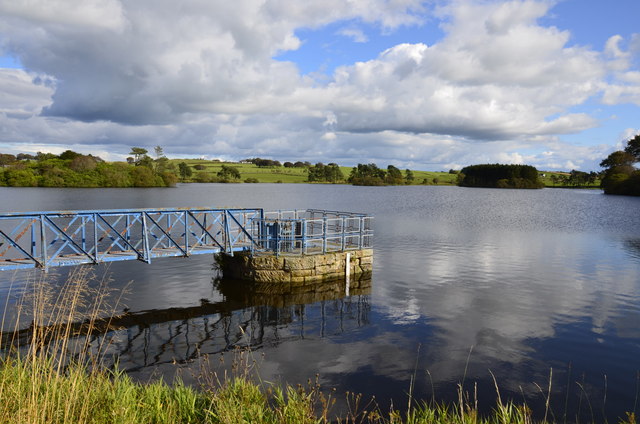
Visiting this summer
Seasonal nature notes and what to look for now
Visiting this summer
Seasonal nature notes and what to look for now
- 🌞Midsummer — dragonfly and damselfly activity peaks along water edges
- 🌿Foraging is at its best in summer here
- 🐕Dogs welcome — bring water in summer; the site has enough space to find shade on hot days
🌤️ Visiting this summer
- 🌞Midsummer — dragonfly and damselfly activity peaks along water edges
- 🌿Foraging is at its best in summer here
- 🐕Dogs welcome — bring water in summer; the site has enough space to find shade on hot days
Good to know
- £Free to visit — no entry charge
- 🐕Dogs welcome
Best for
Wildlife
Very strong match
Multi-group wildlife — Amphibians, Birds, Mammals; Multi-group wildlife — Amphibians, Birds, Mammals
Bird watching
Very strong match
Birds — Canada Goose, Mallard, Carrion Crow +72 more · last seen 2025; Birds — Canada Goose, Mallard, Carrion Crow +72 more · last seen 2025
Seasonal nature
Strong match
Plants — Climbing Corydalis, Apple, Pyrenean Valerian +21 more · last seen 2023; Plants — Climbing Corydalis, Apple, Pyrenean Valerian +21 more · last seen 2023
Insect spotting
Good match
Insects — Syrphus, Mesembrina meridiana, Leucozona laternaria +14 more · last seen 2025; Insects — Syrphus, Mesembrina meridiana, Leucozona laternaria +14 more · last seen 2025
Foraging
Good match
Plants — Large-flowered Hemp-nettle, Bilberry, Beech +2 more foraging species
Trails nearby
Within roughly 5 km🚶Walking
2 signed routes nearby
Signed route nearby
Walking
Whithorn Way - a Glasgow Cathedral to GirvanWalking route
This creation is Glasgow Cathedral to Girvan. Any route from Girvan is a busy road with no shoulders. Bus/Train to Barrhill and continue to Whithorn, the spiritual home of Saint Ninian..
Semple TrailWalking route
🚴Cycling
15 signed routes nearby
Signed route nearby
Cycling
Route 7Cycling route
EuroVelo 1 - Atlantic Coast Route - part United Kingdom 1Cycling route
Main RouteCycling route3.7 km
N/ACycling route117 m
N/ACycling route115 m
N/ACycling route158 m
Wildlife to spot
Photos
Weather for this location
Loading local forecast…
Nearby places
Useful places within 5 km
Own or manage this place?
Claim this listing to keep details accurate, add photos, and highlight what makes it special — free.
Claim this pageVisitor access unverified.We don't yet have confirmed information about walking routes or public access at this reservoir. If you've visited, please help us improve this page.
How was your visit?
How useful was the information on this page?
id: 9f8278f4-f690-4594-a0ad-639d8a6e9531