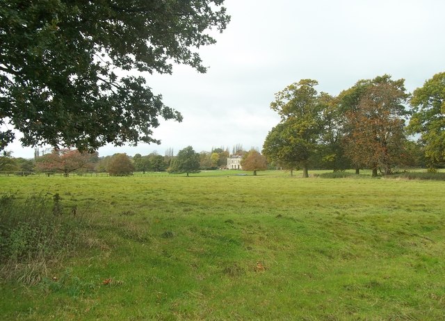
Barton Blount medieval settlement remains, including a chapel, decoy pond and part of the open field system, 340m north of Barton Hall 23 ha
Plan your visit
🦅 Birds🦉 Wildlife✦ Heritage
Public access Free entry Dogs welcome 23 ha
Getting here
52.91116, -1.69215
Open directionsv ✦ Scheduled Ancient Monument — Nationally protected archaeological site on the National Heritage List for England (NHLE). Scheduled monuments represent the best surviving examples of England's irreplaceable archaeological heritage.
Archaeological site scheduled monument
Visiting this summer
Seasonal nature notes and what to look for now
▾ 🐦 60+ species recorded in this area — summer evenings are best for activity; watch for Starling and Blackbird ✦ Historic character is a year-round quality here — summer brings its own atmosphere to the setting 🐕 Dogs welcome — bring water in summer; the site has enough space to find shade on hot days 🌤️ Visiting this summer
🐦 60+ species recorded in this area — summer evenings are best for activity; watch for Starling and Blackbird ✦ Historic character is a year-round quality here — summer brings its own atmosphere to the setting 🐕 Dogs welcome — bring water in summer; the site has enough space to find shade on hot days £ Free to visit — no entry charge🐕 Dogs welcome🦅 Bird watching
Very strong match
Birds — Starling, Blackbird, Fieldfare +57 more · last seen 2023; Deciduous woodland — woodpeckers, warblers and woodland birds
Free
Birds — Starling, Blackbird, Fieldfare +57 more · last seen 2023; Deciduous woodland priority habitat
Free
Historic site with public access
Free
🦋 Insect spotting
Strong match
Insects — Small White, Large White, Small Tortoiseshell +16 more · last seen 2019
Free
🍂 Seasonal nature
Strong match
Plants — Field Forklet-moss, Schreber's Forklet-moss, Pill Bryum +64 more · last seen 2019
Free
Dogs allowed with public access
Free
Trails nearby Within roughly 5 km 2 signed routes nearby · 3 public paths nearby
Signed route nearby Public paths
Exploring Sudbury - Village Trail, Sudbury Hall Walking route 2 km ▾
The main trail covers a mix of terrain including cobbles, uneven surfaces and depending on the weather parts may be muddy. Through Sudbury village, the trail follows roads, some have pavements while others do not.
Named route Length 2 km Duration 00:45-01:00 Round trip Local walking route
Show on map Bonnie Prince Charlie Walk Walking route 28 km ▾
Named route Length 28 km Local walking route
Show on map 9 signed routes nearby
Signed route nearby
Hilton Local Cycle Route Cycling route ▾
Named route Local cycle route
Show on map Pennine Cycleway Cycling route ▾
Named route Ref 68 National Cycle Network
Show on map Route 549 Cycling route ▾
Named route Ref 549 National Cycle Network
Show on map Main Route Cycling route 11.5 km ▾
Named route Ref 68 Length 11.5 km National Cycle Network On-road Surface asphalt
Show on map Main Route Cycling route 3.7 km ▾
Named route Ref 68 Length 3.7 km National Cycle Network On-road Surface asphalt
Show on map Main Route Cycling route 700 m ▾
Named route Ref 549 Length 700 m National Cycle Network Traffic-free Surface unsealedfirm
Show on map 8 public paths nearby
Public paths
No named routes yet. Public paths are shown on the map.
Weather for this location Next 14 days Nearby places Useful places within 5 km
All Historic
UK green spaces mapped from open public data — so anyone can find the woodland, trail, or nature reserve closest to them.
© 2026 Glade · Made with care for UK green spaces
Events & activities nearby Switch provider to compare local events, tours and bookable activities.
Bookable tours GetYourGuide Tripadvisor
Wildlife to spot
1,324 records · National Biodiversity Network
▾
Wildlife to spot 1,324 records · National Biodiversity Network Rook · Jackdaw · Woodpigeon · Carrion Crow · Redwing +18
Rook Corvus frugilegus Jackdaw Coloeus monedula Woodpigeon Columba palumbus Carrion Crow Corvus corone Redwing Turdus iliacus2022 Mute Swan Cygnus olor2022 Pied Wagtail Motacilla alba yarrellii2022 Starling Sturnus vulgaris2022 Fieldfare Turdus pilaris2022 Skylark Alauda arvensis Stonechat Saxicola rubicola Golden Plover Pluvialis apricaria2022 Lapwing Vanellus vanellus2022 Robin Erithacus rubecula2022 Green Woodpecker Picus viridis2019 Yellowhammer Emberiza citrinella2019 Blackbird Turdus merula2019 Goldfinch Carduelis carduelis2019 Linnet Linaria cannabina2019 Black-headed Gull Chroicocephalus ridibundus2019 Reed Bunting Emberiza schoeniclus2019 Snipe Gallinago gallinago2019 Chiffchaff Phylloscopus collybita2018 🦌 Mammals 2 species
spring summer winter
2021 ▾
Hedgehog · Badger
Hedgehog Erinaceus europaeus Badger Meles meles2016 Large White · Green-veined White · Small Tortoiseshell · Small White · Red Admiral +13
Large White Pieris brassicae Green-veined White Pieris napi Small Tortoiseshell Aglais urticae Small White Pieris rapae Red Admiral Vanessa atalanta Meadow Brown Maniola jurtina Ringlet Aphantopus hyperantus 🌿 Plants 86 species
winter autumn
2025 ▾
Common Nettle · Cow Parsley · Wood Forget-me-not · Creeping Buttercup · Dandelion +81
Common Nettle Urtica dioica Cow Parsley Anthriscus sylvestris Wood Forget-me-not Myosotis sylvatica Creeping Buttercup Ranunculus repens Dandelion Taraxacum Ground-ivy Glechoma hederacea Species observations from the last 10 years via NBN Atlas
Painted Lady Vanessa cardui
Painted Lady Vanessa cardui
Green Shieldbug Palomena prasina
Green Shieldbug Palomena prasina
Common Carder Bee Bombus pascuorum
Common Carder Bee Bombus pascuorum
Holly Blue Celastrina argiolus
Holly Blue Celastrina argiolus
Peacock Aglais io
Peacock Aglais io
Gatekeeper Pyronia tithonus
Gatekeeper Pyronia tithonus
Comma Polygonia c-album
Comma Polygonia c-album
Small Skipper Thymelicus sylvestris
Small Skipper Thymelicus sylvestris
Marbled White Melanargia galathea
Marbled White Melanargia galathea
Tree Bumblebee Bombus hypnorum2017
Tree Bumblebee Bombus hypnorum2017
Orange-tip Anthocharis cardamines2016
Orange-tip Anthocharis cardamines2016 Yew
Yew
Taxus baccata
Taxus baccata
Cleavers Galium aparine
Cleavers Galium aparine
Oxeye Daisy Leucanthemum vulgare
Oxeye Daisy Leucanthemum vulgare
Primrose Primula vulgaris
Primrose Primula vulgaris
Groundsel Senecio vulgaris
Groundsel Senecio vulgaris
Holly Ilex aquifolium
Holly Ilex aquifolium
Spear Thistle Cirsium vulgare
Spear Thistle Cirsium vulgare
Elder Sambucus nigra
Elder Sambucus nigra
Bluebell Hyacinthoides non-scripta
Bluebell Hyacinthoides non-scripta
Smooth Sow-thistle Sonchus oleraceus
Smooth Sow-thistle Sonchus oleraceus
Common Mallow Malva sylvestris
Common Mallow Malva sylvestris
Creeping Bent Agrostis stolonifera
Creeping Bent Agrostis stolonifera
Herb-Robert Geranium robertianum
Herb-Robert Geranium robertianum
Wood Avens Geum urbanum
Wood Avens Geum urbanum
Common Ragwort Jacobaea vulgaris
Common Ragwort Jacobaea vulgaris
Great Willowherb Epilobium hirsutum
Great Willowherb Epilobium hirsutum
Bramble Rubus fruticosus
Bramble Rubus fruticosus
Broad-leaved Dock Rumex obtusifolius
Broad-leaved Dock Rumex obtusifolius
White Dead-nettle Lamium album
White Dead-nettle Lamium album
Nipplewort Lapsana communis
Nipplewort Lapsana communis
Daisy Bellis perennis
Daisy Bellis perennis
Festuca rubra Festuca rubra
Festuca rubra Festuca rubra
Shepherd's-purse Capsella bursa-pastoris
Shepherd's-purse Capsella bursa-pastoris
Bush Vetch Vicia sepium2019
Bush Vetch Vicia sepium2019
Redshank Ceratodon purpureus2017
Redshank Ceratodon purpureus2017
Creeping Feather-moss Amblystegium serpens2017
Creeping Feather-moss Amblystegium serpens2017
Schreber's Forklet-moss Dicranella schreberiana2017
Schreber's Forklet-moss Dicranella schreberiana2017
Common Pincushion Dicranoweisia cirrata2017
Common Pincushion Dicranoweisia cirrata2017
Water Screw-moss Syntrichia latifolia2017
Water Screw-moss Syntrichia latifolia2017
Pill Bryum Bryum violaceum2017
Pill Bryum Bryum violaceum2017
Capillary Thread-moss Bryum capillare2017
Capillary Thread-moss Bryum capillare2017
Field Forklet-moss Dicranella staphylina2017
Field Forklet-moss Dicranella staphylina2017
Grey-cushioned Grimmia Grimmia pulvinata2017
Grey-cushioned Grimmia Grimmia pulvinata2017
Clustered Feather-moss Rhynchostegium confertum2017
Clustered Feather-moss Rhynchostegium confertum2017
Lyell's Bristle-moss Pulvigera lyellii2017
Lyell's Bristle-moss Pulvigera lyellii2017
Perthshire Beard-moss Didymodon rigidulus2017
Perthshire Beard-moss Didymodon rigidulus2017
Frizzled Pincushion Plenogemma phyllantha2017
Frizzled Pincushion Plenogemma phyllantha2017
Crocus neapolitanus Crocus neapolitanus
Crocus neapolitanus Crocus neapolitanus
Pedunculate Oak Quercus robur
Pedunculate Oak Quercus robur
Silver Birch Betula pendula
Silver Birch Betula pendula
Butterfly-bush Buddleja davidii
Butterfly-bush Buddleja davidii
Ribwort Plantain Plantago lanceolata
Ribwort Plantain Plantago lanceolata
Hawthorn Crataegus monogyna
Hawthorn Crataegus monogyna
Green Alkanet Pentaglottis sempervirens
Green Alkanet Pentaglottis sempervirens
Stinking Iris Iris foetidissima
Stinking Iris Iris foetidissima
Red Dead-nettle Lamium purpureum
Red Dead-nettle Lamium purpureum
Cat's-ear Hypochaeris radicata
Cat's-ear Hypochaeris radicata
Wild Strawberry Fragaria vesca
Wild Strawberry Fragaria vesca
Common Mouse-ear Cerastium fontanum
Common Mouse-ear Cerastium fontanum
Sowbread Cyclamen hederifolium
Sowbread Cyclamen hederifolium
Lords-and-Ladies Arum maculatum
Lords-and-Ladies Arum maculatum
Ivy-leaved Speedwell Veronica hederifolia
Ivy-leaved Speedwell Veronica hederifolia
Snowdrop Galanthus nivalis
Snowdrop Galanthus nivalis
Himalayan Cotoneaster Cotoneaster simonsii
Himalayan Cotoneaster Cotoneaster simonsii
Lesser Celandine Ficaria verna
Lesser Celandine Ficaria verna
daffodils Narcissus
daffodils Narcissus
Common Ivy Hedera helix subsp. helix
Common Ivy Hedera helix subsp. helix
Early Crocus Crocus tommasinianus
Early Crocus Crocus tommasinianus
Sitka Spruce Picea sitchensis
Sitka Spruce Picea sitchensis
Cut-leaved Crane's-bill Geranium dissectum
Cut-leaved Crane's-bill Geranium dissectum
Red Valerian Centranthus ruber2018
Red Valerian Centranthus ruber2018
Least Yellow-sorrel Oxalis exilis2018
Least Yellow-sorrel Oxalis exilis2018
False Oat-grass Arrhenatherum elatius2018
False Oat-grass Arrhenatherum elatius2018
Prickly Sow-thistle Sonchus asper2018
Prickly Sow-thistle Sonchus asper2018
Common Couch Elymus repens2018
Common Couch Elymus repens2018
Columbine Aquilegia vulgaris2018
Columbine Aquilegia vulgaris2018
Selfheal Prunella vulgaris2018
Selfheal Prunella vulgaris2018
Fox-and-cubs Pilosella aurantiaca2018
Fox-and-cubs Pilosella aurantiaca2018
Bread Wheat Triticum aestivum2018
Bread Wheat Triticum aestivum2018
Cuckooflower Cardamine pratensis2018
Cuckooflower Cardamine pratensis2018
Sun Spurge Euphorbia helioscopia2018
Sun Spurge Euphorbia helioscopia2018
Enchanter's-nightshade Circaea lutetiana2018
Enchanter's-nightshade Circaea lutetiana2018
Petty Spurge Euphorbia peplus2018
Petty Spurge Euphorbia peplus2018
Lime Tilia cordata x platyphyllos = T. x europaea2018
Lime Tilia cordata x platyphyllos = T. x europaea2018
Ash Fraxinus excelsior2018
Ash Fraxinus excelsior2018
Barren Brome Anisantha sterilis2018
Barren Brome Anisantha sterilis2018
Germander Speedwell Veronica chamaedrys2018
Germander Speedwell Veronica chamaedrys2018
Lady-fern Athyrium filix-femina2018
Lady-fern Athyrium filix-femina2018
Ivy Hedera helix2018
Ivy Hedera helix2018
Black Medick Medicago lupulina2018
Black Medick Medicago lupulina2018