Plan your visit
🦉 Wildlife🦅 Birds🛝 Family
Public access Dogs welcome
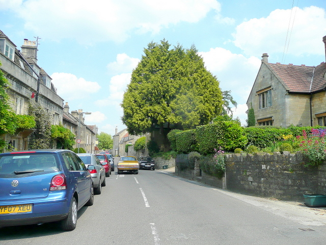
Places › England › South West › Bath and North East Somerset Getting here
51.39448, -2.32361
Open directionsv Visiting this summer
Seasonal nature notes and what to look for now
▾ 🌞 Midsummer — early morning visits most comfortable; look for deer fawns in quieter clearings ☀️ Summer family visits work well here — arrive early and plan for a longer stay 🧺 Picnic area on site — summer afternoons here are an easy, low-cost day out 🌤️ Visiting this summer
🌞 Midsummer — early morning visits most comfortable; look for deer fawns in quieter clearings ☀️ Summer family visits work well here — arrive early and plan for a longer stay 🧺 Picnic area on site — summer afternoons here are an easy, low-cost day out 🚲 Bike parking🅿️ Parking· Free 🧺 Picnic spot🛝 Playground
🦉 Wildlife
Very strong match
Multi-group wildlife — Amphibians, Birds, Mammals, Reptiles; Multi-group wildlife — Amphibians, Birds, Mammals, Reptiles
Free
🦅 Bird watching
Very strong match
Birds — Robin, Blackbird, Woodpigeon +66 more · last seen 2026; Birds — Robin, Blackbird, Woodpigeon +66 more · last seen 2026
Free
🛝 Family friendly
Strong match
playground, picnic area; Allotments
Free
🍂 Seasonal nature
Strong match
Plants — Wood Avens, Spurge-laurel, Rambling Tail-moss +23 more · last seen 2026; Plants — Wood Avens, Spurge-laurel, Rambling Tail-moss +23 more · last seen 2026
Free
🦋 Insect spotting
Strong match
Insects — Meadow Brown, Large White, Speckled Wood +144 more · last seen 2026; Insects — Meadow Brown, Large White, Speckled Wood +144 more · last seen 2026
Free
Trails nearby Within roughly 5 km 6 signed routes nearby · 26 public paths nearby
Signed route nearby Public paths
Macmillan Way Walking route 290 km ▾
Named route Ref MWA Length 290 km Listed length 461 Regional walking route
Show on map Bath Skyline Walk Walking route 9.6 km ▾
An elevated clockwise circular with panoramic views of the Bath landscape. The contrast of the city, so close to this rural haven, has earned the area World Heritage Site status. Roads, surfaced paths, steep hills, a rocky uneven section, steps & a stile.
Named route Ref BS Length 9.6 km Duration 03:30-04:00 Round trip Local walking route
Show on map Limestone Link Walking route 58 km ▾
Named route Ref LL Length 58 km Regional walking route
Show on map Kennet and Avon Canal Trail Walking route 140 km ▾
Rivers linked by a canal. The name refers to the entire navigable length. From Bristol the way is the Avon. The canal is from Bath to Newbury. From there to Reading the way is the Kennet. 53 locks to Summit Pound (150 m asl) and 54 down to Reading.
Named route Ref K&A Length 140 km Regional walking route
Show on map Cotswold Way Walking route 164 km ▾
Named route Ref CW Length 164 km National walking route
Show on map Dark Lane public footpath · 43 m ▾
Public path public footpath Length 43 m Surface asphalt Path type: footway
Show on map 114 signed routes nearby
Signed route nearby
Bath Two Tunnels Circuit Cycling route ▾
Named route Local cycle route
Show on map Route 24 Cycling route ▾
Named route Ref 24 National Cycle Network
Show on map EuroVelo 2 - Capitals Route - part United Kingdom 4 Cycling route ▾
Named route Ref EV2 International cycle route
Show on map Colliers Way Cycling route ▾
Named route Local cycle route
Show on map EuroVelo 2 - Capitals Route - part United Kingdom 3 Cycling route ▾
Named route Ref EV2 International cycle route
Show on map National Cycle Network Route 4 Cycling route ▾
Named route Ref 4 National Cycle Network
Show on map 1 public path nearby
Public paths
No named routes yet. Public paths are shown on the map.
Weather for this location Next 14 days Nearby places Useful places within 5 km
All Historic
Own or manage this place?
Claim this listing to keep details accurate, add photos, and highlight what makes it special — free.
Claim this page→ How useful was the information on this page?
id: 979bde41-8576-4180-bd2c-de2f4e65a973
UK green spaces mapped from open public data — so anyone can find the woodland, trail, or nature reserve closest to them.
© 2026 Glade · Made with care for UK green spaces
Events & activities nearby Switch provider to compare local events, tours and bookable activities.
Bookable tours GetYourGuide Promote here
Wildlife to spot
61,668 records · National Biodiversity Network
▾
Wildlife to spot 61,668 records · National Biodiversity Network 🐦 Birds 44 species
winter summer autumn
2026 ▾
Mallard · Moorhen · Magpie · Robin · Woodpigeon +39
Mallard Anas platyrhynchos Moorhen Gallinula chloropus Magpie Pica pica Robin Erithacus rubecula Woodpigeon Columba palumbus Black-headed Gull Chroicocephalus ridibundus Blackbird Turdus merula Mute Swan Cygnus olor Grey Heron Ardea cinerea2025 Wren Troglodytes troglodytes2025 Chiffchaff Phylloscopus collybita2025 Long-tailed Tit Aegithalos caudatus2025 Carrion Crow Corvus corone2025 House Martin Delichon urbicum2025 Canada Goose Branta canadensis Black Redstart Phoenicurus ochruros2025 Kingfisher Alcedo atthis2025 Coal Tit Periparus ater2025 Nuthatch Sitta europaea2025 Swift Apus apus2025 Great Tit Parus major Starling Sturnus vulgaris Jay Garrulus glandarius2025 Yellow-browed Warbler Phylloscopus inornatus2025 Little Egret Egretta garzetta2025 Cormorant Phalacrocorax carbo2025 Dipper Cinclus cinclus2025 Grey Wagtail Motacilla cinerea2025 Jackdaw Coloeus monedula2025 Goldcrest Regulus regulus2025 Great Spotted Woodpecker Dendrocopos major2025 Tawny Owl Strix aluco2025 Spotted Flycatcher Muscicapa striata2025 Kestrel Falco tinnunculus2025 Skylark Alauda arvensis2025 Swallow Hirundo rustica2025 Willow Warbler Phylloscopus trochilus2025 Raven Corvus corax2025 Stock Dove Columba oenas2025 Dunnock Prunella modularis2025 House Sparrow Passer domesticus2025 Blackcap Sylvia atricapilla2025 Sedge Warbler Acrocephalus schoenobaenus2025 Song Thrush Turdus philomelos2025 🦌 Mammals 2 species
summer autumn
2025 ▾
Otter · Beaver
Otter Lutra lutra Beaver Castor fiber 🐸 Amphibians 1 species
winter
2026 ▾
Frog
Harlequin Ladybird · 7-spot Ladybird · Sicus ferrugineus · Dark Bush-cricket · Platycheirus albimanus +35
Harlequin Ladybird Harmonia axyridis2025 7-spot Ladybird Coccinella septempunctata2025 Sicus ferrugineus Sicus ferrugineus2025 Dark Bush-cricket Pholidoptera griseoaptera2025 Platycheirus albimanus Platycheirus albimanus2025 Cramp-Ball Fungus Weevil Broad-leaved Helleborine · Stinking Iris · Spurge-laurel · Perennial Sow-thistle · Annual Mercury +23
Broad-leaved Helleborine Epipactis helleborine2025 Stinking Iris Iris foetidissima2025 Spurge-laurel Daphne laureola Perennial Sow-thistle Sonchus arvensis2025 Annual Mercury Mercurialis annua2025 Devil's-bit Scabious Succisa pratensis Species observations from the last 10 years via NBN Atlas
Platyrhinus resinosus
Platyrhinus resinosus
Juniper Shieldbug Cyphostethus tristriatus2025
Juniper Shieldbug Cyphostethus tristriatus2025
Western Conifer Seed Bug Leptoglossus occidentalis2025
Western Conifer Seed Bug Leptoglossus occidentalis2025
Syrphus Syrphus2025
Syrphus Syrphus2025
Conomelus anceps Conomelus anceps2025
Conomelus anceps Conomelus anceps2025
Field Grasshopper Chorthippus brunneus2025
Field Grasshopper Chorthippus brunneus2025
Leucozona glaucia Leucozona glaucia2025
Leucozona glaucia Leucozona glaucia2025
Hornet Robberfly Asilus crabroniformis2025
Hornet Robberfly Asilus crabroniformis2025
Eupteryx melissae Eupteryx melissae2025
Eupteryx melissae Eupteryx melissae2025
Speckled Bush-cricket Leptophyes punctatissima2025
Speckled Bush-cricket Leptophyes punctatissima2025
Green Shieldbug Palomena prasina2025
Green Shieldbug Palomena prasina2025
Stripe-winged Grasshopper Stenobothrus lineatus2025
Stripe-winged Grasshopper Stenobothrus lineatus2025
Roesel's Bush-cricket Roeseliana roeselii2025
Roesel's Bush-cricket Roeseliana roeselii2025
Common Green Grasshopper Omocestus viridulus2025
Common Green Grasshopper Omocestus viridulus2025
Green Tiger Beetle Cicindela campestris2025
Green Tiger Beetle Cicindela campestris2025
Emperor Dragonfly Anax imperator2025
Emperor Dragonfly Anax imperator2025
Meadow Grasshopper Pseudochorthippus parallelus2025
Meadow Grasshopper Pseudochorthippus parallelus2025
Common Red Soldier Beetle Rhagonycha fulva2025
Common Red Soldier Beetle Rhagonycha fulva2025
Eristalis tenax Eristalis tenax2025
Eristalis tenax Eristalis tenax2025
Hairy Shieldbug Dolycoris baccarum2025
Hairy Shieldbug Dolycoris baccarum2025
Chrysotoxum bicinctum Chrysotoxum bicinctum2025
Chrysotoxum bicinctum Chrysotoxum bicinctum2025
Brown Hawker Aeshna grandis2025
Brown Hawker Aeshna grandis2025
Sphaerophoria Sphaerophoria2025
Sphaerophoria Sphaerophoria2025
Black Snipefly Chrysopilus cristatus2025
Black Snipefly Chrysopilus cristatus2025
Marmalade Hoverfly Episyrphus balteatus2025
Marmalade Hoverfly Episyrphus balteatus2025
Helophilus pendulus Helophilus pendulus2025
Helophilus pendulus Helophilus pendulus2025
Liophloeus tessulatus Liophloeus tessulatus2025
Liophloeus tessulatus Liophloeus tessulatus2025
Swollen-thighed Beetle Oedemera nobilis2025
Swollen-thighed Beetle Oedemera nobilis2025
Broad-bodied Chaser Libellula depressa2025
Broad-bodied Chaser Libellula depressa2025
Phaonia pallida Phaonia pallida2025
Phaonia pallida Phaonia pallida2025
Cream-spot Ladybird Calvia quattuordecimguttata2025
Cream-spot Ladybird Calvia quattuordecimguttata2025
Polydrusus formosus Polydrusus formosus2025
Polydrusus formosus Polydrusus formosus2025
Large Red Damselfly Pyrrhosoma nymphula2025
Large Red Damselfly Pyrrhosoma nymphula2025
Green Nettle Weevil Phyllobius pomaceus2025
Green Nettle Weevil Phyllobius pomaceus2025
Beautiful Demoiselle Calopteryx virgo2025
Beautiful Demoiselle Calopteryx virgo2025 2025
2025
Scots Pine Pinus sylvestris2025
Scots Pine Pinus sylvestris2025
Spiny Restharrow Ononis spinosa2025
Spiny Restharrow Ononis spinosa2025
Rambling Tail-moss Anomodon viticulosus2025
Rambling Tail-moss Anomodon viticulosus2025
Common Valerian Valeriana officinalis2025
Common Valerian Valeriana officinalis2025
Marsh Thistle Cirsium palustre2025
Marsh Thistle Cirsium palustre2025
Common Spotted-orchid Dactylorhiza fuchsii2025
Common Spotted-orchid Dactylorhiza fuchsii2025
Green Alkanet Pentaglottis sempervirens2025
Green Alkanet Pentaglottis sempervirens2025
Wild Strawberry Fragaria vesca2025
Wild Strawberry Fragaria vesca2025
Woodruff Galium odoratum2025
Woodruff Galium odoratum2025
Bugle Ajuga reptans2025
Bugle Ajuga reptans2025
Pale Yellow-eyed-grass Sisyrinchium striatum2025
Pale Yellow-eyed-grass Sisyrinchium striatum2025
Great Mullein Verbascum thapsus2025
Great Mullein Verbascum thapsus2025
Yew Taxus baccata2025
Yew Taxus baccata2025
Common Rock-rose Helianthemum nummularium2025
Common Rock-rose Helianthemum nummularium2025
Dog's Mercury Mercurialis perennis2025
Dog's Mercury Mercurialis perennis2025
Field Scabious Knautia arvensis2025
Field Scabious Knautia arvensis2025
Foxglove Digitalis purpurea2025
Foxglove Digitalis purpurea2025
Pendulous Sedge Carex pendula2025
Pendulous Sedge Carex pendula2025
Water Figwort Scrophularia auriculata2025
Water Figwort Scrophularia auriculata2025
Prickly Sow-thistle Sonchus asper2025
Prickly Sow-thistle Sonchus asper2025
Hedge Bedstraw Galium album2025
Hedge Bedstraw Galium album2025
Oxeye Daisy Leucanthemum vulgare2025
Oxeye Daisy Leucanthemum vulgare2025