Beans and Bacon, Old Eye, Fiery Dragon and Cod Beat lead mines and a limekiln 480m south of Blakelow Farm 8 ha
🦉 Wildlife🦅 Birds✦ Heritage
↑ Share
Public access Free entry Dogs welcome 8 ha
Places › England › East Midlands › Derbyshire Dales Getting here
53.12968, -1.61888
Open directionsv ✦ Scheduled Ancient Monument — Nationally protected archaeological site on the National Heritage List for England (NHLE). Scheduled monuments represent the best surviving examples of England's irreplaceable archaeological heritage.
Lead mine scheduled monument
Visiting this summer
Seasonal nature notes and what to look for now
▾ 🌞 Midsummer — early morning visits most comfortable; look for deer fawns in quieter clearings ✦ Historic character is a year-round quality here — summer brings its own atmosphere to the setting 🐕 Dogs welcome — bring water in summer; the site has enough space to find shade on hot days 🌤️ Visiting this summer
🌞 Midsummer — early morning visits most comfortable; look for deer fawns in quieter clearings ✦ Historic character is a year-round quality here — summer brings its own atmosphere to the setting 🐕 Dogs welcome — bring water in summer; the site has enough space to find shade on hot days £ Free to visit — no entry charge🐕 Dogs welcome🦉 Wildlife
Very strong match
Multi-group wildlife — Birds, Mammals, Reptiles; Multi-group wildlife — Birds, Mammals, Reptiles
Free
🦅 Bird watching
Very strong match
Birds — Carrion Crow, Woodpigeon, Goldfinch +78 more · last seen 2025; Birds — Carrion Crow, Woodpigeon, Goldfinch +78 more · last seen 2025
Free
Historic site with public access
Free
🦋 Insect spotting
Strong match
Insects — Orange-tailed Mining Bee, Gatekeeper, Meadow Brown +48 more · last seen 2025; Insects — Orange-tailed Mining Bee, Gatekeeper, Meadow Brown +48 more · last seen 2025
Free
🍂 Seasonal nature
Strong match
Plants — Bee Orchid, Pyramidal Orchid, Moonwort +30 more · last seen 2025; Plants — Bee Orchid, Pyramidal Orchid, Moonwort +30 more · last seen 2025
Free
Dogs allowed with public access
Free
Trails nearby Within roughly 5 km 6 signed routes nearby · 6 public paths nearby
Signed route nearby Public paths
Midshires Way Walking route 370 km ▾
Multi-use trail links the Ridgeway National Trail with the Trans Pennine Trail
Named route Length 370 km Regional walking route
Show on map Limestone Way Walking route 74 km ▾
Castleton to Rocester
Named route Length 74 km Point-to-point Regional walking route
Show on map High Peak Trail Walking route 27 km ▾
Named route Length 27 km Regional walking route
Show on map Derwent Valley Heritage Way Walking route 89 km ▾
Named route Length 89 km Regional walking route
Show on map Peak District Boundary Walk Stage 13 Walking route 16 km ▾
Named route Length 16 km Regional walking route
Show on map 19 signed routes nearby
Signed route nearby
Route 54 Cycling route ▾
Named route Ref 54 National Cycle Network
Show on map Route 547 Cycling route ▾
Named route Ref 547 National Cycle Network
Show on map White Peak Loop Cycling route ▾
Named route Ref 680 National Cycle Network
Show on map Main Route Cycling route 2.3 km ▾
Named route Ref 680 Length 2.3 km National Cycle Network Traffic-free Surface flexsurface
Show on map Main Route Cycling route 852 m ▾
Named route Ref 680 Length 852 m National Cycle Network Traffic-free Surface asphalt
Show on map Main Route Cycling route 1.8 km ▾
Named route Ref 680 Length 1.8 km National Cycle Network Traffic-free Surface flexsurface
Show on map 2 signed routes nearby
Signed route nearby
High Peak Trail Mountain bike route 27 km ▾
Named route Ref High Peak Trail Length 27 km Point-to-point Local cycle route
Show on map Great North Trail (Peak District and South Pennines) Mountain bike route 130.4 km ▾
Named route Length 130.4 km National Cycle Network
Show on map 1 public path nearby
Public paths
No named routes yet. Public paths are shown on the map.
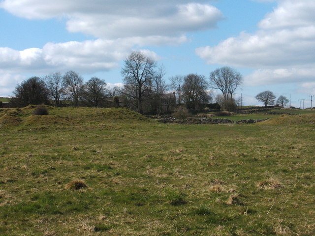
Photos Blakelow Farm and spoil heaps
‹ ›
Weather for this location Next 14 days Nearby places Useful places within 5 km
All Historic
Own or manage this place?
Claim this listing to keep details accurate, add photos, and highlight what makes it special — free.
Claim this page→ How useful was the information on this page?
Something wrong on this page?
id: 96286dc8-7a07-4da8-9e40-fa63baf46549
UK green spaces mapped from open public data — so anyone can find the woodland, trail, or nature reserve closest to them.
© 2026 Glade · Made with care for UK green spaces
Events & activities nearby Switch provider to compare local events, tours and bookable activities.
Bookable tours GetYourGuide Promote here
Wildlife to spot
12,452 records · National Biodiversity Network
▾
Wildlife to spot 12,452 records · National Biodiversity Network 🐦 Birds 45 species
autumn winter
2025 ▾
Magpie · Dunnock · Great Tit · Mistle Thrush · Blackbird +40
Magpie Pica pica Dunnock Prunella modularis Great Tit Parus major Mistle Thrush Turdus viscivorus Blackbird Turdus merula Wren Troglodytes troglodytes Carrion Crow Corvus corone Redwing Turdus iliacus Robin Erithacus rubecula Goldcrest Regulus regulus Woodpigeon Columba palumbus Blue Tit Cyanistes caeruleus Goldfinch Carduelis carduelis Chaffinch Fringilla coelebs Raven Corvus corax Jackdaw Coloeus monedula Song Thrush Turdus philomelos Rook Corvus frugilegus Pied Wagtail Motacilla alba yarrellii Siskin Spinus spinus Lesser Black-backed Gull Larus fuscus Long-tailed Tit Aegithalos caudatus House Sparrow Passer domesticus Starling Sturnus vulgaris Stock Dove Columba oenas Fieldfare Turdus pilaris Skylark Alauda arvensis Greenfinch Chloris chloris Crossbill Loxia curvirostra Treecreeper Certhia familiaris Coal Tit Periparus ater Bullfinch Pyrrhula pyrrhula Jay Garrulus glandarius Grey Heron Ardea cinerea Common Gull Larus canus Coot Fulica atra Kestrel Falco tinnunculus Cormorant Phalacrocorax carbo Pheasant Phasianus colchicus Meadow Pipit Anthus pratensis Black-headed Gull Chroicocephalus ridibundus Mallard Anas platyrhynchos Barn Owl Tyto alba Pink-footed Goose Anser brachyrhynchus Whinchat Saxicola rubetra 22-spot Ladybird
22-spot Ladybird Psyllobora vigintiduopunctata Red Clover · Cleavers · Wild Thyme · Maidenhair Spleenwort · Hairy-brome +65
Red Clover Trifolium pratense Cleavers Galium aparine Wild Thyme Thymus drucei Maidenhair Spleenwort Asplenium trichomanes Hairy-brome Bromopsis ramosa Selfheal Prunella vulgaris Blackthorn Prunus spinosa Species observations from the last 10 years via NBN Atlas
Tormentil Potentilla erecta
Tormentil Potentilla erecta
Ribwort Plantain Plantago lanceolata
Ribwort Plantain Plantago lanceolata
Oxeye Daisy Leucanthemum vulgare
Oxeye Daisy Leucanthemum vulgare
Yarrow Achillea millefolium
Yarrow Achillea millefolium
Sycamore Acer pseudoplatanus
Sycamore Acer pseudoplatanus
Shepherd's-purse Capsella bursa-pastoris
Shepherd's-purse Capsella bursa-pastoris
Shining Crane's-bill Geranium lucidum
Shining Crane's-bill Geranium lucidum
Common Nettle Urtica dioica
Common Nettle Urtica dioica
Bramble Rubus fruticosus
Bramble Rubus fruticosus
Perforate St John's-wort Hypericum perforatum
Perforate St John's-wort Hypericum perforatum
Lady's Bedstraw Galium verum
Lady's Bedstraw Galium verum
Hoary Plantain Plantago media
Hoary Plantain Plantago media
Wood Avens Geum urbanum
Wood Avens Geum urbanum
Annual Meadow-grass Poa annua
Annual Meadow-grass Poa annua
Elder Sambucus nigra
Elder Sambucus nigra
Phleum pratense Phleum pratense
Phleum pratense Phleum pratense
Lesser Burdock Arctium minus
Lesser Burdock Arctium minus
Sweet Vernal-grass Anthoxanthum odoratum
Sweet Vernal-grass Anthoxanthum odoratum
Silverweed Potentilla anserina
Silverweed Potentilla anserina
Fairy Flax Linum catharticum
Fairy Flax Linum catharticum
Upright Hedge-parsley Torilis japonica
Upright Hedge-parsley Torilis japonica
Crosswort Cruciata laevipes
Crosswort Cruciata laevipes
False Oat-grass Arrhenatherum elatius
False Oat-grass Arrhenatherum elatius
Garlic Mustard Alliaria petiolata
Garlic Mustard Alliaria petiolata
Goat Willow Salix caprea
Goat Willow Salix caprea
Hedera helix Hedera helix
Hedera helix Hedera helix
Spring-sedge Carex caryophyllea
Spring-sedge Carex caryophyllea
Burnet-saxifrage Pimpinella saxifraga
Burnet-saxifrage Pimpinella saxifraga
Red Campion Silene dioica
Red Campion Silene dioica
Hogweed Heracleum sphondylium
Hogweed Heracleum sphondylium
Common Dog-violet Viola riviniana
Common Dog-violet Viola riviniana
Germander Speedwell Veronica chamaedrys
Germander Speedwell Veronica chamaedrys
Rosa canina Rosa canina
Rosa canina Rosa canina
Wych Elm Ulmus glabra
Wych Elm Ulmus glabra
Sticky Mouse-ear Cerastium glomeratum
Sticky Mouse-ear Cerastium glomeratum
Gooseberry Ribes uva-crispa
Gooseberry Ribes uva-crispa
Early Goldenrod Solidago gigantea
Early Goldenrod Solidago gigantea
Common Bird's-foot-trefoil Lotus corniculatus
Common Bird's-foot-trefoil Lotus corniculatus
Field Scabious Knautia arvensis
Field Scabious Knautia arvensis
Fat-hen Chenopodium album
Fat-hen Chenopodium album
Carnation Sedge Carex panicea
Carnation Sedge Carex panicea
Creeping Thistle Cirsium arvense
Creeping Thistle Cirsium arvense
Limestone Bedstraw Galium sterneri
Limestone Bedstraw Galium sterneri
Small Scabious Scabiosa columbaria
Small Scabious Scabiosa columbaria
Euphrasia officinalis Euphrasia officinalis
Euphrasia officinalis Euphrasia officinalis
Hedge Bindweed Calystegia sepium
Hedge Bindweed Calystegia sepium
Broad-leaved Dock Rumex obtusifolius
Broad-leaved Dock Rumex obtusifolius
Common Sorrel Rumex acetosa
Common Sorrel Rumex acetosa
Black Medick Medicago lupulina
Black Medick Medicago lupulina
Tufted Vetch Vicia cracca
Tufted Vetch Vicia cracca
Yellow-rattle Rhinanthus minor
Yellow-rattle Rhinanthus minor
Hairy Rock-cress Arabis hirsuta
Hairy Rock-cress Arabis hirsuta
Hedge Mustard Sisymbrium officinale
Hedge Mustard Sisymbrium officinale
Common Bent Agrostis capillaris
Common Bent Agrostis capillaris
Quaking-grass Briza media
Quaking-grass Briza media
Common Ragwort Jacobaea vulgaris
Common Ragwort Jacobaea vulgaris
Perennial Rye-grass Lolium perenne
Perennial Rye-grass Lolium perenne
Common Chickweed Stellaria media
Common Chickweed Stellaria media
Ground-ivy Glechoma hederacea
Ground-ivy Glechoma hederacea
Devil's-bit Scabious Succisa pratensis
Devil's-bit Scabious Succisa pratensis
Creeping Buttercup Ranunculus repens
Creeping Buttercup Ranunculus repens
Cowslip Primula veris
Cowslip Primula veris
Ground-elder Aegopodium podagraria
Ground-elder Aegopodium podagraria