Plan your visit
Getting here
51.40797, -0.88268
Course details
- Course18-hole course
- ParPar 72
Visiting this summer
Seasonal nature notes and what to look for now
Visiting this summer
Seasonal nature notes and what to look for now
- 🌞Midsummer — early morning visits most comfortable; look for deer fawns in quieter clearings
- ⛳Golf is at its best in summer here
- 🐕Dogs welcome — bring water in summer; the site has enough space to find shade on hot days
🌤️ Visiting this summer
- 🌞Midsummer — early morning visits most comfortable; look for deer fawns in quieter clearings
- ⛳Golf is at its best in summer here
- 🐕Dogs welcome — bring water in summer; the site has enough space to find shade on hot days
Good to know
- 🐕Dogs welcome
Best for
Golf
Very strong match
Golf course
Trails nearby
Within roughly 5 km🚶Walking
8 signed routes nearby · 9 public paths nearby
Signed route nearbyPublic paths
Walking
Ramblers RouteWalking route
California GreenwayWalking route
Finchampstead Ridges Ramble, Finchampstead RidgesWalking route2.2 km
A waymarked trail across Finchampstead Ridges, with views toward the Hog's Back ridge in Surrey. The route takes in two ponds, a woodland section, with slopes & opportunities to spot wildlife including birds of prey, deer and colourful dragonflies
Simons Wood Trail, Finchampstead RidgesWalking route2.1 km
An area of wet woodlands & lowland heath providing habitat for birds & invertebrates. Explore the views, flora & fauna of the broadleaved & coniferous woods, the naturally created Heath Pond, and the rare delights of a heathland habitat.
Blackwater Valley PathWalking route
🚴Cycling
21 signed routes nearby
Signed route nearby
Cycling
Barkham Useful Cycle RoutesCycling route
Emmbrook Useful Cycle RoutesCycling route
Route 19Cycling route
California GreenwayCycling route
Route CR5Cycling route
Earley Useful Cycle RoutesCycling route
🚵Mountain biking
1 signed route nearby
Signed route nearby
Mountain biking
King Alfred's WayMountain bike route
King Alfreds Way is 350km (220 miles) off road route designed to be ridden clockwise. It starts & ends in Winchester. It is suitable for gravel or cross-country bikes.
🐴Horse riding
34 public paths nearby
Public paths
Horse riding
Sandy Lanebyway open to all traffic · 77 m
Aggisters Lanebyway open to all traffic · 20 m
Coombes Lanebyway open to all traffic · 14 m
Coombes Lanebyway open to all traffic · 217 m
Hayes Lanebridleway · 79 m
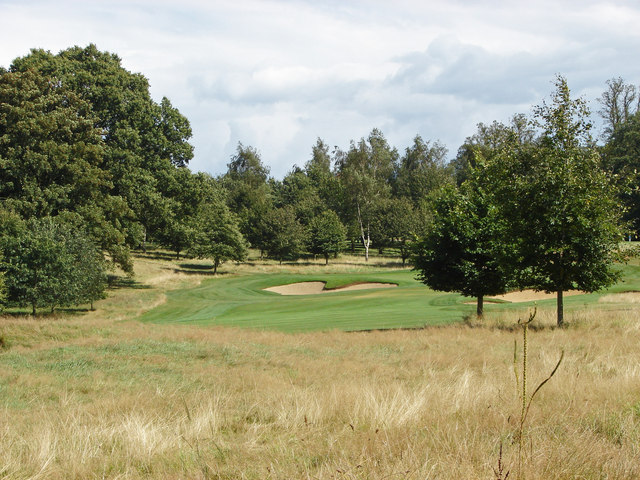
About this golf course
18 hole Par 72
Wildlife to spot
Photos
Weather for this location
Loading local forecast…
Nearby places
Useful places within 5 km
Own or manage this place?
Claim this listing to keep details accurate, add photos, and highlight what makes it special — free.
Claim this pageHow was your visit?
How useful was the information on this page?
id: 99bbb466-01e1-46c3-bae3-39eb80b8bf15