Getting here
52.30748, 1.07778
Visiting this summer
Seasonal nature notes and what to look for now
Visiting this summer
Seasonal nature notes and what to look for now
- 🌞Midsummer — early morning visits most comfortable; look for deer fawns in quieter clearings
- 🐕Early mornings are best for dog walks in summer — visit before 9am to avoid the heat and find quieter trails
- 🅿️Parking on site — 10 car parks within reach
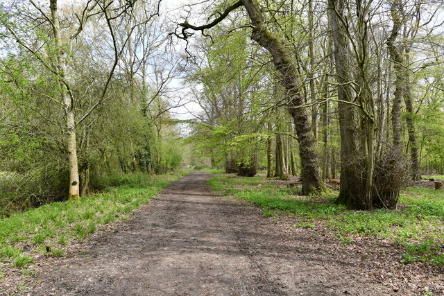
🌤️ Visiting this summer
- 🌞Midsummer — early morning visits most comfortable; look for deer fawns in quieter clearings
- 🐕Early mornings are best for dog walks in summer — visit before 9am to avoid the heat and find quieter trails
- 🅿️Parking on site — 10 car parks within reach
Good to know
- £Free to visit — no entry charge
- 🐕Dogs welcome
- 🌿Ancient woodland — rare wildlife habitat
Best for
Wildlife
Very strong match
Multi-group wildlife — Amphibians, Birds, Mammals; Multi-group wildlife — Amphibians, Birds, Mammals
Seasonal nature
Strong match
Ancient woodland — bluebells, fungi and autumn colour; Plants — Primrose, Traveller's-joy, Lords-and-Ladies +65 more · last seen 2025
Bird watching
Strong match
Birds — Blue Tit, Robin, Blackbird +45 more · last seen 2025; Birds — Blue Tit, Robin, Blackbird +45 more · last seen 2025
Dog walks
Strong match
Dogs allowed — public woodland
Foraging
Strong match
Plants — Red Dead-nettle, Corn Mint, Barren Strawberry +7 more foraging species; Deciduous woodland — fungi, berries and wild garlic
Forest walks
Good match
Public woodland
Trails nearby
Within roughly 5 km🚶Walking
8 signed routes nearby · 18 public paths nearby
Signed route nearbyPublic paths
Walking
The Mid Suffolk FootpathWalking route34.6 km
Wortham & Burgate WalksWalking route
Saint Botolph's WayWalking route10 km
Gislingham Circular Walk 2 (Pink)Walking route
Gislingham Circular Walk 1 (Blue)Walking route
Howe Lanepublic footpath · 6 m
Howe Lanepublic footpath · 4 m
Howe Lanepublic footpath · 40 m
🚴Cycling
19 signed routes nearby
Signed route nearby
Cycling
Two Rivers Cycle RouteCycling route
Heart of Suffolk RouteCycling route
Wolf WayCycling route400 km
Regional Cycle Route 30Cycling route373 km
N/ACycling route573 m
N/ACycling route1.9 km
🐴Horse riding
3 public paths nearby
Public paths
Horse riding
Park Lanebyway open to all traffic · 490 m
Park Lanebyway open to all traffic · 352 m
Chapel Farm Lanebyway open to all traffic · 108 m
Wildlife to spot
Photos
Weather for this location
Loading local forecast…
Nearby places
Useful places within 5 km
Own or manage this place?
Claim this listing to keep details accurate, add photos, and highlight what makes it special — free.
Claim this pageHow was your visit?
How useful was the information on this page?
id: 0dc734f3-bf5d-4ed1-9eaf-6fe4bb59266c