Plan your visit
🦅Birds🧺Picnic🦉Wildlife
Public accessFree entryDogs welcome10 ha
Getting here
51.60821, -1.26859
Open directionsv
Visiting this summer
Seasonal nature notes and what to look for now
- 🐦47+ species recorded in this area — summer evenings are best for activity; watch for Long-tailed Tit and Goldfinch
- 🧺Good picnic destination in summer — open space and facilities for a relaxed day out
- 🛝Playground 246m away — built-in entertainment for younger visitors alongside the wider site
🌤️ Visiting this summer
- 🐦47+ species recorded in this area — summer evenings are best for activity; watch for Long-tailed Tit and Goldfinch
- 🧺Good picnic destination in summer — open space and facilities for a relaxed day out
- 🛝Playground 246m away — built-in entertainment for younger visitors alongside the wider site
- £Free to visit — no entry charge
- 🐕Dogs welcome
🅿️Parking· Free🧺Picnic spot🛝Playground
🦅Bird watching
Very strong match
Birds — Long-tailed Tit, Goldfinch, Dunnock +44 more · last seen 2026
Free
🧺Picnic day out
Strong match
picnic area, car park; Urban park — open green space
Free
Birds — Long-tailed Tit, Goldfinch, Dunnock +44 more · last seen 2026
Free
🛝Family friendly
Strong match
playground, picnic area; Urban park — family destination
Free
🦋Insect spotting
Strong match
Insects — Light Brown Apple Moth, Turnip Moth, Shuttle-shaped Dart +144 more · last seen 2026
Free
Trails nearby
Within roughly 5 km6 signed routes nearby · 105 public paths nearby
Signed route nearbyPublic paths
The Roman WayWalking route274.5 km▾
Named routeLength 274.5 kmRegional walking route
The Vale WayWalking route43 km▾
Route through the Vale of White Horse in Oxfordshire, UK. (27 miles).
Named routeLength 43 kmLocal walking route
European walking route E2 west, UK, South East EnglandWalking route▾
Westroute: Stranraer (UK) - Birminhgham (UK) - Calais (FR) - Zoersel (BE) / Eastroute: Stranraer (UK) - Harwich (UK) - Rotterdam (NL) - Zoersel (BE) / Both Routes: Zoersel (BE) - Maastrich (NL) - Luxembourg (LUX) - Lake Geneva (CH) - Nice (FR)
Named routeRef E2International walking route
Hanson WayWalking route▾
Thames PathWalking route296 km▾
Named routeRef TPLength 296 kmNational walking route
Ash Waypublic footpath · 18 m▾
Public pathpublic footpathLength 18 mSurface paving_stonesPath type: residential
The Avenuepublic footpath · 189 m▾
Public pathpublic footpathLength 189 mSurface paving_stonesPath type: living_street
Raven Roadpublic footpath · 13 m▾
Public pathpublic footpathLength 13 mSurface paving_stonesPath type: residential
87 signed routes nearby
Signed route nearby
National Cycle Network Route 5Cycling route▾
Named routeRef 5National Cycle Network
Route 544Cycling route▾
Named routeRef 544National Cycle Network
Wantage to Harwell Campus (Icknield Greenway)Cycling route▾
Named routeRef 1Local cycle route
Didcot to Culham Science CentreCycling route▾
Named routeRef 8Local cycle route
Didcot to Milton ParkCycling route▾
Named routeRef 6Local cycle route
Didcot to Harwell CampusCycling route▾
Named routeRef 5Local cycle route
Photos
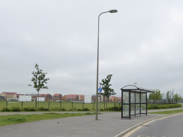
Bus shelter by Boundary Park, Didcot
Weather for this location
Next 14 daysNearby places
Useful places within 5 km
Wildlife to spot
52,524 records · National Biodiversity Network
Wildlife to spot
52,524 records · National Biodiversity NetworkDunnock · Goldfinch · Long-tailed Tit · Pied Wagtail · House Sparrow +36
- DunnockPrunella modularis
- GoldfinchCarduelis carduelis
- Long-tailed TitAegithalos caudatus
- Pied WagtailMotacilla alba yarrellii2025
- House SparrowPasser domesticus2025
- Mistle ThrushTurdus viscivorus2025
- StarlingSturnus vulgaris2025
- WrenTroglodytes troglodytes2025
- RookCorvus frugilegus2025
- Great TitParus major2025
- WoodpigeonColumba palumbus2025
- GoldcrestRegulus regulus2025
- Carrion CrowCorvus corone2025
- JackdawColoeus monedula2025
- RobinErithacus rubecula2025
- Coal TitPeriparus ater
- Blue TitCyanistes caeruleus2025
- Green WoodpeckerPicus viridis2025
- GreenfinchChloris chloris2025
- StonechatSaxicola rubicola2025
- BlackcapSylvia atricapilla2025
- RedwingTurdus iliacus2025
- Meadow PipitAnthus pratensis2025
- Corn BuntingEmberiza calandra2025
- Stock DoveColumba oenas2025
- MagpiePica pica2025
- Black-headed GullChroicocephalus ridibundus2025
- ChaffinchFringilla coelebs2025
- Golden PloverPluvialis apricaria2025
- Red-legged PartridgeAlectoris rufa2025
- Collared DoveStreptopelia decaocto2025
- Song ThrushTurdus philomelos2025
- Common GullLarus canus2025
- Reed BuntingEmberiza schoeniclus2025
- LinnetLinaria cannabina2025
- FieldfareTurdus pilaris2025
- KestrelFalco tinnunculus2025
- Grey PartridgePerdix perdix2025
- ChiffchaffPhylloscopus collybita2025
- SkylarkAlauda arvensis2025
- BlackbirdTurdus merula2025
🦌Mammals3 species
winterspring
2026▾
Roe Deer · Badger · Otter
- Roe DeerCapreolus capreolus
- BadgerMeles meles
- OtterLutra lutra
🐝Insects42 species
winterautumn
2026▾
Common Quaker · Light Brown Apple Moth · Rusty Dot · Silver Y · Turnip Moth +37
- Common QuakerOrthosia cerasi
- Light Brown Apple MothEpiphyas postvittana2025
- Rusty DotUdea ferrugalis2025
- Silver YAutographa gamma2025
- Turnip MothAgrotis segetum2025
- Oak Beauty
Species observations from the last 10 years via NBN Atlas
Biston strataria
Biston strataria
Hebrew CharacterOrthosia gothicaHebrew CharacterOrthosia gothicaChestnutConistra vacciniiChestnutConistra vacciniiSatelliteEupsilia transversaSatelliteEupsilia transversaViburnum TortrixAcleris schallerianaViburnum TortrixAcleris schallerianaWhite-pointMythimna albipuncta2025White-pointMythimna albipuncta2025Vine's RusticHoplodrina ambigua2025Vine's RusticHoplodrina ambigua2025Early GreyXylocampa areolaEarly GreyXylocampa areolaSmall QuakerOrthosia crudaSmall QuakerOrthosia crudaClouded DrabOrthosia incertaClouded DrabOrthosia incertaAcleris ferrugana/notanaAcleris ferrugana/notanaAcleris ferrugana/notanaAcleris ferrugana/notanaMottled UmberErannis defoliaria2025Mottled UmberErannis defoliaria2025Diamond-back MothPlutella xylostella2025Diamond-back MothPlutella xylostella2025December MothPoecilocampa populi2025December MothPoecilocampa populi2025Twin-spotted QuakerAnorthoa mundaTwin-spotted QuakerAnorthoa mundaGrey Shoulder-knotLithophane ornitopusGrey Shoulder-knotLithophane ornitopusPale Brindled BeautyPhigalia pilosariaPale Brindled BeautyPhigalia pilosariaBeautiful PlumeAmblyptilia acanthadactylaBeautiful PlumeAmblyptilia acanthadactylaWinter MothOperophtera brumata2025Winter MothOperophtera brumata2025Tree-mallow TortrixCrocidosema plebejana2025Tree-mallow TortrixCrocidosema plebejana2025Cypress CarpetThera cupressata2025Cypress CarpetThera cupressata2025Shuttle-shaped DartAgrotis puta2025Shuttle-shaped DartAgrotis puta2025Dark-edged Bee-flyBombylius majorDark-edged Bee-flyBombylius majorBrindled BeautyLycia hirtariaBrindled BeautyLycia hirtariaDouble-striped PugGymnoscelis rufifasciataDouble-striped PugGymnoscelis rufifasciataParadromius linearisParadromius linearisParadromius linearisParadromius linearisSpring UsherAgriopis leucophaeariaSpring UsherAgriopis leucophaeariaDark ChestnutConistra ligula2025Dark ChestnutConistra ligula2025Angle ShadesPhlogophora meticulosa2025Angle ShadesPhlogophora meticulosa2025Olive-tree PearlPalpita vitrealis2025Olive-tree PearlPalpita vitrealis2025Dark ArchesApamea monoglypha2025Dark ArchesApamea monoglypha2025Scarce UmberAgriopis aurantiaria2025Scarce UmberAgriopis aurantiaria2025Rush VeneerNomophila noctuella2025Rush VeneerNomophila noctuella2025Australian Orange-tipTachystola acroxantha2025Australian Orange-tipTachystola acroxantha2025Black RusticAporophyla nigra2025Black RusticAporophyla nigra2025Red-green CarpetChloroclysta siterata2025Red-green CarpetChloroclysta siterata2025November MothEpirrita dilutata2025November MothEpirrita dilutata2025Events & activities nearby
Switch provider to compare local events, tours and bookable activities.