Bowl barrow 150m east of Waterman's Lodge: one of a pair of Bronze Age barrows on the western edge of Wychwood Forest
0 ha
Plan your visit
🦅Birds🦉Wildlife✦Heritage
Public accessFree entryDogs welcome0 ha
Getting here
51.86059, -1.51722
Open directionsv
Visiting this summer
Seasonal nature notes and what to look for now
- 🐦70+ species recorded in this area — summer evenings are best for activity; watch for Woodpigeon and Nuthatch
- ✦Historic character is a year-round quality here — summer brings its own atmosphere to the setting
- 🐕Dogs welcome — bring water in summer; the site has enough space to find shade on hot days
🌤️ Visiting this summer
- 🐦70+ species recorded in this area — summer evenings are best for activity; watch for Woodpigeon and Nuthatch
- ✦Historic character is a year-round quality here — summer brings its own atmosphere to the setting
- 🐕Dogs welcome — bring water in summer; the site has enough space to find shade on hot days
- £Free to visit — no entry charge
- 🐕Dogs welcome
🦅Bird watching
Very strong match
Birds — Woodpigeon, Nuthatch, Blackbird +67 more · last seen 2025; Deciduous woodland — woodpeckers, warblers and woodland birds
Free
Birds — Woodpigeon, Nuthatch, Blackbird +67 more · last seen 2025; Deciduous woodland priority habitat
Free
Historic site with public access
Free
🦋Insect spotting
Strong match
Insects — Small White, Large White, Gatekeeper +81 more · last seen 2026
Free
🍂Seasonal nature
Strong match
Plants — White Clover, Red Bartsia, Creeping Buttercup +155 more · last seen 2022
Free
Dogs allowed with public access
Free
Trails nearby
Within roughly 5 km5 signed routes nearby · 1 public path nearby
Signed route nearbyPublic paths
Oxfordshire WayWalking route110 km▾
a traverse of Oxfordshire from the Cotswolds to the Chilterns
Named routeRef OWLength 110 kmRegional walking route
Wychwood WayWalking route59.5 km▾
Named routeLength 59.5 kmRegional walking route
D'Arcy Dalton WayWalking route107 km▾
Follows roughly the western boundary of Oxfordshire in unspoilt countryside.
Named routeLength 107 kmRegional walking route
The Roman WayWalking route274.5 km▾
Named routeLength 274.5 kmRegional walking route
European walking route E2 west, UK, South East EnglandWalking route▾
Westroute: Stranraer (UK) - Birminhgham (UK) - Calais (FR) - Zoersel (BE) / Eastroute: Stranraer (UK) - Harwich (UK) - Rotterdam (NL) - Zoersel (BE) / Both Routes: Zoersel (BE) - Maastrich (NL) - Luxembourg (LUX) - Lake Geneva (CH) - Nice (FR)
Named routeRef E2International walking route
Patch Ridingpublic footpath · 3.3 km▾
Public pathpublic footpathLength 3.3 kmPath type: footway
36 signed routes nearby
Signed route nearby
Cotswold Line Cycle RouteCycling route▾
Named routeRef 442National Cycle Network
National Byway (Oxon and Glos)Cycling route▾
Named routeRef NBRegional cycle route
Main RouteCycling route756 m▾
Named routeRef 442Length 756 mNational Cycle NetworkOn-roadSurface asphalt
Main RouteCycling route449 m▾
Named routeRef 442Length 449 mNational Cycle NetworkOn-roadSurface asphalt
Main RouteCycling route2.5 km▾
Named routeRef 442Length 2.5 kmNational Cycle NetworkOn-roadSurface asphalt
Main RouteCycling route430 m▾
Named routeRef 442Length 430 mNational Cycle NetworkOn-roadSurface asphalt
Photos
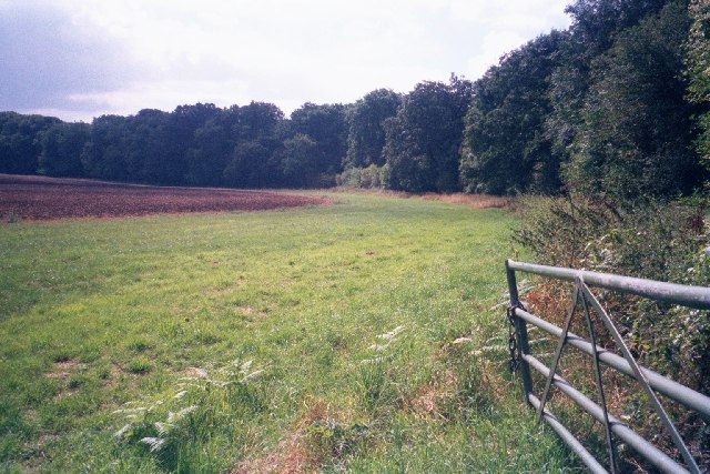
Edge of field within Wychwood Forest
Weather for this location
Next 14 daysNearby places
Useful places within 5 km
Events & activities nearby
Switch provider to compare local events, tours and bookable activities.
Wildlife to spot
3,551 records · National Biodiversity Network
Wildlife to spot
3,551 records · National Biodiversity Network🐦Birds46 species
winterspring
2025▾
Carrion Crow · Skylark · Woodpigeon · Pheasant · Goldfinch +41
- Carrion CrowCorvus corone
- SkylarkAlauda arvensis
- WoodpigeonColumba palumbus
- PheasantPhasianus colchicus
- GoldfinchCarduelis carduelis
- BlackbirdTurdus merula
- Blue TitCyanistes caeruleus
- NuthatchSitta europaea
- Great TitParus major
- DunnockPrunella modularis
- ChaffinchFringilla coelebs
- WrenTroglodytes troglodytes
- Green WoodpeckerPicus viridis
- RobinErithacus rubecula
- JackdawColoeus monedula
- Mistle ThrushTurdus viscivorus
- Coal TitPeriparus ater
- Stock DoveColumba oenas
- YellowhammerEmberiza citrinella2024
- Marsh TitPoecile palustris2024
- KestrelFalco tinnunculus2024
- ChiffchaffPhylloscopus collybita
- Long-tailed TitAegithalos caudatus
- GoldcrestRegulus regulus
- Great Spotted WoodpeckerDendrocopos major
- FieldfareTurdus pilaris2024
- LinnetLinaria cannabina2024
- Song ThrushTurdus philomelos2024
- House SparrowPasser domesticus
- MallardAnas platyrhynchos
- Collared DoveStreptopelia decaocto
- BlackcapSylvia atricapilla
- GreenfinchChloris chloris
- House MartinDelichon urbicum
- SwiftApus apus
- MagpiePica pica
- RookCorvus frugilegus
- RavenCorvus corax2024
- StonechatSaxicola rubicola2024
- StarlingSturnus vulgaris2024
- Red-legged PartridgeAlectoris rufa2024
- JayGarrulus glandarius2023
- LapwingVanellus vanellus2023
- Barn OwlTyto alba2023
- WoodcockScolopax rusticola2023
- RedwingTurdus iliacus2023
Grey Squirrel · Roe Deer · Fallow Deer · Brown Hare · Badger +1
- Grey SquirrelSciurus carolinensis
- Roe DeerCapreolus capreolus
- Fallow DeerDama dama
- Brown HareLepus europaeus
- BadgerMeles meles2023
- MuntjacMuntiacus reevesi2023
Common Lizard
- Common LizardZootoca vivipara
Non-biting midges · Azure Damselfly · Common Blue Damselfly · Toothed Pondskater · Common Pondskater +29
- Non-biting midgesChironomidae2025
- Azure DamselflyCoenagrion puella2025
- Common Blue DamselflyEnallagma cyathigerum2025
- Toothed PondskaterGerris (Gerris) odontogaster2025
- Common PondskaterGerris (Gerris) lacustris2025
- Aquarius paludum
Species observations from the last 10 years via NBN Atlas
Aquarius paludum2025
Aquarius paludum2025
Sigara (Sigara) dorsalisSigara (Sigara) dorsalis2025Sigara (Sigara) dorsalisSigara (Sigara) dorsalis2025Blue-tailed DamselflyIschnura elegans2025Blue-tailed DamselflyIschnura elegans2025Athous bicolorAthous bicolor2025Athous bicolorAthous bicolor2025Oak Bush-cricketMeconema thalassinum2024Oak Bush-cricketMeconema thalassinum2024Cream-spot LadybirdCalvia quattuordecimguttataCream-spot LadybirdCalvia quattuordecimguttataAbax parallelepipedusAbax parallelepipedusAbax parallelepipedusAbax parallelepipedusSigara (Subsigara) fossarumSigara (Subsigara) fossarum2025Sigara (Subsigara) fossarumSigara (Subsigara) fossarum2025Plea minutissimaPlea minutissima2025Plea minutissimaPlea minutissima2025Sigara (Subsigara) falleniSigara (Subsigara) falleni2025Sigara (Subsigara) falleniSigara (Subsigara) falleni2025Cymatia coleoptrataCymatia coleoptrata2025Cymatia coleoptrataCymatia coleoptrata2025Water MeasurerHydrometra stagnorum2025Water MeasurerHydrometra stagnorum2025Leptocerus tineiformisLeptocerus tineiformis2025Leptocerus tineiformisLeptocerus tineiformis2025Red-eyed DamselflyErythromma najas2025Red-eyed DamselflyErythromma najas2025Microvelia (Microvelia) reticulataMicrovelia (Microvelia) reticulata2025Microvelia (Microvelia) reticulataMicrovelia (Microvelia) reticulata2025Saucer BugIlyocoris cimicoides2025Saucer BugIlyocoris cimicoides2025Emperor DragonflyAnax imperator2025Emperor DragonflyAnax imperator2025Pondweed BugMesovelia furcata2025Pondweed BugMesovelia furcata2025Common Water-BoatmanNotonecta (Notonecta) glauca2025Common Water-BoatmanNotonecta (Notonecta) glauca2025PhryganeidaePhryganeidae2025PhryganeidaePhryganeidae2025Ephemera vulgataEphemera vulgata2025Ephemera vulgataEphemera vulgata2025Athous haemorrhoidalisAthous haemorrhoidalis2025Athous haemorrhoidalisAthous haemorrhoidalis2025Hawthorn ShieldbugAcanthosoma haemorrhoidale2025Hawthorn ShieldbugAcanthosoma haemorrhoidale2025Cantharis rusticaCantharis rustica2025Cantharis rusticaCantharis rustica2025Red-headed Cardinal BeetlePyrochroa serraticornis2025Red-headed Cardinal BeetlePyrochroa serraticornis2025Harlequin LadybirdHarmonia axyridis2025Harlequin LadybirdHarmonia axyridis2025Cantharis decipiensCantharis decipiens2025Cantharis decipiensCantharis decipiens2025Orange LadybirdHalyzia sedecimguttata2025Orange LadybirdHalyzia sedecimguttata202516-spot LadybirdTytthaspis sedecimpunctata202516-spot LadybirdTytthaspis sedecimpunctata2025