Bowl barrow 70m north-east of Bincliff Mines 0 ha
🦅 Birds🦉 Wildlife🍂 Seasonal
↑ Share
Free entry Dogs welcome 0 ha
Places › England › West Midlands › Staffordshire Moorlands Getting here
53.08343, -1.82769
Open directionsv ✦ Scheduled Ancient Monument — Nationally protected archaeological site on the National Heritage List for England (NHLE). Scheduled monuments represent the best surviving examples of England's irreplaceable archaeological heritage.
Bowl barrow scheduled monument
Visiting this summer
Seasonal nature notes and what to look for now
▾ 🐦 76+ species recorded in this area — summer evenings are best for activity; watch for Blue Tit and Blackbird ✦ Historic character is a year-round quality here — summer brings its own atmosphere to the setting 🐕 Dogs welcome — bring water in summer; the site has enough space to find shade on hot days 🌤️ Visiting this summer
🐦 76+ species recorded in this area — summer evenings are best for activity; watch for Blue Tit and Blackbird ✦ Historic character is a year-round quality here — summer brings its own atmosphere to the setting 🐕 Dogs welcome — bring water in summer; the site has enough space to find shade on hot days £ Free to visit — no entry charge🐕 Dogs welcome🦅 Bird watching
Very strong match
Birds — Blue Tit, Blackbird, Carrion Crow +73 more · last seen 2025; Birds — Blue Tit, Blackbird, Carrion Crow +73 more · last seen 2025
Free
🦉 Wildlife
Very strong match
Multi-group wildlife — Birds, Mammals; Multi-group wildlife — Birds, Mammals
Free
🍂 Seasonal nature
Strong match
Plants — Encalypta pilifera, Canary Thread-moss, Blackthorn +40 more · last seen 2025; Plants — Encalypta pilifera, Canary Thread-moss, Blackthorn +40 more · last seen 2025
Free
🦋 Insect spotting
Strong match
Insects — Painted Lady, Small White, Small Tortoiseshell +39 more · last seen 2025; Insects — Painted Lady, Small White, Small Tortoiseshell +39 more · last seen 2025
Free
Plants — Blackthorn, Ramsons, Common Sorrel +5 more foraging species
Varies
Trails nearby Within roughly 5 km 17 signed routes nearby · 7 public paths nearby
Signed route nearby Public paths
Limestone Way Walking route 74 km ▾
Castleton to Rocester
Named route Length 74 km Point-to-point Regional walking route
Show on map Circular Park Walk Walking route 1.6 km ▾
https://nt.global.ssl.fastly.net/binaries/content/assets/website/national/regions/peak-district-derbyshire/places/ilam-park-dovedale-and-the-white-peak/pdf/230525-property-access-statement---ilam-park.pdf
Named route Length 1.6 km Duration 00:40 Round trip Local walking route
Show on map Hinkley Wood Route, Ilam Park Walking route 1.2 km ▾
https://nt.global.ssl.fastly.net/binaries/content/assets/website/national/regions/peak-district-derbyshire/places/ilam-park-dovedale-and-the-white-peak/pdf/230525-property-access-statement---ilam-park.pdf
Named route Length 1.2 km Duration 00:20 Point-to-point Local walking route
Show on map Walk from Dovedale to Milldale, Dovedale Walking route 5 km ▾
Named route Length 5 km Duration 03:00 Point-to-point Local walking route
Show on map Manifold Trail Walking route ▾
Named route Local walking route
Show on map 47 signed routes nearby
Signed route nearby
National Route 550 Cycling route ▾
Named route Ref 550 National Cycle Network
Show on map Route 548 Cycling route ▾
Named route Ref 548 National Cycle Network
Show on map Pennine Cycleway Cycling route ▾
Named route Ref 68 National Cycle Network
Show on map Route 549 Cycling route ▾
Named route Ref 549 National Cycle Network
Show on map Main Route Cycling route 312 m ▾
Named route Ref 549 Length 312 m National Cycle Network Traffic-free Surface bareearth
Show on map Main Route Cycling route 13.8 km ▾
Named route Ref 550 Length 13.8 km National Cycle Network Traffic-free Surface unsealedfirm
Show on map 1 signed route nearby
Signed route nearby
Tissington Trail Mountain bike route ▾
Named route Ref Tissington Trail Point-to-point Local cycle route
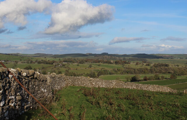
Show on map Photos Looking North East from Stable Lane
‹ ›
Weather for this location Next 14 days Nearby places Useful places within 5 km
All Historic
Own or manage this place?
Claim this listing to keep details accurate, add photos, and highlight what makes it special — free.
Claim this page→ How useful was the information on this page?
Something wrong on this page?
id: 22cb64ad-eef9-4623-83ed-4ccc8e2a5141
UK green spaces mapped from open public data — so anyone can find the woodland, trail, or nature reserve closest to them.
© 2026 Glade · Made with care for UK green spaces
Events & activities nearby Switch provider to compare local events, tours and bookable activities.
Bookable tours GetYourGuide Promote here
Wildlife to spot
6,863 records · National Biodiversity Network
▾
Wildlife to spot 6,863 records · National Biodiversity Network 🐦 Birds 33 species
autumn winter
2025 ▾
Woodpigeon · Magpie · Robin · Carrion Crow · Great Tit +28
Woodpigeon Columba palumbus Magpie Pica pica Robin Erithacus rubecula Carrion Crow Corvus corone Great Tit Parus major Blue Tit Cyanistes caeruleus Blackbird Turdus merula Jackdaw Coloeus monedula Chaffinch Fringilla coelebs Wren Troglodytes troglodytes Rook Corvus frugilegus Redwing Turdus iliacus Grey Wagtail Motacilla cinerea Collared Dove Streptopelia decaocto Bullfinch Pyrrhula pyrrhula House Sparrow Passer domesticus Fieldfare Turdus pilaris Grey Heron Ardea cinerea Lesser Black-backed Gull Larus fuscus Mallard Anas platyrhynchos Pied Wagtail Motacilla alba yarrellii Great Spotted Woodpecker Dendrocopos major Nuthatch Sitta europaea Dunnock Prunella modularis Coal Tit Periparus ater Goosander Mergus merganser Kestrel Falco tinnunculus Dipper Cinclus cinclus Meadow Pipit Anthus pratensis Kingfisher Alcedo atthis Long-tailed Tit Aegithalos caudatus Goldfinch Carduelis carduelis Chiffchaff Phylloscopus collybita Natterer's Bat
Natterer's Bat Myotis nattereri Eristalis tenax · Roesel's Bush-cricket · Volucella pellucens · Meadow Grasshopper
Eristalis tenax Eristalis tenax Roesel's Bush-cricket Roeseliana roeselii Volucella pellucens Volucella pellucens Meadow Grasshopper Pseudochorthippus parallelus Germander Speedwell · Elder · Creeping Thistle · Broad-leaved Dock · Ash +105
Germander Speedwell Veronica chamaedrys Elder Sambucus nigra Creeping Thistle Cirsium arvense Broad-leaved Dock Rumex obtusifolius Ash Fraxinus excelsior Devil's-bit Scabious Succisa pratensis Cock's-foot Dactylis glomerata Species observations from the last 10 years via NBN Atlas
Common Mouse-ear Cerastium fontanum
Common Mouse-ear Cerastium fontanum
Yarrow Achillea millefolium
Yarrow Achillea millefolium
Nipplewort Lapsana communis
Nipplewort Lapsana communis
Velvet Bent Agrostis canina
Velvet Bent Agrostis canina
Perennial Rye-grass Lolium perenne
Perennial Rye-grass Lolium perenne
White Clover Trifolium repens
White Clover Trifolium repens
Common Nettle Urtica dioica
Common Nettle Urtica dioica
Dandelion Taraxacum
Dandelion Taraxacum
Hazel Corylus avellana
Hazel Corylus avellana
Red Fescue Festuca rubra
Red Fescue Festuca rubra
Hoary Plantain Plantago media
Hoary Plantain Plantago media
Wall-rue Asplenium ruta-muraria
Wall-rue Asplenium ruta-muraria
Shepherd's-purse Capsella bursa-pastoris
Shepherd's-purse Capsella bursa-pastoris
Spear Thistle Cirsium vulgare
Spear Thistle Cirsium vulgare
Tufted Hair-grass Deschampsia cespitosa subsp. cespitosa
Tufted Hair-grass Deschampsia cespitosa subsp. cespitosa
Common Ragwort Jacobaea vulgaris
Common Ragwort Jacobaea vulgaris
Barren Strawberry Potentilla sterilis
Barren Strawberry Potentilla sterilis
Sheep's-fescue Festuca ovina
Sheep's-fescue Festuca ovina
Glaucous Sedge Carex flacca
Glaucous Sedge Carex flacca
Ribwort Plantain Plantago lanceolata
Ribwort Plantain Plantago lanceolata
Blackthorn Prunus spinosa
Blackthorn Prunus spinosa
Maidenhair Spleenwort Asplenium trichomanes
Maidenhair Spleenwort Asplenium trichomanes
Tragopogon pratensis subsp. minor Tragopogon pratensis subsp. minor
Tragopogon pratensis subsp. minor Tragopogon pratensis subsp. minor
Small Scabious Scabiosa columbaria
Small Scabious Scabiosa columbaria
Meadowsweet Filipendula ulmaria
Meadowsweet Filipendula ulmaria
Harebell Campanula rotundifolia
Harebell Campanula rotundifolia
Orpine Hylotelephium telephium
Orpine Hylotelephium telephium
Wild Basil Clinopodium vulgare
Wild Basil Clinopodium vulgare
Acer pseudoplatanus group 'Purpureum' Acer pseudoplatanus group 'Purpureum'
Acer pseudoplatanus group 'Purpureum' Acer pseudoplatanus group 'Purpureum'
Creeping Buttercup Ranunculus repens
Creeping Buttercup Ranunculus repens
Creeping Bent Agrostis stolonifera
Creeping Bent Agrostis stolonifera
European Larch Larix decidua
European Larch Larix decidua
Smooth Sow-thistle Sonchus oleraceus
Smooth Sow-thistle Sonchus oleraceus
Annual Pearlwort Sagina apetala
Annual Pearlwort Sagina apetala
Knotgrass Polygonum aviculare
Knotgrass Polygonum aviculare
Yorkshire-fog Holcus lanatus
Yorkshire-fog Holcus lanatus
Herb-Robert Geranium robertianum
Herb-Robert Geranium robertianum
Hawthorn Crataegus monogyna
Hawthorn Crataegus monogyna
Wavy Bitter-cress Cardamine flexuosa
Wavy Bitter-cress Cardamine flexuosa
Sessile Oak Quercus petraea
Sessile Oak Quercus petraea
Pedunculate Oak Quercus robur
Pedunculate Oak Quercus robur
Pineappleweed Matricaria discoidea
Pineappleweed Matricaria discoidea
Crosswort Cruciata laevipes
Crosswort Cruciata laevipes
Festuca rubra Festuca rubra
Festuca rubra Festuca rubra
Yellow Oat-grass Trisetum flavescens
Yellow Oat-grass Trisetum flavescens
Selfheal Prunella vulgaris
Selfheal Prunella vulgaris
Crested Dog's-tail Cynosurus cristatus
Crested Dog's-tail Cynosurus cristatus
Bullace Prunus domestica subsp. insititia
Bullace Prunus domestica subsp. insititia
Cat's-ear Hypochaeris radicata
Cat's-ear Hypochaeris radicata
Annual Meadow-grass Poa annua
Annual Meadow-grass Poa annua
Creeping Cinquefoil Potentilla reptans
Creeping Cinquefoil Potentilla reptans
Horse-chestnut Aesculus hippocastanum
Horse-chestnut Aesculus hippocastanum
Dove's-foot Crane's-bill Geranium molle
Dove's-foot Crane's-bill Geranium molle
Sweet Chestnut Castanea sativa
Sweet Chestnut Castanea sativa
Mouse-ear-hawkweed Pilosella officinarum
Mouse-ear-hawkweed Pilosella officinarum
Meadow Foxtail Alopecurus pratensis
Meadow Foxtail Alopecurus pratensis
Midland Hawthorn Crataegus laevigata
Midland Hawthorn Crataegus laevigata
Lady's Bedstraw Galium verum
Lady's Bedstraw Galium verum
Hogweed Heracleum sphondylium
Hogweed Heracleum sphondylium
Red Clover Trifolium pratense
Red Clover Trifolium pratense
Field Scabious Knautia arvensis
Field Scabious Knautia arvensis
Biting Stonecrop Sedum acre
Biting Stonecrop Sedum acre
Enchanter's-nightshade Circaea lutetiana
Enchanter's-nightshade Circaea lutetiana
Bitter-vetch Lathyrus linifolius
Bitter-vetch Lathyrus linifolius
Wild Angelica Angelica sylvestris
Wild Angelica Angelica sylvestris
Meadow Oat Helictochloa pratensis
Meadow Oat Helictochloa pratensis
Carnation Sedge Carex panicea
Carnation Sedge Carex panicea
Greater Burnet-saxifrage Pimpinella major
Greater Burnet-saxifrage Pimpinella major
Goat's-beard Tragopogon pratensis
Goat's-beard Tragopogon pratensis
Common Sorrel Rumex acetosa
Common Sorrel Rumex acetosa
Oxeye Daisy Leucanthemum vulgare
Oxeye Daisy Leucanthemum vulgare
Bugle Ajuga reptans
Bugle Ajuga reptans
Meadow Fescue Schedonorus pratensis
Meadow Fescue Schedonorus pratensis
Wood Forget-me-not Myosotis sylvatica
Wood Forget-me-not Myosotis sylvatica
Cowslip Primula veris
Cowslip Primula veris
Bluebell Hyacinthoides non-scripta
Bluebell Hyacinthoides non-scripta
Red Campion Silene dioica
Red Campion Silene dioica
Bush Vetch Vicia sepium
Bush Vetch Vicia sepium
Water Avens Geum rivale
Water Avens Geum rivale
Rough Hawkbit Leontodon hispidus
Rough Hawkbit Leontodon hispidus
Common Bird's-foot-trefoil Lotus corniculatus
Common Bird's-foot-trefoil Lotus corniculatus
Common Hemp-nettle Galeopsis tetrahit
Common Hemp-nettle Galeopsis tetrahit
Hairy St John's-wort Hypericum hirsutum
Hairy St John's-wort Hypericum hirsutum
Sweet Vernal-grass Anthoxanthum odoratum
Sweet Vernal-grass Anthoxanthum odoratum
Pignut Conopodium majus
Pignut Conopodium majus
Field-rose Rosa arvensis
Field-rose Rosa arvensis
Early Hair-grass Aira praecox
Early Hair-grass Aira praecox
Salad Burnet Poterium sanguisorba subsp. sanguisorba
Salad Burnet Poterium sanguisorba subsp. sanguisorba
Bramble Rubus
Bramble Rubus
Limestone Bedstraw Galium sterneri
Limestone Bedstraw Galium sterneri
False Oat-grass Arrhenatherum elatius
False Oat-grass Arrhenatherum elatius
False-brome Brachypodium sylvaticum
False-brome Brachypodium sylvaticum
Crested Hair-grass Koeleria macrantha
Crested Hair-grass Koeleria macrantha
Meadow Vetchling Lathyrus pratensis
Meadow Vetchling Lathyrus pratensis
Tormentil Potentilla erecta
Tormentil Potentilla erecta
Burnet-saxifrage Pimpinella saxifraga
Burnet-saxifrage Pimpinella saxifraga
Gorse Ulex europaeus
Gorse Ulex europaeus
Greater Stitchwort Stellaria holostea
Greater Stitchwort Stellaria holostea
Marsh Thistle Cirsium palustre
Marsh Thistle Cirsium palustre
Male-fern Dryopteris filix-mas
Male-fern Dryopteris filix-mas
Common Rock-rose Helianthemum nummularium
Common Rock-rose Helianthemum nummularium
Cleavers Galium aparine
Cleavers Galium aparine
Fairy Flax Linum catharticum
Fairy Flax Linum catharticum