Bowl barrow in Mount Ephraim Plantation, 770m north west of Field Barn
0 ha
Plan your visit
🦅Birds🦉Wildlife✦Heritage
Public accessFree entryDogs welcome0 ha
Getting here
52.49269, 0.61492
Open directionsv
Visiting this summer
Seasonal nature notes and what to look for now
- 🐦74+ species recorded in this area — summer evenings are best for activity; watch for Shoveler and Wigeon
- ✦Historic character is a year-round quality here — summer brings its own atmosphere to the setting
- 🐕Dogs welcome — bring water in summer; the site has enough space to find shade on hot days
🌤️ Visiting this summer
- 🐦74+ species recorded in this area — summer evenings are best for activity; watch for Shoveler and Wigeon
- ✦Historic character is a year-round quality here — summer brings its own atmosphere to the setting
- 🐕Dogs welcome — bring water in summer; the site has enough space to find shade on hot days
- £Free to visit — no entry charge
- 🐕Dogs welcome
🦅Bird watching
Very strong match
Birds — Shoveler, Wigeon, Pochard +71 more · last seen 2025; Deciduous woodland — woodpeckers, warblers and woodland birds
Free
Birds — Shoveler, Wigeon, Pochard +71 more · last seen 2025; Deciduous woodland priority habitat
Free
Historic site with public access
Free
🦋Insect spotting
Strong match
Insects — Cabbage Bug, Tortoise Bug, Adonis' Ladybird +159 more · last seen 2025
Free
Dogs allowed with public access
Free
Deciduous woodland — fungi, berries and wild garlic
Varies
Trails nearby
Within roughly 5 km19 signed routes nearby
Signed route nearby
Hereward WayWalking route▾
Named routePoint-to-pointRegional walking route
Santon Downham CircularWalking route4 km▾
Named routeLength 4 kmRound tripLocal walking route
Little Ouse PathWalking route9 km▾
Named routeLength 9 kmPoint-to-pointLocal walking route
St Helen's Orange WalkWalking route▾
Named routeLocal walking route
Weeting Village WalkWalking route▾
Named routeLocal walking route
26 signed routes nearby
Signed route nearby
Regional Route 30 (alternative)Cycling route▾
Named routeRef (30)Regional cycle route
Thetford Cycle LoopCycling route▾
Named routeRegional cycle route
Two Rivers Cycle RouteCycling route▾
Named routeRef 30Regional cycle route
Rebellion WayCycling route373 km▾
Named routeRef RebelLength 373 kmRound tripRegional cycle route
Regional Cycle Route 30Cycling route373 km▾
Named routeRef 30Length 373 kmRound tripRegional cycle route
N/ACycling route542 m▾
Named routeRef 30Length 542 mNational Cycle NetworkOn-roadSurface asphalt
3 public paths nearby
Public paths
Pilgrim's Walkrestricted byway · 1.5 km▾
Public pathrestricted bywayLength 1.5 kmPath type: track
Pilgrim's Walkrestricted byway · 624 m▾
Public pathrestricted bywayLength 624 mPath type: bridleway
Pilgrim's Walkrestricted byway · 490 m▾
Public pathrestricted bywayLength 490 mPath type: track
Photos
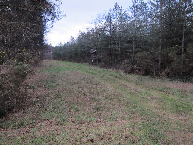
Forest track, Mount Ephraim
Weather for this location
Next 14 daysNearby places
Useful places within 5 km
Events & activities nearby
Switch provider to compare local events, tours and bookable activities.
Wildlife to spot
7,577 records · National Biodiversity Network
Wildlife to spot
7,577 records · National Biodiversity NetworkShoveler · Bittern · Pochard · Tree Pipit · Hawfinch +29
- ShovelerSpatula clypeata
- BitternBotaurus stellaris
- PochardAythya ferina
- Tree PipitAnthus trivialis
- HawfinchCoccothraustes coccothraustes
- Stone-curlewBurhinus oedicnemus
- Garden WarblerSylvia borin
- BlackbirdTurdus merula
- WoodpigeonColumba palumbus
- WigeonMareca penelope
- Glossy IbisPlegadis falcinellus
- CuckooCuculus canorus
- Carrion CrowCorvus corone
- WhitethroatCurruca communis
- ChiffchaffPhylloscopus collybita
- YellowhammerEmberiza citrinella
- StonechatSaxicola rubicola
- WrenTroglodytes troglodytes
- Black-tailed GodwitLimosa limosa
- PheasantPhasianus colchicus
- Indian PeafowlPavo cristatus
- Song ThrushTurdus philomelos
- Tawny OwlStrix aluco
- GoldcrestRegulus regulus
- RobinErithacus rubecula
- JayGarrulus glandarius
- KestrelFalco tinnunculus
- GoldfinchCarduelis carduelis
- SwiftApus apus
- Great TitParus major
- Willow WarblerPhylloscopus trochilus
- Blue TitCyanistes caeruleus
- MagpiePica pica
- BlackcapSylvia atricapilla
Muntjac
Adonis' Ladybird · Chrysotoxum bicinctum · Cheilosia illustrata · Dasysyrphus albostriatus · Cabbage Bug +51
- Adonis' LadybirdHippodamia variegata
- Chrysotoxum bicinctumChrysotoxum bicinctum
- Cheilosia illustrataCheilosia illustrata
- Dasysyrphus albostriatusDasysyrphus albostriatus
- Cabbage BugEurydema (Eurydema) oleracea
- Lucerne BugAdelphocoris lineolatus
🌿Plants4 species
springsummer
2026▾
Hairy Bitter-cress · Small Toadflax · Smooth Rupturewort · White Melilot
- Hairy Bitter-cressCardamine hirsuta
- Small ToadflaxChaenorhinum minus2025
- Smooth RupturewortHerniaria glabra2025
- White MelilotMelilotus albus2025
Species observations from the last 10 years via NBN Atlas
Scaeva pyrastri
Scaeva pyrastri
Scaeva pyrastri
Scaeva pyrastri
CheilosiaCheilosiaCheilosiaCheilosiaBishop's MitreAelia acuminataBishop's MitreAelia acuminataVolucella bombylans subsp. plumataVolucella bombylans subsp. plumataVolucella bombylans subsp. plumataVolucella bombylans subsp. plumataTortoise BugEurygaster testudinariaTortoise BugEurygaster testudinariaPleasant SawflyTenthredo amoenaPleasant SawflyTenthredo amoenaMelanostomaMelanostomaMelanostomaMelanostomaCommon Rose FusehornArge paganaCommon Rose FusehornArge paganaHairy ShieldbugDolycoris baccarumHairy ShieldbugDolycoris baccarumCorizus hyoscyamiCorizus hyoscyamiCorizus hyoscyamiCorizus hyoscyamiRhopalus (Rhopalus) subrufusRhopalus (Rhopalus) subrufusRhopalus (Rhopalus) subrufusRhopalus (Rhopalus) subrufusSphaerophoriaSphaerophoriaSphaerophoriaSphaerophoriaSyrphus ribesiiSyrphus ribesiiSyrphus ribesiiSyrphus ribesiiCheilosia impressaCheilosia impressaCheilosia impressaCheilosia impressaSpeckled Bush-cricketLeptophyes punctatissimaSpeckled Bush-cricketLeptophyes punctatissimaEumerusEumerusEumerusEumerusChrysogaster solstitialisChrysogaster solstitialisChrysogaster solstitialisChrysogaster solstitialisAphanus rolandriAphanus rolandriAphanus rolandriAphanus rolandriCommon DarterSympetrum striolatumCommon DarterSympetrum striolatumNeophilaenus lineatusNeophilaenus lineatusNeophilaenus lineatusNeophilaenus lineatusLong-winged Cone-headConocephalus fuscusLong-winged Cone-headConocephalus fuscusCommon Sedge-sawflySelandria servaCommon Sedge-sawflySelandria servaAlydus calcaratusAlydus calcaratusAlydus calcaratusAlydus calcaratusPlatycheirus scutatusPlatycheirus scutatusPlatycheirus scutatusPlatycheirus scutatusStrawberry-blossom WeevilAnthonomus rubiStrawberry-blossom WeevilAnthonomus rubiChrysotoxum festivumChrysotoxum festivumChrysotoxum festivumChrysotoxum festivumMelangyna umbellatarumMelangyna umbellatarumMelangyna umbellatarumMelangyna umbellatarumVolucella pellucensVolucella pellucensVolucella pellucensVolucella pellucensRhombic LeatherbugSyromastus rhombeusRhombic LeatherbugSyromastus rhombeusBarberry FusehornArge berberidisBarberry FusehornArge berberidisBronze FusehornArge ustulataBronze FusehornArge ustulataVolucella inanisVolucella inanisVolucella inanisVolucella inanisBlack ClockPterostichus madidusBlack ClockPterostichus madidusMeliscaeva cinctellaMeliscaeva cinctellaMeliscaeva cinctellaMeliscaeva cinctellaHelophilus pendulusHelophilus pendulusHelophilus pendulusHelophilus pendulusZipperbackChrysotoxum elegansZipperbackChrysotoxum elegansCicadella viridisCicadella viridisCicadella viridisCicadella viridisPithanus maerkeliiPithanus maerkeliiPithanus maerkeliiPithanus maerkeliiOncotylus (Oncotylus) viridiflavusOncotylus (Oncotylus) viridiflavusOncotylus (Oncotylus) viridiflavusOncotylus (Oncotylus) viridiflavusCream-streaked LadybirdHarmonia quadripunctataCream-streaked LadybirdHarmonia quadripunctataField GrasshopperChorthippus brunneusField GrasshopperChorthippus brunneusPhysocephala rufipesPhysocephala rufipesPhysocephala rufipesPhysocephala rufipesTimothy GrassbugStenotus binotatusTimothy GrassbugStenotus binotatusMeliscaeva auricollisMeliscaeva auricollisMeliscaeva auricollisMeliscaeva auricollisSulphur BeetleCteniopus sulphureusSulphur BeetleCteniopus sulphureusLiocoris tripustulatusLiocoris tripustulatusLiocoris tripustulatusLiocoris tripustulatusMyrmus miriformisMyrmus miriformisMyrmus miriformisMyrmus miriformisPhytocoris (Ktenocoris) varipesPhytocoris (Ktenocoris) varipesPhytocoris (Ktenocoris) varipesPhytocoris (Ktenocoris) varipesOrange LadybirdHalyzia sedecimguttataOrange LadybirdHalyzia sedecimguttataSwollen-thighed BeetleOedemera nobilisSwollen-thighed BeetleOedemera nobilis