Plan your visit
Getting here
53.40706, -2.05588
Visiting this summer
Seasonal nature notes and what to look for now
Visiting this summer
Seasonal nature notes and what to look for now
- 🌞Midsummer — early morning visits most comfortable; look for deer fawns in quieter clearings
- 🧺Good picnic destination in summer — open space and facilities for a relaxed day out
- 🐕Dogs welcome — bring water in summer; the site has enough space to find shade on hot days
🌤️ Visiting this summer
- 🌞Midsummer — early morning visits most comfortable; look for deer fawns in quieter clearings
- 🧺Good picnic destination in summer — open space and facilities for a relaxed day out
- 🐕Dogs welcome — bring water in summer; the site has enough space to find shade on hot days
Good to know
- £Free to visit — no entry charge
- 🐕Dogs welcome
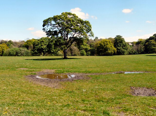
- 🌿Ancient woodland — rare wildlife habitat
Best for
Wildlife
Very strong match
Multi-group wildlife — Amphibians, Birds, Mammals; Multi-group wildlife — Amphibians, Birds, Mammals
Bird watching
Very strong match
Birds — Robin, Jackdaw, Woodpigeon +67 more · last seen 2026; Birds — Robin, Jackdaw, Woodpigeon +67 more · last seen 2026
Picnic day out
Strong match
picnic area, car park
Seasonal nature
Strong match
Ancient woodland — bluebells, fungi and autumn colour; Plants — Ivy, Holly, Daisy +18 more · last seen 2026
Dog walks
Strong match
Dogs allowed — public woodland
Foraging
Good match
Deciduous woodland — fungi, berries and wild garlic; Plants — Hazel, Beech, Hawthorn +2 more foraging species
Trails nearby
Within roughly 5 km🚶Walking
22 signed routes nearby · 15 public paths nearby
Signed route nearbyPublic paths
Walking
Midshires WayWalking route370 km
Multi-use trail links the Ridgeway National Trail with the Trans Pennine Trail
GM Ringway Stage 6Walking route13.4 km
GM Ringway Stage 6 - Strines to Marple
E2 connector hiking trailWalking route
Tameside Trail (West - Broadbottom to Mossley)Walking route
Tameside Trail (East - Broadbottom to Mossley)Walking route
🚴Cycling
106 signed routes nearby
Signed route nearby
Cycling
Alan Newton WayCycling route
Bramhall Park–A6 CyclewayCycling route
Trans-Pennine TrailCycling route
Trans Pennine TrailCycling route
A555 CyclewayCycling route
Middlewood WayCycling route
🚵Mountain biking
1 signed route nearby
Signed route nearby
Mountain biking
Great North Trail (Peak District and South Pennines)Mountain bike route130.4 km
🐴Horse riding
1 public path nearby
Public paths
Horse riding
Low Lea Roadbridleway · 441 m
Wildlife to spot
Photos
Weather for this location
Loading local forecast…
Nearby places
Useful places within 5 km
Own or manage this place?
Claim this listing to keep details accurate, add photos, and highlight what makes it special — free.
Claim this pageHow was your visit?
How useful was the information on this page?
id: c9c8d070-66c4-4f22-837c-89028189510c