Getting here
53.77855, -1.39298
Visiting this summer
Seasonal nature notes and what to look for now
Visiting this summer
Seasonal nature notes and what to look for now
- 🐦24+ species recorded in this area — summer evenings are best for activity; watch for Magpie and House Sparrow
- 🐕Early mornings are best for dog walks in summer — visit before 9am to avoid the heat and find quieter trails
- 🧺Picnic area on site — summer afternoons here are an easy, low-cost day out
🌤️ Visiting this summer
- 🐦24+ species recorded in this area — summer evenings are best for activity; watch for Magpie and House Sparrow
- 🐕Early mornings are best for dog walks in summer — visit before 9am to avoid the heat and find quieter trails
- 🧺Picnic area on site — summer afternoons here are an easy, low-cost day out
Good to know
- £Free to visit — no entry charge
- 🐕Dogs welcome
Best for
Bird watching
Strong match
Birds — Magpie, House Sparrow, Rock Dove +21 more · last seen 2026; Birds — Magpie, House Sparrow, Rock Dove +21 more · last seen 2026
Wildlife
Strong match
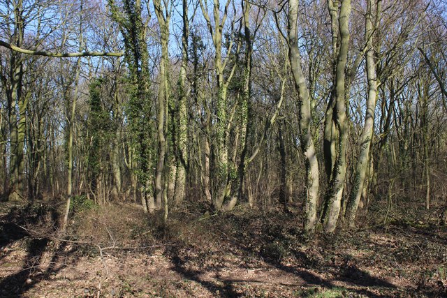
Deciduous woodland priority habitat; Birds — Magpie, House Sparrow, Rock Dove +21 more · last seen 2026
Dog walks
Strong match
Dogs allowed — public woodland
Insect spotting
Strong match
Lowland meadows — marbled white, meadow brown and pollinating insects
Picnic day out
Strong match
picnic area
Cycling
Good match
Named cycling route nearby: NCN National Route 697
Trails nearby
Within roughly 5 km🚶Walking
7 signed routes nearby · 1 public path nearby
Signed route nearbyPublic paths
Walking
Trans-Pennine Trail (Wombwell to Leeds)Walking route
Trans-Pennine Trail (Wombwell to Leeds spur)
Hillside HikeWalking route
Reedbed RambleWalking route
Lowther LoopWalking route
Leeds Country WayWalking route
🚴Cycling
75 signed routes nearby
Signed route nearby
Cycling
Route 66Cycling route
Garforth to Leeds City Centre Core Cycle RouteCycling route
Swarcliffe Health TrailCycling route
Wyke Beck WayCycling route
NCN National Route 697Cycling route
Cycle Superhighway 2Cycling route
🐴Horse riding
3 public paths nearby
Public paths
Horse riding
Brecks Lanebridleway · 4 m
Brecks Lanebridleway · 577 m
Brecks Lanebridleway · 22 m
Wildlife to spot
Photos
Weather for this location
Loading local forecast…
Nearby places
Useful places within 5 km
Own or manage this place?
Claim this listing to keep details accurate, add photos, and highlight what makes it special — free.
Claim this pageHow was your visit?
How useful was the information on this page?
id: 60eb11b3-cac7-4bde-921a-259172c0fb32