Mocketts Wood - Broadleaved woodland
1 ha
Plan your visit
🐶Dogs🦉Wildlife🦅Birds
Public accessFree entryDogs welcome1 ha
Getting here
51.34983, 1.42512
Open directionsv
Visiting this summer
Seasonal nature notes and what to look for now
- ☀️June — canopy now fully closed, creating cool dappled shade even on warm days
- 🐕Early mornings are best for dog walks in summer — visit before 9am to avoid the heat and find quieter trails
- 🅿️Parking 344m away — 6 car parks within reach
🌤️ Visiting this summer
- ☀️June — canopy now fully closed, creating cool dappled shade even on warm days
- 🐕Early mornings are best for dog walks in summer — visit before 9am to avoid the heat and find quieter trails
- 🅿️Parking 344m away — 6 car parks within reach
- £Free to visit — no entry charge
- 🐕Dogs welcome
Dogs allowed — public woodland
Free
Deciduous woodland priority habitat
Free
🦅Bird watching
Strong match
Deciduous woodland — woodpeckers, warblers and woodland birds
Free
Deciduous woodland — fungi, berries and wild garlic
Varies
Trails nearby
Within roughly 5 km7 signed routes nearby · 11 public paths nearby
Signed route nearbyPublic paths
Turner & Dickens WalkWalking route▾
Named routeRef T&DLocal walking route
Pegwell Bay Country Park Long Nature TrailWalking route▾
Named routeLocal walking route
Pegwell Bay Country Park Short Nature TrailWalking route▾
Named routeLocal walking route
Stonelees TrailWalking route▾
Named routeLocal walking route
Augustine CaminoWalking route▾
Named routeRegional walking route
Grange Waypublic footpath · 183 m▾
Public pathpublic footpathLength 183 mPath type: residential
72 signed routes nearby
Signed route nearby
NCN Regional Route 15 (Kent)Cycling route▾
Named routeRef 15Regional cycle route
N/ACycling route170 m▾
Named routeRef 15Length 170 mNational Cycle NetworkTraffic-freeSurface asphalt
N/ACycling route131 m▾
Named routeRef 15Length 131 mNational Cycle NetworkTraffic-freeSurface asphalt
N/ACycling route112 m▾
Named routeRef 15Length 112 mNational Cycle NetworkOn-roadSurface asphalt
N/ACycling route92 m▾
Named routeRef 15Length 92 mNational Cycle NetworkOn-roadSurface asphalt
N/ACycling route292 m▾
Named routeRef 15Length 292 mNational Cycle NetworkOn-roadSurface asphalt
7 public paths nearby
Public paths
Ramsgate Roadbridleway · 287 m▾
Public pathbridlewayLength 287 mSurface asphaltPath type: primary
Ramsgate Roadbridleway · 17 m▾
Public pathbridlewayLength 17 mSurface asphaltPath type: primary
Photos
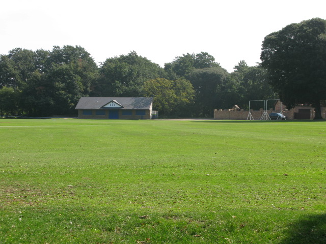
Playing fields on Park Avenue, home of Broadstairs Cricket Club
Weather for this location
Next 14 daysNearby places
Useful places within 5 km
Own or manage this place?
Claim this listing to keep details accurate, add photos, and highlight what makes it special — free.
Claim this page→How useful was the information on this page?
id: 790617b1-0d92-4881-ad8b-f750554b10de
Wildlife to spot
34,531 records · National Biodiversity Network
Wildlife to spot
34,531 records · National Biodiversity Network🐦Birds38 species
summerautumn
2026▾
Herring Gull · Carrion Crow · House Sparrow · Woodpigeon · Turnstone +33
- Herring GullLarus argentatus2025
- Carrion CrowCorvus corone2025
- House SparrowPasser domesticus
- WoodpigeonColumba palumbus2025
- TurnstoneArenaria interpres
- Rock DoveColumba livia2025
- FulmarFulmarus glacialis
- MagpiePica pica2025
- RobinErithacus rubecula2025
- DunnockPrunella modularis
- WrenTroglodytes troglodytes2025
- Blue TitCyanistes caeruleus2025
- Great TitParus major2025
- BlackbirdTurdus merula2025
- SwiftApus apus2025
- OystercatcherHaematopus ostralegus
- Lesser Black-backed GullLarus fuscus2025
- Collared DoveStreptopelia decaocto2025
- CormorantPhalacrocorax carbo2025
- Black-headed GullChroicocephalus ridibundus2025
- ChiffchaffPhylloscopus collybita2025
- GoldcrestRegulus regulus2025
- JayGarrulus glandarius2025
- Yellow-browed WarblerPhylloscopus inornatus2025
- JackdawColoeus monedula2025
- Purple SandpiperCalidris maritima2025
- Great Black-backed GullLarus marinus2025
- Rock PipitAnthus petrosus2025
- Radde's WarblerPhylloscopus schwarzi2025
- Pied WagtailMotacilla alba
- StonechatSaxicola rubicola2025
- Pallas's WarblerPhylloscopus proregulus2025
- Common GullLarus canus2025
- ChaffinchFringilla coelebs2025
- Green WoodpeckerPicus viridis2025
- KestrelFalco tinnunculus2025
- Little EgretEgretta garzetta2025
- StarlingSturnus vulgaris2025
🦌Mammals5 species
summerautumn
2026▾
Common Pipistrelle · Red Fox · Brown Rat · Bats · Hedgehog
- Common PipistrellePipistrellus pipistrellus2025
- Red FoxVulpes vulpes2025
- Brown RatRattus norvegicus
- BatsVespertilionidae2025
- HedgehogErinaceus europaeus2025
🐸Amphibians1 species
winter
2026▾
Smooth Newt
- Smooth NewtLissotriton vulgaris
🐝Insects15 species
summerautumn
2026▾
Migrant Hawker · Common Darter · Western Conifer Seed Bug · Scathophaga stercoraria · Red-legged Shieldbug +10
- Migrant HawkerAeshna mixta2025
- Common DarterSympetrum striolatum2025
- Western Conifer Seed BugLeptoglossus occidentalis2025
- Scathophaga stercorariaScathophaga stercoraria
- Red-legged ShieldbugPentatoma rufipes2025
Species observations from the last 10 years via NBN Atlas
Southern Oak Bush-cricket
Southern Oak Bush-cricket
Meconema meridionale2025
Meconema meridionale2025
Lucerne BugAdelphocoris lineolatus2025Lucerne BugAdelphocoris lineolatus2025Southern Green ShieldbugNezara viridula2025Southern Green ShieldbugNezara viridula2025Hairy ShieldbugDolycoris baccarum2025Hairy ShieldbugDolycoris baccarum2025Lepinotus patruelisLepinotus patruelis2025Lepinotus patruelisLepinotus patruelis2025Ledra auritaLedra aurita2025Ledra auritaLedra aurita2025Banded DemoiselleCalopteryx splendens2025Banded DemoiselleCalopteryx splendens2025Summer ChaferAmphimallon solstitiale2025Summer ChaferAmphimallon solstitiale2025Lily BeetleLilioceris lilii2025Lily BeetleLilioceris lilii202510-spot LadybirdAdalia decempunctata202510-spot LadybirdAdalia decempunctata2025Events & activities nearby
Switch provider to compare local events, tours and bookable activities.