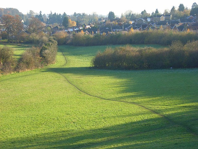
Beech Wood - Broadleaved woodland 1 ha
Plan your visit
🐶 Dogs🦉 Wildlife🦅 Birds
Public access Free entry Dogs welcome 1 ha
Places › England › South East › Reading Getting here
51.48134, -0.98274
Open directionsv Visiting this summer
Seasonal nature notes and what to look for now
▾ 🌞 Midsummer — early morning visits most comfortable; look for deer fawns in quieter clearings 🐕 Early mornings are best for dog walks in summer — visit before 9am to avoid the heat and find quieter trails 🅿️ Parking 483m away — 4 car parks within reach 🌤️ Visiting this summer
🌞 Midsummer — early morning visits most comfortable; look for deer fawns in quieter clearings 🐕 Early mornings are best for dog walks in summer — visit before 9am to avoid the heat and find quieter trails 🅿️ Parking 483m away — 4 car parks within reach £ Free to visit — no entry charge🐕 Dogs welcomeDogs allowed — public woodland
Free
Deciduous woodland priority habitat
Free
🦅 Bird watching
Strong match
Deciduous woodland — woodpeckers, warblers and woodland birds
Free
Deciduous woodland — fungi, berries and wild garlic
Varies
Trails nearby Within roughly 5 km 8 signed routes nearby
Signed route nearby
The Chiltern Way Southern Extension Walking route ▾
Long distance path
Named route Ref CWS Regional walking route
Show on map The Chiltern Way Berkshire Loop Walking route 28 km ▾
Long distance path
Named route Ref CWB Length 28 km Regional walking route
Show on map European walking route E2 west, UK, South East England Walking route ▾
Westroute: Stranraer (UK) - Birminhgham (UK) - Calais (FR) - Zoersel (BE) / Eastroute: Stranraer (UK) - Harwich (UK) - Rotterdam (NL) - Zoersel (BE) / Both Routes: Zoersel (BE) - Maastrich (NL) - Luxembourg (LUX) - Lake Geneva (CH) - Nice (FR)
Named route Ref E2 International walking route
Show on map Kennet and Avon Canal Trail Walking route 140 km ▾
Rivers linked by a canal. The name refers to the entire navigable length. From Bristol the way is the Avon. The canal is from Bath to Newbury. From there to Reading the way is the Kennet. 53 locks to Summit Pound (150 m asl) and 54 down to Reading.
Named route Ref K&A Length 140 km Regional walking route
Show on map The Wokingham Way Walking route ▾
Named route Regional walking route
Show on map 119 signed routes nearby
Signed route nearby
National Cycle Network Route 5 Cycling route ▾
Named route Ref 5 National Cycle Network
Show on map Round Berkshire Cycle Route Cycling route ▾
Named route Regional cycle route
Show on map Route R5 Cycling route ▾
Named route Ref R5 Local cycle route
Show on map Route R1 Cycling route ▾
Named route Ref R1 Local cycle route
Show on map Route R6 Cycling route ▾
Named route Ref R6 Local cycle route
Show on map Reading R50 Cycling route ▾
Named route Ref R50 Local cycle route
Show on map 1 signed route nearby
Signed route nearby
King Alfred's Way Mountain bike route ▾
King Alfreds Way is 350km (220 miles) off road route designed to be ridden clockwise. It starts & ends in Winchester. It is suitable for gravel or cross-country bikes.
Named route Regional cycle route
Show on map 3 public paths nearby
Public paths
No named routes yet. Public paths are shown on the map.
Weather for this location Next 14 days Nearby places Useful places within 5 km
All Historic
Own or manage this place?
Claim this listing to keep details accurate, add photos, and highlight what makes it special — free.
Claim this page→ How useful was the information on this page?
id: 8be73295-01f3-4687-b84a-d401b31d4a51
UK green spaces mapped from open public data — so anyone can find the woodland, trail, or nature reserve closest to them.
© 2026 Glade · Made with care for UK green spaces
Events & activities nearby Switch provider to compare local events, tours and bookable activities.
Bookable tours GetYourGuide Promote here
Wildlife to spot
35,707 records · National Biodiversity Network
▾
Wildlife to spot 35,707 records · National Biodiversity Network 🐦 Birds 40 species
spring summer
2025 ▾
Mute Swan · Mallard · Greylag Goose · Canada Goose · Egyptian Goose +35
Mute Swan Cygnus olor Mallard Anas platyrhynchos Greylag Goose Anser anser Canada Goose Branta canadensis Egyptian Goose Alopochen aegyptiaca Rock Dove Columba livia Black-headed Gull Chroicocephalus ridibundus Ruddy Shelduck Tadorna ferruginea Lesser Black-backed Gull Larus fuscus Herring Gull Larus argentatus2024 Woodpigeon Columba palumbus Magpie Pica pica Jackdaw Coloeus monedula Cormorant Phalacrocorax carbo Jay Garrulus glandarius Blackbird Turdus merula House Sparrow Passer domesticus Great Tit Parus major Robin Erithacus rubecula Goldfinch Carduelis carduelis Blackcap Sylvia atricapilla Dunnock Prunella modularis Snow Goose Anser caerulescens Pied Wagtail Motacilla alba yarrellii Common Gull Larus canus Green Woodpecker Picus viridis House Martin Delichon urbicum Swift Apus apus Chiffchaff Phylloscopus collybita Wren Troglodytes troglodytes Blue Tit Cyanistes caeruleus Mistle Thrush Turdus viscivorus Mandarin Duck Aix galericulata Grey Wagtail Motacilla cinerea2024 Tawny Owl Strix aluco2024 Carrion Crow Corvus corone2024 Common Tern Sterna hirundo2024 Grey Heron Ardea cinerea2024 Little Egret Egretta garzetta2024 Moorhen Gallinula chloropus2024 Daubenton's Bat · Hedgehog · Soprano Pipistrelle · Red Fox · Grey Squirrel +3
Daubenton's Bat Myotis daubentonii2024 Hedgehog Erinaceus europaeus2025 Soprano Pipistrelle Pipistrellus pygmaeus2024 Red Fox Vulpes vulpes2025 Grey Squirrel Sciurus carolinensis American Mink Neovison vison Slow-worm
🐝 Insects 50 species
spring summer
2025 ▾
Stag Beetle · Harlequin Ladybird · Swollen-thighed Beetle · 7-spot Ladybird · Helophilus pendulus +45
Stag Beetle Lucanus cervus Harlequin Ladybird Harmonia axyridis Swollen-thighed Beetle Oedemera nobilis 7-spot Ladybird Coccinella septempunctata Helophilus pendulus Helophilus pendulus Dark Bush-cricket Pholidoptera griseoaptera Species observations from the last 10 years via NBN Atlas
2025
2025
Eurasian Serotine Cnephaeus serotinus2025
Eurasian Serotine Cnephaeus serotinus2025
Hazel Dormouse Muscardinus avellanarius2024
Hazel Dormouse Muscardinus avellanarius2024
Azure Damselfly Coenagrion puella2024
Azure Damselfly Coenagrion puella2024
Hairy Shieldbug Dolycoris baccarum
Hairy Shieldbug Dolycoris baccarum
Speckled Bush-cricket Leptophyes punctatissima
Speckled Bush-cricket Leptophyes punctatissima
Common Darter Sympetrum striolatum
Common Darter Sympetrum striolatum
Cream-spot Ladybird Calvia quattuordecimguttata
Cream-spot Ladybird Calvia quattuordecimguttata
Glow-worm Lampyris noctiluca
Glow-worm Lampyris noctiluca
Volucella inanis Volucella inanis
Volucella inanis Volucella inanis
Chrysotoxum bicinctum Chrysotoxum bicinctum
Chrysotoxum bicinctum Chrysotoxum bicinctum
Field Grasshopper Chorthippus brunneus
Field Grasshopper Chorthippus brunneus
Common Red Soldier Beetle Rhagonycha fulva
Common Red Soldier Beetle Rhagonycha fulva
Scarlet Tiger Callimorpha dominula
Scarlet Tiger Callimorpha dominula
Green Shieldbug Palomena prasina
Green Shieldbug Palomena prasina
Rose Chafer Cetonia aurata
Rose Chafer Cetonia aurata
Malachite Beetle Malachius bipustulatus
Malachite Beetle Malachius bipustulatus
Hypera rumicis Hypera rumicis
Hypera rumicis Hypera rumicis
Dock Bug Coreus marginatus
Dock Bug Coreus marginatus
Cheilosia pagana Cheilosia pagana
Cheilosia pagana Cheilosia pagana
Platycheirus albimanus Platycheirus albimanus
Platycheirus albimanus Platycheirus albimanus
Green Dock Beetle Gastrophysa viridula
Green Dock Beetle Gastrophysa viridula
Syrphus Syrphus
Syrphus Syrphus
Corizus hyoscyami Corizus hyoscyami
Corizus hyoscyami Corizus hyoscyami
St Marks Fly Bibio marci
St Marks Fly Bibio marci
Cheilosia Cheilosia
Cheilosia Cheilosia
Platycheirus Platycheirus2024
Platycheirus Platycheirus2024
Marmalade Hoverfly Episyrphus balteatus2024
Marmalade Hoverfly Episyrphus balteatus2024
Sphaerophoria Sphaerophoria2024
Sphaerophoria Sphaerophoria2024
Batman Hoverfly Myathropa florea2024
Batman Hoverfly Myathropa florea2024
Tree Damsel Bug Himacerus (Himacerus) apterus2024
Tree Damsel Bug Himacerus (Himacerus) apterus2024
Roesel's Bush-cricket Roeseliana roeselii2024
Roesel's Bush-cricket Roeseliana roeselii2024
Nephus quadrimaculatus Nephus quadrimaculatus2024
Nephus quadrimaculatus Nephus quadrimaculatus2024
Pinalitus cervinus Pinalitus cervinus2024
Pinalitus cervinus Pinalitus cervinus2024
Orange Ladybird Halyzia sedecimguttata2024
Orange Ladybird Halyzia sedecimguttata2024
Golden-tabbed Robberfly Eutolmus rufibarbis2024
Golden-tabbed Robberfly Eutolmus rufibarbis2024
Banded Demoiselle Calopteryx splendens2024
Banded Demoiselle Calopteryx splendens2024
Jersey Tiger Euplagia quadripunctaria2024
Jersey Tiger Euplagia quadripunctaria2024
Red-legged Shieldbug Pentatoma rufipes2024
Red-legged Shieldbug Pentatoma rufipes2024
Southern Hawker Aeshna cyanea2024
Southern Hawker Aeshna cyanea2024
Hawthorn Shieldbug Acanthosoma haemorrhoidale2024
Hawthorn Shieldbug Acanthosoma haemorrhoidale2024
Broad Centurion Chloromyia formosa2024
Broad Centurion Chloromyia formosa2024
Rhopalus (Rhopalus) subrufus Rhopalus (Rhopalus) subrufus2024
Rhopalus (Rhopalus) subrufus Rhopalus (Rhopalus) subrufus2024
Campyloneura virgula Campyloneura virgula2024
Campyloneura virgula Campyloneura virgula2024
Greater Bulb-Fly Merodon equestris2024
Greater Bulb-Fly Merodon equestris2024
Woundwort Shieldbug Eysarcoris venustissimus2024
Woundwort Shieldbug Eysarcoris venustissimus2024
14-spot Ladybird Propylea quattuordecimpunctata2024
14-spot Ladybird Propylea quattuordecimpunctata2024