Snitterfield Bushes - Broadleaved woodland ✦ Ancient woodland 12 ha
Plan your visit
🦉 Wildlife🍂 Seasonal🦅 Birds
Free entry Dogs welcome 12 ha
Places › England › West Midlands › Stratford-on-Avon Getting here
52.23893, -1.71009
Open directionsv Visiting this summer
Seasonal nature notes and what to look for now
▾ 🌞 Midsummer — early morning visits most comfortable; look for deer fawns in quieter clearings 🌿 Foraging is at its best in summer here 🐕 Dogs welcome — bring water in summer; the site has enough space to find shade on hot days 🌤️ Visiting this summer
🌞 Midsummer — early morning visits most comfortable; look for deer fawns in quieter clearings 🌿 Foraging is at its best in summer here 🐕 Dogs welcome — bring water in summer; the site has enough space to find shade on hot days £ Free to visit — no entry charge🐕 Dogs welcome🌿 Ancient woodland — rare wildlife habitatDeciduous woodland priority habitat; Ancient woodland
Free
🍂 Seasonal nature
Strong match
Ancient woodland — bluebells, fungi and autumn colour
Free
🦅 Bird watching
Strong match
Deciduous woodland — woodpeckers, warblers and woodland birds
Free
Deciduous woodland — fungi, berries and wild garlic
Varies
Ancient woodland — historic landscape
Free
🌲 Forest walks
Moderate match
Public woodland
Free
Trails nearby Within roughly 5 km 8 signed routes nearby · 2 public paths nearby
Signed route nearby Public paths
Monarch's Way Walking route 990 km ▾
approximate route of Charles II's escape
Named route Ref MW Length 990 km Regional walking route
Show on map Shakespeare's Avon Way Walking route 142 km ▾
From the source at Naseby, Northamptonshire to the Severn at Tewkesbury
Named route Ref SAW Length 142 km Regional walking route
Show on map Rail Trail: Bearley > Claverdon Walking route 7.6 km ▾
A 4.75-mile walk to discover ancient villages, churches and leafy woodland amid some truly glorious Warwickshire countryside.
Duration: 2.5 hours
Distance: 4.75 miles
Named route Ref rtBea Length 7.6 km Point-to-point Local walking route
Show on map Rail Trail: Wootton Wawen > Wilmcote Walking route 7.2 km ▾
A 2.5-mile trail exploring Warwickshire’s oldest church, England’s longest iron aqueduct and enjoying some unparalleled views along the Stratford-upon-Avon Canal.
Duration: 2.5 hours
Distance: 4.5 miles
Named route Ref rtWW Length 7.2 km Point-to-point Local walking route
Show on map Rail Trail: Claverdon > Hatton Walking route 4.8 km ▾
A 3-mile short trail through gently rolling farmland and past pockets of woodland to the Grand Union Canal and its “stairway to heaven” flight of locks at Hatton.
Duration: 1.5 hours
Distance: 3 miles
Named route Ref rtCla Length 4.8 km Point-to-point Local walking route
Show on map 18 signed routes nearby
Signed route nearby
National Cycle Network Route 5 Cycling route ▾
Named route Ref 5 National Cycle Network
Show on map Main Route Cycling route 5.8 km ▾
Named route Ref 5 Length 5.8 km National Cycle Network On-road Surface asphalt
Show on map Main Route Cycling route 630 m ▾
Named route Ref 5 Length 630 m National Cycle Network Traffic-free Surface unsealedfirm
Show on map N/A Cycling route 387 m ▾
Named route Length 387 m National Cycle Network Traffic-free Surface unsealedfirm
Show on map Main Route Cycling route 334 m ▾
Named route Ref 5 Length 334 m National Cycle Network On-road Surface asphalt
Show on map Main Route Cycling route 212 m ▾
Named route Ref 5 Length 212 m National Cycle Network Traffic-free Surface asphalt
Show on map ✦ Ancient woodland — continuously wooded since at least 1600 AD. A rare and irreplaceable habitat, rich in biodiversity and historical character.
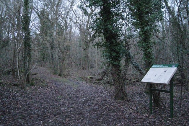
Photos Snitterfield Bushes, near the entrance
‹ ›
Weather for this location Next 14 days Nearby places Useful places within 5 km
All Historic
Own or manage this place?
Claim this listing to keep details accurate, add photos, and highlight what makes it special — free.
Claim this page→ How useful was the information on this page?
id: 1918d317-e335-4cbf-86e8-aa825fed932f
UK green spaces mapped from open public data — so anyone can find the woodland, trail, or nature reserve closest to them.
© 2026 Glade · Made with care for UK green spaces
Events & activities nearby Switch provider to compare local events, tours and bookable activities.
Bookable tours GetYourGuide Promote here
Wildlife to spot
20,273 records · National Biodiversity Network
▾
Wildlife to spot 20,273 records · National Biodiversity Network 🐦 Birds 41 species
spring summer autumn
2025 ▾
Great Tit · Robin · Jackdaw · Carrion Crow · Wren +36
Great Tit Parus major Robin Erithacus rubecula Jackdaw Coloeus monedula Carrion Crow Corvus corone Wren Troglodytes troglodytes Blue Tit Cyanistes caeruleus Mallard Anas platyrhynchos Blackbird Turdus merula Rock Dove Columba livia Long-tailed Tit Aegithalos caudatus Coot Fulica atra Magpie Pica pica Chiffchaff Phylloscopus collybita Dunnock Prunella modularis Pheasant Phasianus colchicus Goldfinch Carduelis carduelis Chaffinch Fringilla coelebs Moorhen Gallinula chloropus Woodpigeon Columba palumbus Jay Garrulus glandarius Song Thrush Turdus philomelos Green Woodpecker Picus viridis Stock Dove Columba oenas Blackcap Sylvia atricapilla Redwing Turdus iliacus Stonechat Saxicola rubicola Goldcrest Regulus regulus Siskin Spinus spinus Lesser Black-backed Gull Larus fuscus Rook Corvus frugilegus Nuthatch Sitta europaea Treecreeper Certhia familiaris Great Spotted Woodpecker Dendrocopos major Marsh Tit Poecile palustris Coal Tit Periparus ater Collared Dove Streptopelia decaocto Swift Apus apus Swallow Hirundo rustica Pied Wagtail Motacilla alba yarrellii Kestrel Falco tinnunculus Canada Goose Branta canadensis Brown Hare
Brown Hare Lepus europaeus 🐝 Insects 22 species
spring summer
2025 ▾
Common Darter · Ruddy Darter · Hairy Dragonfly · Common Blue Damselfly · Brown Hawker +17
Common Darter Sympetrum striolatum Ruddy Darter Sympetrum sanguineum Hairy Dragonfly Brachytron pratense Common Blue Damselfly Enallagma cyathigerum Brown Hawker Aeshna grandis Southern Hawker Aeshna cyanea Meadow Saffron · Common Valerian · Whorled Mint · Kamchatka Stonecrop · Bent Grass +16
Meadow Saffron Colchicum autumnale Common Valerian Valeriana officinalis Whorled Mint Mentha aquatica x arvensis = M. x verticillata Kamchatka Stonecrop Phedimus kamtschaticus Bent Grass Agrostis Potentilla x mixta Potentilla x mixta Balm Species observations from the last 10 years via NBN Atlas
Azure Damselfly
Azure Damselfly
Coenagrion puella
Coenagrion puella
Broad-bodied Chaser Libellula depressa
Broad-bodied Chaser Libellula depressa
Corizus hyoscyami Corizus hyoscyami
Corizus hyoscyami Corizus hyoscyami
Migrant Hawker Aeshna mixta
Migrant Hawker Aeshna mixta
Beautiful Demoiselle Calopteryx virgo
Beautiful Demoiselle Calopteryx virgo
Scarce Chaser Libellula fulva
Scarce Chaser Libellula fulva
Four-spotted Chaser Libellula quadrimaculata
Four-spotted Chaser Libellula quadrimaculata
Hairy Shieldbug Dolycoris baccarum
Hairy Shieldbug Dolycoris baccarum
Gorse Shieldbug Piezodorus lituratus
Gorse Shieldbug Piezodorus lituratus
Stictopleurus punctatonervosus Stictopleurus punctatonervosus
Stictopleurus punctatonervosus Stictopleurus punctatonervosus
Woundwort Shieldbug Eysarcoris venustissimus
Woundwort Shieldbug Eysarcoris venustissimus
Eupeodes Eupeodes
Eupeodes Eupeodes
Hawthorn Shieldbug Acanthosoma haemorrhoidale
Hawthorn Shieldbug Acanthosoma haemorrhoidale
Emperor Dragonfly Anax imperator
Emperor Dragonfly Anax imperator
Common Pollen Beetle Meligethes aeneus
Common Pollen Beetle Meligethes aeneus
Large Red Damselfly Pyrrhosoma nymphula
Large Red Damselfly Pyrrhosoma nymphula Melissa officinalis
Melissa officinalis
Zigzag Clover Trifolium medium
Zigzag Clover Trifolium medium
Hart's-Tongue Asplenium scolopendrium
Hart's-Tongue Asplenium scolopendrium
Lesser Spearwort Ranunculus flammula
Lesser Spearwort Ranunculus flammula
Lamiastrum galeobdolon subsp. argentatum Lamiastrum galeobdolon subsp. argentatum
Lamiastrum galeobdolon subsp. argentatum Lamiastrum galeobdolon subsp. argentatum
Agrimony Agrimonia
Agrimony Agrimonia
Giant Fescue Schedonorus giganteus
Giant Fescue Schedonorus giganteus
Caucasian-Stonecrop Phedimus spurius
Caucasian-Stonecrop Phedimus spurius
Erigeron Erigeron
Erigeron Erigeron
Heath Speedwell Veronica officinalis
Heath Speedwell Veronica officinalis
Bramble Rubus
Bramble Rubus
Yellow-wort Blackstonia perfoliata
Yellow-wort Blackstonia perfoliata
Virginia-creeper Parthenocissus quinquefolia
Virginia-creeper Parthenocissus quinquefolia
Cyperus Sedge Carex pseudocyperus
Cyperus Sedge Carex pseudocyperus
Compact Rush Juncus conglomeratus
Compact Rush Juncus conglomeratus