Winnall Coppice - Broadleaved woodland
✦ Ancient woodland8 ha
Plan your visit
🦉Wildlife🐶Dogs🍂Seasonal
Public accessFree entryDogs welcome8 ha
Getting here
52.31159, -2.25845
Open directionsv
Visiting this summer
Seasonal nature notes and what to look for now
- 🌞Midsummer — early morning visits most comfortable; look for deer fawns in quieter clearings
- 🐕Early mornings are best for dog walks in summer — visit before 9am to avoid the heat and find quieter trails
- 📍Open access throughout summer — no booking required
🌤️ Visiting this summer
- 🌞Midsummer — early morning visits most comfortable; look for deer fawns in quieter clearings
- 🐕Early mornings are best for dog walks in summer — visit before 9am to avoid the heat and find quieter trails
- 📍Open access throughout summer — no booking required
- £Free to visit — no entry charge
- 🐕Dogs welcome
- 🌿Ancient woodland — rare wildlife habitat
Deciduous woodland priority habitat; Ancient woodland
Free
Dogs allowed — public woodland
Free
🍂Seasonal nature
Strong match
Ancient woodland — bluebells, fungi and autumn colour
Free
🦅Bird watching
Strong match
Deciduous woodland — woodpeckers, warblers and woodland birds
Free
Deciduous woodland — fungi, berries and wild garlic
Varies
Trails nearby
Within roughly 5 km5 signed routes nearby · 3 public paths nearby
Signed route nearbyPublic paths
Monarch's WayWalking route990 km▾
approximate route of Charles II's escape
Named routeRef MWLength 990 kmRegional walking route
Geopark WayWalking route175 km▾
Named routeRef geoLength 175 kmRegional walking route
Stourport Circular WalkWalking route6.5 km▾
Named routeLength 6.5 kmLocal walking route
Wychavon Way (old)Walking route67 km▾
A route from Holt Fleet on the River Severn to Winchcombe in the Cotswolds.
Named routeLength 67 km
Severn Way (2) Shrewsbury to WorcesterWalking route93 km▾
Named routeRef SW (2)Length 93 kmRegional walking route
38 signed routes nearby
Signed route nearby
Mercian WayCycling route▾
Named routeRef 45National Cycle Network
Route 54Cycling route▾
Named routeRef 54National Cycle Network
Main RouteCycling route995 m▾
Named routeRef 45Length 995 mNational Cycle NetworkOn-roadSurface asphalt
Main RouteCycling route9 m▾
Named routeRef 45Length 9 mNational Cycle NetworkTraffic-freeSurface asphalt
Main RouteCycling route64 m▾
Named routeRef 45Length 64 mNational Cycle NetworkTraffic-freeSurface bareearth
N/ACycling route161 m▾
Named routeLength 161 mNational Cycle NetworkOn-roadSurface asphalt
Photos
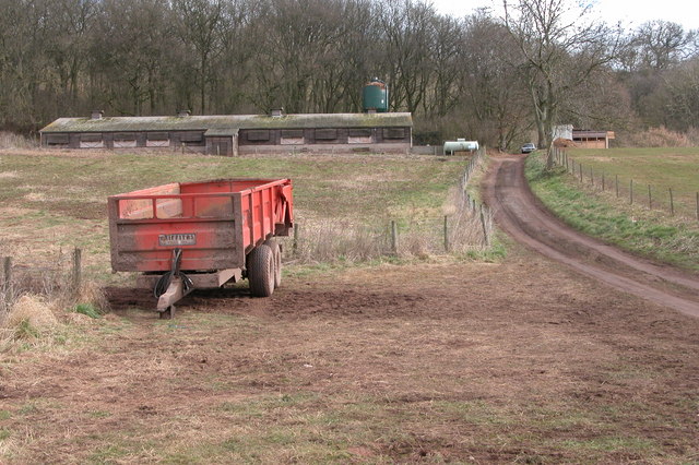
Chicken shed near Lincomb
Weather for this location
Next 14 daysNearby places
Useful places within 5 km
Own or manage this place?
Claim this listing to keep details accurate, add photos, and highlight what makes it special — free.
Claim this page→How useful was the information on this page?
id: 86e95a69-7e0c-4c05-82e6-e881ea30692c
Events & activities nearby
Switch provider to compare local events, tours and bookable activities.
Wildlife to spot
9,433 records · National Biodiversity Network
Wildlife to spot
9,433 records · National Biodiversity Network🐦Birds8 species
winterspringsummer
2026▾
Green Woodpecker · Moorhen · Mallard · Jay · Great Tit +3
- Green WoodpeckerPicus viridis
- MoorhenGallinula chloropus
- MallardAnas platyrhynchos
- JayGarrulus glandarius
- Great TitParus major
- Lesser RedpollAcanthis flammea cabaret2025
- Mistle ThrushTurdus viscivorus2025
- TreecreeperCerthia familiaris2025
Muntjac · Mole · Red Fox · Rabbit · Grey Squirrel
- MuntjacMuntiacus reevesi2025
- MoleTalpa europaea
- Red FoxVulpes vulpes2025
- RabbitOryctolagus cuniculus2025
- Grey SquirrelSciurus carolinensis2025
Grass Snake
- Grass SnakeNatrix helvetica
🐸Amphibians1 species
spring
2026▾
Great Crested Newt
- Great Crested NewtTriturus cristatus
🐝Insects89 species
summerautumn
2026▾
Southern Hawker · 7-spot Ladybird · Hairy Shieldbug · Common Darter · Common Carder Bee +84
- Southern HawkerAeshna cyanea2025
- 7-spot LadybirdCoccinella septempunctata
- Hairy ShieldbugDolycoris baccarum
- Common DarterSympetrum striolatum2025
- Common Carder BeeBombus pascuorum2025
- Kite-tailed Robberfly
Straw Bristle-moss · Silky Forklet-moss · Even Scalewort · Ulota crispa · Forked Veilwort +3
- Straw Bristle-mossOrthotrichum stramineum
- Silky Forklet-mossDicranella heteromalla
- Even ScalewortRadula complanata
- Ulota crispaUlota crispa
- Forked VeilwortMetzgeria furcata
- Minute PouncewortMyriocoleopsis minutissima
- Hart's-tongue Thyme-moss
Species observations from the last 10 years via NBN Atlas
Machimus atricapillus2025
Machimus atricapillus2025
Common Red Soldier BeetleRhagonycha fulva2025Common Red Soldier BeetleRhagonycha fulva2025HornetVespa crabro2025HornetVespa crabro2025Birch ShieldbugElasmostethus interstinctusBirch ShieldbugElasmostethus interstinctusRed-legged ShieldbugPentatoma rufipesRed-legged ShieldbugPentatoma rufipesBuff-tailed BumblebeeBombus terrestris2025Buff-tailed BumblebeeBombus terrestris2025Parent BugElasmucha grisea2025Parent BugElasmucha grisea2025Enoicyla pusillaEnoicyla pusilla2025Enoicyla pusillaEnoicyla pusilla2025Green ShieldbugPalomena prasina2025Green ShieldbugPalomena prasina2025Marmalade HoverflyEpisyrphus balteatus2025Marmalade HoverflyEpisyrphus balteatus2025Hawthorn ShieldbugAcanthosoma haemorrhoidale2025Hawthorn ShieldbugAcanthosoma haemorrhoidale202524-spot LadybirdSubcoccinella vigintiquattuorpunctata202524-spot LadybirdSubcoccinella vigintiquattuorpunctata202516-spot LadybirdTytthaspis sedecimpunctata202516-spot LadybirdTytthaspis sedecimpunctata2025Cream-spot LadybirdCalvia quattuordecimguttata2025Cream-spot LadybirdCalvia quattuordecimguttata2025Dock BugCoreus marginatus2025Dock BugCoreus marginatus2025Batman HoverflyMyathropa florea2025Batman HoverflyMyathropa florea2025Red-tailed BumblebeeBombus lapidarius2025Red-tailed BumblebeeBombus lapidarius2025Swollen-thighed BeetleOedemera nobilis2025Swollen-thighed BeetleOedemera nobilis2025Cheilosia impressaCheilosia impressa2025Cheilosia impressaCheilosia impressa2025Sphaerophoria scriptaSphaerophoria scripta2025Sphaerophoria scriptaSphaerophoria scripta2025Chrysotoxum bicinctumChrysotoxum bicinctum2025Chrysotoxum bicinctumChrysotoxum bicinctum2025Oedemera luridaOedemera lurida2025Oedemera luridaOedemera lurida2025Morellia aenescensMorellia aenescens2025Morellia aenescensMorellia aenescens2025White-legged DamselflyPlatycnemis pennipes2025White-legged DamselflyPlatycnemis pennipes2025Plagiognathus (Plagiognathus) arbustorumPlagiognathus (Plagiognathus) arbustorum2025Plagiognathus (Plagiognathus) arbustorumPlagiognathus (Plagiognathus) arbustorum2025Eristalis pertinaxEristalis pertinaxEristalis pertinaxEristalis pertinaxDark-edged Bee-flyBombylius majorDark-edged Bee-flyBombylius majorApion frumentariumApion frumentariumApion frumentariumApion frumentarium10-spot LadybirdAdalia decempunctata10-spot LadybirdAdalia decempunctataSitona striatellusSitona striatellusSitona striatellusSitona striatellusCoeliodes ruberCoeliodes ruberCoeliodes ruberCoeliodes ruberBirch Catkin BugKleidocerys resedae2025Birch Catkin BugKleidocerys resedae2025Common DamselbugNabis (Nabis) rugosus2025Common DamselbugNabis (Nabis) rugosus2025Minotaur BeetleTyphaeus typhoeus2025Minotaur BeetleTyphaeus typhoeus2025Nut Leaf WeevilStrophosoma melanogrammum2025Nut Leaf WeevilStrophosoma melanogrammum2025Hydrotaea dentipesHydrotaea dentipes2025Hydrotaea dentipesHydrotaea dentipes2025Orange LadybirdHalyzia sedecimguttata2025Orange LadybirdHalyzia sedecimguttata2025MuscidaeMuscidae2025MuscidaeMuscidae2025Phaonia subventaPhaonia subventa2025Phaonia subventaPhaonia subventa2025Tree BumblebeeBombus hypnorum2025Tree BumblebeeBombus hypnorum2025Phaonia validaPhaonia valida2025Phaonia validaPhaonia valida2025Woundwort ShieldbugEysarcoris venustissimus2025Woundwort ShieldbugEysarcoris venustissimus2025Iris WeevilMononychus punctumalbum2025Iris WeevilMononychus punctumalbum2025Willow Emerald DamselflyChalcolestes viridis2025Willow Emerald DamselflyChalcolestes viridis2025Populicerus populiPopulicerus populi2025Populicerus populiPopulicerus populi2025KybosKybos2025KybosKybos2025Limnephilus lunatusLimnephilus lunatus2025Limnephilus lunatusLimnephilus lunatus2025Non-biting midgesChironomidae2025Non-biting midgesChironomidae2025Helophilus pendulusHelophilus pendulus2025Helophilus pendulusHelophilus pendulus2025Bishop's MitreAelia acuminata2025Bishop's MitreAelia acuminata2025Pea-leaf WeevilSitona lineatus2025Pea-leaf WeevilSitona lineatus2025Tremulicerus tremulaeTremulicerus tremulae2025Tremulicerus tremulaeTremulicerus tremulae2025Lagria hirtaLagria hirta2025Lagria hirtaLagria hirta2025Ant Damsel BugHimacerus (Aptus) mirmicoides2025Ant Damsel BugHimacerus (Aptus) mirmicoides2025Meadow GrasshopperPseudochorthippus parallelus2025Meadow GrasshopperPseudochorthippus parallelus2025Acrossus rufipesAcrossus rufipes2025Acrossus rufipesAcrossus rufipes2025Bradycellus verbasciBradycellus verbasci2025Bradycellus verbasciBradycellus verbasci2025Sicus ferrugineusSicus ferrugineus2025Sicus ferrugineusSicus ferrugineus2025Ringed TigressAthalia circularis2025Ringed TigressAthalia circularis2025Rhingia rostrataRhingia rostrata2025Rhingia rostrataRhingia rostrata2025Bird BlowflyProtocalliphora azurea2025Bird BlowflyProtocalliphora azurea2025Melanostoma scalareMelanostoma scalare2025Melanostoma scalareMelanostoma scalare2025Muscina levidaMuscina levida2025Muscina levidaMuscina levida2025Graphomya maculataGraphomya maculata2025Graphomya maculataGraphomya maculata2025Heringia heringiHeringia heringi2025Heringia heringiHeringia heringi2025Willow SwordtailXiphydria prolongata2025Willow SwordtailXiphydria prolongata2025Hill Cuckoo BeeBombus rupestris2025Hill Cuckoo BeeBombus rupestris2025Turnip TigressAthalia rosae2025Turnip TigressAthalia rosae2025Oedemera femoralisOedemera femoralis2025Oedemera femoralisOedemera femoralis2025Downland VillaVilla cingulata2025Downland VillaVilla cingulata2025Platycheirus albimanusPlatycheirus albimanus2025Platycheirus albimanusPlatycheirus albimanus2025Hornet HoverflyVolucella zonaria2025Hornet HoverflyVolucella zonaria2025Harlequin LadybirdHarmonia axyridis2025Harlequin LadybirdHarmonia axyridis2025Chrysogaster solstitialisChrysogaster solstitialis2025Chrysogaster solstitialisChrysogaster solstitialis2025Small Black AntLasius niger2025Small Black AntLasius niger2025SphaerophoriaSphaerophoria2025SphaerophoriaSphaerophoria2025Xylota sylvarumXylota sylvarum2025Xylota sylvarumXylota sylvarum2025Empis lividaEmpis livida2025Empis lividaEmpis livida2025Field GrasshopperChorthippus brunneus2025Field GrasshopperChorthippus brunneus2025Limnephilus rhombicusLimnephilus rhombicus2025Limnephilus rhombicusLimnephilus rhombicus2025Volucella pellucensVolucella pellucens2025Volucella pellucensVolucella pellucens2025Melangyna compositarum/labiatarumMelangyna compositarum/labiatarum2025Melangyna compositarum/labiatarumMelangyna compositarum/labiatarum2025Banded DemoiselleCalopteryx splendens2025Banded DemoiselleCalopteryx splendens2025Greater Bulb-FlyMerodon equestris2025Greater Bulb-FlyMerodon equestris2025Plagiomnium undulatum
Plagiomnium undulatum
Dilated ScalewortFrullania dilatataDilated ScalewortFrullania dilatata