North Benfleet Hall Wood - Broadleaved woodland 5 ha
Plan your visit
🐶 Dogs🦉 Wildlife🦅 Birds
Public access Free entry Dogs welcome 5 ha
Places › England › Eastern › Castle Point Getting here
51.58075, 0.56144
Open directionsv Visiting this summer
Seasonal nature notes and what to look for now
▾ ☀️ June — canopy now fully closed, creating cool dappled shade even on warm days 🐕 Early mornings are best for dog walks in summer — visit before 9am to avoid the heat and find quieter trails 🅿️ Parking 213m away — 4 car parks within reach 🌤️ Visiting this summer
☀️ June — canopy now fully closed, creating cool dappled shade even on warm days 🐕 Early mornings are best for dog walks in summer — visit before 9am to avoid the heat and find quieter trails 🅿️ Parking 213m away — 4 car parks within reach £ Free to visit — no entry charge🐕 Dogs welcomeDogs allowed — public woodland
Free
Deciduous woodland priority habitat
Free
🦅 Bird watching
Strong match
Deciduous woodland — woodpeckers, warblers and woodland birds
Free
Deciduous woodland — fungi, berries and wild garlic
Varies
🍂 Seasonal nature
Good match
Broadleaved woodland — spring blossom and autumn colour
Free
Trails nearby Within roughly 5 km 5 signed routes nearby · 2 public paths nearby
Signed route nearby Public paths
Accessible Route, Rayleigh Mount Walking route 600 m ▾
Gravel path with inclines around Rayleigh Mount.
AccessAble: https://www.accessable.co.uk/national-trust/access-guides/rayleigh-mount-the-mount-national-trust
Named route Length 600 m Duration 00:30 Round trip Local walking route
Show on map Blue Walk Walking route ▾
Thames Estuary Path Walking route 46.6 km ▾
Named route Length 46.6 km National walking route
Show on map King Charles III England Coast Path: Tilbury to Southend-on-Sea Walking route ▾
Named route Ref ECP National walking route
Show on map Southend Ring Walking route ▾
Named route Local walking route
Show on map 4 signed routes nearby
Signed route nearby
National Cycle Route 16 (proposed) Cycling route ▾
Named route Ref 16 National Cycle Network
Show on map National Cycle Route 16 Cycling route ▾
Named route Ref 16 National Cycle Network
Show on map Main Route Cycling route 1.6 km ▾
Named route Ref 16 Length 1.6 km National Cycle Network Traffic-free Surface asphalt
Show on map Main Route Cycling route 41 m ▾
Named route Ref 16 Length 41 m National Cycle Network On-road Surface concrete
Show on map 9 public paths nearby
Public paths
Windermere Road bridleway · 418 m ▾
Public path bridleway Length 418 m Surface unpaved Path type: service
Show on map Grange Road bridleway · 244 m ▾
Public path bridleway Length 244 m Path type: bridleway
Show on map Manor Road bridleway · 148 m ▾
Public path bridleway Length 148 m Surface unpaved Path type: service
Show on map Manor Road bridleway · 105 m ▾
Public path bridleway Length 105 m Path type: service
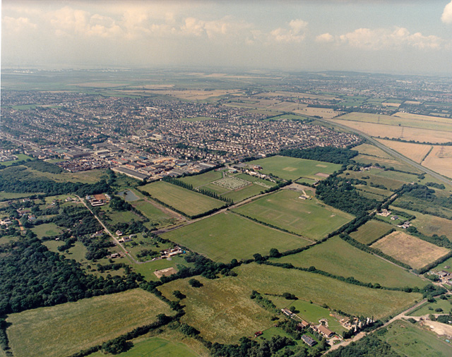
Show on map Photos Aerial view of New Thundersley and Plotlands from the north-east
‹ ›
Weather for this location Next 14 days Nearby places Useful places within 5 km
All Historic
How useful was the information on this page?
id: bc066c1f-6e45-4ae9-91e9-f70111804288
UK green spaces mapped from open public data — so anyone can find the woodland, trail, or nature reserve closest to them.
© 2026 Glade · Made with care for UK green spaces
Wildlife to spot
24,475 records · National Biodiversity Network
▾
Wildlife to spot 24,475 records · National Biodiversity Network Woodpigeon · Magpie · Carrion Crow · Black-headed Gull · Herring Gull +34
Woodpigeon Columba palumbus Magpie Pica pica Carrion Crow Corvus corone Black-headed Gull Chroicocephalus ridibundus Herring Gull Larus argentatus House Sparrow Passer domesticus Goldfinch Carduelis carduelis Robin Erithacus rubecula Jackdaw Coloeus monedula Starling Sturnus vulgaris Green Woodpecker Picus viridis Moorhen Gallinula chloropus Chiffchaff Phylloscopus collybita Swallow Hirundo rustica Greenfinch Chloris chloris Mallard Anas platyrhynchos Kestrel Falco tinnunculus Blue Tit Cyanistes caeruleus Collared Dove Streptopelia decaocto Long-tailed Tit Aegithalos caudatus Canada Goose Branta canadensis Stock Dove Columba oenas Blackbird Turdus merula Wren Troglodytes troglodytes Great Tit Parus major Blackcap Sylvia atricapilla Song Thrush Turdus philomelos Skylark Alauda arvensis Chaffinch Fringilla coelebs Coot Fulica atra Dunnock Prunella modularis Pied Wagtail Motacilla alba Reed Warbler Acrocephalus scirpaceus Great Spotted Woodpecker Dendrocopos major Rock Dove Columba livia Whitethroat Curruca communis Goldcrest Regulus regulus Swift Apus apus Lesser Black-backed Gull Larus fuscus Slow-worm
🐸 Amphibians 1 species
spring
2025 ▾
Common Frog
Common Frog Rana temporaria 🐝 Insects 34 species
summer autumn
2026 ▾
7-spot Ladybird · Speckled Bush-cricket · Roesel's Bush-cricket · Tortoise Bug · Long-winged Cone-head +29
7-spot Ladybird Coccinella septempunctata2025 Speckled Bush-cricket Leptophyes punctatissima2025 Roesel's Bush-cricket Roeseliana roeselii2025 Tortoise Bug Eurygaster testudinaria2025 Long-winged Cone-head Conocephalus fuscus Species observations from the last 10 years via NBN Atlas
2025
2025
Field Grasshopper Chorthippus brunneus2025
Field Grasshopper Chorthippus brunneus2025
Marbled White Melanargia galathea2025
Marbled White Melanargia galathea2025
Dark Bush-cricket Pholidoptera griseoaptera2025
Dark Bush-cricket Pholidoptera griseoaptera2025
Leistus fulvibarbis Leistus fulvibarbis
Leistus fulvibarbis Leistus fulvibarbis
2-spot Ladybird Adalia bipunctata2025
2-spot Ladybird Adalia bipunctata2025
Syrphus ribesii Syrphus ribesii2025
Syrphus ribesii Syrphus ribesii2025
Eristalis pertinax Eristalis pertinax2025
Eristalis pertinax Eristalis pertinax2025
Leopoldius signatus Leopoldius signatus2025
Leopoldius signatus Leopoldius signatus2025
Meadow Grasshopper Pseudochorthippus parallelus2025
Meadow Grasshopper Pseudochorthippus parallelus2025
Dock Bug Coreus marginatus2025
Dock Bug Coreus marginatus2025
Lesser Marsh Grasshopper Chorthippus albomarginatus2025
Lesser Marsh Grasshopper Chorthippus albomarginatus2025
Dyroderes umbraculatus Dyroderes umbraculatus2025
Dyroderes umbraculatus Dyroderes umbraculatus2025
Green Shieldbug Palomena prasina2025
Green Shieldbug Palomena prasina2025
Blue-tailed Damselfly Ischnura elegans2025
Blue-tailed Damselfly Ischnura elegans2025
Black-tailed Skimmer Orthetrum cancellatum2025
Black-tailed Skimmer Orthetrum cancellatum2025
Corizus hyoscyami Corizus hyoscyami2025
Corizus hyoscyami Corizus hyoscyami2025
Rosemary Beetle Chrysolina americana2025
Rosemary Beetle Chrysolina americana2025
Gatekeeper Pyronia tithonus2025
Gatekeeper Pyronia tithonus2025
Large White Pieris brassicae2025
Large White Pieris brassicae2025
Green-veined White Pieris napi2025
Green-veined White Pieris napi2025
Peacock Aglais io2025
Peacock Aglais io2025
Essex Skipper Thymelicus lineola2025
Essex Skipper Thymelicus lineola2025
Hornet Hoverfly Volucella zonaria2025
Hornet Hoverfly Volucella zonaria2025
Cuckoo-Spit Insect Philaenus spumarius2025
Cuckoo-Spit Insect Philaenus spumarius2025
Eupeodes corollae Eupeodes corollae2025
Eupeodes corollae Eupeodes corollae2025
Red-headed Cardinal Beetle Pyrochroa serraticornis2025
Red-headed Cardinal Beetle Pyrochroa serraticornis2025
Cantharis rustica Cantharis rustica2025
Cantharis rustica Cantharis rustica2025
Small Green Nettle Weevil Phyllobius roboretanus2025
Small Green Nettle Weevil Phyllobius roboretanus2025
Dark-edged Bee-fly Bombylius major2025
Dark-edged Bee-fly Bombylius major2025 Events & activities nearby Switch provider to compare local events, tours and bookable activities.
Bookable tours