Culver Wood - Broadleaved woodland
6 ha
Plan your visit
🐶Dogs🦉Wildlife🦅Birds
Public accessFree entryDogs welcome6 ha
Getting here
51.76173, -0.13041
Open directionsv
Visiting this summer
Seasonal nature notes and what to look for now
- 🌞Midsummer — early morning visits most comfortable; look for deer fawns in quieter clearings
- 🐕Early mornings are best for dog walks in summer — visit before 9am to avoid the heat and find quieter trails
- 📍Open access throughout summer — no booking required
🌤️ Visiting this summer
- 🌞Midsummer — early morning visits most comfortable; look for deer fawns in quieter clearings
- 🐕Early mornings are best for dog walks in summer — visit before 9am to avoid the heat and find quieter trails
- 📍Open access throughout summer — no booking required
- £Free to visit — no entry charge
- 🐕Dogs welcome
Dogs allowed — public woodland
Free
Deciduous woodland priority habitat
Free
🦅Bird watching
Strong match
Deciduous woodland — woodpeckers, warblers and woodland birds
Free
Deciduous woodland — fungi, berries and wild garlic
Varies
🍂Seasonal nature
Good match
Broadleaved woodland — spring blossom and autumn colour
Free
Trails nearby
Within roughly 5 km13 signed routes nearby · 9 public paths nearby
Signed route nearbyPublic paths
Red TrailWalking route▾
Named routeRound tripLocal walking route
Short TrailWalking route▾
Named routeListed length 1.3Round tripLocal walking route
Hertfordshire WayWalking route267 km▾
Long distance path
Named routeLength 267 kmRegional walking route
Hertfordshire Chain WalkWalking route▾
Not waymarked
Named routeRegional walking route
New River PathWalking route▾
Named routeRef NRRegional walking route
43 signed routes nearby
Signed route nearby
Route 12Cycling route▾
Named routeRef 12National Cycle Network
Route 61Cycling route34 km▾
Route 61 travels from Maidenhead to Hatfield, Welwyn Garden City and Hertford before arriving near Hoddesdon.
Named routeRef 61Length 34 kmNational Cycle Network
Main RouteCycling route550 m▾
Named routeRef 61Length 550 mNational Cycle NetworkTraffic-freeSurface asphalt
Main RouteCycling route68 m▾
Named routeRef 61Length 68 mNational Cycle NetworkOn-roadSurface asphalt
Main RouteCycling route75 m▾
Named routeRef 61Length 75 mNational Cycle NetworkOn-roadSurface asphalt
Main RouteCycling route59 m▾
Named routeRef 61Length 59 mNational Cycle NetworkTraffic-freeSurface asphalt
9 public paths nearby
Public paths
Breach Lanebridleway · 316 m▾
Public pathbridlewayLength 316 mPath type: service
Photos
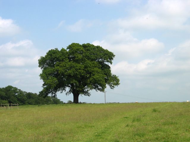
Oak Tree in open access field
Weather for this location
Next 14 daysNearby places
Useful places within 5 km
Own or manage this place?
Claim this listing to keep details accurate, add photos, and highlight what makes it special — free.
Claim this page→How useful was the information on this page?
id: 55d011dd-f6fa-4848-9f00-de6e72881d60
Wildlife to spot
6,012 records · National Biodiversity Network
Wildlife to spot
6,012 records · National Biodiversity Network🐦Birds52 species
summerautumnwinter
2025▾
Robin · Great Tit · Blue Tit · Great Spotted Woodpecker · Wren +47
- RobinErithacus rubecula
- Great TitParus major
- Blue TitCyanistes caeruleus
- Great Spotted WoodpeckerDendrocopos major
- WrenTroglodytes troglodytes
- GoldfinchCarduelis carduelis
- JackdawColoeus monedula
- Long-tailed TitAegithalos caudatus
- Coal TitPeriparus ater
- BlackbirdTurdus merula
- Carrion CrowCorvus corone
- MagpiePica pica
- WoodpigeonColumba palumbus
- NuthatchSitta europaea
- Egyptian GooseAlopochen aegyptiaca
- Song ThrushTurdus philomelos
- Stock DoveColumba oenas
- DunnockPrunella modularis
- GoldcrestRegulus regulus
- TreecreeperCerthia familiaris
- Green WoodpeckerPicus viridis
- BlackcapSylvia atricapilla
- ChaffinchFringilla coelebs
- Grey WagtailMotacilla cinerea
- MallardAnas platyrhynchos
- RookCorvus frugilegus
- Canada GooseBranta canadensis
- JayGarrulus glandarius
- SkylarkAlauda arvensis
- Rock DoveColumba livia
- PheasantPhasianus colchicus
- Common GullLarus canus
- FieldfareTurdus pilaris
- Grey HeronArdea cinerea
- Mandarin DuckAix galericulata
- Mistle ThrushTurdus viscivorus
- GadwallMareca strepera
- Black-headed GullChroicocephalus ridibundus
- TealAnas crecca
- StarlingSturnus vulgaris
- CormorantPhalacrocorax carbo
- RedwingTurdus iliacus
- RavenCorvus corax
- MoorhenGallinula chloropus
- Green SandpiperTringa ochropus
- SwallowHirundo rustica
- House SparrowPasser domesticus
- BullfinchPyrrhula pyrrhula
- WhitethroatCurruca communis
- GreenfinchChloris chloris
- ChiffchaffPhylloscopus collybita
- Garden WarblerSylvia borin
Grey Squirrel · Muntjac · Rabbit · Domestic Dog
- Grey SquirrelSciurus carolinensis
- MuntjacMuntiacus reevesi
- RabbitOryctolagus cuniculus
- Domestic DogCanis lupus subsp. familiaris
🐸Amphibians1 species
spring
2025▾
Great Crested Newt
- Great Crested NewtTriturus cristatus
Issus
🌿Plants15 species
springautumn
2025▾
Bramble · Common Nettle · Ivy · Hawthorn · Hogweed +10
- BrambleRubus fruticosus
- Common NettleUrtica dioica
- IvyHedera helix
- HawthornCrataegus monogyna
- HogweedHeracleum sphondylium
- Wood AvensGeum urbanum
- Cleavers
Species observations from the last 10 years via NBN Atlas
Galium aparine
Galium aparine
Ground-ivyGlechoma hederaceaGround-ivyGlechoma hederaceaBulbous ButtercupRanunculus bulbosusBulbous ButtercupRanunculus bulbosusPendulous SedgeCarex pendulaPendulous SedgeCarex pendulaDog's MercuryMercurialis perennisDog's MercuryMercurialis perennisCow ParsleyAnthriscus sylvestrisCow ParsleyAnthriscus sylvestrisLesser StitchwortStellaria gramineaLesser StitchwortStellaria gramineaLords-and-LadiesArum maculatumLords-and-LadiesArum maculatumCommon ChickweedStellaria mediaCommon ChickweedStellaria mediaEvents & activities nearby
Switch provider to compare local events, tours and bookable activities.