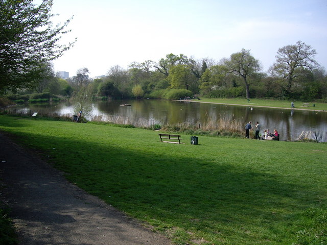
The Moors - Broadleaved woodland
1 ha
Plan your visit
🐶Dogs🦉Wildlife🦅Birds
Public accessFree entryDogs welcome1 ha
Getting here
51.76521, 0.10641
Open directionsv
Visiting this summer
Seasonal nature notes and what to look for now
- ☀️June — canopy now fully closed, creating cool dappled shade even on warm days
- 🐕Early mornings are best for dog walks in summer — visit before 9am to avoid the heat and find quieter trails
- 🅿️Harlow Sport's Center 150m away — 16 car parks within reach
🌤️ Visiting this summer
- ☀️June — canopy now fully closed, creating cool dappled shade even on warm days
- 🐕Early mornings are best for dog walks in summer — visit before 9am to avoid the heat and find quieter trails
- 🅿️Harlow Sport's Center 150m away — 16 car parks within reach
- £Free to visit — no entry charge
- 🐕Dogs welcome
Dogs allowed — public woodland
Free
Deciduous woodland priority habitat
Free
🦅Bird watching
Strong match
Deciduous woodland — woodpeckers, warblers and woodland birds
Free
Deciduous woodland — fungi, berries and wild garlic
Varies
Named hiking route nearby: Netteswell Trail
Free
Trails nearby
Within roughly 5 km9 signed routes nearby · 9 public paths nearby
Signed route nearbyPublic paths
Three Forests WayWalking route96 km▾
Named routeLength 96 kmRound tripRegional walking route
Harcamlow WayWalking route▾
Named routeRef HARRegional walking route
London to Walsingham - stage 02Walking route▾
Named routeRef LW02Local walking route
London to Walsingham - stage 03Walking route▾
Named routeRef LW03Local walking route
Forest WayWalking route▾
Named routeRegional walking route
Toddbrook Pathpublic footpath · 273 m▾
Public pathpublic footpathLength 273 mPath type: footway
41 signed routes nearby
Signed route nearby
EuroVelo 2 - Capitals Route - part United Kingdom 7Cycling route▾
Named routeRef EV2International cycle route
NCN National Route 1Cycling route▾
Named routeRef 1National Cycle Network
Main RouteCycling route140 m▾
Named routeRef 1Length 140 mNational Cycle NetworkOn-roadSurface asphalt
N/ACycling route224 m▾
Named routeLength 224 mNational Cycle NetworkTraffic-freeSurface asphalt
Main RouteCycling route418 m▾
Named routeRef 1Length 418 mNational Cycle NetworkOn-roadSurface asphalt
Main RouteCycling route660 m▾
Named routeRef 1Length 660 mNational Cycle NetworkTraffic-freeSurface asphalt
1 public path nearby
Public paths
No named routes yet. Public paths are shown on the map.
Weather for this location
Next 14 daysNearby places
Useful places within 5 km
Own or manage this place?
Claim this listing to keep details accurate, add photos, and highlight what makes it special — free.
Claim this page→How useful was the information on this page?
id: 40d4691d-49dc-4e27-ad84-bbc4298a5f77
Wildlife to spot
5,552 records · National Biodiversity Network
Wildlife to spot
5,552 records · National Biodiversity Network🐦Birds46 species
summerwinter
2026▾
Woodpigeon · Carrion Crow · Magpie · Lesser Black-backed Gull · Robin +41
- WoodpigeonColumba palumbus
- Carrion CrowCorvus corone2025
- MagpiePica pica2025
- Lesser Black-backed GullLarus fuscus2025
- RobinErithacus rubecula
- JackdawColoeus monedula
- Blue TitCyanistes caeruleus
- Black-headed GullChroicocephalus ridibundus2025
- MoorhenGallinula chloropus2025
- Rock DoveColumba livia2025
- MallardAnas platyrhynchos2025
- Herring GullLarus argentatus2025
- BlackbirdTurdus merula
- WrenTroglodytes troglodytes2025
- GoldfinchCarduelis carduelis2025
- House SparrowPasser domesticus2025
- Great TitParus major2025
- StarlingSturnus vulgaris2025
- GoldcrestRegulus regulus
- DunnockPrunella modularis2025
- Long-tailed TitAegithalos caudatus2025
- Collared DoveStreptopelia decaocto2025
- SwiftApus apus2024
- WoodcockScolopax rusticola
- StonechatSaxicola rubicola2025
- Grey HeronArdea cinerea2025
- TealAnas crecca2025
- Mistle ThrushTurdus viscivorus2025
- Egyptian GooseAlopochen aegyptiaca2025
- Great Spotted WoodpeckerDendrocopos major2025
- Tufted DuckAythya fuligula2025
- Mute SwanCygnus olor2025
- CormorantPhalacrocorax carbo2025
- Great Crested GrebePodiceps cristatus2025
- CootFulica atra2025
- RedwingTurdus iliacus2025
- LapwingVanellus vanellus2025
- Cetti's WarblerCettia cetti2025
- Common GullLarus canus2025
- GadwallMareca strepera2025
- PheasantPhasianus colchicus2025
- Canada GooseBranta canadensis2025
- Little GrebeTachybaptus ruficollis2025
- Tawny OwlStrix aluco2025
- RookCorvus frugilegus2025
- Pied WagtailMotacilla alba yarrellii2024
🦌Mammals2 species
summerautumnwinter
2025▾
Grey Squirrel · Red Fox
- Grey SquirrelSciurus carolinensis
- Red FoxVulpes vulpes
🐸Amphibians1 species
summerautumn
2024▾
Common Frog
- Common FrogRana temporaria
Migrant Hawker · Blue-tailed Damselfly · Azure Damselfly · Syrphus · Large Red Damselfly +17
- Migrant HawkerAeshna mixta
- Blue-tailed DamselflyIschnura elegans
- Azure DamselflyCoenagrion puella
- SyrphusSyrphus
- Large Red DamselflyPyrrhosoma nymphula
- Buff-tailed BumblebeeBombus terrestris2024
- 7-spot Ladybird
Species observations from the last 10 years via NBN Atlas
Coccinella septempunctata
Coccinella septempunctata
Willow Emerald DamselflyChalcolestes viridis2024Willow Emerald DamselflyChalcolestes viridis2024Common Blue DamselflyEnallagma cyathigerum2024Common Blue DamselflyEnallagma cyathigerum2024White-tailed BumblebeeBombus lucorum2024White-tailed BumblebeeBombus lucorum2024Southern Oak Bush-cricketMeconema meridionaleSouthern Oak Bush-cricketMeconema meridionale14-spot LadybirdPropylea quattuordecimpunctata14-spot LadybirdPropylea quattuordecimpunctataVolucella inanisVolucella inanisVolucella inanisVolucella inanisCommon Red Soldier BeetleRhagonycha fulvaCommon Red Soldier BeetleRhagonycha fulvaBanded DemoiselleCalopteryx splendensBanded DemoiselleCalopteryx splendensRose ChaferCetonia aurataRose ChaferCetonia aurataSwollen-thighed BeetleOedemera nobilisSwollen-thighed BeetleOedemera nobilisSphaerophoriaSphaerophoriaSphaerophoriaSphaerophoriaEupeodesEupeodesEupeodesEupeodesCantharis rusticaCantharis rusticaCantharis rusticaCantharis rusticaEmperor DragonflyAnax imperator2024Emperor DragonflyAnax imperator2024Hairy DragonflyBrachytron pratense2024Hairy DragonflyBrachytron pratense2024Events & activities nearby
Switch provider to compare local events, tours and bookable activities.