🌞Midsummer — early morning visits most comfortable; look for deer fawns in quieter clearings
🐕Early mornings are best for dog walks in summer — visit before 9am to avoid the heat and find quieter trails
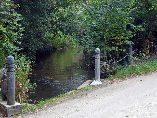
🅿️Parking 446m away — 2 car parks within reach
🌤️ Visiting this summer
🌞Midsummer — early morning visits most comfortable; look for deer fawns in quieter clearings
🐕Early mornings are best for dog walks in summer — visit before 9am to avoid the heat and find quieter trails
🅿️Parking 446m away — 2 car parks within reach
Good to know
£Free to visit — no entry charge
🐕Dogs welcome
🅿️Parking
Best for
6 activities
🐶
Dog walks
Strong match
Dogs allowed — public woodland
Free
🦉
Wildlife
Strong match
Deciduous woodland priority habitat
Free
🦅
Bird watching
Strong match
Deciduous woodland — woodpeckers, warblers and woodland birds
Free
🌿
Foraging
Good match
Deciduous woodland — fungi, berries and wild garlic
Varies
🌲
Forest walks
Good match
Public woodland
Free
🦋
Insect spotting
Good match
Semi-improved grassland — butterflies and wildflowers
Free
Trails nearby
Within roughly 5 km
🚶
Walking
▾
19 signed routes nearby · 7 public paths nearby
Signed route nearbyPublic paths
STOOP Link Path 3 - Stevenage Outer Orbital Path LinkWalking route▾
A link from Stevenage to the STOOP path (at approx 4 o'clock on clockface)
Named route
Old Railway & River LeaWalking route7.9 km▾
After a brief visit to the remains of Wheathampstead railway station, the walk follows the Ayot Greenway (route of the Permanent Way) to Ayot Green. The return journey follows the course of the River Lea.
Named routeLength 7.9 kmRound tripLocal walking route
Wheathampstead to Shaw's Corner Circular Walk, Shaw's CornerWalking route12.2 km▾
Mostly easy walking across established footpaths and fields. There are some steps along the route, and a steep gully at section 2. Assistance dogs only at Shaw's Corner.
Named routeLength 12.2 kmDuration 03:00Round tripLocal walking route
Above the Lea ValleyWalking route6.5 km▾
From quiet woods to expansive views over the Lea valley, this walk includes Gustard Wood at the northern tip of Wheathampstead and the Grade I splendour of Mackerye End.
Named routeLength 6.5 kmRound tripLocal walking route
Hertfordshire WayWalking route267 km▾
Long distance path
Named routeLength 267 kmRegional walking route
🚴
Cycling
▾
76 signed routes nearby
Signed route nearby
Ayot GreenwayCycling route▾
Named route
Route 12Cycling route▾
Named routeRef 12National Cycle Network
Route 61Cycling route34 km▾
Route 61 travels from Maidenhead to Hatfield, Welwyn Garden City and Hertford before arriving near Hoddesdon.
Named routeRef 61Length 34 kmNational Cycle Network