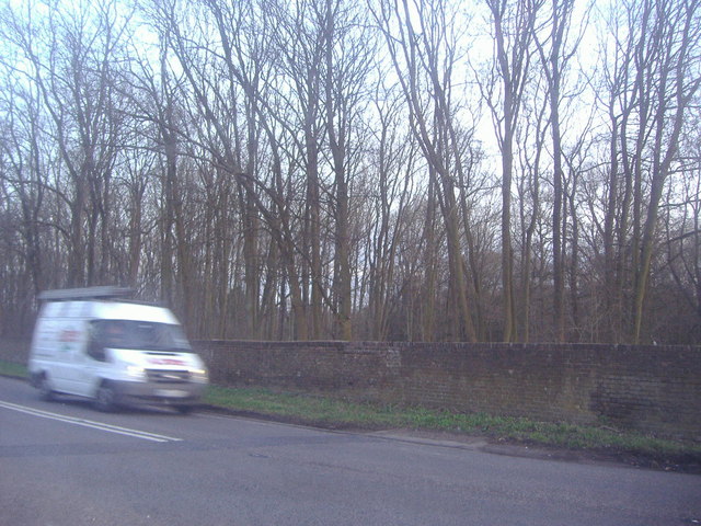
Punyards Wood - Broadleaved woodland
11 ha
🦉Wildlife🦅Birds🌿Foraging
Free entryDogs welcome11 ha
Getting here
51.85460, -0.08633
Open directionsv
Visiting this summer
Seasonal nature notes and what to look for now
- 🌞Midsummer — early morning visits most comfortable; look for deer fawns in quieter clearings
- 🌿Foraging is at its best in summer here
- 🐕Dogs welcome — bring water in summer; the site has enough space to find shade on hot days
🌤️ Visiting this summer
- 🌞Midsummer — early morning visits most comfortable; look for deer fawns in quieter clearings
- 🌿Foraging is at its best in summer here
- 🐕Dogs welcome — bring water in summer; the site has enough space to find shade on hot days
- £Free to visit — no entry charge
- 🐕Dogs welcome
Deciduous woodland priority habitat
Free
🦅Bird watching
Strong match
Deciduous woodland — woodpeckers, warblers and woodland birds
Free
Deciduous woodland — fungi, berries and wild garlic
Varies
🌲Forest walks
Moderate match
Public woodland
Free
Trails nearby
Within roughly 5 km9 signed routes nearby · 6 public paths nearby
Signed route nearbyPublic paths
STOOP Link Path 3 - Stevenage Outer Orbital Path LinkWalking route▾
A link from Stevenage to the STOOP path (at approx 4 o'clock on clockface)
Named route
Hertfordshire WayWalking route267 km▾
Long distance path
Named routeLength 267 kmRegional walking route
Hertfordshire Chain WalkWalking route▾
Not waymarked
Named routeRegional walking route
Circular Walk "Town to Country No 2"Walking route▾
Circular WalkWalking route▾
The Avenuepublic footpath · 7 m▾
Public pathpublic footpathLength 7 mPath type: service
Beehives Drivepublic footpath · 194 m▾
Public pathpublic footpathLength 194 mPath type: service
Bottom Drivepublic footpath · 341 m▾
Public pathpublic footpathLength 341 mPath type: service
5 signed routes nearby
Signed route nearby
Route 61Cycling route34 km▾
Route 61 travels from Maidenhead to Hatfield, Welwyn Garden City and Hertford before arriving near Hoddesdon.
Named routeRef 61Length 34 kmNational Cycle Network
N/ACycling route96 m▾
Named routeLength 96 mNational Cycle NetworkTraffic-freeSurface asphalt
Main RouteCycling route808 m▾
Named routeRef 61Length 808 mNational Cycle NetworkTraffic-freeSurface unsealedfirm
Main RouteCycling route444 m▾
Named routeRef 61Length 444 mNational Cycle NetworkTraffic-freeSurface asphalt
Main RouteCycling route14 m▾
Named routeRef 61Length 14 mNational Cycle NetworkTraffic-freeSurface other
Photos
Ware Road near Watton-at-Stone
Weather for this location
Next 14 daysNearby places
Useful places within 5 km
Own or manage this place?
Claim this listing to keep details accurate, add photos, and highlight what makes it special — free.
Claim this page→How useful was the information on this page?
id: a4c74efc-44ae-4693-9321-da0f0987632b
Wildlife to spot
2,463 records · National Biodiversity Network
Wildlife to spot
2,463 records · National Biodiversity Network🐦Birds50 species
winterautumn
2025▾
Kestrel · Jackdaw · Swift · Carrion Crow · Woodpigeon +45
- KestrelFalco tinnunculus
- JackdawColoeus monedula
- SwiftApus apus2023
- Carrion CrowCorvus corone
- WoodpigeonColumba palumbus
- MagpiePica pica
- RobinErithacus rubecula
- Blue TitCyanistes caeruleus
- MallardAnas platyrhynchos
- Long-tailed TitAegithalos caudatus
- Grey HeronArdea cinerea
- Green WoodpeckerPicus viridis
- Great TitParus major
- MoorhenGallinula chloropus
- Black-headed GullChroicocephalus ridibundus2024
- StarlingSturnus vulgaris2024
- Tufted DuckAythya fuligula
- JayGarrulus glandarius
- GoldfinchCarduelis carduelis
- GadwallMareca strepera
- PheasantPhasianus colchicus
- CootFulica atra
- LapwingVanellus vanellus
- Little EgretEgretta garzetta
- Greylag GooseAnser anser
- House SparrowPasser domesticus2024
- BlackbirdTurdus merula2024
- GoldcrestRegulus regulus2024
- Great Crested GrebePodiceps cristatus
- Egyptian GooseAlopochen aegyptiaca
- Mistle ThrushTurdus viscivorus
- Canada GooseBranta canadensis
- DunnockPrunella modularis
- Lesser Black-backed GullLarus fuscus2024
- KingfisherAlcedo atthis2024
- House MartinDelichon urbicum2024
- ChiffchaffPhylloscopus collybita2024
- Garden WarblerSylvia borin2024
- BlackcapSylvia atricapilla2024
- WrenTroglodytes troglodytes2024
- GreenfinchChloris chloris2024
- Coal TitPeriparus ater2024
- ChaffinchFringilla coelebs2022
- CormorantPhalacrocorax carbo2022
- RookCorvus frugilegus2022
- Grey WagtailMotacilla cinerea2022
- RedwingTurdus iliacus2022
- YellowhammerEmberiza citrinella2022
- Mute SwanCygnus olor2022
- Little GrebeTachybaptus ruficollis2022
Grass Snake · Slow-worm
- Grass SnakeNatrix helvetica
- Slow-wormAnguis fragilis2024
🐝Insects17 species
summerautumn
2025▾
Harlequin Ladybird · Southern Hawker · Marmalade Hoverfly · Broad-bodied Chaser · 7-spot Ladybird +12
- Harlequin LadybirdHarmonia axyridis
- Southern HawkerAeshna cyanea2024
- Marmalade HoverflyEpisyrphus balteatus
- Broad-bodied ChaserLibellula depressa2024
- 7-spot LadybirdCoccinella septempunctata
- 24-spot Ladybird
🌿Plants12 species
springsummerautumn
2025▾
Lords-and-Ladies · Thale Cress · Himalayan Balsam · Traveller's-joy · Pendulous Sedge +7
- Lords-and-LadiesArum maculatum2023
- Thale CressArabidopsis thaliana
- Himalayan BalsamImpatiens glandulifera2024
- Traveller's-joyClematis vitalba2023
- Pendulous SedgeCarex pendula
Species observations from the last 10 years via NBN Atlas
Subcoccinella vigintiquattuorpunctata
Subcoccinella vigintiquattuorpunctata
2-spot LadybirdAdalia bipunctata2-spot LadybirdAdalia bipunctata14-spot LadybirdPropylea quattuordecimpunctata14-spot LadybirdPropylea quattuordecimpunctataVolucella pellucensVolucella pellucensVolucella pellucensVolucella pellucens22-spot LadybirdPsyllobora vigintiduopunctata22-spot LadybirdPsyllobora vigintiduopunctataCoccidula rufaCoccidula rufaCoccidula rufaCoccidula rufaCantharis rusticaCantharis rusticaCantharis rusticaCantharis rusticaBanded DemoiselleCalopteryx splendens2024Banded DemoiselleCalopteryx splendens2024Common Carder BeeBombus pascuorum2023Common Carder BeeBombus pascuorum2023Common WaspVespula vulgaris2023Common WaspVespula vulgaris2023Cheilosia grossaCheilosia grossa2023Cheilosia grossaCheilosia grossa2023Speckled Bush-cricketLeptophyes punctatissima2022Speckled Bush-cricketLeptophyes punctatissima20222023
2023
Giant HogweedHeracleum mantegazzianum2023Giant HogweedHeracleum mantegazzianum2023GooseberryRibes uva-crispa2023GooseberryRibes uva-crispa2023Field-roseRosa arvensis2023Field-roseRosa arvensis2023BluebellHyacinthoides non-scripta2022BluebellHyacinthoides non-scripta2022Goldilocks ButtercupRanunculus auricomus2022Goldilocks ButtercupRanunculus auricomus2022RamsonsAllium ursinum2022RamsonsAllium ursinum2022MistletoeViscum album2022MistletoeViscum album2022Events & activities nearby
Switch provider to compare local events, tours and bookable activities.