The Firs - Broadleaved woodland
1 ha
🐶Dogs🦉Wildlife🦅Birds
Public accessFree entryDogs welcome1 ha
Getting here
51.88602, -0.22576
Open directionsv
Visiting this summer
Seasonal nature notes and what to look for now
- 🌞Midsummer — early morning visits most comfortable; look for deer fawns in quieter clearings
- 🐕Early mornings are best for dog walks in summer — visit before 9am to avoid the heat and find quieter trails
- 📍Open access throughout summer — no booking required
🌤️ Visiting this summer
- 🌞Midsummer — early morning visits most comfortable; look for deer fawns in quieter clearings
- 🐕Early mornings are best for dog walks in summer — visit before 9am to avoid the heat and find quieter trails
- 📍Open access throughout summer — no booking required
- £Free to visit — no entry charge
- 🐕Dogs welcome
Dogs allowed — public woodland
Free
Deciduous woodland priority habitat
Free
🦅Bird watching
Strong match
Deciduous woodland — woodpeckers, warblers and woodland birds
Free
Deciduous woodland — fungi, berries and wild garlic
Varies
Named hiking route nearby: Circular Walk
Free
Trails nearby
Within roughly 5 km20 signed routes nearby · 11 public paths nearby
Signed route nearbyPublic paths
STOOP Link Path 2 - Stevenage Outer Orbital Path LinkWalking route▾
A link from Stevenage to the STOOP path (at approx 3 o'clock on clockface)
Named route
STOOP Link Path 3 - Stevenage Outer Orbital Path LinkWalking route▾
A link from Stevenage to the STOOP path (at approx 4 o'clock on clockface)
Named route
STOOP Link Path 1 - Stevenage Outer Orbital Path LinkWalking route▾
A link from Stevenage to the STOOP path (at approx 2 o'clock on clockface)
Named route
STOOP Link Path 8 - Stevenage Outer Orbital Path LinkWalking route▾
Link from Stevenage to the STOOP path (at approx 11 o'clock on clockface)
Named routeLocal walking route
Woodland TrailWalking route▾
36 signed routes nearby
Signed route nearby
Route 12Cycling route▾
Named routeRef 12National Cycle Network
Recreational Cycle Route 16Cycling route▾
Local circular? cycle route
Named routeLocal cycle route
Chilterns CyclewayCycling route▾
Named routeRound tripRegional cycle route
Main RouteCycling route53 m▾
Named routeRef 12Length 53 mNational Cycle NetworkOn-roadSurface asphalt
Main RouteCycling route769 m▾
Named routeRef 12Length 769 mNational Cycle NetworkOn-roadSurface asphalt
Main RouteCycling route337 m▾
Named routeRef 12Length 337 mNational Cycle NetworkTraffic-freeSurface asphalt
10 public paths nearby
Public paths
Homefield Lanebyway open to all traffic · 15 m▾
Public pathbyway open to all trafficLength 15 mPath type: unclassified
Kitching Lanebyway open to all traffic · 141 m▾
Public pathbyway open to all trafficLength 141 mSurface groundPath type: track
Kitching Lanebyway open to all traffic · 393 m▾
Public pathbyway open to all trafficLength 393 mSurface compactedPath type: track
Photos
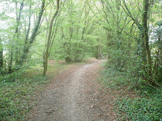
Bridleway through a strip of woodland, Langley
Weather for this location
Next 14 daysNearby places
Useful places within 5 km
Own or manage this place?
Claim this listing to keep details accurate, add photos, and highlight what makes it special — free.
Claim this page→How useful was the information on this page?
id: aa19500d-50e7-4ee5-8ea6-243e01d858e3
Wildlife to spot
32,759 records · National Biodiversity Network
Wildlife to spot
32,759 records · National Biodiversity Network🐦Birds48 species
summerautumnwinter
2026▾
Woodpigeon · Carrion Crow · Blackbird · Wren · Goldfinch +43
- WoodpigeonColumba palumbus2025
- Carrion CrowCorvus corone2025
- BlackbirdTurdus merula2025
- WrenTroglodytes troglodytes2025
- GoldfinchCarduelis carduelis2025
- PheasantPhasianus colchicus2025
- RobinErithacus rubecula2025
- Blue TitCyanistes caeruleus2025
- Great TitParus major2025
- GreenfinchChloris chloris2025
- Black-headed GullChroicocephalus ridibundus2025
- BlackcapSylvia atricapilla2025
- Long-tailed TitAegithalos caudatus2025
- GoldcrestRegulus regulus2025
- NuthatchSitta europaea2025
- MagpiePica pica2025
- Rock DoveColumba livia2025
- RookCorvus frugilegus2025
- DunnockPrunella modularis2025
- ChiffchaffPhylloscopus collybita2025
- Marsh TitPoecile palustris2025
- Great Spotted WoodpeckerDendrocopos major2025
- StarlingSturnus vulgaris2025
- JackdawColoeus monedula2025
- FieldfareTurdus pilaris
- RedwingTurdus iliacus
- SkylarkAlauda arvensis2025
- TreecreeperCerthia familiaris2025
- ChaffinchFringilla coelebs2025
- JayGarrulus glandarius2025
- Green WoodpeckerPicus viridis2025
- Canada GooseBranta canadensis2025
- WhitethroatCurruca communis2025
- Collared DoveStreptopelia decaocto2025
- Stock DoveColumba oenas2025
- Lesser Black-backed GullLarus fuscus2025
- MallardAnas platyrhynchos2025
- SiskinSpinus spinus2025
- Meadow PipitAnthus pratensis2025
- Herring GullLarus argentatus2025
- LinnetLinaria cannabina2025
- House SparrowPasser domesticus2025
- Garden WarblerSylvia borin2025
- Song ThrushTurdus philomelos2025
- SwiftApus apus2025
- Coal TitPeriparus ater2025
- Lesser WhitethroatCurruca curruca2025
- MoorhenGallinula chloropus2025
Muntjac · Fallow Deer · Grey Squirrel · Brown Hare
- MuntjacMuntiacus reevesi
- Fallow DeerDama dama
- Grey SquirrelSciurus carolinensis
- Brown HareLepus europaeus
7-spot Ladybird · Cream-streaked Ladybird · Sallow Pea-galler · Harlequin Ladybird · Hairy Shieldbug +6
- 7-spot LadybirdCoccinella septempunctata
- Cream-streaked LadybirdHarmonia quadripunctata
- Sallow Pea-gallerEuura pedunculi
- Harlequin LadybirdHarmonia axyridis
- Hairy ShieldbugDolycoris baccarum
- Orange LadybirdHalyzia sedecimguttata
- Cramp-Ball Fungus Weevil
🌿Plants2 species
summerautumn
2025▾
Heath Star Moss · Hairy St John's-wort
- Heath Star MossCampylopus introflexus
- Hairy St John's-wortHypericum hirsutum
Species observations from the last 10 years via NBN Atlas
Platyrhinus resinosus
Platyrhinus resinosus
Southern HawkerAeshna cyaneaSouthern HawkerAeshna cyaneaBrown HawkerAeshna grandisBrown HawkerAeshna grandis14-spot LadybirdPropylea quattuordecimpunctata14-spot LadybirdPropylea quattuordecimpunctataDock BugCoreus marginatusDock BugCoreus marginatusEvents & activities nearby
Switch provider to compare local events, tours and bookable activities.