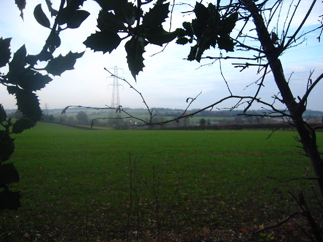
Sloggar's Wood - Broadleaved woodland
3 ha
Plan your visit
🐶Dogs🦉Wildlife🦅Birds
Public accessFree entryDogs welcome3 ha
Getting here
51.94127, -0.12702
Open directionsv
Visiting this summer
Seasonal nature notes and what to look for now
- 🌞Midsummer — early morning visits most comfortable; look for deer fawns in quieter clearings
- 🐕Early mornings are best for dog walks in summer — visit before 9am to avoid the heat and find quieter trails
- 📍Open access throughout summer — no booking required
🌤️ Visiting this summer
- 🌞Midsummer — early morning visits most comfortable; look for deer fawns in quieter clearings
- 🐕Early mornings are best for dog walks in summer — visit before 9am to avoid the heat and find quieter trails
- 📍Open access throughout summer — no booking required
- £Free to visit — no entry charge
- 🐕Dogs welcome
Dogs allowed — public woodland
Free
Deciduous woodland priority habitat
Free
🦅Bird watching
Strong match
Deciduous woodland — woodpeckers, warblers and woodland birds
Free
Deciduous woodland — fungi, berries and wild garlic
Varies
Named hiking route nearby: Weston Golden Jubilee Walk
Free
Trails nearby
Within roughly 5 km15 signed routes nearby · 4 public paths nearby
Signed route nearbyPublic paths
STOOP Link Path 2 - Stevenage Outer Orbital Path LinkWalking route▾
A link from Stevenage to the STOOP path (at approx 3 o'clock on clockface)
Named route
STOOP Link Path 1 - Stevenage Outer Orbital Path LinkWalking route▾
A link from Stevenage to the STOOP path (at approx 2 o'clock on clockface)
Named route
STOOP Link Path 8 - Stevenage Outer Orbital Path LinkWalking route▾
Link from Stevenage to the STOOP path (at approx 11 o'clock on clockface)
Named routeLocal walking route
Icknield Way PathWalking route169 km▾
long distance footpath 169 km
Named routeLength 169 kmRegional walking route
Woodland TrailWalking route▾
12 signed routes nearby
Signed route nearby
Route 12Cycling route▾
Named routeRef 12National Cycle Network
recreational cycle route 10Cycling route▾
Named routeLocal cycle route
Main RouteCycling route410 m▾
Named routeRef 12Length 410 mNational Cycle NetworkTraffic-freeSurface asphalt
Main RouteCycling route2.5 km▾
Named routeRef 12Length 2.5 kmNational Cycle NetworkTraffic-freeSurface asphalt
Main RouteCycling route403 m▾
Named routeRef 12Length 403 mNational Cycle NetworkTraffic-freeSurface unsealedfirm
Main RouteCycling route330 m▾
Named routeRef 12Length 330 mNational Cycle NetworkOn-roadSurface asphalt
8 public paths nearby
Public paths
Lolleywood Lanebridleway · 1.3 km▾
Public pathbridlewayLength 1.3 kmPath type: bridleway
Weather for this location
Next 14 daysNearby places
Useful places within 5 km
Own or manage this place?
Claim this listing to keep details accurate, add photos, and highlight what makes it special — free.
Claim this page→How useful was the information on this page?
id: 853129a4-75c2-4e98-8354-fbb077036bba
Events & activities nearby
Switch provider to compare local events, tours and bookable activities.
Wildlife to spot
8,922 records · National Biodiversity Network
Wildlife to spot
8,922 records · National Biodiversity Network🐦Birds23 species
winterspring
2026▾
Blue Tit · Long-tailed Tit · Goldfinch · Magpie · Fieldfare +18
- Blue TitCyanistes caeruleus
- Long-tailed TitAegithalos caudatus
- GoldfinchCarduelis carduelis
- MagpiePica pica
- FieldfareTurdus pilaris
- MallardAnas platyrhynchos
- RobinErithacus rubecula
- Great TitParus major
- KestrelFalco tinnunculus
- WoodpigeonColumba palumbus
- RedwingTurdus iliacus
- DunnockPrunella modularis
- Great Spotted WoodpeckerDendrocopos major
- JayGarrulus glandarius2025
- ChaffinchFringilla coelebs
- GreenfinchChloris chloris
- GoldcrestRegulus regulus
- JackdawColoeus monedula
- Coal TitPeriparus ater
- MoorhenGallinula chloropus
- Tawny OwlStrix aluco
- BlackbirdTurdus merula2025
- SwallowHirundo rustica2025
🐸Amphibians3 species
wintersummerautumn
2026▾
Common Toad · Smooth Newt · Common Frog
- Common ToadBufo bufo2025
- Smooth NewtLissotriton vulgaris
- Common FrogRana temporaria2025
🐝Insects29 species
summerautumn
2026▾
Red-legged Shieldbug · 2-spot Ladybird · Hairy Shieldbug · Cuckoo-Spit Insect · Vine Weevil +24
- Red-legged ShieldbugPentatoma rufipes2025
- 2-spot LadybirdAdalia bipunctata
- Hairy ShieldbugDolycoris baccarum2025
- Cuckoo-Spit InsectPhilaenus spumarius2025
- Vine WeevilOtiorhynchus sulcatus
- Corizus hyoscyami
Species observations from the last 10 years via NBN Atlas
Corizus hyoscyami2025
Corizus hyoscyami2025
Toxonevra muliebrisToxonevra muliebris2025Toxonevra muliebrisToxonevra muliebris2025SphaerophoriaSphaerophoria2025SphaerophoriaSphaerophoria2025Hawthorn ShieldbugAcanthosoma haemorrhoidale2025Hawthorn ShieldbugAcanthosoma haemorrhoidale2025Oak Bush-cricketMeconema thalassinum2025Oak Bush-cricketMeconema thalassinum2025Helophilus pendulusHelophilus pendulus2025Helophilus pendulusHelophilus pendulus2025Green ShieldbugPalomena prasina2025Green ShieldbugPalomena prasina2025Ptinus sexpunctatusPtinus sexpunctatusPtinus sexpunctatusPtinus sexpunctatusHarlequin LadybirdHarmonia axyridis2025Harlequin LadybirdHarmonia axyridis2025Eupeodes lunigerEupeodes luniger2025Eupeodes lunigerEupeodes luniger2025Baccha elongataBaccha elongata2025Baccha elongataBaccha elongata2025Batman HoverflyMyathropa florea2025Batman HoverflyMyathropa florea202522-spot LadybirdPsyllobora vigintiduopunctata202522-spot LadybirdPsyllobora vigintiduopunctata2025EumerusEumerus2025EumerusEumerus2025Mocydia croceaMocydia crocea2025Mocydia croceaMocydia crocea2025Hollyhock WeevilRhopalapion longirostre2025Hollyhock WeevilRhopalapion longirostre2025Acorn WeevilCurculio glandium2025Acorn WeevilCurculio glandium202516-spot LadybirdTytthaspis sedecimpunctata202516-spot LadybirdTytthaspis sedecimpunctata2025Adonis' LadybirdHippodamia variegata2025Adonis' LadybirdHippodamia variegata2025Box BugGonocerus acuteangulatus2025Box BugGonocerus acuteangulatus2025Xanthogramma pedissequumXanthogramma pedissequum2025Xanthogramma pedissequumXanthogramma pedissequum2025Speckled Bush-cricketLeptophyes punctatissima2025Speckled Bush-cricketLeptophyes punctatissima2025Long-winged Cone-headConocephalus fuscus2025Long-winged Cone-headConocephalus fuscus2025ChrysotoxumChrysotoxum2025ChrysotoxumChrysotoxum2025