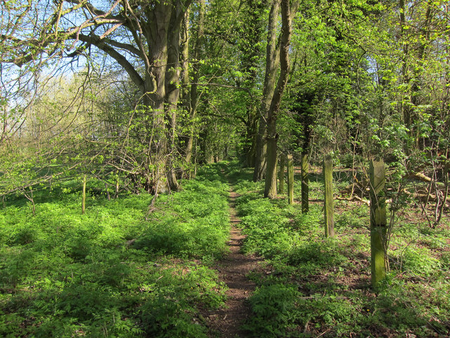
Cinder Path Belt - Broadleaved woodland
4 ha
Plan your visit
🐶Dogs🌿Foraging🦉Wildlife
Public accessFree entryDogs welcome4 ha
Getting here
52.19061, 0.31811
Open directionsv
Visiting this summer
Seasonal nature notes and what to look for now
- ☀️June — canopy now fully closed, creating cool dappled shade even on warm days
- 🐕Early mornings are best for dog walks in summer — visit before 9am to avoid the heat and find quieter trails
- 🅿️SMBSSC Car Park 421m away — 8 car parks within reach
🌤️ Visiting this summer
- ☀️June — canopy now fully closed, creating cool dappled shade even on warm days
- 🐕Early mornings are best for dog walks in summer — visit before 9am to avoid the heat and find quieter trails
- 🅿️SMBSSC Car Park 421m away — 8 car parks within reach
- £Free to visit — no entry charge
- 🐕Dogs welcome
Dogs allowed — public woodland
Free
Traditional orchard — seasonal fruit, fungi and wild plants
Varies
Deciduous woodland priority habitat
Free
🦅Bird watching
Strong match
Deciduous woodland — woodpeckers, warblers and woodland birds
Free
🦋Insect spotting
Good match
Traditional orchard — specialist orchard insects and lichens
Free
Trails nearby
Within roughly 5 km3 signed routes nearby · 4 public paths nearby
Signed route nearbyPublic paths
Icknield Way PathWalking route169 km▾
long distance footpath 169 km
Named routeLength 169 kmRegional walking route
Harcamlow WayWalking route▾
Named routeRef HARRegional walking route
Stour Valley Path part 1Walking route▾
Named routeRegional walking route
13 signed routes nearby
Signed route nearby
NCN 51Cycling route▾
Named routeRef 51National Cycle Network
Cambridge secondary cycle networkCycling route▾
Named routeLocal cycle route
Main RouteCycling route699 m▾
Named routeRef 51Length 699 mNational Cycle NetworkOn-roadSurface asphalt
Main RouteCycling route305 m▾
Named routeRef 51Length 305 mNational Cycle NetworkTraffic-freeSurface asphalt
Main RouteCycling route1.7 km▾
Named routeRef 51Length 1.7 kmNational Cycle NetworkTraffic-freeSurface asphalt
N/ACycling route375 m▾
Named routeLength 375 mNational Cycle NetworkOn-roadSurface asphalt
1 signed route nearby
Signed route nearby
Icknield Way Cycle TrailMountain bike route226 km▾
This is the off-road or mountain cycling route of the Icknield Way Trail.
Named routeLength 226 kmRegional cycle route
1 public path nearby
Public paths
Westley Roadbyway open to all traffic · 661 m▾
Public pathbyway open to all trafficLength 661 mSurface unpavedPath type: unclassified
Weather for this location
Next 14 daysNearby places
Useful places within 5 km
Own or manage this place?
Claim this listing to keep details accurate, add photos, and highlight what makes it special — free.
Claim this page→How useful was the information on this page?
id: 88e6e5fe-5107-4337-8621-04f9d469f14f
Events & activities nearby
Switch provider to compare local events, tours and bookable activities.
Wildlife to spot
3,549 records · National Biodiversity Network
Wildlife to spot
3,549 records · National Biodiversity Network🐦Birds48 species
springsummer
2025▾
Corn Bunting · Red-legged Partridge · Wigeon · Kestrel · Pheasant +43
- Corn BuntingEmberiza calandra2024
- Red-legged PartridgeAlectoris rufa
- WigeonMareca penelope
- KestrelFalco tinnunculus
- PheasantPhasianus colchicus2024
- ShovelerSpatula clypeata
- WoodpigeonColumba palumbus2024
- SkylarkAlauda arvensis2024
- ChiffchaffPhylloscopus collybita2024
- Blue TitCyanistes caeruleus2024
- Carrion CrowCorvus corone2024
- BlackbirdTurdus merula2024
- RobinErithacus rubecula2024
- WrenTroglodytes troglodytes2024
- Great TitParus major2024
- WhitethroatCurruca communis2024
- LinnetLinaria cannabina2024
- DunnockPrunella modularis2024
- Lesser WhitethroatCurruca curruca2024
- BlackcapSylvia atricapilla2024
- MagpiePica pica2024
- Reed BuntingEmberiza schoeniclus2024
- FieldfareTurdus pilaris2024
- SwallowHirundo rustica2023
- Song ThrushTurdus philomelos2024
- Grey PartridgePerdix perdix2024
- ChaffinchFringilla coelebs2024
- WheatearOenanthe oenanthe2024
- Coal TitPeriparus ater2023
- JackdawColoeus monedula2022
- YellowhammerEmberiza citrinella2022
- Yellow-legged GullLarus michahellis
- Yellow WagtailMotacilla flava2024
- CuckooCuculus canorus2024
- Pied WagtailMotacilla alba2024
- Canada GooseBranta canadensis2024
- Lesser Black-backed GullLarus fuscus2024
- Long-tailed TitAegithalos caudatus2024
- Stock DoveColumba oenas2024
- PochardAythya ferina2024
- MoorhenGallinula chloropus2023
- Tawny OwlStrix aluco2023
- Rock DoveColumba livia2023
- GreenfinchChloris chloris2023
- Black-headed GullChroicocephalus ridibundus2022
- Common GullLarus canus2022
- QuailCoturnix coturnix2022
- Great Spotted WoodpeckerDendrocopos major2022
🦌Mammals9 species
springsummer
2025▾
Brown Hare · Fallow Deer · Badger · Muntjac · Rabbit +4
- Brown HareLepus europaeus
- Fallow DeerDama dama2023
- BadgerMeles meles
- MuntjacMuntiacus reevesi2024
- RabbitOryctolagus cuniculus2024
- Grey SquirrelSciurus carolinensis
Orange-footed Furrow Bee · Green Leaf Weevil · Field Grasshopper · Cramp-Ball Fungus Weevil · Liparus coronatus
- Orange-footed Furrow BeeLasioglossum xanthopus2024
- Green Leaf WeevilPhyllobius maculicornis
- Field GrasshopperChorthippus brunneus2024
- Cramp-Ball Fungus WeevilPlatyrhinus resinosus2022
- Liparus coronatusLiparus coronatus2022
Lizard Orchid
- Lizard OrchidHimantoglossum hircinum
Species observations from the last 10 years via NBN Atlas
2023
2023
WeaselMustela nivalis2024WeaselMustela nivalis2024Red FoxVulpes vulpes2024Red FoxVulpes vulpes2024Roe DeerCapreolus capreolus2022Roe DeerCapreolus capreolus2022