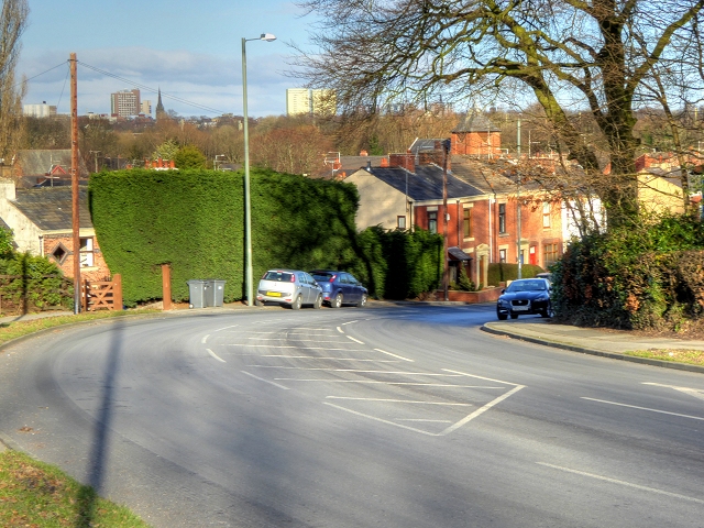
Oaks Wood - Broadleaved woodland
1 ha
Plan your visit
🐶Dogs🦉Wildlife🦅Birds
Public accessFree entryDogs welcome1 ha
Getting here
53.74179, -2.71209
Open directionsv
Visiting this summer
Seasonal nature notes and what to look for now
- 🌞Midsummer — early morning visits most comfortable; look for deer fawns in quieter clearings
- 🐕Early mornings are best for dog walks in summer — visit before 9am to avoid the heat and find quieter trails
- 🅿️Parking nearby — easy to reach by car
🌤️ Visiting this summer
- 🌞Midsummer — early morning visits most comfortable; look for deer fawns in quieter clearings
- 🐕Early mornings are best for dog walks in summer — visit before 9am to avoid the heat and find quieter trails
- 🅿️Parking nearby — easy to reach by car
- £Free to visit — no entry charge
- 🐕Dogs welcome
Dogs allowed — public woodland
Free
Deciduous woodland priority habitat
Free
🦅Bird watching
Strong match
Deciduous woodland — woodpeckers, warblers and woodland birds
Free
Deciduous woodland — fungi, berries and wild garlic
Varies
Trails nearby
Within roughly 5 km2 signed routes nearby · 15 public paths nearby
Signed route nearbyPublic paths
Ribble WayWalking route114 km▾
The Ribble Way follows the valley of the River Ribble from the mouth to the source near to the Pennine Way National Trail on Gayle Moor.
Named routeLength 114 kmRegional walking route
Preston Guild WheelWalking route▾
Relation for walking route. The Cycling relation is separately mapped as NCN 622
Named routeRound tripLocal walking route
Ridge Waypublic footpath · 27 m▾
Public pathpublic footpathLength 27 mPath type: residential
Marshall's Closepublic footpath · 43 m▾
Public pathpublic footpathLength 43 mPath type: residential
Park Roadpublic footpath · 62 m▾
Public pathpublic footpathLength 62 mPath type: residential
226 signed routes nearby
Signed route nearby
Penwortham to LeylandCycling route▾
Named routeLocal cycle route
NCN 622 Preston Guild WheelCycling route▾
Named routeRef 622National Cycle Network
Route 62Cycling route▾
Named routeRef 62National Cycle Network
Route 6Cycling route▾
Named routeRef 6National Cycle Network
Route 55Cycling route▾
Named routeRef 55National Cycle Network
Main RouteCycling route295 m▾
Named routeRef 55Length 295 mNational Cycle NetworkTraffic-freeSurface asphalt
8 public paths nearby
Public paths
Stricklands Lanebridleway · 182 m▾
Public pathbridlewayLength 182 mPath type: residential
Hill Road Southbridleway · 135 m▾
Public pathbridlewayLength 135 mPath type: tertiary
Stricklands Lanebridleway · 125 m▾
Public pathbridlewayLength 125 mPath type: residential
Photos
Higher Penwortham, Marshalls Brow
Weather for this location
Next 14 daysNearby places
Useful places within 5 km
Own or manage this place?
Claim this listing to keep details accurate, add photos, and highlight what makes it special — free.
Claim this page→How useful was the information on this page?
id: 7eb4807a-615e-4024-9247-cb2cac1710f1
Wildlife to spot
45,512 records · National Biodiversity Network
Wildlife to spot
45,512 records · National Biodiversity Network🐦Birds39 species
autumnwinter
2026▾
Woodpigeon · Black-headed Gull · Carrion Crow · Magpie · Jackdaw +34
- WoodpigeonColumba palumbus
- Black-headed GullChroicocephalus ridibundus
- Carrion CrowCorvus corone2025
- MagpiePica pica
- JackdawColoeus monedula2025
- Rock DoveColumba livia2025
- Blue TitCyanistes caeruleus
- RobinErithacus rubecula
- TealAnas crecca
- Coal TitPeriparus ater2025
- Long-tailed TitAegithalos caudatus2025
- BlackbirdTurdus merula2025
- Great TitParus major2025
- MallardAnas platyrhynchos2025
- Grey HeronArdea cinerea
- DunnockPrunella modularis2025
- Herring GullLarus argentatus2025
- MoorhenGallinula chloropus2025
- GoldfinchCarduelis carduelis2025
- NuthatchSitta europaea2025
- Great Spotted WoodpeckerDendrocopos major2025
- Song ThrushTurdus philomelos2025
- House SparrowPasser domesticus2025
- WrenTroglodytes troglodytes2025
- TreecreeperCerthia familiaris2025
- Collared DoveStreptopelia decaocto
- StarlingSturnus vulgaris2025
- BlackcapSylvia atricapilla2025
- GoldcrestRegulus regulus2025
- BullfinchPyrrhula pyrrhula2025
- Pied WagtailMotacilla alba2025
- Stock DoveColumba oenas2025
- GreenfinchChloris chloris2025
- ChaffinchFringilla coelebs2025
- JayGarrulus glandarius2025
- Pica pica picaPica pica pica2025
- Falco tinnunculus tinnunculusFalco tinnunculus tinnunculus2025
- KestrelFalco tinnunculus2025
- Tawny OwlStrix aluco2025
🦌Mammals3 species
autumnwinter
2025▾
Grey Squirrel · Mole · Brown Rat
- Grey SquirrelSciurus carolinensis
- MoleTalpa europaea
- Brown RatRattus norvegicus
🐸Amphibians1 species
winterautumn
2026▾
Common Frog
- Common FrogRana temporaria
🐝Insects3 species
springautumn
2026▾
Western Honey Bee · Buff-tailed Bumblebee · German Wasp
- Western Honey BeeApis mellifera2025
- Buff-tailed BumblebeeBombus terrestris
- German WaspVespula germanica2025
🌿Plants44 species
summerautumn
2026▾
Himalayan Balsam · Coltsfoot · Lesser Celandine · Creeping Thistle · Chicory +39
- Himalayan BalsamImpatiens glandulifera2025
- ColtsfootTussilago farfara
- Lesser CelandineFicaria verna
- Creeping ThistleCirsium arvense2025
- ChicoryCichorium intybus2025
- BorageBorago officinalis
Species observations from the last 10 years via NBN Atlas
2025
2025
Dog's MercuryMercurialis perennisDog's MercuryMercurialis perennisCommon WhitlowgrassErophila vernaCommon WhitlowgrassErophila vernaPrimrosePrimula vulgarisPrimrosePrimula vulgarisHazelCorylus avellanaHazelCorylus avellanaEarly CrocusCrocus tommasinianusEarly CrocusCrocus tommasinianusCapillary Thread-mossBryum capillareCapillary Thread-mossBryum capillareDaisyBellis perennisDaisyBellis perennisAnnual Meadow-grassPoa annuaAnnual Meadow-grassPoa annuaPetty SpurgeEuphorbia peplusPetty SpurgeEuphorbia peplusSenecio vulgaris subsp. vulgarisSenecio vulgaris subsp. vulgarisSenecio vulgaris subsp. vulgarisSenecio vulgaris subsp. vulgarisDandelionTaraxacumDandelionTaraxacumShepherd's-purseCapsella bursa-pastorisShepherd's-purseCapsella bursa-pastorisPot MarigoldCalendula officinalis2025Pot MarigoldCalendula officinalis2025Californian PoppyEschscholzia californica2025Californian PoppyEschscholzia californica2025Black NightshadeSolanum nigrum2025Black NightshadeSolanum nigrum2025Purple ToadflaxLinaria purpurea2025Purple ToadflaxLinaria purpurea2025Common NettleUrtica dioica2025Common NettleUrtica dioica2025Creeping ButtercupRanunculus repens2025Creeping ButtercupRanunculus repens2025Guelder-roseViburnum opulus2025Guelder-roseViburnum opulus2025Large BindweedCalystegia silvatica2025Large BindweedCalystegia silvatica2025Spotted-laurelAucuba japonica2025Spotted-laurelAucuba japonica2025Boston-ivyParthenocissus tricuspidata2025Boston-ivyParthenocissus tricuspidata2025Mexican FleabaneErigeron karvinskianus2025Mexican FleabaneErigeron karvinskianus2025FatsiaFatsia japonica2025FatsiaFatsia japonica2025Ivy-leaved ToadflaxCymbalaria muralis2025Ivy-leaved ToadflaxCymbalaria muralis2025PolypodyPolypodium vulgare2025PolypodyPolypodium vulgare2025YarrowAchillea millefolium2025YarrowAchillea millefolium2025HogweedHeracleum sphondylium2025HogweedHeracleum sphondylium2025Bush VetchVicia sepium2025Bush VetchVicia sepium2025Annual Wall-rocketDiplotaxis muralis2025Annual Wall-rocketDiplotaxis muralis2025Traveller's-joyClematis vitalba2025Traveller's-joyClematis vitalba2025CornflowerCentaurea cyanus2025CornflowerCentaurea cyanus2025Chinese BrambleRubus tricolor2025Chinese BrambleRubus tricolor2025Common Bird's-foot-trefoilLotus corniculatus2025Common Bird's-foot-trefoilLotus corniculatus2025Japanese KnotweedReynoutria japonica2025Japanese KnotweedReynoutria japonica2025Rubus newbouldiiRubus newbouldii2025Rubus newbouldiiRubus newbouldii2025Alsike CloverTrifolium hybridum2025Alsike CloverTrifolium hybridum2025Rubus tuberculatusRubus tuberculatus2025Rubus tuberculatusRubus tuberculatus2025Events & activities nearby
Switch provider to compare local events, tours and bookable activities.