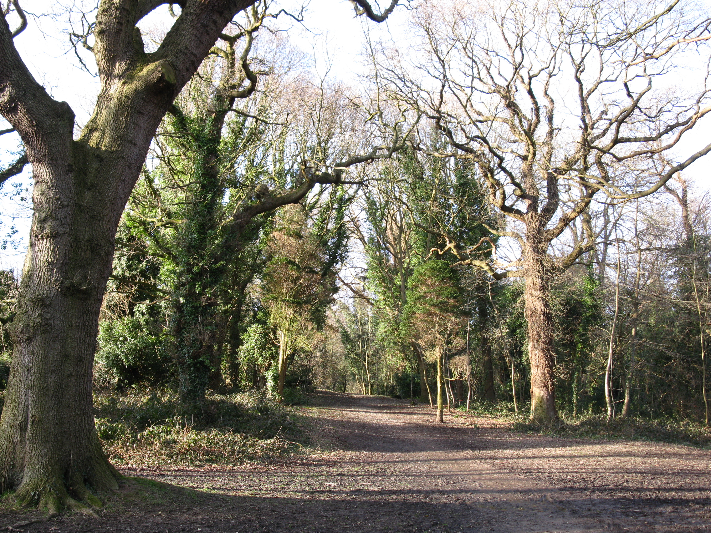
Crane Wood - Broadleaved woodland
12 ha
Plan your visit
🐶Dogs🦉Wildlife🦅Birds
Public accessFree entryDogs welcome12 ha
Getting here
54.01865, -2.80682
Open directionsv
Visiting this summer
Seasonal nature notes and what to look for now
- 🌞Midsummer — early morning visits most comfortable; look for deer fawns in quieter clearings
- 🐕Early mornings are best for dog walks in summer — visit before 9am to avoid the heat and find quieter trails
- 🅿️Parking 478m away — 2 car parks within reach
🌤️ Visiting this summer
- 🌞Midsummer — early morning visits most comfortable; look for deer fawns in quieter clearings
- 🐕Early mornings are best for dog walks in summer — visit before 9am to avoid the heat and find quieter trails
- 🅿️Parking 478m away — 2 car parks within reach
- £Free to visit — no entry charge
- 🐕Dogs welcome
Dogs allowed — public woodland
Free
Deciduous woodland priority habitat
Free
🦅Bird watching
Strong match
Deciduous woodland — woodpeckers, warblers and woodland birds
Free
Deciduous woodland — fungi, berries and wild garlic
Varies
🍂Seasonal nature
Good match
Broadleaved woodland — spring blossom and autumn colour
Free
Trails nearby
Within roughly 5 km3 signed routes nearby · 13 public paths nearby
Signed route nearbyPublic paths
Lune Valley RambleWalking route▾
Named routeRegional walking route
Lancashire Coastal WayWalking route▾
Named routeListed length 220kmRegional walking route
Wyre Way (Garstang to Abbeystead)Walking route▾
Named routePoint-to-pointRegional walking route
Broken Back Lanepublic footpath · 50 m▾
Public pathpublic footpathLength 50 mSurface compactedPath type: unclassified
Carr Lanepublic footpath · 111 m▾
Public pathpublic footpathLength 111 mSurface asphaltPath type: unclassified
Carr Lanepublic footpath · 12 m▾
Public pathpublic footpathLength 12 mSurface asphaltPath type: unclassified
64 signed routes nearby
Signed route nearby
Route 6Cycling route▾
Named routeRef 6National Cycle Network
Lancashire Cycleway (Northern Loop)Cycling route▾
Named routeRef 90Regional cycle route
City LoopCycling route▾
Named routeLocal cycle route
University Cycle RoutesCycling route▾
Named routeLocal cycle route
Route 69Cycling route▾
Named routeRef 69National Cycle Network
Way of the Roses Cycle RouteCycling route▾
Named routeRef WoRNational Cycle Network
7 public paths nearby
Public paths
Cinder Lanebridleway · 209 m▾
Public pathbridlewayLength 209 mSurface earthPath type: bridleway
Cinder Lanebridleway · 150 m▾
Public pathbridlewayLength 150 mSurface compactedPath type: track
Uggle Lanebridleway · 19 m▾
Public pathbridlewayLength 19 mSurface concretePath type: bridleway
Uggle Lanebridleway · 7 m▾
Public pathbridlewayLength 7 mSurface compactedPath type: bridleway
Uggle Lanebridleway · 142 m▾
Public pathbridlewayLength 142 mSurface earthPath type: bridleway
Photos
Old Roar Gill and Coronation Wood
Weather for this location
Next 14 daysNearby places
Useful places within 5 km
Own or manage this place?
Claim this listing to keep details accurate, add photos, and highlight what makes it special — free.
Claim this page→How useful was the information on this page?
id: 4bfb193f-1edf-45d7-8236-6fce2f328d20
Events & activities nearby
Switch provider to compare local events, tours and bookable activities.
Wildlife to spot
17,085 records · National Biodiversity Network
Wildlife to spot
17,085 records · National Biodiversity NetworkMallard · Treecreeper · Goldcrest · Stock Dove · Woodpigeon +11
- MallardAnas platyrhynchos
- TreecreeperCerthia familiaris
- GoldcrestRegulus regulus
- Stock DoveColumba oenas2025
- WoodpigeonColumba palumbus2025
- RobinErithacus rubecula2025
- Song ThrushTurdus philomelos2025
- Long-tailed TitAegithalos caudatus2025
- JayGarrulus glandarius2025
- GoldfinchCarduelis carduelis2025
- Great TitParus major2025
- Mistle ThrushTurdus viscivorus2025
- WrenTroglodytes troglodytes2025
- Coal TitPeriparus ater2025
- NuthatchSitta europaea2025
- BlackbirdTurdus merula2025
🦌Mammals8 species
winterspring
2026▾
Mole · Rabbit · Grey Squirrel · Wood Mouse · Brown Rat +3
- MoleTalpa europaea
- RabbitOryctolagus cuniculus
- Grey SquirrelSciurus carolinensis
- Wood MouseApodemus sylvaticus
- Brown RatRattus norvegicus
- BatChiroptera
- Roe Deer
Common Carder Bee · 7-spot Ladybird · Western Honey Bee
- Common Carder BeeBombus pascuorum
- 7-spot LadybirdCoccinella septempunctata
- Western Honey BeeApis mellifera
Lesser Celandine · Daisy · Ivy · Hart's-Tongue · Lords-and-Ladies +58
- Lesser CelandineFicaria verna
- DaisyBellis perennis
- IvyHedera helix
- Hart's-TongueAsplenium scolopendrium
- Lords-and-LadiesArum maculatum
- PrimrosePrimula vulgaris
- ColtsfootTussilago farfara
Species observations from the last 10 years via NBN Atlas
Capreolus capreolus
Capreolus capreolus
Brown HareLepus europaeusBrown HareLepus europaeusCuckooflowerCardamine pratensisCuckooflowerCardamine pratensisGarden Grape-hyacinthMuscari armeniacumGarden Grape-hyacinthMuscari armeniacumHollyIlex aquifoliumHollyIlex aquifoliumNarcissus agg.Narcissus agg.Narcissus agg.Narcissus agg.Ribwort PlantainPlantago lanceolataRibwort PlantainPlantago lanceolataOxeye DaisyLeucanthemum vulgareOxeye DaisyLeucanthemum vulgareCommon WhitlowgrassErophila vernaCommon WhitlowgrassErophila vernaRed Dead-nettleLamium purpureumRed Dead-nettleLamium purpureumCleaversGalium aparineCleaversGalium aparineVeronica hederifolia subsp. lucorumVeronica hederifolia subsp. lucorumVeronica hederifolia subsp. lucorumVeronica hederifolia subsp. lucorumWood Forget-me-notMyosotis sylvaticaWood Forget-me-notMyosotis sylvaticaButterburPetasites hybridusButterburPetasites hybridusThale CressArabidopsis thalianaThale CressArabidopsis thalianaBlackthornPrunus spinosaBlackthornPrunus spinosaSticky Mouse-earCerastium glomeratumSticky Mouse-earCerastium glomeratumField Wood-rushLuzula campestrisField Wood-rushLuzula campestrisNew Zealand Bitter-cressCardamine corymbosaNew Zealand Bitter-cressCardamine corymbosaShining Crane's-billGeranium lucidumShining Crane's-billGeranium lucidumHybrid Lenten-roseHelleborus x hybridusHybrid Lenten-roseHelleborus x hybridusFritillaryFritillaria meleagrisFritillaryFritillaria meleagrisDog's MercuryMercurialis perennisDog's MercuryMercurialis perennisCommon NettleUrtica dioicaCommon NettleUrtica dioicaCock's-footDactylis glomerataCock's-footDactylis glomerataMeadowsweetFilipendula ulmariaMeadowsweetFilipendula ulmariaSmooth Sow-thistleSonchus oleraceusSmooth Sow-thistleSonchus oleraceusRue-leaved SaxifrageSaxifraga tridactylitesRue-leaved SaxifrageSaxifraga tridactylitesSkimmia japonicaSkimmia japonicaSkimmia japonicaSkimmia japonicaCommon KnapweedCentaurea nigraCommon KnapweedCentaurea nigraGarlic MustardAlliaria petiolataGarlic MustardAlliaria petiolataCow ParsleyAnthriscus sylvestrisCow ParsleyAnthriscus sylvestrisBroad-leaved DockRumex obtusifoliusBroad-leaved DockRumex obtusifoliusShepherd's-purseCapsella bursa-pastorisShepherd's-purseCapsella bursa-pastorisPetty SpurgeEuphorbia peplusPetty SpurgeEuphorbia peplusGorseUlex europaeusGorseUlex europaeusCommon Field-speedwellVeronica persicaCommon Field-speedwellVeronica persicaCut-leaved Dead-nettleLamium hybridumCut-leaved Dead-nettleLamium hybridumRamsonsAllium ursinumRamsonsAllium ursinumCommon RagwortJacobaea vulgarisCommon RagwortJacobaea vulgarisFlowering CurrantRibes sanguineumFlowering CurrantRibes sanguineumSelfhealPrunella vulgarisSelfhealPrunella vulgarisSpear ThistleCirsium vulgareSpear ThistleCirsium vulgareBristly OxtongueHelminthotheca echioidesBristly OxtongueHelminthotheca echioidesButterfly-bushBuddleja davidiiButterfly-bushBuddleja davidiiElderSambucus nigraElderSambucus nigraBeechFagus sylvaticaBeechFagus sylvaticaLungwortPulmonaria officinalisLungwortPulmonaria officinalisGreater PeriwinkleVinca majorGreater PeriwinkleVinca majorWhite StonecropSedum albumWhite StonecropSedum albumHairy Bitter-cressCardamine hirsutaHairy Bitter-cressCardamine hirsutaEvergreen OakQuercus ilexEvergreen OakQuercus ilexSpotted-laurelAucuba japonicaSpotted-laurelAucuba japonicaWild TeaselDipsacus fullonumWild TeaselDipsacus fullonumCherry LaurelPrunus laurocerasusCherry LaurelPrunus laurocerasusTaxus baccata f. baccataTaxus baccata f. baccataTaxus baccata f. baccataTaxus baccata f. baccataSnowdropGalanthus nivalisSnowdropGalanthus nivalisWood AvensGeum urbanum2025Wood AvensGeum urbanum2025