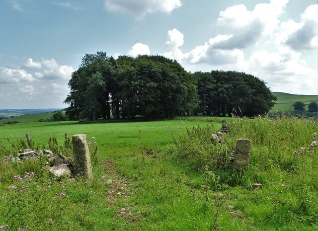
Rushley Wood - Broadleaved woodland
5 ha
Plan your visit
🐶Dogs🦋Insects🦉Wildlife
Public accessFree entryDogs welcome5 ha
Getting here
53.05498, -1.83932
Open directionsv
Visiting this summer
Seasonal nature notes and what to look for now
- 🌞Midsummer — early morning visits most comfortable; look for deer fawns in quieter clearings
- 🐕Early mornings are best for dog walks in summer — visit before 9am to avoid the heat and find quieter trails
- 📍Open access throughout summer — no booking required
🌤️ Visiting this summer
- 🌞Midsummer — early morning visits most comfortable; look for deer fawns in quieter clearings
- 🐕Early mornings are best for dog walks in summer — visit before 9am to avoid the heat and find quieter trails
- 📍Open access throughout summer — no booking required
- £Free to visit — no entry charge
- 🐕Dogs welcome
Dogs allowed — public woodland
Free
🦋Insect spotting
Strong match
Chalk and limestone grassland — chalkhill blue, adonis blue and rare moths
Free
Deciduous woodland priority habitat
Free
🦅Bird watching
Strong match
Deciduous woodland — woodpeckers, warblers and woodland birds
Free
Deciduous woodland — fungi, berries and wild garlic
Varies
Trails nearby
Within roughly 5 km17 signed routes nearby · 15 public paths nearby
Signed route nearbyPublic paths
Limestone WayWalking route74 km▾
Castleton to Rocester
Named routeLength 74 kmPoint-to-pointRegional walking route
Circular Park WalkWalking route1.6 km▾
https://nt.global.ssl.fastly.net/binaries/content/assets/website/national/regions/peak-district-derbyshire/places/ilam-park-dovedale-and-the-white-peak/pdf/230525-property-access-statement---ilam-park.pdf
Named routeLength 1.6 kmDuration 00:40Round tripLocal walking route
Hinkley Wood Route, Ilam ParkWalking route1.2 km▾
https://nt.global.ssl.fastly.net/binaries/content/assets/website/national/regions/peak-district-derbyshire/places/ilam-park-dovedale-and-the-white-peak/pdf/230525-property-access-statement---ilam-park.pdf
Named routeLength 1.2 kmDuration 00:20Point-to-pointLocal walking route
Walk from Dovedale to Milldale, DovedaleWalking route5 km▾
Named routeLength 5 kmDuration 03:00Point-to-pointLocal walking route
Manifold TrailWalking route▾
Named routeLocal walking route
Dog Lanepublic footpath · 68 m▾
Public pathpublic footpathLength 68 mPath type: service
Dog Lanepublic footpath · 95 m▾
Public pathpublic footpathLength 95 mPath type: service
24 signed routes nearby
Signed route nearby
National Route 550Cycling route▾
Named routeRef 550National Cycle Network
Pennine CyclewayCycling route▾
Named routeRef 68National Cycle Network
Route 549Cycling route▾
Named routeRef 549National Cycle Network
Main RouteCycling route13.8 km▾
Named routeRef 550Length 13.8 kmNational Cycle NetworkTraffic-freeSurface unsealedfirm
Main RouteCycling route140 m▾
Named routeRef 549Length 140 mNational Cycle NetworkTraffic-freeSurface asphalt
Main RouteCycling route29 m▾
Named routeRef 549Length 29 mNational Cycle NetworkTraffic-freeSurface other
1 signed route nearby
Signed route nearby
Tissington TrailMountain bike route▾
Named routeRef Tissington TrailPoint-to-pointLocal cycle route
Weather for this location
Next 14 daysNearby places
Useful places within 5 km
Own or manage this place?
Claim this listing to keep details accurate, add photos, and highlight what makes it special — free.
Claim this page→How useful was the information on this page?
id: 09219a82-9d81-4574-b9f6-794c0e6f0593
Events & activities nearby
Switch provider to compare local events, tours and bookable activities.
Wildlife to spot
2,692 records · National Biodiversity Network
Wildlife to spot
2,692 records · National Biodiversity NetworkMagpie · Helmeted Guineafowl · Woodpigeon · Chaffinch · Nuthatch +2
- MagpiePica pica
- Helmeted GuineafowlNumida meleagris
- WoodpigeonColumba palumbus
- ChaffinchFringilla coelebs
- NuthatchSitta europaea2024
- ChiffchaffPhylloscopus collybita2024
- WrenTroglodytes troglodytes2024
🦌Mammals7 species
autumnwinter
2024▾
Mole · Red Fox · Brown Hare · Field Vole · Bank Vole +2
- MoleTalpa europaea
- Red FoxVulpes vulpes
- Brown HareLepus europaeus
- Field VoleMicrotus agrestis
- Bank VoleMyodes glareolus
- Grey SquirrelSciurus carolinensis
- Shrew
Rhipidia maculata · Acrossus rufipes · Nicrophorus investigator · Dark-edged Bee-fly · Black Clock +27
- Rhipidia maculataRhipidia maculata2024
- Acrossus rufipesAcrossus rufipes2024
- Nicrophorus investigatorNicrophorus investigator2024
- Dark-edged Bee-flyBombylius major
- Black ClockPterostichus madidus2024
- Tipula paludosaTipula paludosa
Common Nettle · Broad-leaved Dock · Germander Speedwell · Elder · Yellow-rattle +85
- Common NettleUrtica dioica
- Broad-leaved DockRumex obtusifolius
- Germander SpeedwellVeronica chamaedrys
- ElderSambucus nigra
- Yellow-rattleRhinanthus minor
- Creeping ButtercupRanunculus repens
- KnotgrassPolygonum aviculare
Species observations from the last 10 years via NBN Atlas
Soricidae
Soricidae
2024
2024
Limnephilus affinisLimnephilus affinis2024Limnephilus affinisLimnephilus affinis2024Sylvicola punctatusSylvicola punctatus2024Sylvicola punctatusSylvicola punctatus2024Southern BristletailDilta hibernica2024Southern BristletailDilta hibernica2024Limnephilus auriculaLimnephilus auricula2024Limnephilus auriculaLimnephilus auricula2024Common Orange LegionnaireBeris vallata2024Common Orange LegionnaireBeris vallata2024Deraeocoris (Deraeocoris) ruberDeraeocoris (Deraeocoris) ruber2024Deraeocoris (Deraeocoris) ruberDeraeocoris (Deraeocoris) ruber2024Green ShieldbugPalomena prasina2024Green ShieldbugPalomena prasina2024Rhingia campestrisRhingia campestris2024Rhingia campestrisRhingia campestris2024Syritta pipiensSyritta pipiens2024Syritta pipiensSyritta pipiens2024Limnephilus lunatusLimnephilus lunatus2024Limnephilus lunatusLimnephilus lunatus2024Eristalis tenaxEristalis tenax2024Eristalis tenaxEristalis tenax2024Limnephilus sparsusLimnephilus sparsus2024Limnephilus sparsusLimnephilus sparsus2024Scathophaga stercorariaScathophaga stercoraria2024Scathophaga stercorariaScathophaga stercoraria2024Mystacides longicornisMystacides longicornis2024Mystacides longicornisMystacides longicornis2024Limnephilus marmoratusLimnephilus marmoratus2024Limnephilus marmoratusLimnephilus marmoratus2024Limnephilus flavicornisLimnephilus flavicornis2024Limnephilus flavicornisLimnephilus flavicornis2024Sheep Nostril FlyOestrus ovis2024Sheep Nostril FlyOestrus ovis2024Athous haemorrhoidalisAthous haemorrhoidalis2024Athous haemorrhoidalisAthous haemorrhoidalis2024Clivina fossorClivina fossor2024Clivina fossorClivina fossor2024Agrilinus aterAgrilinus ater2024Agrilinus aterAgrilinus ater2024Ground WeevilBarynotus obscurus2024Ground WeevilBarynotus obscurus2024Rhinoceros BeetleSinodendron cylindricum2024Rhinoceros BeetleSinodendron cylindricum2024Melinopterus prodromusMelinopterus prodromus2024Melinopterus prodromusMelinopterus prodromus2024Bodilopsis rufaBodilopsis rufa2024Bodilopsis rufaBodilopsis rufa2024Acrossus depressusAcrossus depressus2024Acrossus depressusAcrossus depressus2024Teuchestes fossorTeuchestes fossor2024Teuchestes fossorTeuchestes fossor2024Perennial Rye-grassLolium perennePerennial Rye-grassLolium perenneAnnual Meadow-grassPoa annuaAnnual Meadow-grassPoa annuaYorkshire-fogHolcus lanatusYorkshire-fogHolcus lanatusHerb-RobertGeranium robertianumHerb-RobertGeranium robertianumTufted Hair-grassDeschampsia cespitosa subsp. cespitosaTufted Hair-grassDeschampsia cespitosa subsp. cespitosaAshFraxinus excelsiorAshFraxinus excelsiorHoary PlantainPlantago mediaHoary PlantainPlantago mediaShepherd's-purseCapsella bursa-pastorisShepherd's-purseCapsella bursa-pastorisCock's-footDactylis glomerataCock's-footDactylis glomerataSpear ThistleCirsium vulgareSpear ThistleCirsium vulgareSycamoreAcer pseudoplatanusSycamoreAcer pseudoplatanusVelvet BentAgrostis caninaVelvet BentAgrostis caninaHawthornCrataegus monogynaHawthornCrataegus monogynaWhite CloverTrifolium repensWhite CloverTrifolium repensDandelionTaraxacumDandelionTaraxacumCreeping ThistleCirsium arvenseCreeping ThistleCirsium arvenseYellow Oat-grassTrisetum flavescensYellow Oat-grassTrisetum flavescensCommon Mouse-earCerastium fontanumCommon Mouse-earCerastium fontanumCrested Dog's-tailCynosurus cristatusCrested Dog's-tailCynosurus cristatusCommon ChickweedStellaria mediaCommon ChickweedStellaria mediaBeechFagus sylvaticaBeechFagus sylvaticaYarrowAchillea millefoliumYarrowAchillea millefoliumCowslipPrimula verisCowslipPrimula verisRed CloverTrifolium pratenseRed CloverTrifolium pratenseBlackthornPrunus spinosaBlackthornPrunus spinosaRaspberryRubus idaeusRaspberryRubus idaeusAcer pseudoplatanus group 'Purpureum'Acer pseudoplatanus group 'Purpureum'Acer pseudoplatanus group 'Purpureum'Acer pseudoplatanus group 'Purpureum'Common RagwortJacobaea vulgarisCommon RagwortJacobaea vulgarisAnnual PearlwortSagina apetalaAnnual PearlwortSagina apetalaBiting StonecropSedum acreBiting StonecropSedum acreSweet Vernal-grassAnthoxanthum odoratumSweet Vernal-grassAnthoxanthum odoratumCommon DuckweedLemna minorCommon DuckweedLemna minorSessile OakQuercus petraeaSessile OakQuercus petraeaPineappleweedMatricaria discoideaPineappleweedMatricaria discoideaPrickly Sow-thistleSonchus asperPrickly Sow-thistleSonchus asperCrosswortCruciata laevipesCrosswortCruciata laevipesFestuca rubraFestuca rubraFestuca rubraFestuca rubraBlack BentAgrostis giganteaBlack BentAgrostis giganteaRed FescueFestuca rubraRed FescueFestuca rubraWall-rueAsplenium ruta-murariaWall-rueAsplenium ruta-murariaBullacePrunus domestica subsp. insititiaBullacePrunus domestica subsp. insititiaCanadian WaterweedElodea canadensisCanadian WaterweedElodea canadensisTrichophorum germanicumTrichophorum germanicumTrichophorum germanicumTrichophorum germanicumCat's-earHypochaeris radicataCat's-earHypochaeris radicataCreeping CinquefoilPotentilla reptansCreeping CinquefoilPotentilla reptansGroundselSenecio vulgarisGroundselSenecio vulgarisHorse-chestnutAesculus hippocastanumHorse-chestnutAesculus hippocastanumDove's-foot Crane's-billGeranium molleDove's-foot Crane's-billGeranium molleSweet ChestnutCastanea sativaSweet ChestnutCastanea sativaLarge Bitter-cressCardamine amaraLarge Bitter-cressCardamine amaraMouse-ear-hawkweedPilosella officinarumMouse-ear-hawkweedPilosella officinarumMeadow FoxtailAlopecurus pratensisMeadow FoxtailAlopecurus pratensisMidland HawthornCrataegus laevigataMidland HawthornCrataegus laevigataCreeping BentAgrostis stoloniferaCreeping BentAgrostis stoloniferaEuropean LarchLarix deciduaEuropean LarchLarix deciduaSmooth Sow-thistleSonchus oleraceusSmooth Sow-thistleSonchus oleraceusNipplewortLapsana communisNipplewortLapsana communisEnchanter's-nightshadeCircaea lutetianaEnchanter's-nightshadeCircaea lutetianaYellow ArchangelLamiastrum galeobdolonYellow ArchangelLamiastrum galeobdolonCuckooflowerCardamine pratensisCuckooflowerCardamine pratensisGooseberryRibes uva-crispaGooseberryRibes uva-crispaLesser CelandineFicaria vernaLesser CelandineFicaria vernaMeadow VetchlingLathyrus pratensisMeadow VetchlingLathyrus pratensisBush VetchVicia sepiumBush VetchVicia sepiumHazelCorylus avellanaHazelCorylus avellanaCleaversGalium aparineCleaversGalium aparineWood Forget-me-notMyosotis sylvaticaWood Forget-me-notMyosotis sylvaticaDaisyBellis perennisDaisyBellis perennisGlaucous SedgeCarex flaccaGlaucous SedgeCarex flaccaLords-and-LadiesArum maculatumLords-and-LadiesArum maculatumDog's MercuryMercurialis perennisDog's MercuryMercurialis perennisGreater PlantainPlantago majorGreater PlantainPlantago majorColtsfootTussilago farfaraColtsfootTussilago farfaraWild CherryPrunus aviumWild CherryPrunus aviumRed CampionSilene dioicaRed CampionSilene dioicaWild AngelicaAngelica sylvestrisWild AngelicaAngelica sylvestrisHogweedHeracleum sphondyliumHogweedHeracleum sphondyliumMeadow ButtercupRanunculus acrisMeadow ButtercupRanunculus acrisCow ParsleyAnthriscus sylvestrisCow ParsleyAnthriscus sylvestrisBluebellHyacinthoides non-scriptaBluebellHyacinthoides non-scriptaButterburPetasites hybridusButterburPetasites hybridusCurled DockRumex crispus2024Curled DockRumex crispus2024Mountain CurrantRibes alpinum2024Mountain CurrantRibes alpinum2024