Plan your visit
Getting here
53.12307, -1.98636
Visiting this summer
Seasonal nature notes and what to look for now
Visiting this summer
Seasonal nature notes and what to look for now
- ☀️June — canopy now fully closed, creating cool dappled shade even on warm days
- 🐕Early mornings are best for dog walks in summer — visit before 9am to avoid the heat and find quieter trails
- 📍Open access throughout summer — no booking required
🌤️ Visiting this summer
- ☀️June — canopy now fully closed, creating cool dappled shade even on warm days
- 🐕Early mornings are best for dog walks in summer — visit before 9am to avoid the heat and find quieter trails
- 📍Open access throughout summer — no booking required
Good to know
- £Free to visit — no entry charge
- 🐕Dogs welcome
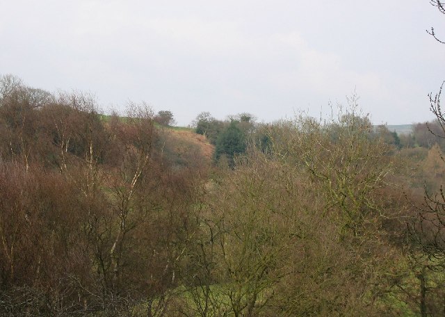
- 🌿Ancient woodland — rare wildlife habitat
Best for
Wildlife
Strong match
Deciduous woodland priority habitat; Ancient woodland
Dog walks
Strong match
Dogs allowed — public woodland
Seasonal nature
Strong match
Ancient woodland — bluebells, fungi and autumn colour
Bird watching
Strong match
Deciduous woodland — woodpeckers, warblers and woodland birds
Foraging
Good match
Deciduous woodland — fungi, berries and wild garlic
Forest walks
Good match
Public woodland
Trails nearby
Within roughly 5 km🚶Walking
11 signed routes nearby · 4 public paths nearby
Signed route nearbyPublic paths
Walking
Habitat Walk Ladderedge Country Park (Green Arrows)Walking route
Includes some hills
Peak District Boundary Walk Stage 17Walking route16.2 km
Churnet WayWalking route
Fosters TrailWalking route
Crabapple TrailWalking route
Leekfrith 25public footpath · 202 m
🚴Cycling
8 signed routes nearby
Signed route nearby
Cycling
Route 559Cycling route
National Route 550Cycling route
Main RouteCycling route3.7 km
Main RouteCycling route1.2 km
Main RouteCycling route302 m
Main RouteCycling route5.5 km
Wildlife to spot
Photos
Weather for this location
Loading local forecast…
Nearby places
Useful places within 5 km
Own or manage this place?
Claim this listing to keep details accurate, add photos, and highlight what makes it special — free.
Claim this pageHow was your visit?
How useful was the information on this page?
id: 29b02133-ed84-4d59-8464-d64956d0e4c6