Walton Plantation - Broadleaved woodland
3 ha
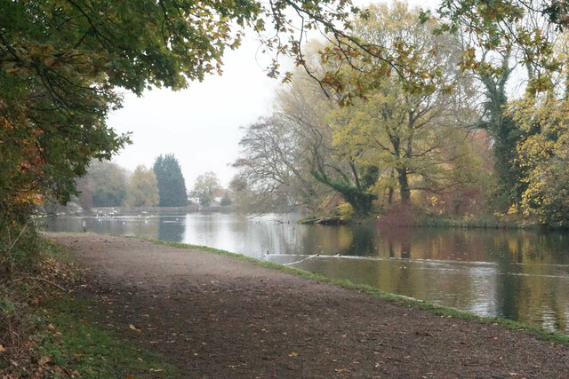
Plan your visit
🐶Dogs🦋Insects🦉Wildlife
Public accessFree entryDogs welcome3 ha
Getting here
53.22878, -1.46112
Open directionsv
Visiting this summer
Seasonal nature notes and what to look for now
- 🌞Midsummer — early morning visits most comfortable; look for deer fawns in quieter clearings
- 🐕Early mornings are best for dog walks in summer — visit before 9am to avoid the heat and find quieter trails
- 🅿️Parking 240m away — 10 car parks within reach
🌤️ Visiting this summer
- 🌞Midsummer — early morning visits most comfortable; look for deer fawns in quieter clearings
- 🐕Early mornings are best for dog walks in summer — visit before 9am to avoid the heat and find quieter trails
- 🅿️Parking 240m away — 10 car parks within reach
- £Free to visit — no entry charge
- 🐕Dogs welcome
Dogs allowed — public woodland
Free
🦋Insect spotting
Strong match
Lowland meadows — marbled white, meadow brown and pollinating insects
Free
Deciduous woodland priority habitat
Free
🦅Bird watching
Strong match
Deciduous woodland — woodpeckers, warblers and woodland birds
Free
Deciduous woodland — fungi, berries and wild garlic
Varies
Trails nearby
Within roughly 5 km10 signed routes nearby · 20 public paths nearby
Signed route nearbyPublic paths
Chesterfield Round WalkWalking route▾
Named routeRound tripLocal walking route
Cuckoo WayWalking route▾
South Chesterfield WayWalking route▾
Named routeLocal walking route
Trans-Pennine Trail (Staveley to Chesterfield spur)Walking route▾
Named routeRegional walking route
Whittington and the HandleysWalking route▾
Hipper Valley Cyclewaypublic footpath · 4 m▾
Public pathpublic footpathLength 4 mSurface concretePath type: cycleway
Hipper Valley Cyclewaypublic footpath · 209 m▾
Public pathpublic footpathLength 209 mSurface fine_gravelPath type: cycleway
Windsor Closepublic footpath · 22 m▾
Public pathpublic footpathLength 22 mSurface pavedPath type: residential
61 signed routes nearby
Signed route nearby
Route 5Cycling route▾
Named routeRef 5Local cycle route
Rother Valley WashlandsCycling route▾
Named routeLocal cycle route
LCN 3Cycling route▾
Named routeRef 3Local cycle route
Route 67Cycling route▾
Named routeRef 67National Cycle Network
N/ACycling route548 m▾
Named routeLength 548 mNational Cycle NetworkTraffic-freeSurface asphalt
N/ACycling route107 m▾
Named routeLength 107 mNational Cycle NetworkOn-roadSurface asphalt
Weather for this location
Next 14 daysNearby places
Useful places within 5 km
Own or manage this place?
Claim this listing to keep details accurate, add photos, and highlight what makes it special — free.
Claim this page→How useful was the information on this page?
id: 3f2484bb-a373-4f14-ad4f-c37727a9c3d1
Events & activities nearby
Switch provider to compare local events, tours and bookable activities.
Wildlife to spot
37,049 records · National Biodiversity Network
Wildlife to spot
37,049 records · National Biodiversity Network🐦Birds50 species
summerwinter
2026▾
Dipper · Mallard · Woodpigeon · Moorhen · Blue Tit +45
- DipperCinclus cinclus2025
- MallardAnas platyrhynchos
- WoodpigeonColumba palumbus
- MoorhenGallinula chloropus
- Blue TitCyanistes caeruleus2025
- Mandarin DuckAix galericulata2025
- KingfisherAlcedo atthis2025
- MagpiePica pica2025
- GoldfinchCarduelis carduelis
- RobinErithacus rubecula2025
- Carrion CrowCorvus corone2025
- Canada GooseBranta canadensis2025
- WrenTroglodytes troglodytes2025
- Mute SwanCygnus olor2025
- JackdawColoeus monedula2025
- GoldcrestRegulus regulus
- Grey HeronArdea cinerea
- Black-headed GullChroicocephalus ridibundus
- House SparrowPasser domesticus2025
- NuthatchSitta europaea2025
- CootFulica atra2025
- Grey WagtailMotacilla cinerea2025
- BlackbirdTurdus merula2025
- Great TitParus major2025
- GoosanderMergus merganser2025
- Long-tailed TitAegithalos caudatus2025
- TreecreeperCerthia familiaris2025
- SiskinSpinus spinus2025
- Rock DoveColumba livia2025
- JayGarrulus glandarius2025
- Little EgretEgretta garzetta2025
- ChiffchaffPhylloscopus collybita2025
- Tufted DuckAythya fuligula2025
- Mistle ThrushTurdus viscivorus2025
- StarlingSturnus vulgaris2025
- Greylag GooseAnser anser2025
- SkylarkAlauda arvensis2025
- RedwingTurdus iliacus2025
- KestrelFalco tinnunculus2025
- Lesser Black-backed GullLarus fuscus2025
- Stock DoveColumba oenas2025
- DunnockPrunella modularis2025
- RookCorvus frugilegus2025
- ShelduckTadorna tadorna2025
- LinnetLinaria cannabina2025
- YellowhammerEmberiza citrinella2025
- ChaffinchFringilla coelebs2025
- GreenfinchChloris chloris2025
- Great Spotted WoodpeckerDendrocopos major2025
- Motacilla cinerea cinereaMotacilla cinerea cinerea2025
Hedgehog · Brown Rat
- HedgehogErinaceus europaeus
- Brown RatRattus norvegicus
🐝Insects2 species
springsummerautumn
2026▾
Harlequin Ladybird · Hornet Hoverfly
- Harlequin LadybirdHarmonia axyridis
- Hornet HoverflyVolucella zonaria2025
Coastal Redwood · Ivy-leaved Toadflax · Japanese Knotweed · Field Maple · Scentless Mayweed +3
- Coastal RedwoodSequoia sempervirens
- Ivy-leaved ToadflaxCymbalaria muralis2025
- Japanese KnotweedReynoutria japonica2025
- Field MapleAcer campestre2025
- Scentless MayweedTripleurospermum inodorum2025
- Wall BarleyHordeum murinum
Species observations from the last 10 years via NBN Atlas
2025
2025
NipplewortLapsana communis2025NipplewortLapsana communis2025Perennial Rye-grassLolium perenne2025Perennial Rye-grassLolium perenne2025